
A Currier and Ives event to end the week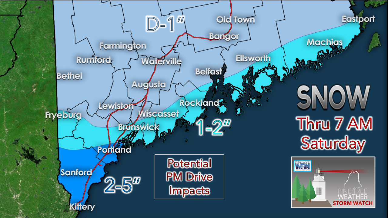 A gentle snowfall freshens up the landscape for the region on Friday. This is a high ratio snow event with medium to large flakes when melted down would not yield more than a tenth of an inch of water. Since the snow is very dry, it is like falling ice, which when compacted on untreated surfaces could become very slick. For the western mountains, snow showers appear to persist into Saturday, which may bring a couple inches there by Saturday afternoon. 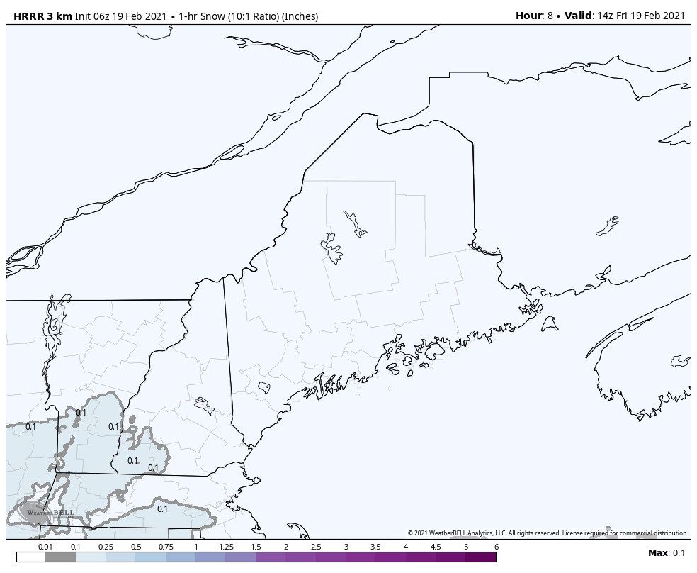 Looking at hourly snowfall rates between 5 AM and 9 PM from the HRRR model shows mainly a steady affair over southwestern areas. A bit of coastal enhancement may create bursts of moderate snowfall toward the evening commute for the southwest coast. If you are travelling this evening, allow for extra time and take it slow. For northern areas, there may be a few flakes in areas, but dry high pressure in the region may evaporate what radar returns pick up there. Storm to watch early next week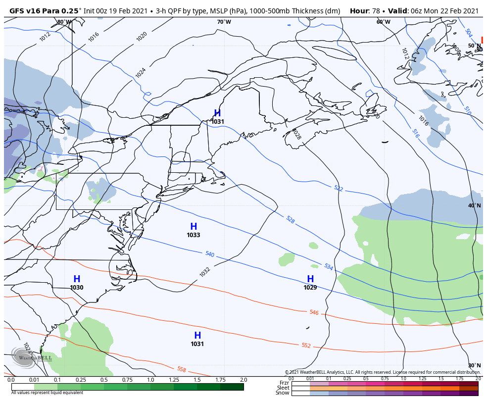 High pressure which appears to dominate the weekend moves offshore late Sunday. A long wave frontal boundary moves east and works into the region Monday afternoon. It appears to be a quick mover for now, but could also bring a punch of precipitation with it. My concern with this one is for a low to develop along the frontal boundary. The timing and intensification of that is critical in determining the outcome. 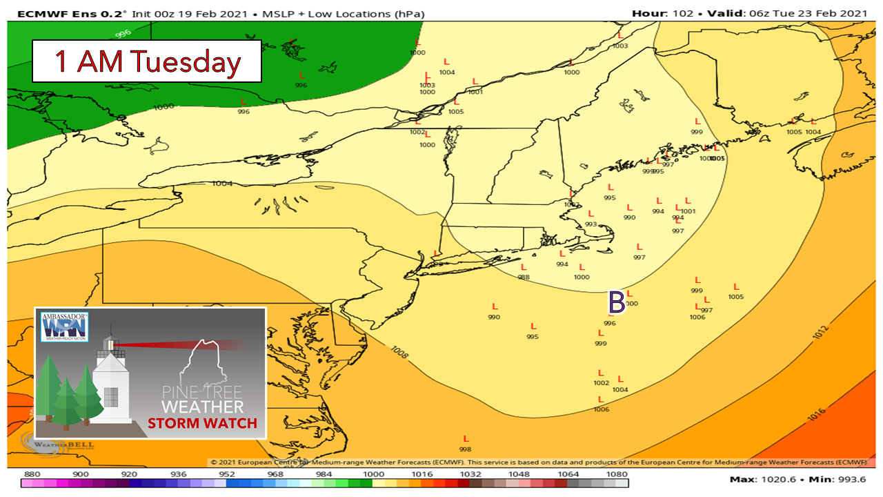 Looking at ensemble ideas of potential regions of low pressure validates my concern. A fair portion indicate development inside the benchmark 40° N / 70° W point, which in that case would bring the potential for mixed precipitation and or rain to the coast and coastal interior. Development near or south of benchmark would bring a snowier affair. Given the widely scattered nature of the ensemble ideas, there is plenty of wiggle room that will need to be consolidated before a more realistic outcome can be determined. 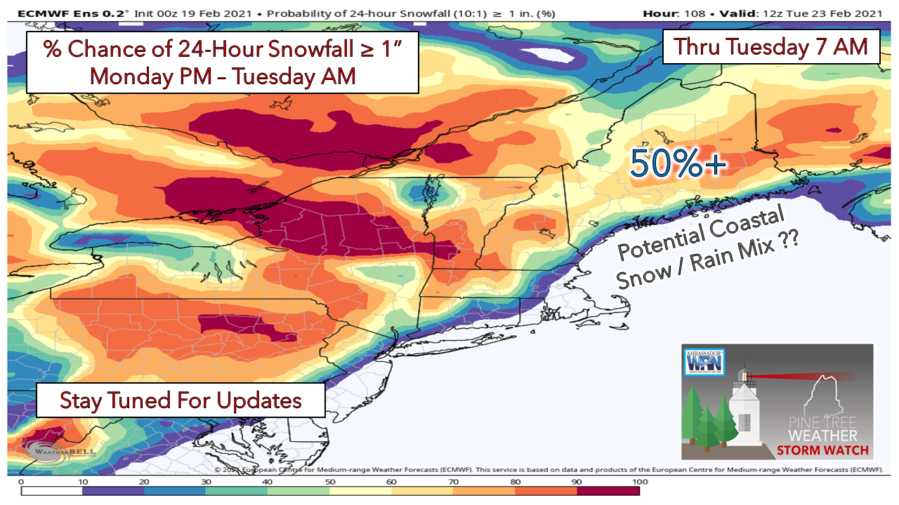 It's too early to get into specifics on the storm, but there is a fair chance snow will come for interior areas. The timing of the development of the low and position of it along will determine coastal precipitation type. Stay tuned for updates over the weekend.  Ice and Snow, Take it Slow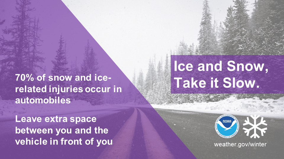 Winter driving can be hazardous. One simple way to keep yourself and everyone on the road safe is to slow down. Remember, “Ice and snow, take it slow”. Learn more at weather.gov/winter Temperature outlook through Thursday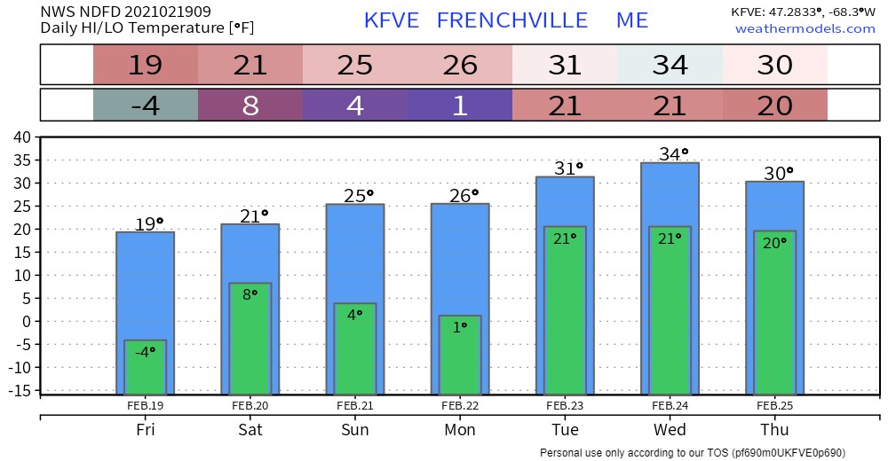 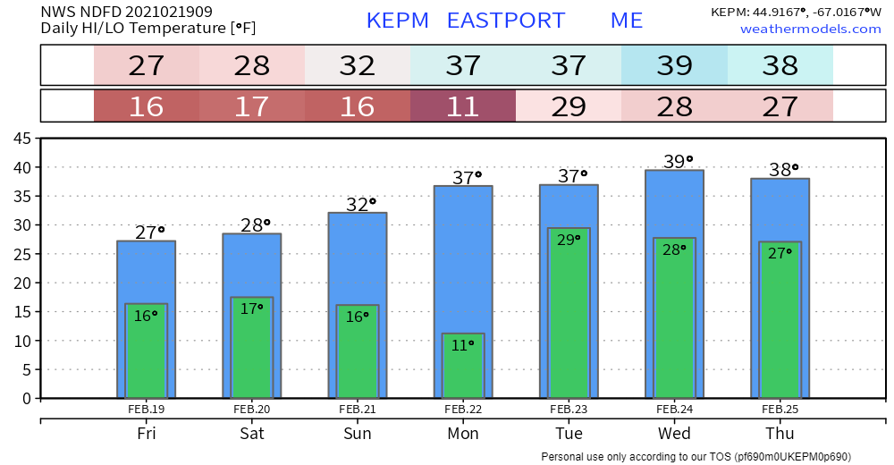 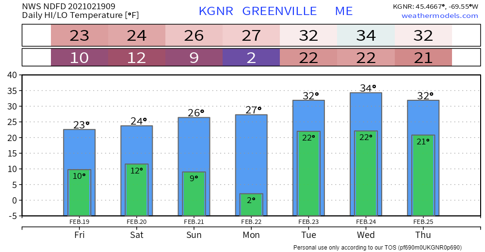 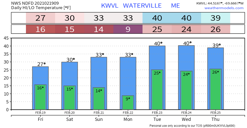 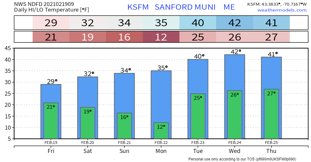 Be prepared to receive alerts and stay updated!
For more information in between posts, please follow Pine Tree Weather on Facebook and Twitter.
Thank you for supporting this community based weather information source which operates by reader supported financial contributions. Stay updated, stay on alert, and stay safe! Thank you as always for your support! - Mike |

Mike Haggett
|


