
Showers for the southern half of the state Wednesday A cold front drifts to the south during the day on Wednesday. Moisture riding along the boundary brings some shower activity to the southern half of the state. Showers clear out of most areas Wednesday afternoon. York County may not see the showers end until Wednesday evening. 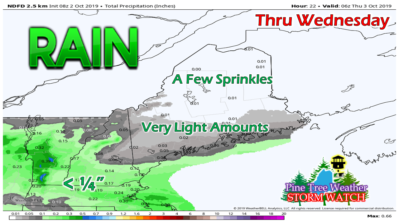 Not a whole lot of rainfall expected for the day. The further south, the better chance for measurable amounts. 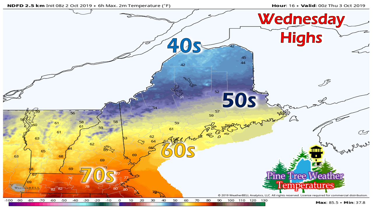 It will be a cool day for the Crown with highs in the 40s. Western and eastern areas are likely to top out in the 50s, with 60s the high point for southern areas. A chilly Thursday with precipitation moving in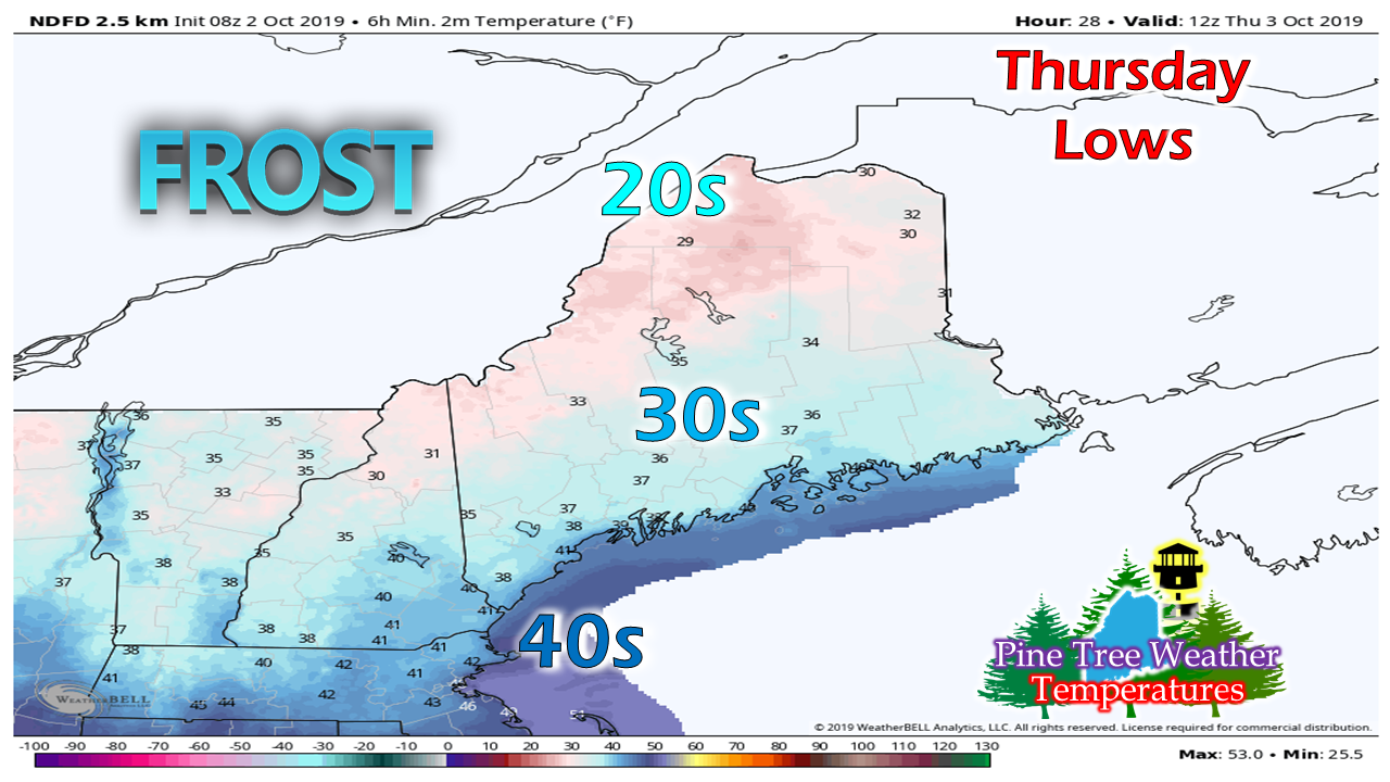 As the front passes south, skies clear out and temperatures plummet overnight. Folks may want to cover the mums and any other vegetation of importance Wednesday night. 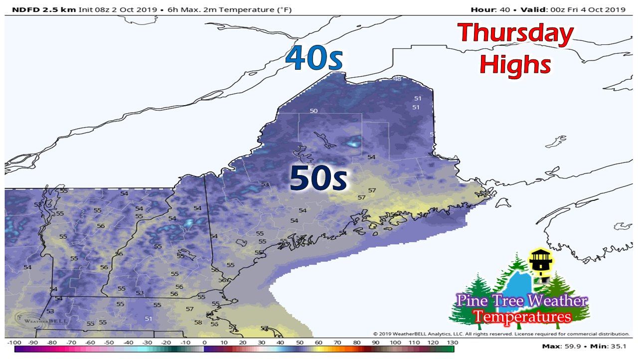 Highs for the day will mainly be in the 50s everywhere in the state, with a few 40s for the roof top.  Southern areas may see some spotty shower activity Thursday afternoon, but the main slug of moisture arrives Thursday night. Rain and higher elevation snow showers taper off Friday morning. 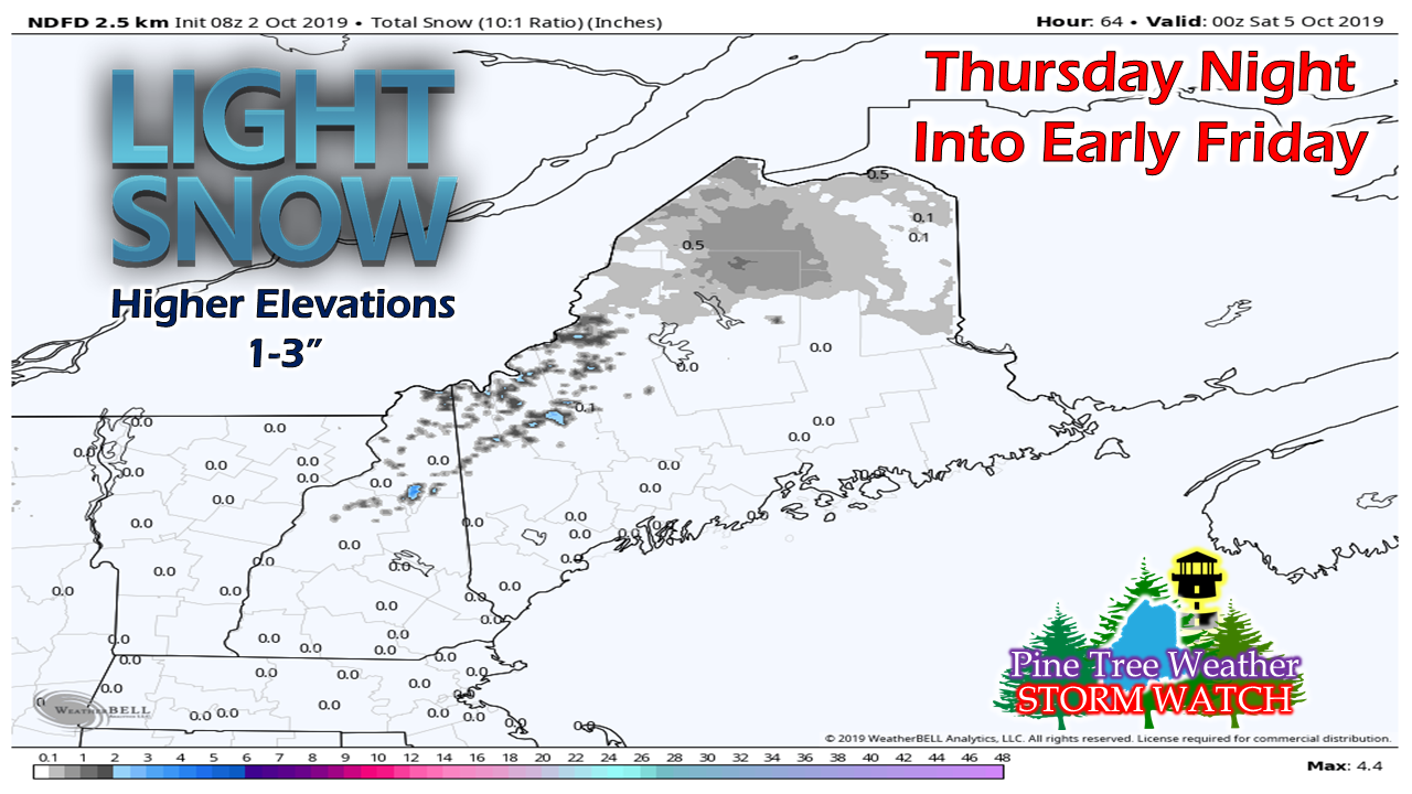 Shovels will not be needed for this event, with the exception of Mount Washington. Snow appears wet in nature, and will stick to the trees and leaves that are near peak over interior areas. It may make for some beautiful photography Friday morning. 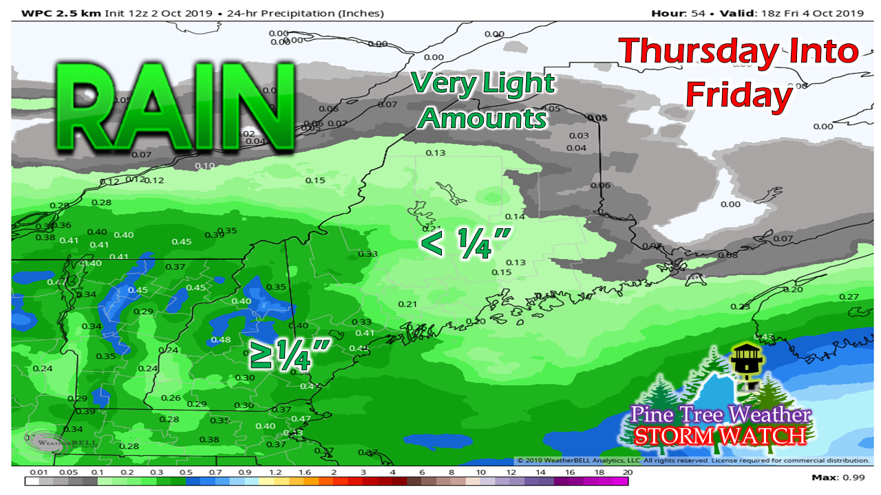 Southern and western areas likely see the most rain by Friday morning. After the rain on Tuesday and Wednesday, along with this on the way, some southern areas may exceed the total rain recorded in September within the first four days of October. Potential soaker rain event early next week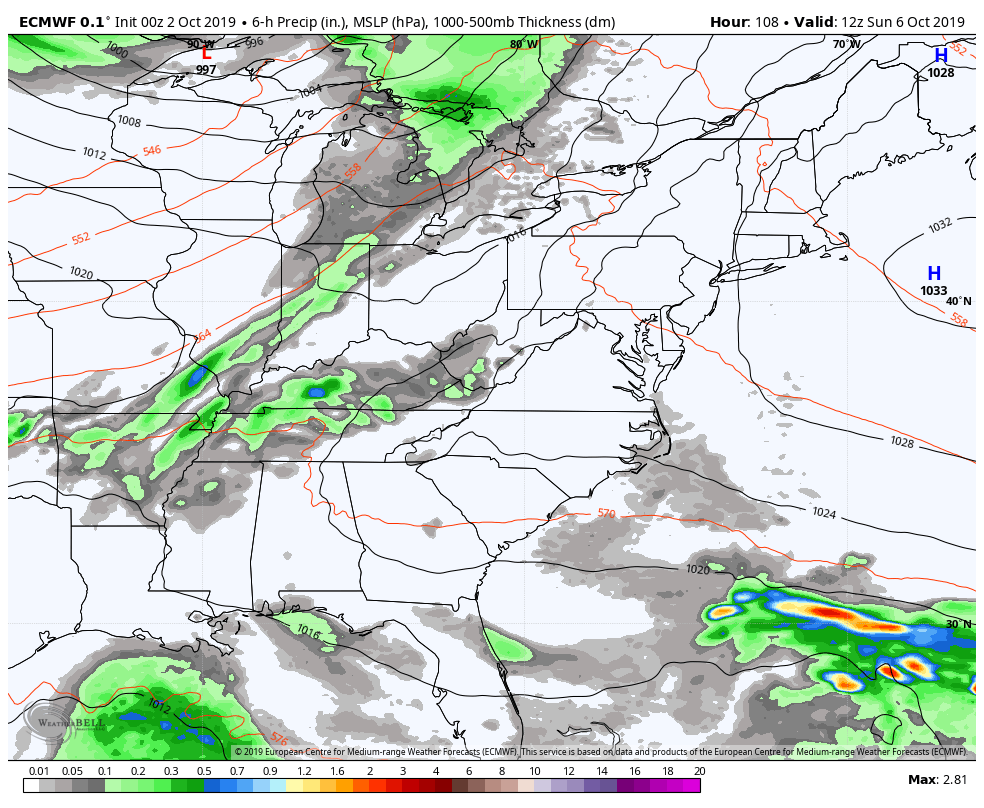 The weekend appears dry and cool overall. Clouds begin to increase Sunday as a long wave frontal boundary moves east. The front appears on track to tap into the moisture in the Gulf of Mexico and could bring a soaking rain to much of the state Monday into Tuesday. A rough estimate of 1-2" of rain is possible, but it is a early to get too specific. Updates to come on this as we approach the weekend. Please support Pine Tree Weather! A special thank you to those that have signed up to be monthly contributors on my Patreon page and to those who have mailed checks to me. This a labor of love here. I don't mind the 4 AM wake up calls (2 AM for snow days) to formulate a forecast, create graphics then write it all out for your consumption, so long as I have the financial support from you to continue to do so. There is no media or marketing influence here. No model forecast bias. No political or scientific agenda. It's just Maine weather, plain and simple. I would appreciate your support to continue this for 2020. Contributors are donation on average of $5 per month / $60 per year either through Patreon or by check. No amount is too small. This is Maine, most of us are on tight budgets, and having been there myself, I understand the struggle. All I ask is to do what you can. If you can't do anything financially right now, that is totally understandable. Please pass along what I do to others and help this site to grow!
Thank you for your support! ► ► For the latest official forecasts, bulletins and advisories, please check in with the National Weather Service in Gray for western and southern areas, or Caribou for northern and eastern parts of Maine. For more information from me, please check the Pine Tree Weather Facebook page as well as my Twitter feed. Always stay weather aware! - Mike |

Mike Haggett
|


