
Winter isn't over quite yet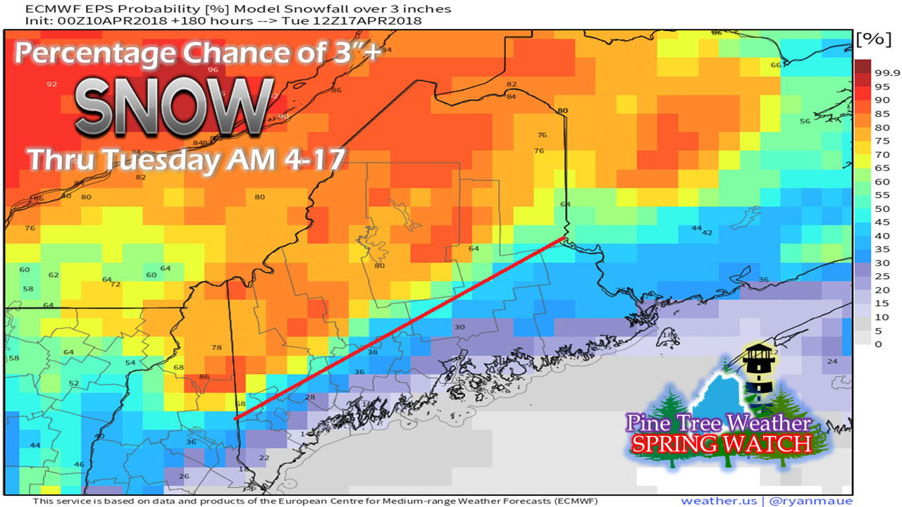 For the folks along the coastal plain, you can put the shovels away, take the plows off, and start your spring yard clean ups. Western and northern areas are getting close to that point. All areas should keep the sanders on. This isn't to say that all areas may see a bit more of the white stuff before all is said and done, but any major impacts are unlikely at this point for coastal areas. As the folks in the mountains and The County can attest, winter isn't over until it is over. Cold is being its stubborn self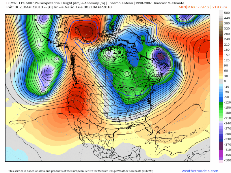 It's the season for bowling balls in the upper atmosphere, which is a sure sign of spring. Cold stays around until later in the week before some resemblance of spring temperatures arrive for the weekend. The next bowling ball that arrives Sunday into Monday has a chance of bringing an inside runner storm to the region. While the textbook inside runner indicates rain for the coast and snow/mix for interior areas, this one will need to be monitored closely. Early indications old friend "Cold Air Damming" may pass along another reminder that it can throw a wrench into forecasts even into mid-April. What works to the advantage for coastal rain at this point is the snow pack will take a hit with the warm up this weekend. Cold air damming is aided by the snow pack, and with less of it around, it has a hard time gaining traction. Folks with Patriots Day plans should expect a cool, and at the very least a wet affair, with snow/mix possibilities away from the coast. How far away from the shorelines will be what to watch for. After that last shot early next week, the region heads into more of a west to east zonal flow as it appears for now. That trend bring the area shots of cool and warm temperatures, with weak disturbances bringing a threat for rain showers. Most of the rest of April appears damp overall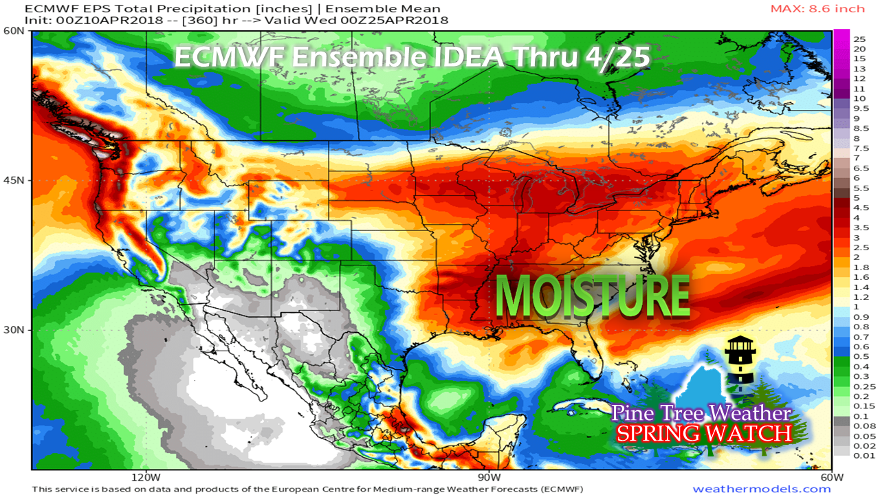 As the southern jet stream begins to reign superiority over the atmosphere, it brings moisture from the Gulf of Mexico along with it. As temperatures begin to modify into more seasonable levels, what was frozen turns to liquid. After early next week, flooding from spring run off begins to elevate. On the other side, areas where the snow has already melted are on track to dry out. The concern with that is a fire threat due to the lack of foliage. The rain idea of roughly 2-3" of liquid will come intermittently. The storms late this week and early next week may bring the bulk of that amount. With the trend appearing to be more zonal by April 18th onward, the double edge concerns for both flooding for the interior and fire for the coastal plain will play a role in the weather discussion as we head into May. Suspending operations for now As many of you know, the family and I are relocating from Poland to Kennebunk. We are officially moving on Friday, April 20th. We are planning an open house at our Poland location on Sunday April 22nd to sell off what items we have left, and also to say thank you to our dear friends for their support of us in the past 16 years. For those in the area, you also are invited to stop by as well. You can RSVP on Facebook.
It will take a bit of time for us to get settled in. I am not sure exactly when I will resume regular updates as of yet, but will do so when it works out. Please keep watch on my Twitter account and the Pine Tree Weather Facebook page for information as warranted, and when I am available. As always, stay in touch with NWS Gray or NWS Caribou for forecast information and any weather bulletins. Thank you as always for the support! - Mike |

Mike Haggett
|


