
A sloppy mess through Tuesday morning Guidance has tweaked a bit colder overnight, and as a result, snow amounts have increased slightly. The margin of error here is +/- 1-2° F around the lower levels. Any deviation in the forecast track could make the storm cooler or warmer. There is a fine line in all of this, therefore bust potential with more or less snow exists. Banding to dictate snow totals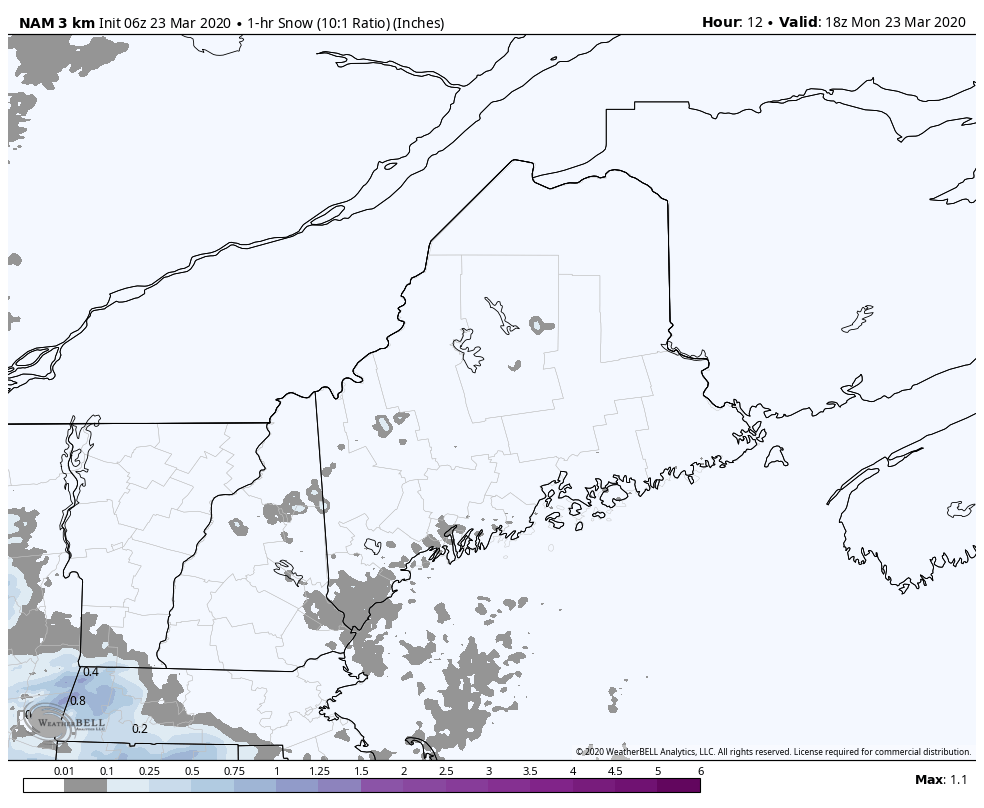 As I have mentioned here over the past couple of updates, banding will be the key issue. Where it happens and for how long will be the difference between who gets how much and for how long. Given the compact nature of the developing low, the main concern is for the coastal plain on up into the western foothills over towards Millinocket and Danforth. Northern areas and the mountains don't get a whole lot out of this from what it appears at this point. Snowfall rates of around 1+" per hour are possible. Given the heavy, wet nature of the snow, this will stick to everything and make roads slick, and with the wind, potential for down tree limbs and power outages. Precipitation begins around the evening commute for far western and southern areas, and will reach into northern and eastern areas between 8-11 PM. Precipitation ends in western and southern areas between 5-8 AM, then exit northern and eastern areas by noon. 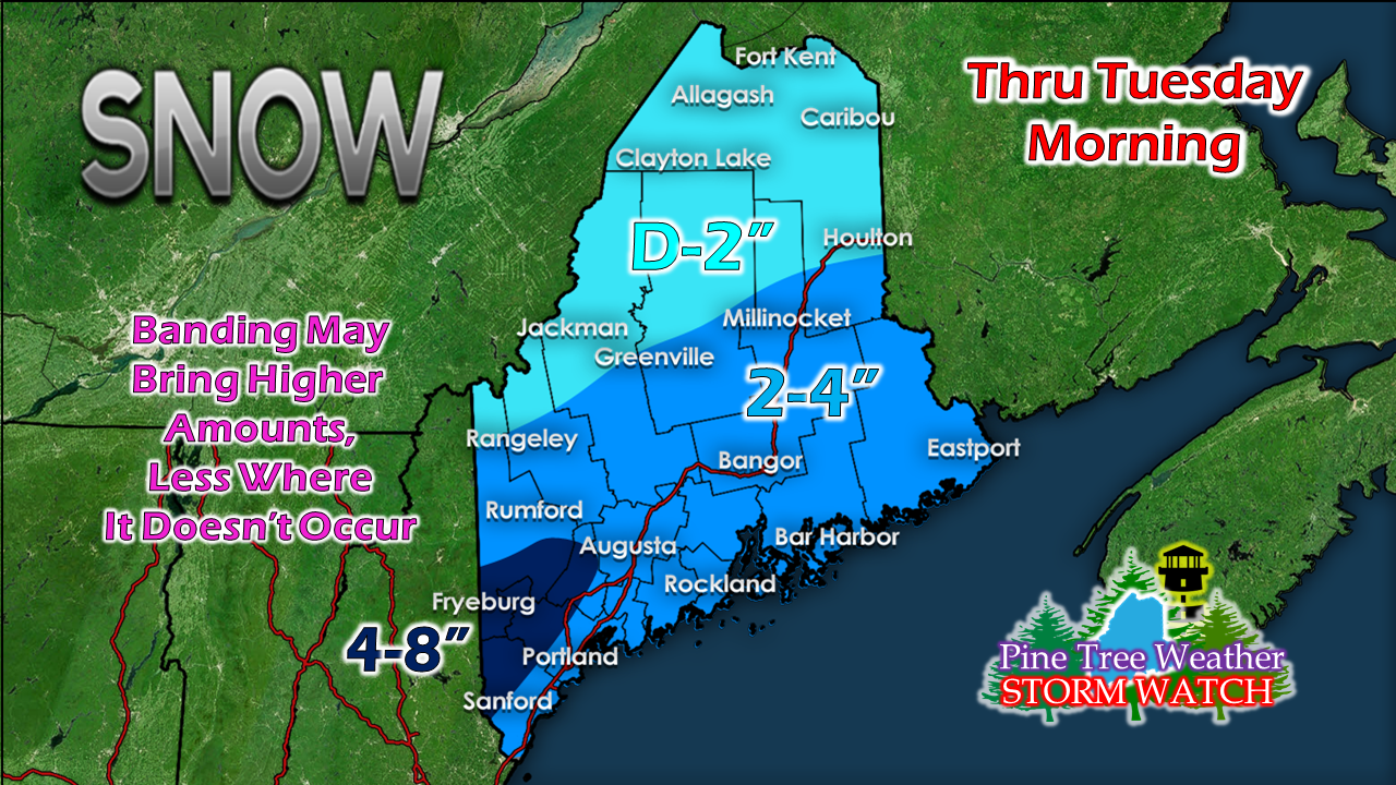 The southwest interior appears to be the jackpot region. As I mentioned yesterday here, the higher hills in the coastal plain are likely to get the higher amounts. The shorelines may fall in the 1-3" range, with rain potential for the islands. The coastal front is always an issue with these events and if it works inland, would reduce totals. With the potential surface temperatures hovering around 32-35° within 5-10 miles of the shoreline, it's a bit of a crap shoot pending on where the melting layer sets up, and if that happens, for how long. This means a potential snow / rain mix for the seaside towns. These spring events bring bust potential and surprises with snow amounts. Be aware of that. Breezy conditions could bring some wires down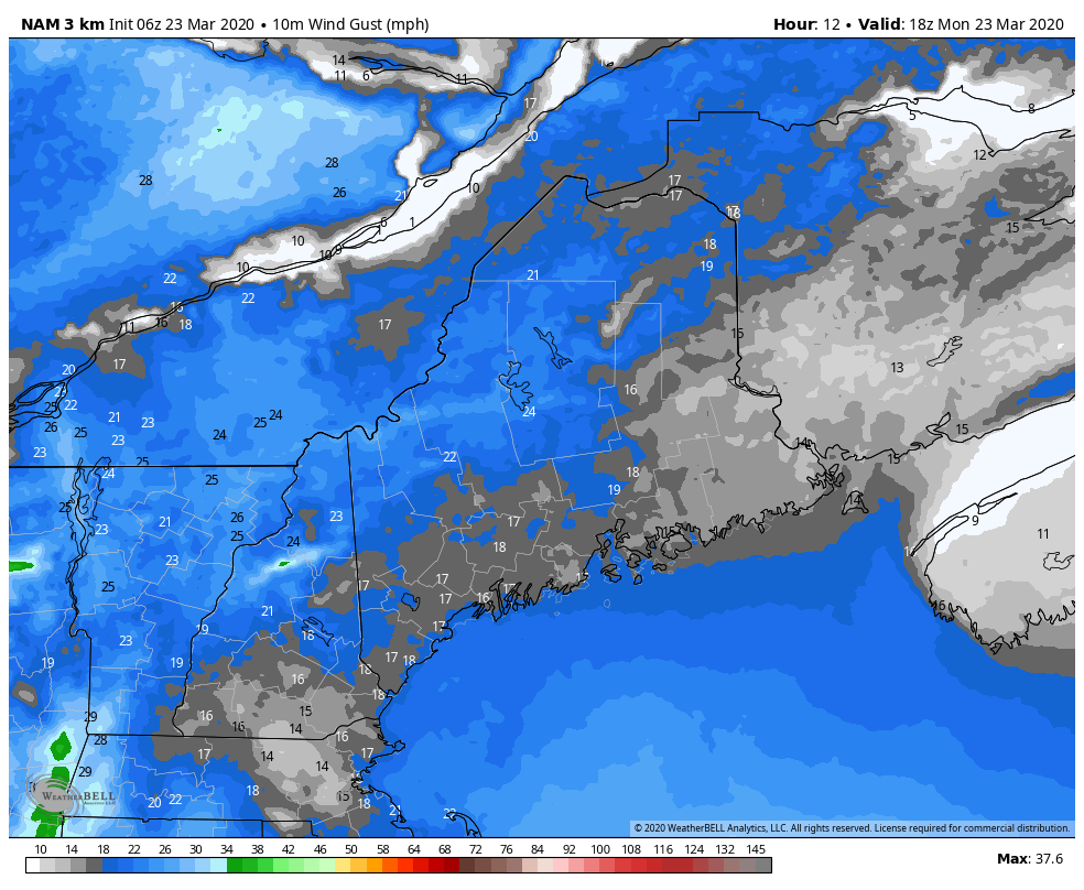 This loop here indicates wind from 2 PM Monday through noon Tuesday. As the storm works just inside the 40° N / 70° W point south of Nantucket, it will be intensifying as it moves eastward. This will kick up the wind, with gusts 15-30 mph possible for the coastal plain through Monday night into Tuesday morning. The wind is likely to pick up Tuesday afternoon as the storm intensifies and high pressure moves in from the northwest. By this point, the threat for power loss is likely to be minimized. Above freezing temperatures help with clean up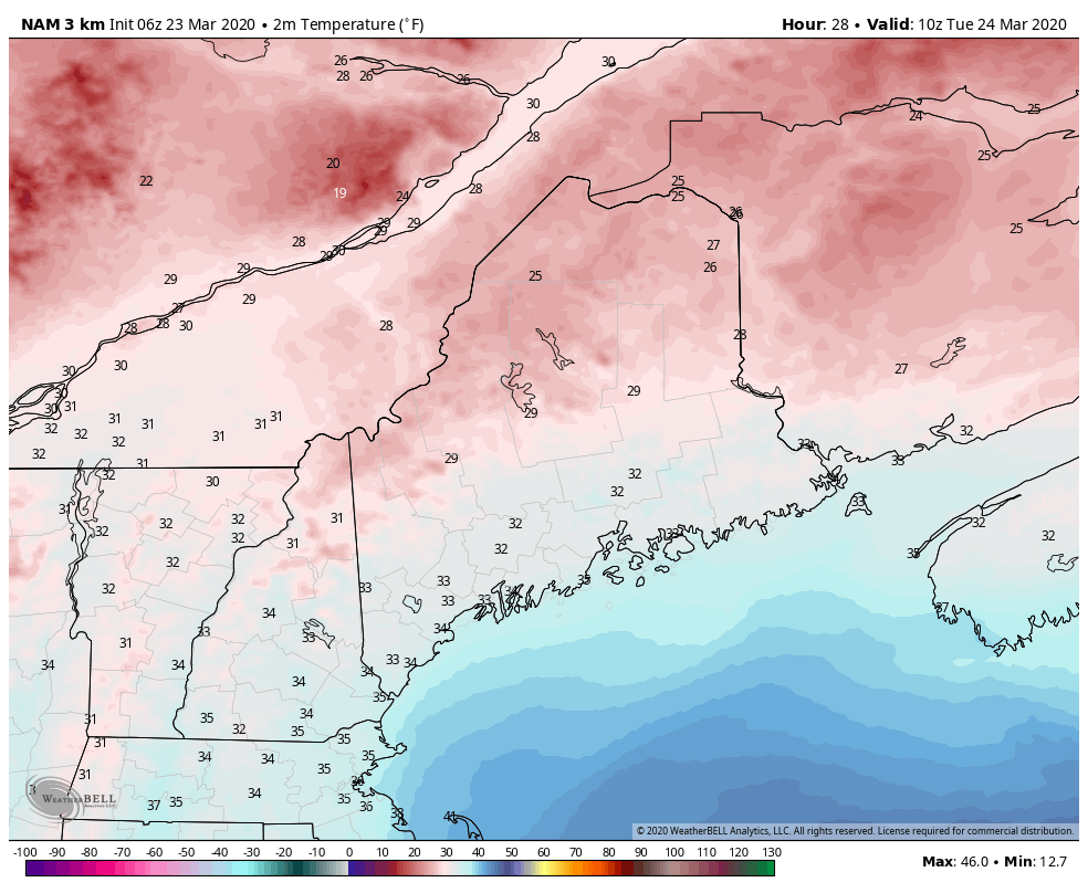 Shoveling and plowing with this one is all at the discretion of the beholder. For the coastal plain, temperatures will rise into the 40s with some 50s possible for southern areas. Add a mainly sunny day for the most affected areas of the coastal plain, Mother Nature will do her job and help clean up her mess. Temperatures do fall below freezing everywhere Tuesday night, so there is potential for some black ice where the sun and ground does not absorb the melting. Wednesday sees temps rise above freezing for most areas with 30s and 40s, a bit cooler than Tuesday.
Feel free to use the many pages available on this website for many types of forecasts on rainfall, snowfall, marine, longer range CPC outlooks and maps. Thank you as always for your support! ► ► For the latest official forecasts, bulletins and advisories, please check in with the National Weather Service in Gray for western and southern areas, or Caribou for northern and eastern parts of Maine. Always stay weather aware! - Mike |

Mike Haggett
|


