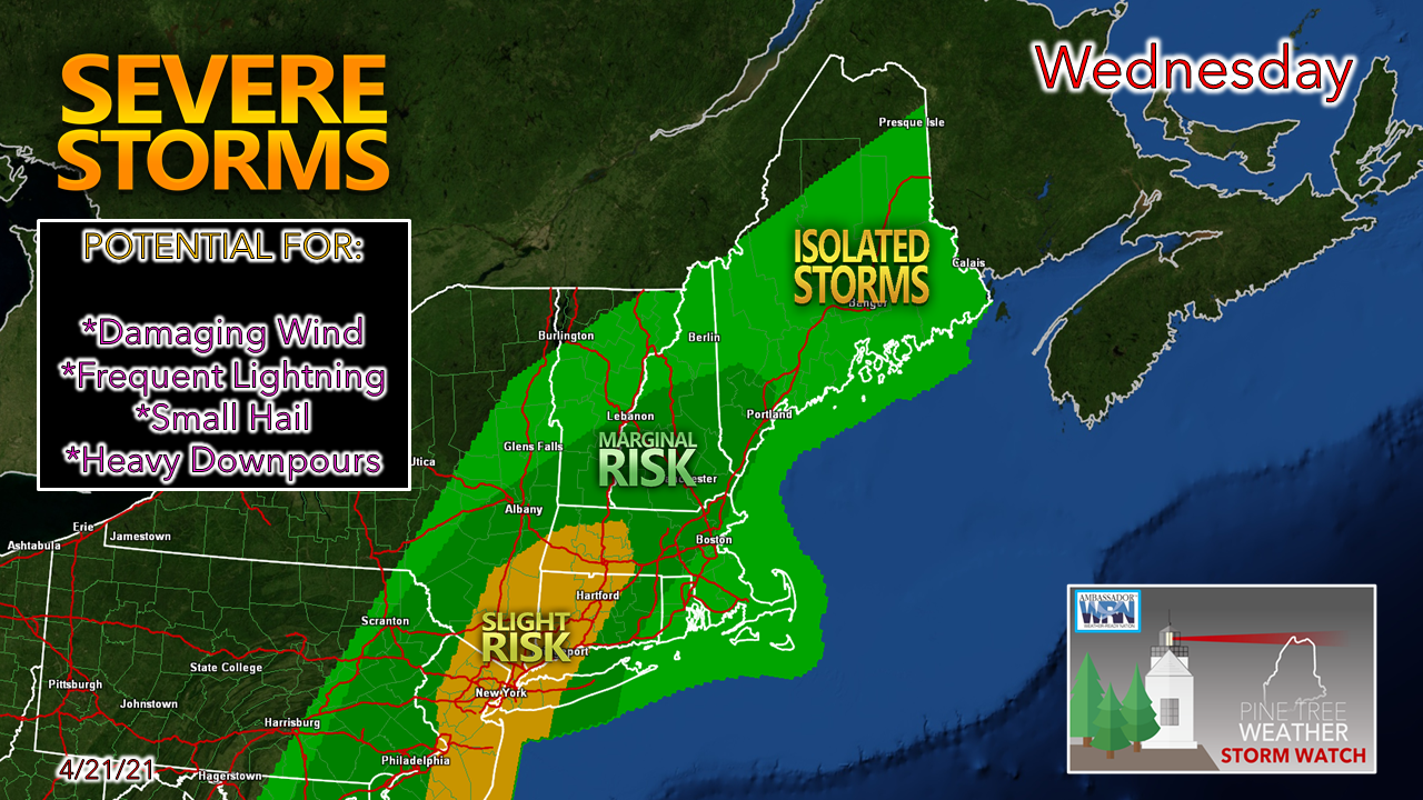
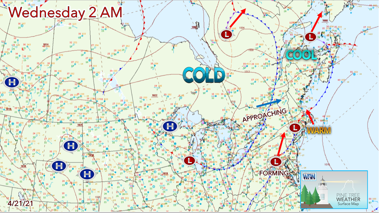
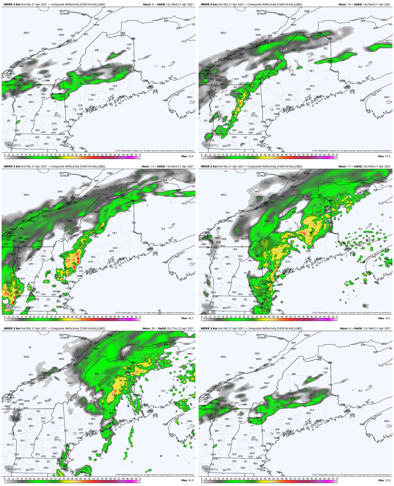
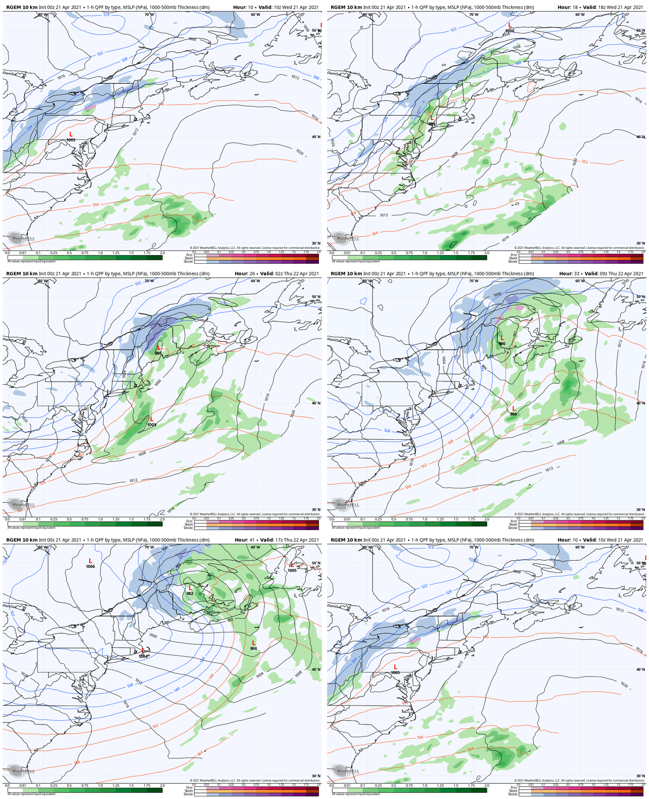
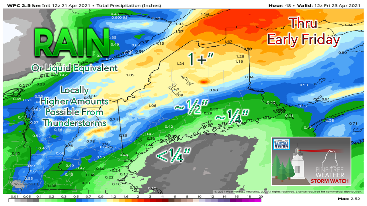
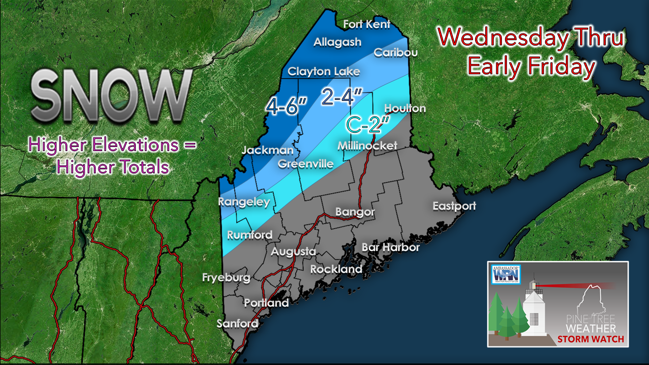
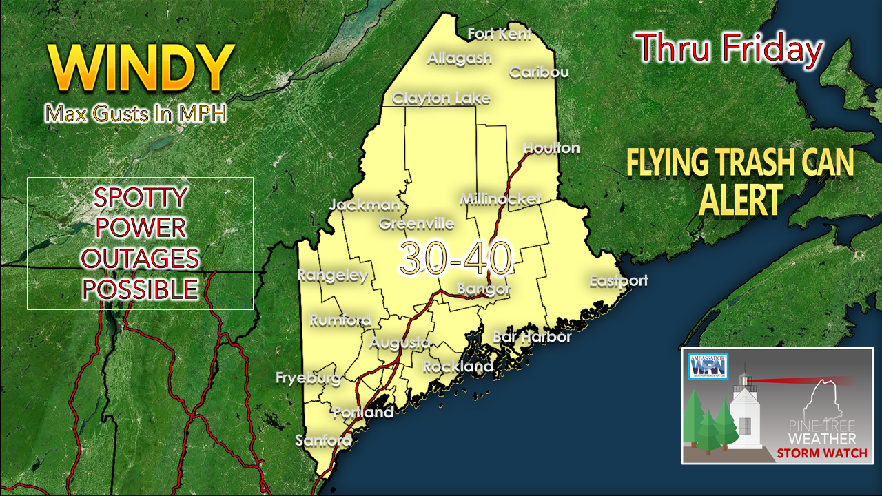
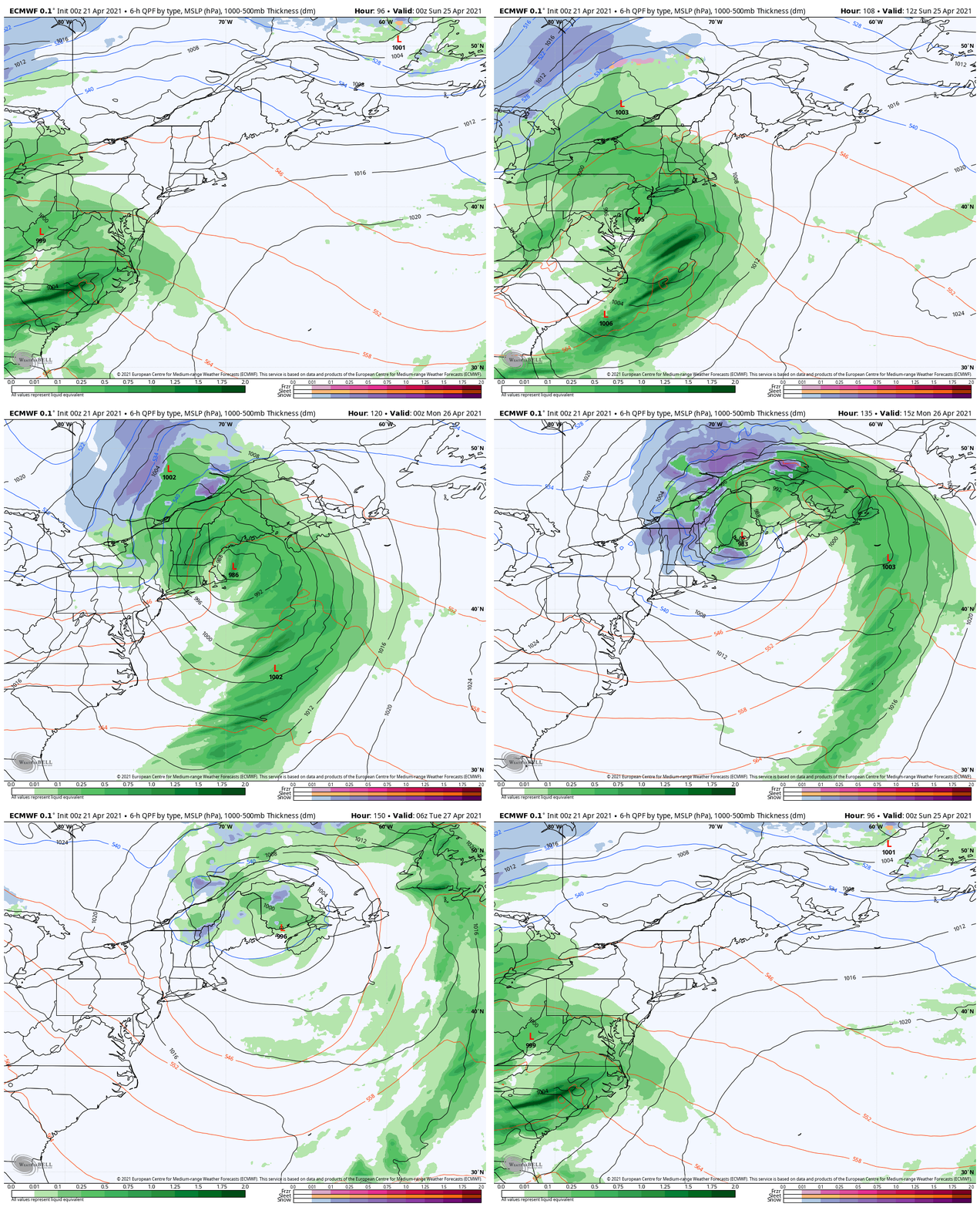
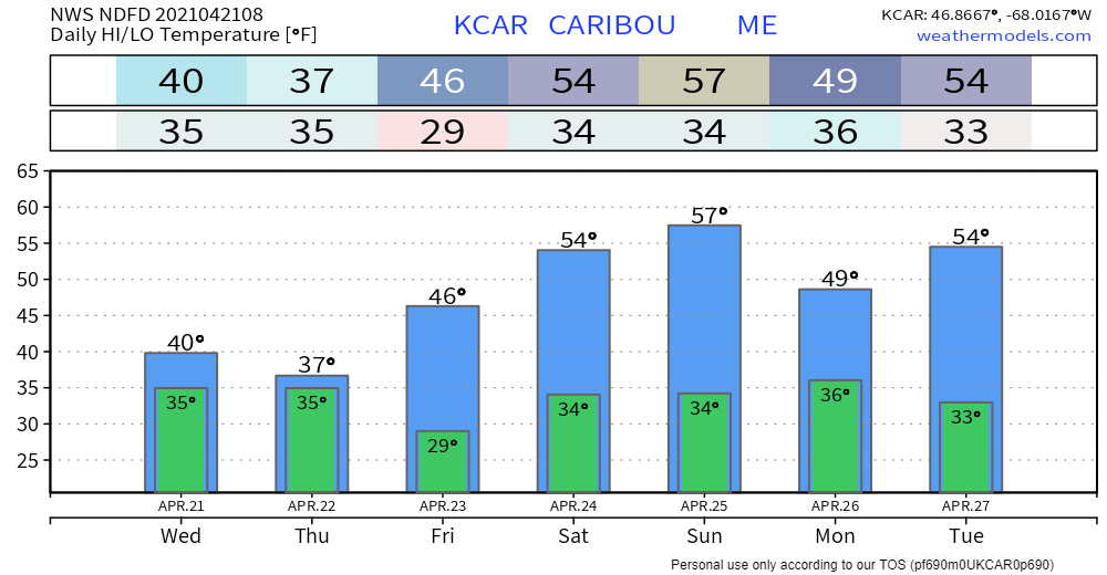
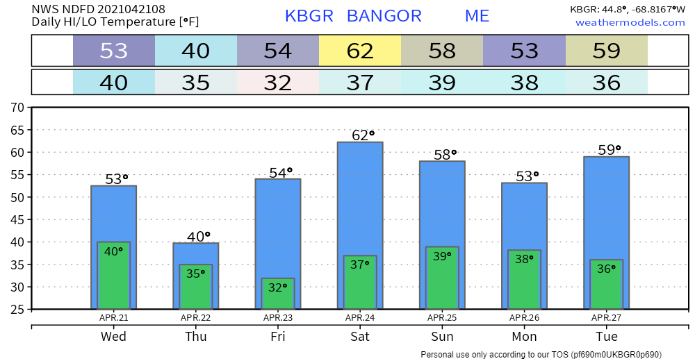
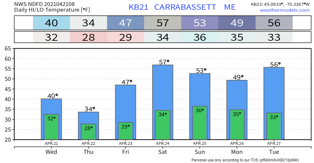
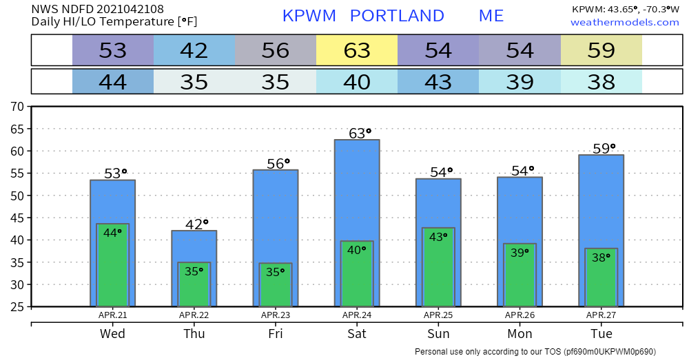
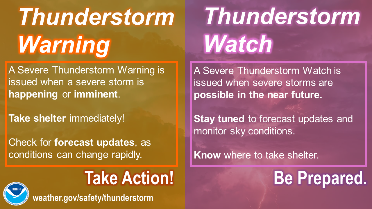
A wild and wacky WednesdayFor those in southwestern areas of Maine, it will be an eye to the sky day for severe storm potential. If you are working or playing outside, make sure shelter is accessible in case storms develop this afternoon. When thunder roars, head indoors! As you plan your outdoor activities this summer, stay updated on potential for thunderstorms by checking the severe weather forecast page here on the website with outlooks out 3 days updated as the Storm Prediction Center releases them. The potential for severe storms comes in the form of a warm front that noses into the region from southern New England. Add the combination of an approaching cold front and low pressure developing over Pennsylvania, the region is caught in the middle of a decent spring storm event. Interior areas see some snow and/or rain showers Wednesday morning as the warm front moves northeast. As the cold front approaches this afternoon, showers and thunderstorms touch off out ahead of it. Storms could be potent with damaging wind, frequent and loud lightning, small hail, heavy downpours, and very low chance for an isolated tornado. As the front kicks through by early evening, storms fizzle out and any remaining showers clear through by around midnight to 1 AM. With the approaching front, wind speeds out of the south could reach 30 mph, with the shorelines potentially reaching a bit higher than that. Thursday brings snow, rain, and windLow pressure situated over Pennsylvania early Wednesday begins to intensify as it moves northeast along a cold front. As the northern and southern streams merge over Maine, the storm gains with intensity as it moves towards the Gaspe Peninsula and slows to a crawl by Thursday evening. The track of the storm splits the state, with the western mountains and northwest Aroostook seeing snow, and eastern and southern areas getting rain. Total liquid amounts continue to favor interior areas, with northern areas likely to see the most. Southern areas get the bulk of the rain from Wednesday's storm activity, with locally higher amounts in areas. No real changes to the snow potential. A heavy, wet sloppy affair. Where snow sticks come the potential for power outages. Wind will be a factor through Friday night across the region. Make sure to secure any loose objects and trash cans. Power outages could be spotty between any thunderstorm activity which could bring damaging wind, along with the storm intensification, and areas that get wet snow. Outlook through the weekendThe next storm on the way moves in on Sunday, which is shaping up to be a complete washout. There are discrepancies on how long the storm will linger around, along with snow potential for the mountains. With the recent storm activity and this potential system, the low rainfall amounts year to date may either break even or turn into a surplus by Tuesday. Stay tuned for more details on this event. Thunderstorm Watch vs. WarningA Severe Thunderstorm WARNING means TAKE ACTION: take shelter in a strong building, because severe weather is occurring or will occur shortly. A Severe Thunderstorm WATCH means BE PREPARED: stay informed and be ready to act, because severe thunderstorms are possible. weather.gov/safety/thunderstorm-ww Be prepared to receive alerts and stay updated!
For more information in between posts, please follow Pine Tree Weather on Facebook and Twitter.
Thank you for supporting this community-based weather information source which operates by reader supported financial contributions. Stay updated, stay on alert, and stay safe! Thank you as always for your support! - Mike |
Mike Haggett
|

