
One degree of separation "Potential" and "possible" are the words of the day. The forecast remains to be very tricky due timing and development. Analyzing data today, a couple things stood out to me. First, the predicted drop in atmospheric pressure. Today, we enjoyed high pressure that moved over us at around 1026mb (30.31") and could be down to 975mb (28.79") by around this time Friday, which is impressive drop. The other piece of analysis is looking at temperatures in the atmosphere. One degree Celsius may dictate who gets rain and who gets snow. This is going to be an interesting storm, to say the least. Three pieces come together to make the storm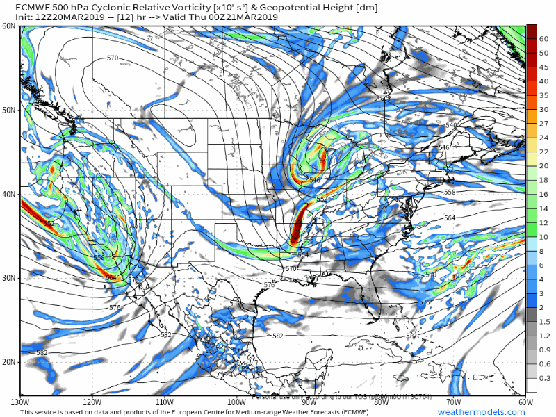 Two pieces of energy are on the playing field, those being over the nations mid-section. A northern stream riding over the immense western ridge, and the southern stream. The critical piece which contains the cold air kicker will be dropping down from the Northwest Territories into Manitoba overnight into Thursday. All three combine and create deep area of low pressure that will travel into the region Thursday night and stay in the area through Saturday. 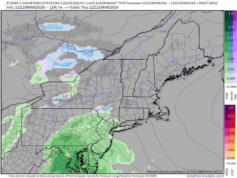 Last night, I mentioned the TROWAL effect, which is an acronym for TRough Of Warm Air aLoft. This remains to be the wildcard. Just how warm will the upper air will be and how cold it will be near the surface will dictate the precipitation type outcome. This storm is going to intensify very quickly. As a result of that, there will dry slotting, so there will be breaks in precipitation at times in areas. The heaviest amounts will come on Friday. Saturday will feature snow and/or rain showers depending on region. Potential impacts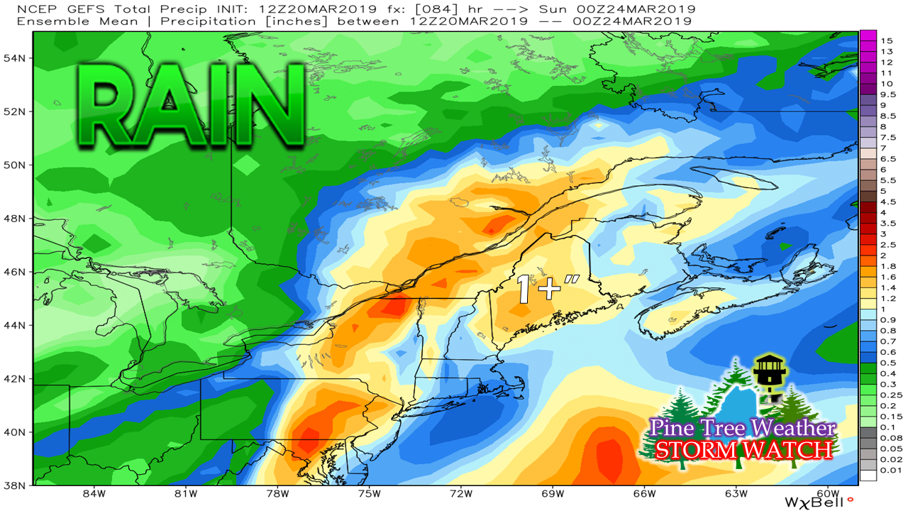 Regardless of what form of precipitation makes landfall, there is a considerable amount of liquid equivalent on the way, ranging from 1-2" worth. 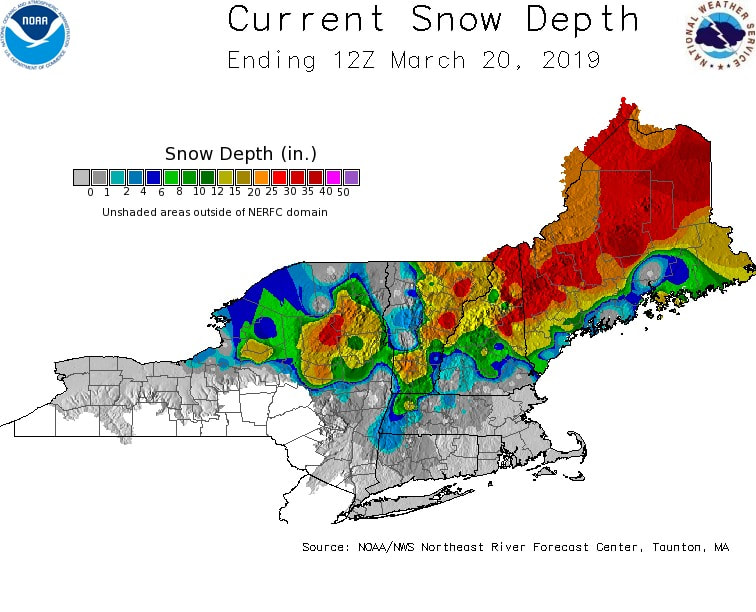 Seeing what is on the ground for snow in areas raises the red flag for potential flooding. If this turns into an all rain event, this could be a big problem with our rivers, brooks and streams. 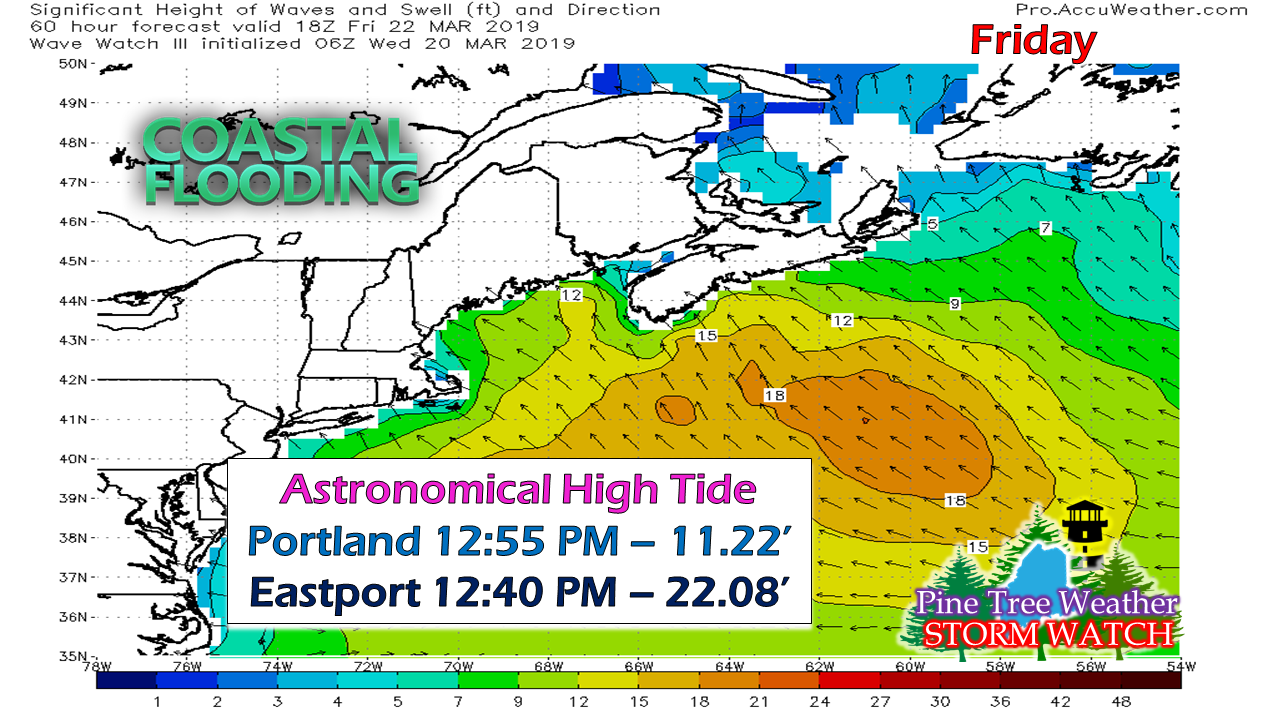 Then with the astronomical high tides and add to that 1-1½ feet of storm surge, our shoreline areas could see minor to moderate flooding. 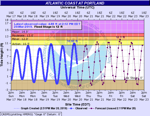 This idea is already on the table for Portland, with minor flooding predicted for now with the Friday afternoon high tide. 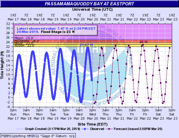 Further up the coast, we see the same issue for Eastport. For my followers in the Machias region, Cutler may experience some flooding as well. 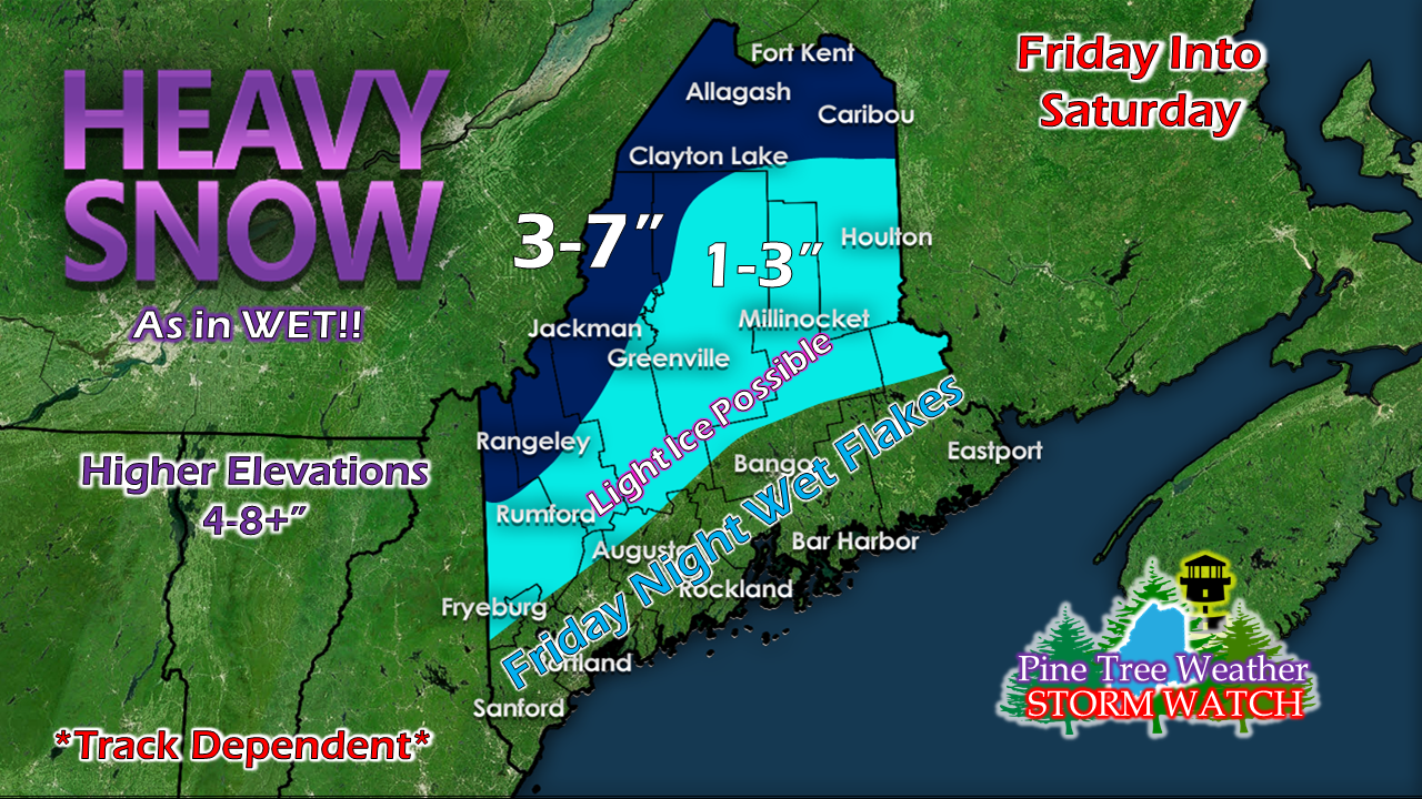 This is my best idea for snow as I see it for now. Friday starts as snow over the interior. There is likely to be some accumulation on the ground for the western mountains by daylight. The storm track will dictate what happens after that. If this sets up right, the ski hills will be loving life. The higher elevations could cash in on this IF this stays snow up that far. One degree of separation. Remember that. Regional outlook through Monday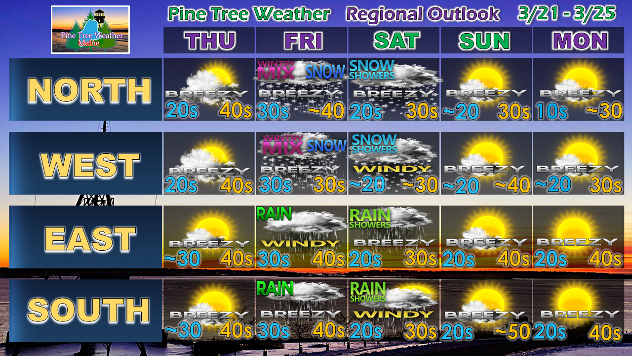 Stay tuned to my Facebook page and Twitter feed for more information from me. I will do my best to provide another update here by 6 PM Thursday.
Stay tuned. ► ► For the latest official forecasts, bulletins and advisories, please check in with the National Weather Service in Gray for western and southern areas, or Caribou for northern and eastern parts of Maine. ► ► Your financial donations are much appreciated to keep this site funded and for further development. I sincerely appreciate your support not only financially, but also in sharing my efforts with others. Always stay weather aware! - Mike |

Mike Haggett
|


