Pine Tree Weather
  • DISCUSSIONS
  • DONATE
  • MAPS
  • NWS BRIEFINGS
  • SATRAD
  • MARINE
  • SNOW / ICE OUTLOOK
  • RAIN OUTLOOK
  • CPC OUTLOOK
  • Kennebunk
  • OBSERVING WEATHER
  • Who We Are
  • My Photography
  • DISCUSSIONS
  • DONATE
  • MAPS
  • NWS BRIEFINGS
  • SATRAD
  • MARINE
  • SNOW / ICE OUTLOOK
  • RAIN OUTLOOK
  • CPC OUTLOOK
  • Kennebunk
  • OBSERVING WEATHER
  • Who We Are
  • My Photography

Springlike unsettled week ahead

3/29/2020

Comments


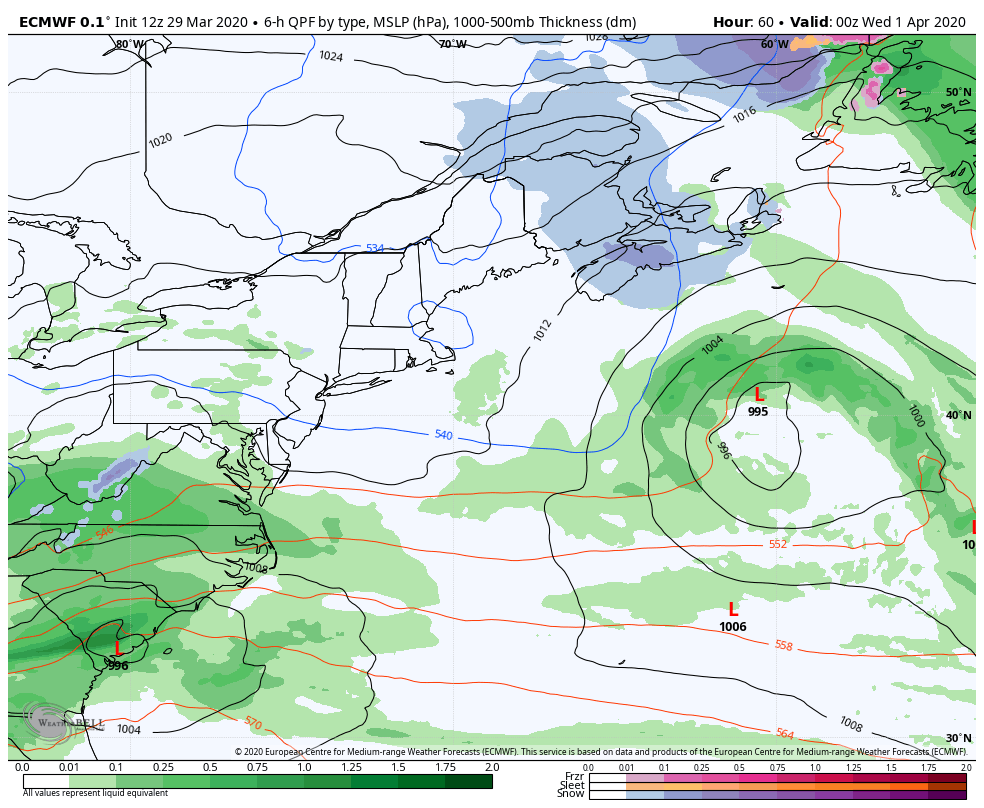
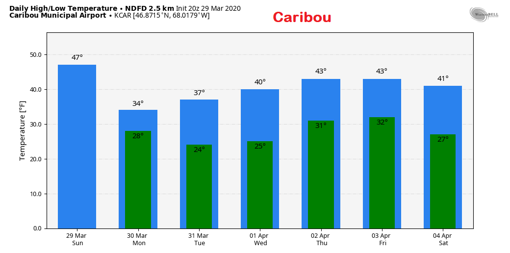
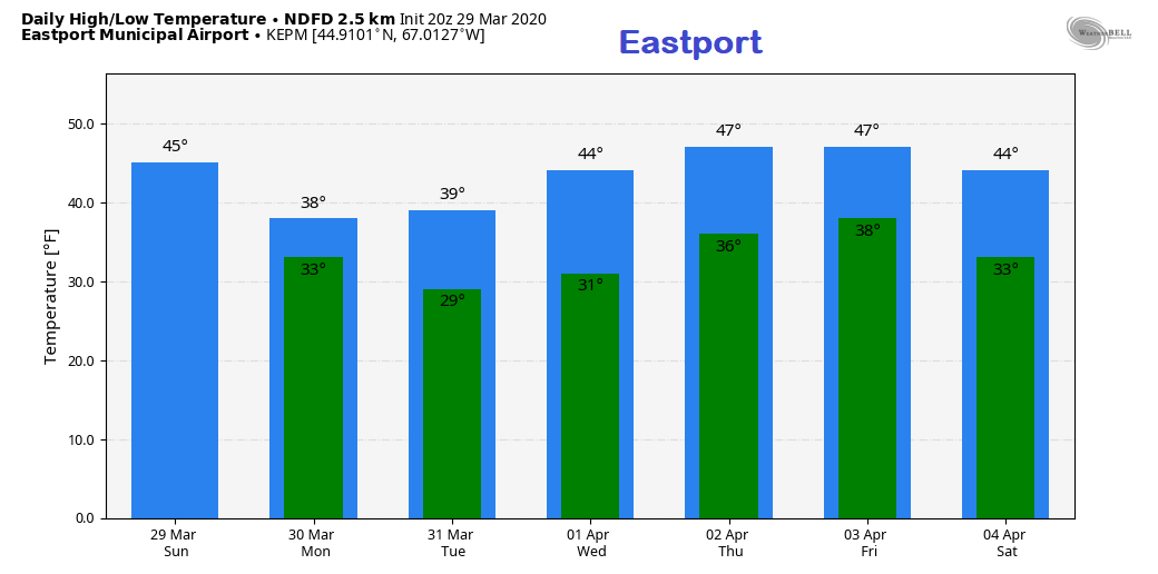
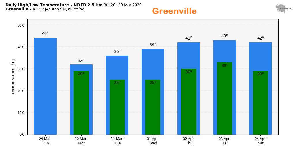
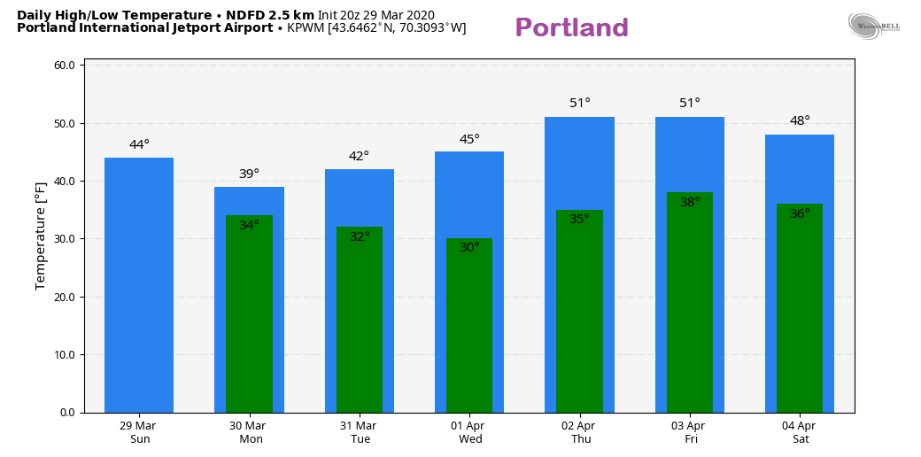
Most everyone could see flakes from current storm

Picture
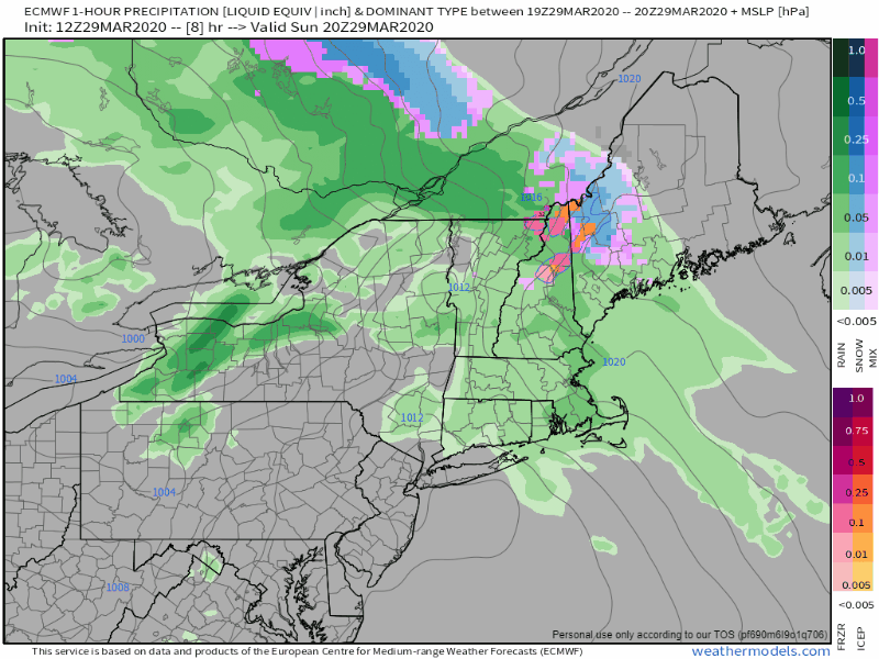
The storm over the Great Lakes that touched off severe weather over the midwest is slowly weakening. A warm front moving northeastward stalls over the region Sunday night into Monday, then dissipates over the area Monday night into early Tuesday. In the meantime, any areas of rain over interior areas change to snow as the air column cools. Snow showers will persist in Monday, with all areas getting a chance for snow showers and/or flurries with light accumulations Monday night into early Tuesday morning. 
Picture
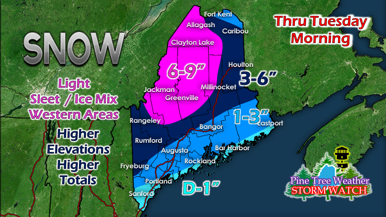
Most of the snow will be on the ground by Monday morning for interior areas. The shoreline region sees its best chance for snow accumulation Monday night into early Tuesday. 

Back door cold front to impact the region
​Wednesday & Thursday

Picture
The upper low associated with the system will impact our weather all the way through ​the end of the week. Given the blocking over the Atlantic to the northeast, the energy has no place to go. This will be an issue as it pinwheels from east to west.

Tuesday appears to be a fair but breezy day.

Snow and rain showers are possible Tuesday night into Wednesday for eastern and northern areas as the backdoor cold front approaches from the Canadian Maritimes.

All areas have a chance some sort of light precipitation Wednesday night into Thursday.

Friday appears fair but breezy as well. 

Temperature outlook for the week

Picture
Picture
Picture
Picture
​Feel free to use the many pages available on this website for many types of forecasts on rainfall, snowfall, marine, longer range CPC outlooks and maps. 

Thank you as always for your support! 


​► ► For the latest official forecasts, bulletins and advisories, please check in with the National Weather Service in Gray for western and southern areas, or Caribou for northern and eastern parts of Maine.

Always stay weather aware!

​- Mike
Comments
    Picture

    Mike Haggett
    Kennebunk, ME

    Certified Weather
    Forecaster
    Penn State '21

    American Meteorological Society

    National Weather Association

    Weather-Ready Nation 
    Ambassador
    ​
    ​SKYWARN-CWOP

    Matthew 19:26


    Support
    Pine Tree Weather

    DONATE

    Picture

    Picture

    Picture

    Picture

    Picture

    Picture

    Picture

    Picture

    Picture

    Picture

    Archives

    January 2023
    December 2022
    November 2022
    October 2022
    September 2022
    August 2022
    July 2022
    June 2022
    May 2022
    April 2022
    March 2022
    February 2022
    January 2022
    December 2021
    November 2021
    October 2021
    September 2021
    August 2021
    July 2021
    June 2021
    May 2021
    April 2021
    March 2021
    February 2021
    January 2021
    December 2020
    November 2020
    October 2020
    September 2020
    August 2020
    July 2020
    June 2020
    May 2020
    April 2020
    March 2020
    February 2020
    January 2020
    December 2019
    November 2019
    October 2019
    September 2019
    August 2019
    July 2019
    June 2019
    May 2019
    April 2019
    March 2019
    February 2019
    January 2019
    December 2018
    November 2018
    October 2018
    September 2018
    August 2018
    July 2018
    June 2018
    May 2018
    April 2018
    March 2018
    February 2018
    January 2018
    December 2017
    November 2017
    October 2017

    RSS Feed

Proudly powered by Weebly