The further inland, the more sun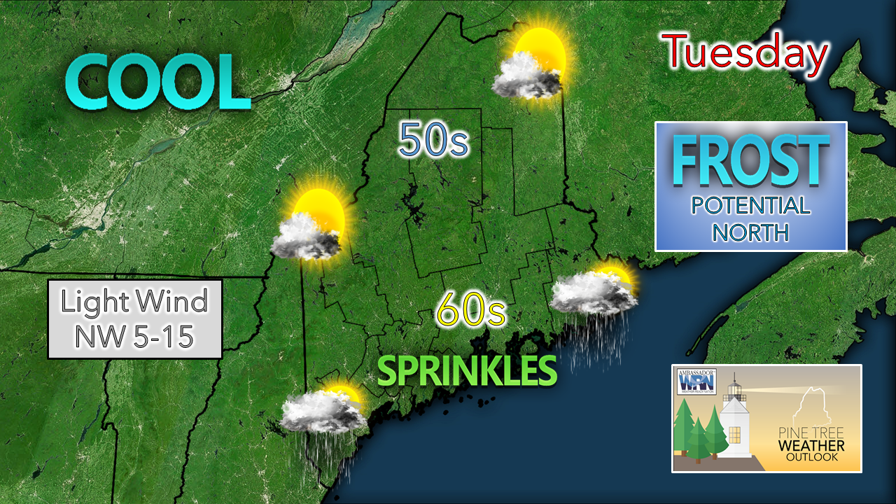 A day which will finally feel like fall is on tap for the region Tuesday. A stalled frontal boundary keeps the coastal plain dealing with clouds through most of the day. Interior areas in the mountains and north see more sun for the day, with cool temperatures to go along with it. 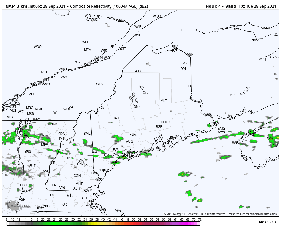 Tuesday 6 AM - 6 PM: The southern half of the state has the best chance to get a sprinkle or a light shower at times through the day. The best chance for southern areas appears before 2 PM, and for eastern areas from around noon to 6 PM. Southern areas may see some sun mixed in with the clouds later in the afternoon. Frost potential Wednesday morning for interior areas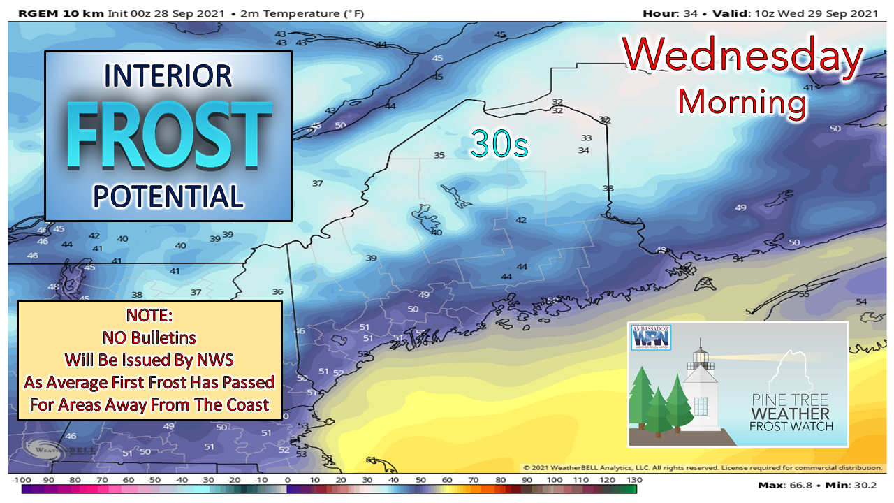 The best chance for clearing skies overnight will be for the mountains and north. With the cold airmass in place from the cut-off upper-level low, that will bring the best chance for areas of frost overnight. For those gardeners who are taking advantage of the longer than average growing season, it would be wise to cover your plants just in case. Unsettled pattern continues into the weekend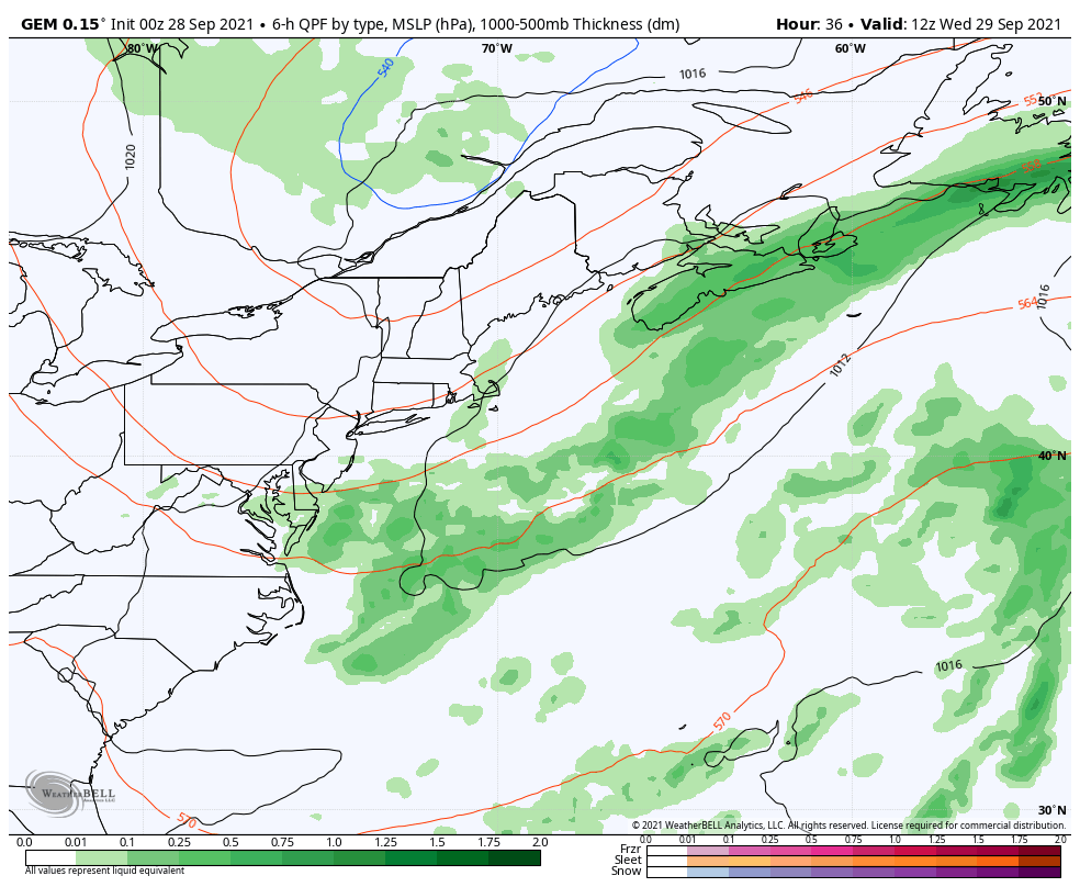 Wednesday 8 AM - Friday 8 PM: The cut-off upper-level low continues to meander over the region. As it pinwheels around, it will drag moisture in from the Atlantic and bring showers to the region. Wednesday appears mainly dry. Scattered showers / sprinkles are possible for Thursday, with northern and eastern areas seeing a best chance at this point. The upper low wobbles to the northeast by Friday, with a risk of a light shower or sprinkle continuing for northern areas through the day. The forecast for the weekend is low confidence at this point given the dynamics of the cut-off upper-level low which is caught in a block with no escape route with any certainty at this point. A chance of showers is possible for both days, with fine tuning to come.  Sam to pass well east of the region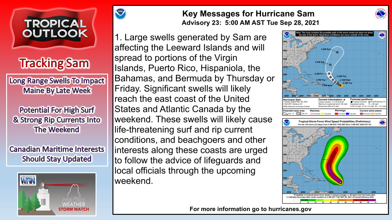 While the cut-off upper-level low over the region will continue to impact our area through the rest of the week into the weekend, it is a blessing in disguise. It will act as a steering mechanism to keep Hurricane Sam well to the east of the region. Folks in Newfoundland should continue to stay updated on the major storm as it may clip the Avalon in similar fashion as Hurricane Larry. For Maine interests, long period swells with strong rip currents are the only concern from this late week and into the weekend. Jetstream Are you interested in learning more about weather and the science behind it? Visit Jetstream, the NWS online weather school! Explore comprehensive, well-organized, colorfully illustrated curricula designed to help teach about the wonders and dangers that abound in the Earth's atmosphere. weather.gov/jetstream Temperature outlook through the weekend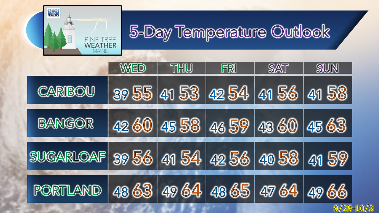 Be prepared to receive alerts and stay updated!
 For more information in between posts, please follow Pine Tree Weather on Facebook and Twitter.
Thank you for supporting this community-based weather information source which operates by reader supported financial contributions. Stay updated, stay on alert, and stay safe! - Mike |

Mike Haggett
|