|
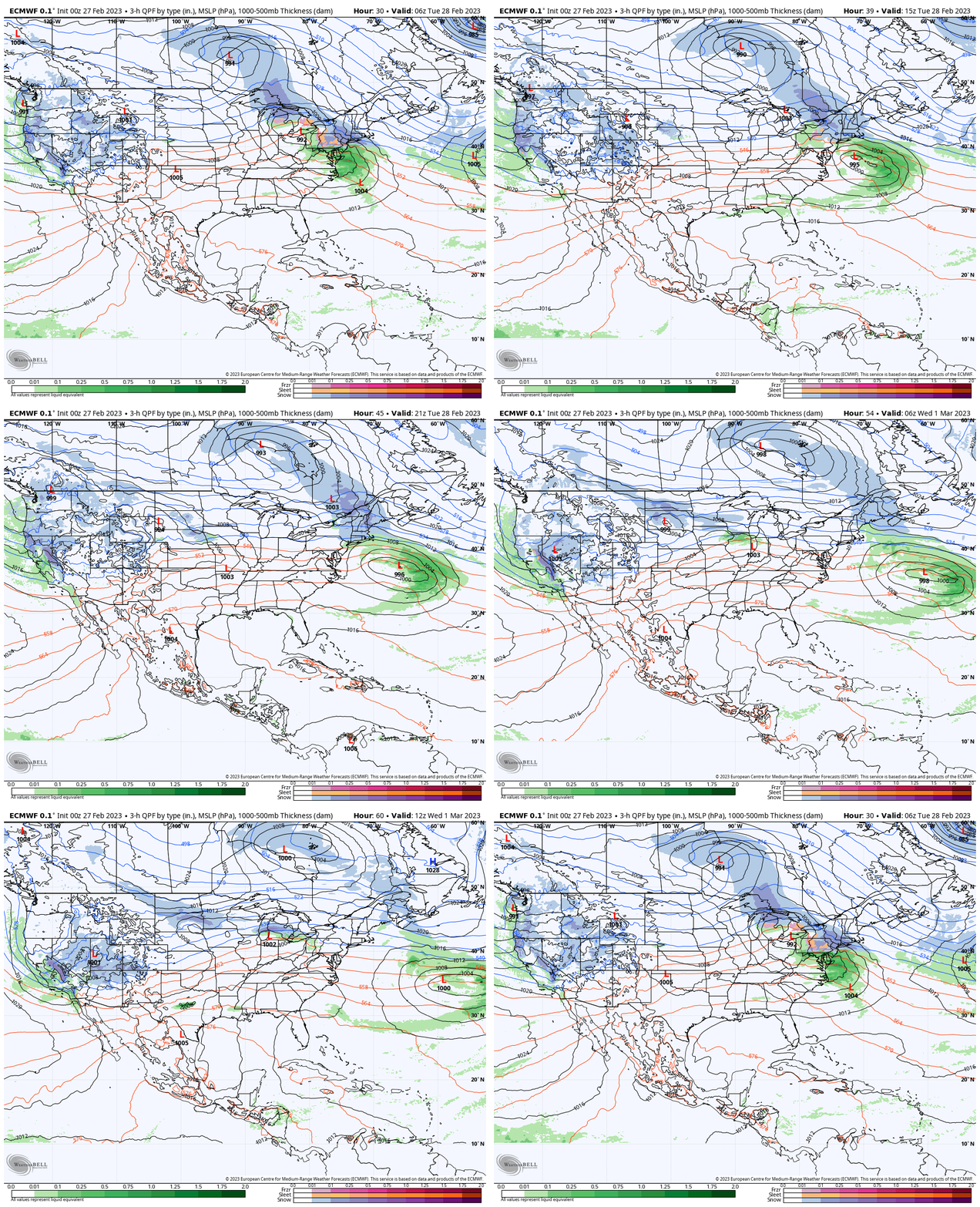
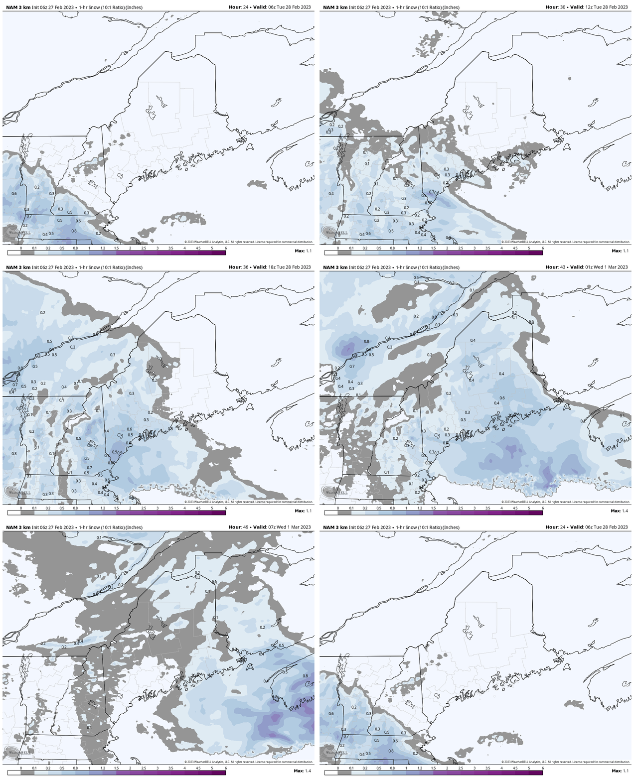
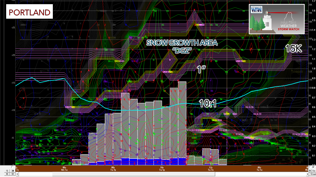
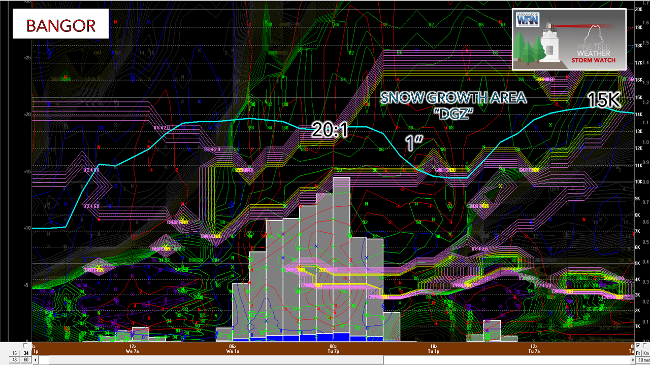
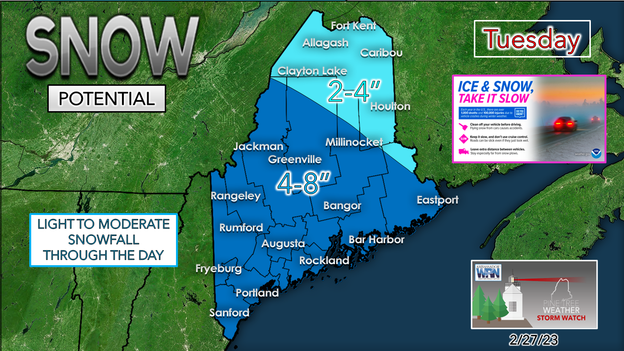
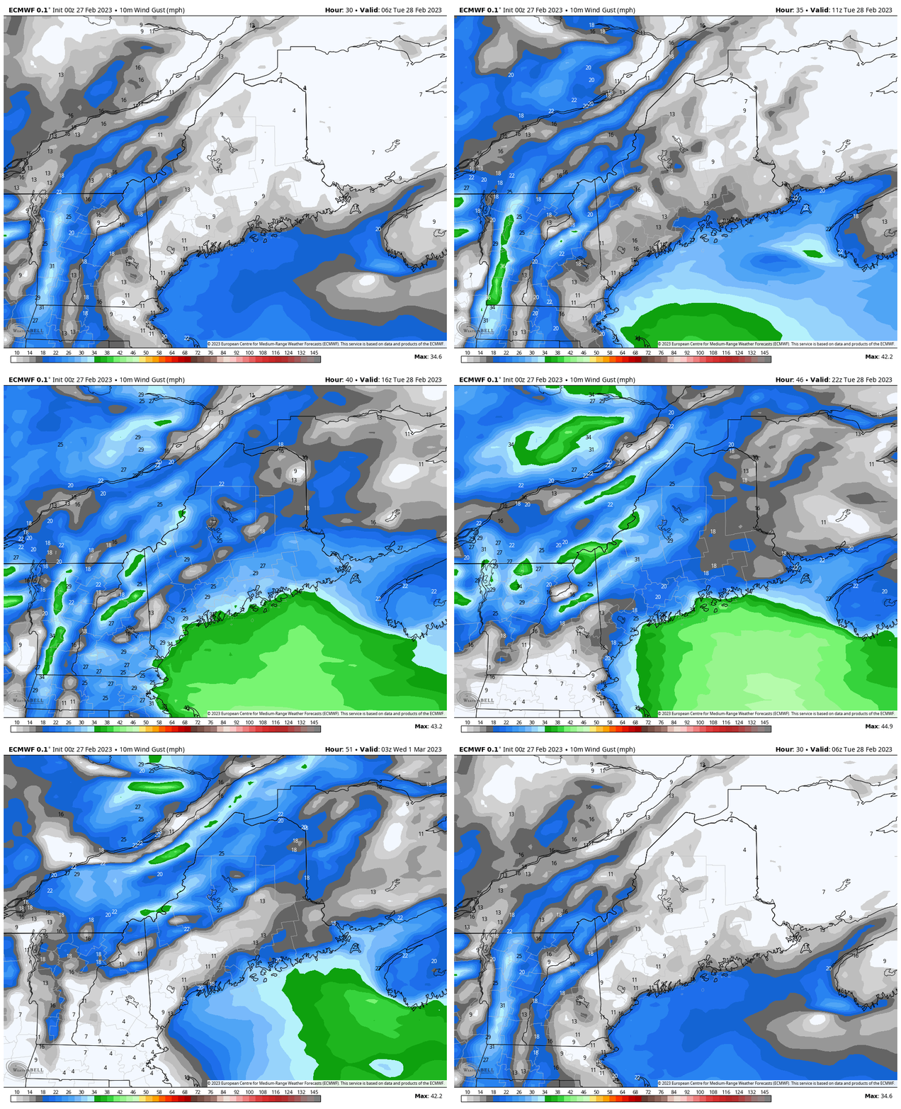
A Winter Weather Advisory has been posted for much of southwestern Maine and most of New Hampshire. This is one of those events that will ebb and flow with snowfall rates and accumulations at times through the day, which may be annoying for those responsible for municipal, commercial, and residential cleanup and maintenance. In the middle of the split flowTuesday 1 AM to Wednesday 1 PM - Guidance has come into agreement on the track of the northern low near Hudson Bay and the southern low that skirts south of the benchmark 40° N / 70° W point. The inverted trough / cold front between the two and its influence over Maine has been the question over the past several days. Models hint at an area of low pressure forming between the two lows along the boundary, but with the proximity of it close to the strengthening low over the ocean, that energy gets sent to the southeast. Maine is caught in the middle of the two systems, which poses forecast challenges as to how it plays out. Tuesday 1 AM to Wednesday 7 AM - Looking at the hourly snowfall amount potential indicates southern and western areas see snowfall for the Tuesday morning commute. Northern and eastern areas stay relatively snow free outside of some snow showers and flurries through the morning and see the snow pick up in the afternoon hours. Off and on steady snow tapers off to snow showers and flurries Tuesday night over southern areas, the wee hours of Wednesday morning for the rest of the state. Looking at the horizontal atmospheric profile for Portland shows the snowfall amount and rates varying at times. The challenge for the coastal plain with accumulations will be marginal temperatures in the upper 20s to low 30s along with solar insolation (height and heat of the sun through the clouds) and its influence on all of this, which may reduce totals. On the flip side, a coastal front will be a key feature to watch which may increase snowfall amounts at times if that materializes. There is a better depiction of the enhancement idea looking at the horizontal profile idea from Bangor. Two areas of snow growth are depicted here, one at 15,000 feet and another around 4-5,000 brings the potential for surprise. This idea may be a bit overdone, but it's out there and worthy to note in case snowfall amounts become heavier. Also, it is important to note the variation in snowfall ratios between the two cities. Portland is more in the 10:1 ratio region which indicates a wetter snow, which makes sense with the marginal temperatures. Further inland as shown here in Bangor, along with other areas over the interior that were sampled, snow to water ratios upwards of 20:1 is possible, which is a fluffier snowfall. The sum of all this is factored into the forecast snowfall amounts. Some areas could bust on the high end given the fluff and enhancement potential, Conversely, some areas could bust on the low end where marginal temperatures and the lack of enhancement occurs. The other factor in place here is the wind. While nothing significant for power outages are concerned, it will be strong enough to blow the snow around a bit and may cause brief whiteout conditions in areas bursts of heavier snow. Wind gusts in the 20-30 mph range are possible for most areas, with 30-40 possible for the shorelines. Thank you as always for your support! You may not like the weather, but I hope you like what I do! Please hit the like button on Twitter and Facebook, and share! Financial donations to fund what I do are always appreciated! Stay updated, stay on alert, and stay safe! - Mike NOTE: The forecast information depicted on this platform is for general information purposes only for the public and is not designed or intended for commercial use. For those seeking pinpoint weather information for business operations, you should use a private sector source. For information about where to find commercial forecasters to assist your business, please message me and I will be happy to help you |
Mike Haggett
|

