Pine Tree Weather
  • DISCUSSIONS
  • MAPS
  • BRIEFINGS
  • SATRAD
  • MARINE
  • RAIN OUTLOOK
  • SNOW / ICE OUTLOOK
  • CPC OUTLOOK
  • Kennebunk
  • Weather Geekdom
  • Who We Are
  • DONATE
  • My Photography
  • DISCUSSIONS
  • MAPS
  • BRIEFINGS
  • SATRAD
  • MARINE
  • RAIN OUTLOOK
  • SNOW / ICE OUTLOOK
  • CPC OUTLOOK
  • Kennebunk
  • Weather Geekdom
  • Who We Are
  • DONATE
  • My Photography

Storm exits the region; gusty wind by evening

12/13/2017

Comments


The storm is pulling away

Picture
As of 5 AM Wednesday, the storm that has impacted the region in the past day heads northeast. As the cold front works through on the back side, snow showers are expected to break out (not shown in this simulated radar loop) that may bring additional accumulation for the higher elevations, and a solid dusting in other areas. 

There is a storm approaching late in the loop, more on that in a minute.
Picture
 Temperatures for the day will be falling throughout the day. By evening, temperatures could be at least 30° cooler compared to where northern Maine starts off the day. 
Picture
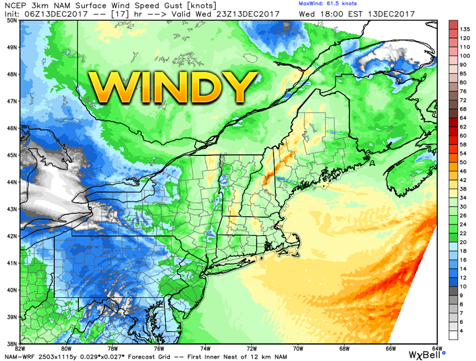
The National Weather Service as issued a wind advisory for York County, southern New Hampshire, all of Massachusetts and Rhode Island. Wind gusting to around 50 mph through this evening. 
Picture
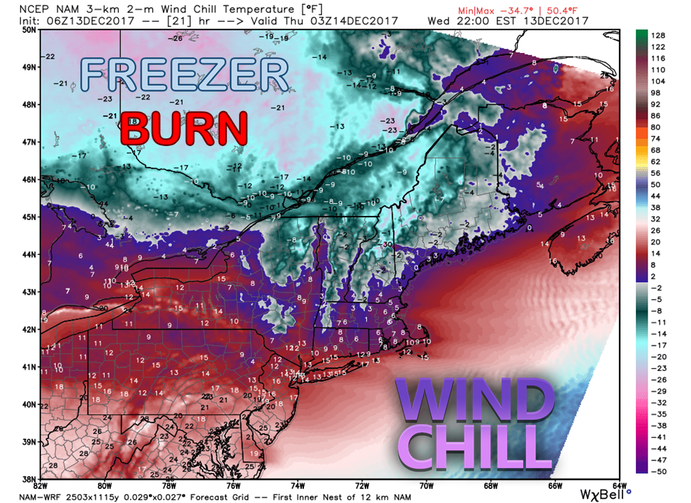
By 10 PM Wednesday night, the wind chill factor appears to be below zero for much of the state. As the wind slowly diminishes, the mountains and north start Thursday with indices below zero, the rest of the region in the single digits above. 

Any snow and slush from the mess from the latest storm will turn into cement by tonight. This cold air coming in isn't going anywhere anytime soon.

Storm passes by to the south

Picture
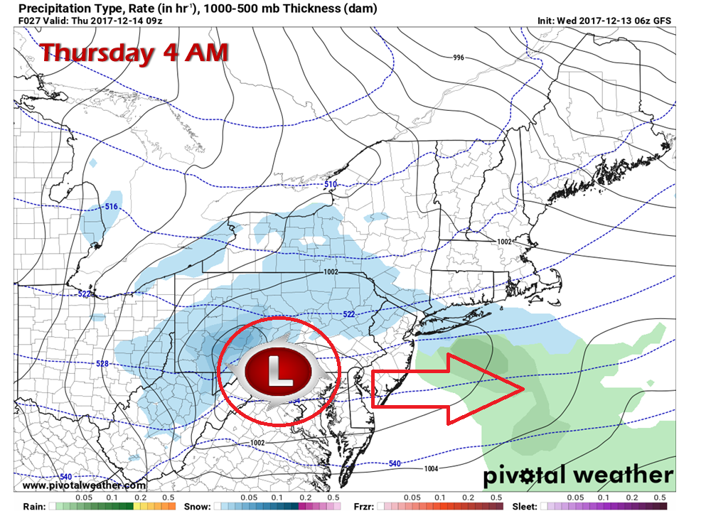
The upper low on the backside of the latest storm moves to the south and east of the region Thursday. I can't rule out some snow showers for the coast for around the York County area, but will likely be very light with little to no accumulation.

I will do my best to get the 5-Day Outlook page updated and have more information on the weekend in my next update.

Have a great day! 

​- Mike 
Comments
    Picture

    Mike Haggett
    Kennebunk, ME

    Penn State
    Weather Forecast Certification '21.
    AMS / NWA
    Weather-Ready Nation 
    ​SKYWARN-CWOP

    Picture

    Alex Hatfield
    Wakefield,MA


    Penn State
    Meteorology and Atmospheric Science ‘21
    PSUBAMS
    Campus Weather Service
    PSU Storm Chase Team
    PSU College of Earth &  Mineral Sciences Ambassador

    Picture

    Kaitlyn Lardeo
    ​Syracuse, NY

    SUNY Oswego
    Atmospheric Science
    Lake Effect Storm Prediction and Research Center
    Northeastern Storm Conference Contributor

    DONATE
    Picture

    Archives

    January 2021
    December 2020
    November 2020
    October 2020
    September 2020
    August 2020
    July 2020
    June 2020
    May 2020
    April 2020
    March 2020
    February 2020
    January 2020
    December 2019
    November 2019
    October 2019
    September 2019
    August 2019
    July 2019
    June 2019
    May 2019
    April 2019
    March 2019
    February 2019
    January 2019
    December 2018
    November 2018
    October 2018
    September 2018
    August 2018
    July 2018
    June 2018
    May 2018
    April 2018
    March 2018
    February 2018
    January 2018
    December 2017
    November 2017
    October 2017

    Categories

    All
    Maine Weather
    Pine Tree Weather

    RSS Feed

Proudly powered by Weebly