
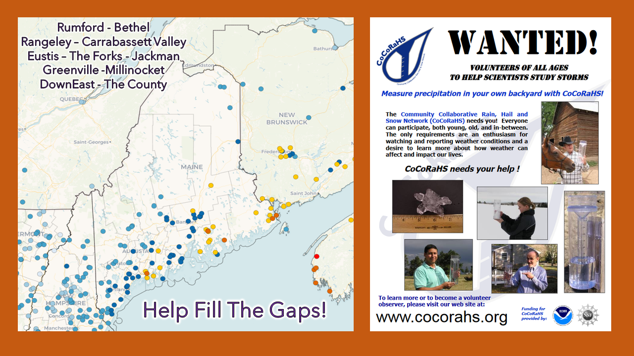
Calling myself out on this past storm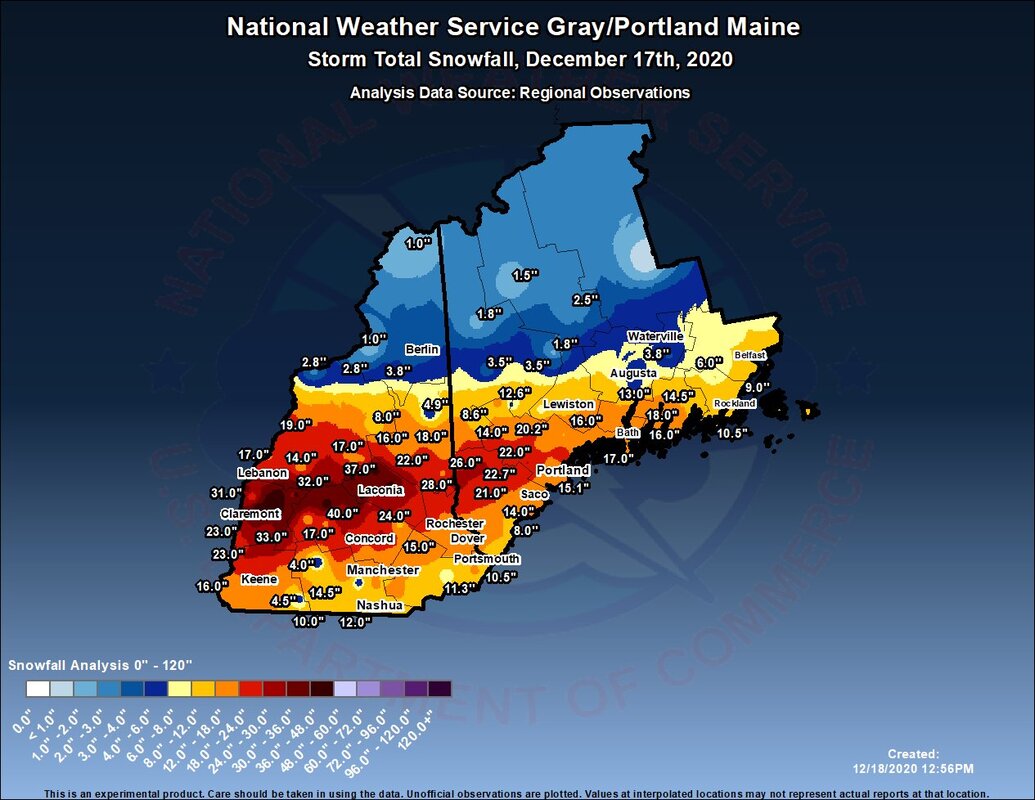 When storms blow up like this one did, it takes me a day or two to pause and reflect on what happened. This forecaster knew better. Sometimes when I know in my gut that storms could get out of hand, I keep myself in a box and conform with what others were thinking. My mindset was this: I knew this storm was going to over perform. The tricky part is figuring where the snow band (or bands) would set up and for how long. This is where the conservative ideas have to kick in. 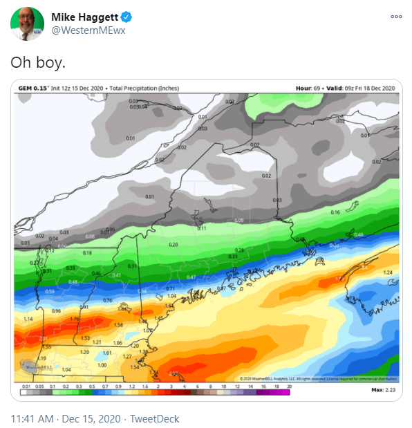 I knew at this point on Tuesday that this could have been a smoker of an event. I tweeted it out. If you look at this liquid equivalent chart here, do some math at 13-15:1, you more or less get the results from the storm we saw. The only question remained was if the low level wind was going to damage the snow flakes before reaching the surface, thereby making them smaller thus reducing the totals. I knew York County was going to get lit up, I knew the gradient was going to be sharp, as this idea indicated. I knew the wind was going to be a factor. Timing and duration stayed on cue. Much of my forecast did verify in that regard. At the end of the day, I was a bit too timid to jump on higher totals, when I absolutely should have. Lesson learned. I am going to go rouge when I have that feeling again, and if I ruffle some feathers by others in the process, so be it. This should not have been as much of a surprise that it turned into. Bottom line. Integrity first. A quiet Saturday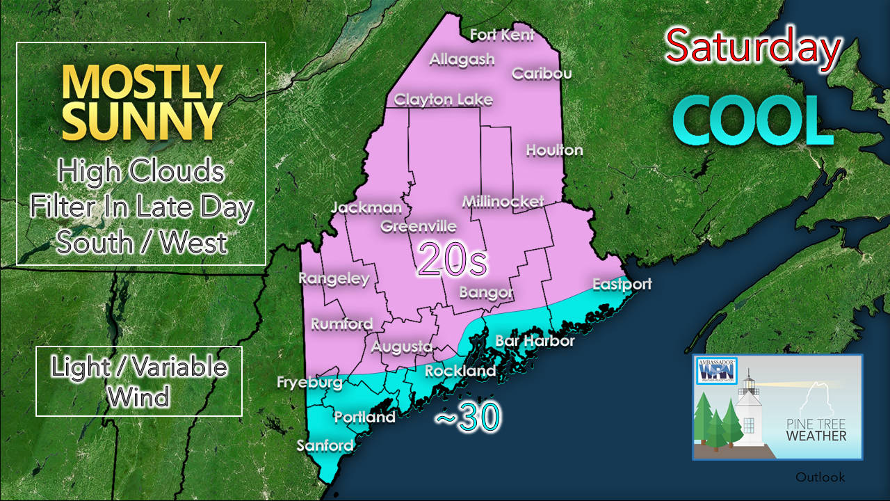 Still a bit on the cooler side of normal for this time of the year. The temps appear to struggle to get to freezing along the coast. Wind will be light. Get out and enjoy the snow. Much of it may be gone by this time next week. Light snow on the way Sunday night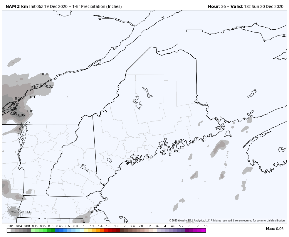 NAM model idea for potential 1 hour liquid equivalent precipitation from 1 PM Sunday to 7 AM Monday High pressure slides east Saturday night, warmer air moves in aloft, which will increase clouds as we venture into Sunday. Liquid equivalent hourly forecast above shows light amounts of mainly frozen precipitation pass through the region Sunday night. 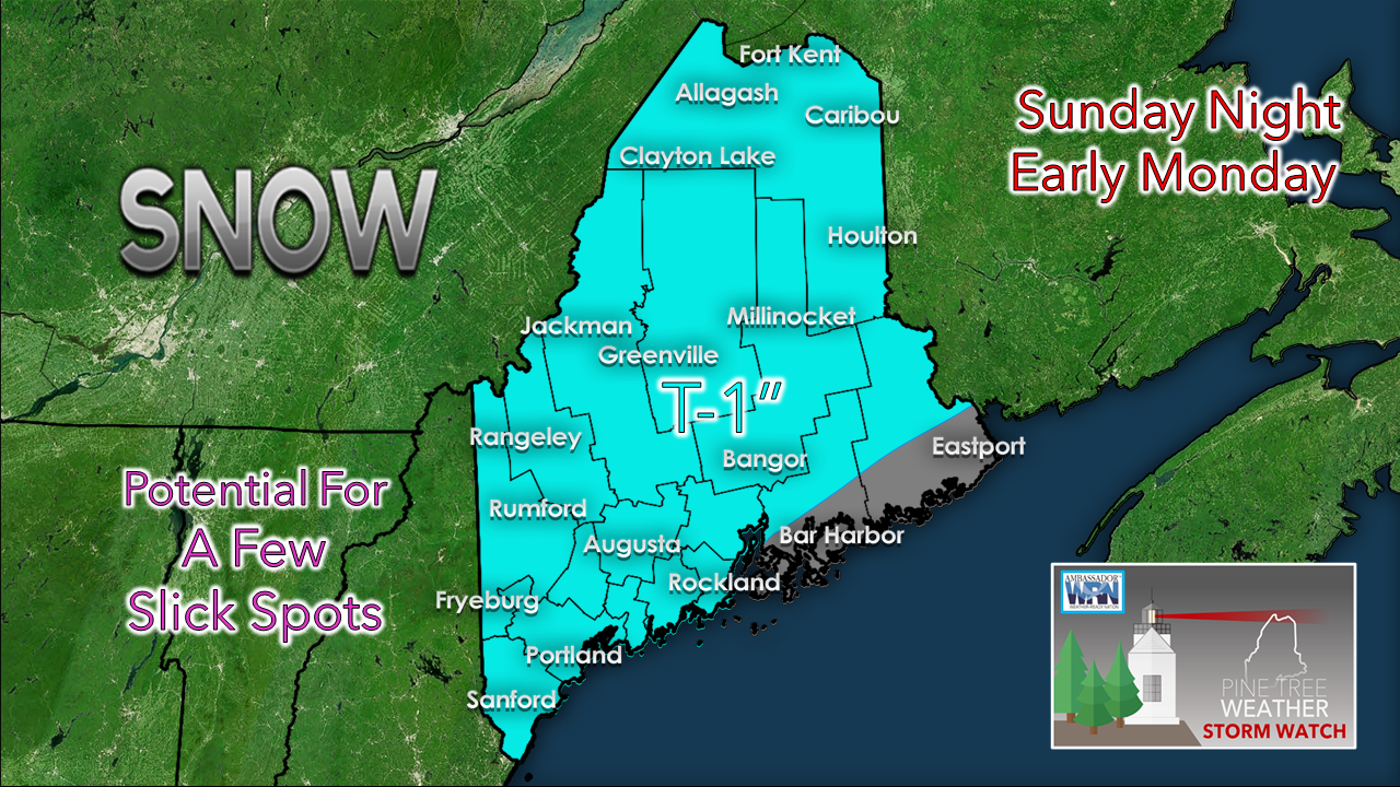 By Monday morning, upwards of an inch of fluff is possible for most areas. DownEast areas may see a touch of ice out of this from light freezing drizzle. Snow showers for some Tuesday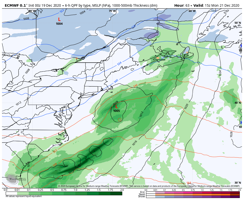 European model idea of precipitation and surface pressure from 10 AM Monday to 7 PM Wednesday The last few days have been interesting to watch the ideas around the frontal boundary along the coast. It does not appear that anything is going to fire up along it that would affect our region. A weak low pressure system passes to the west, and upper level trough slides through the region which may bring some light snow showers for the interior and/or light rain showers for the southwest coast for Tuesday. Behind that, high pressure settles in to bring a calm Wednesday Potential for an ugly Christmas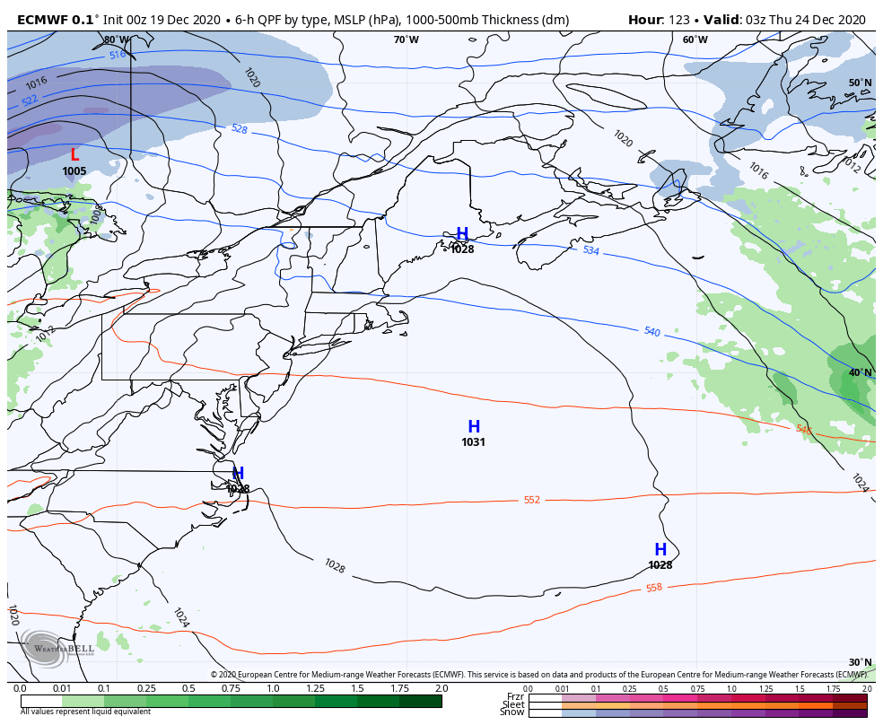 European model idea for precipitation and surface pressure from 10 PM Wednesday to 7 PM Saturday There is still time for changes in ideas here, but the consensus at this point is for a wet Christmas. There is also potential for gusty south/southeasterly wind which will need to be monitored for potential power outages. 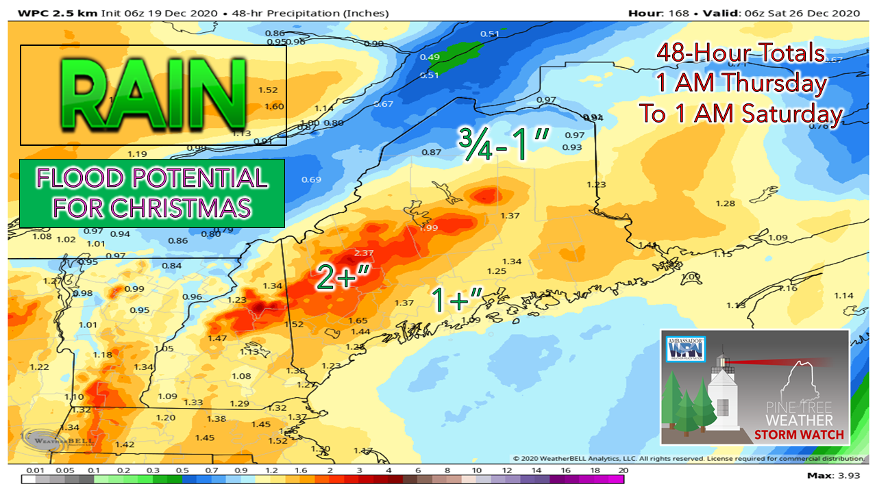 There is also potential for at least some urban street flooding from melting snow and run off from this event. The snowpack may absorb a good portion of the rain, where there are deeper amounts. Where there is less snow, the streams and rivers will need to be monitored for flooding as well. After this front passes through, all of this will freeze up as we head into the weekend. Stay tuned for updates on this, and pray for a Christmas miracle that the impacts are less than the ideas being presented for now. Temperature outlook through Christmas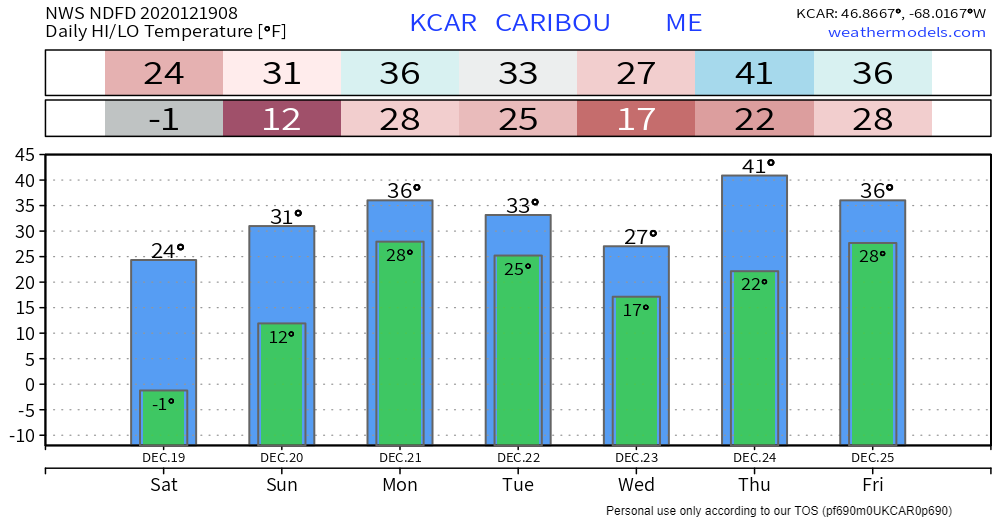 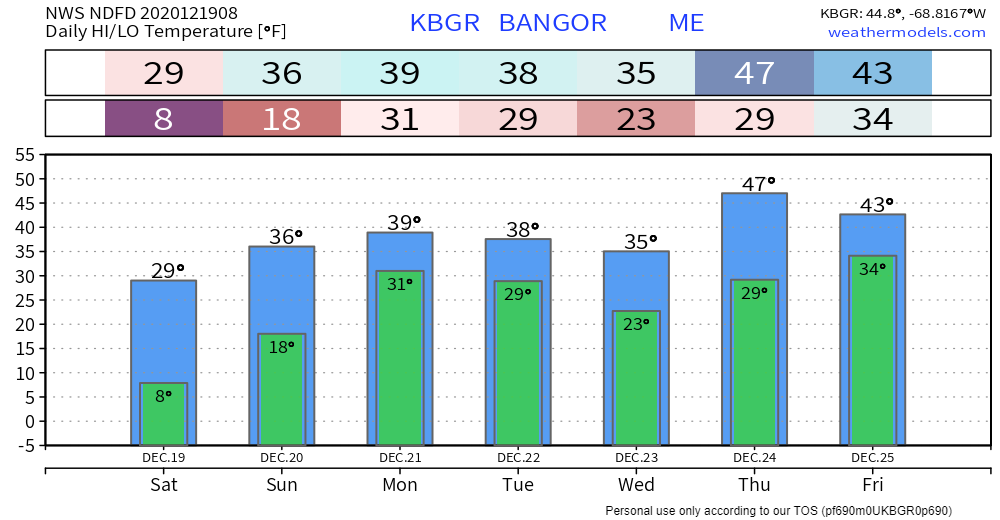 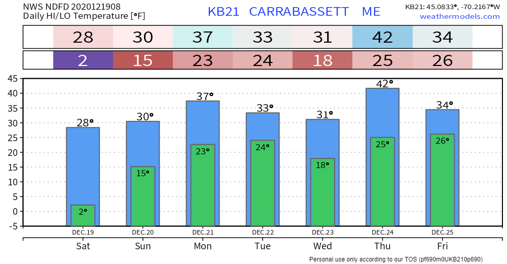 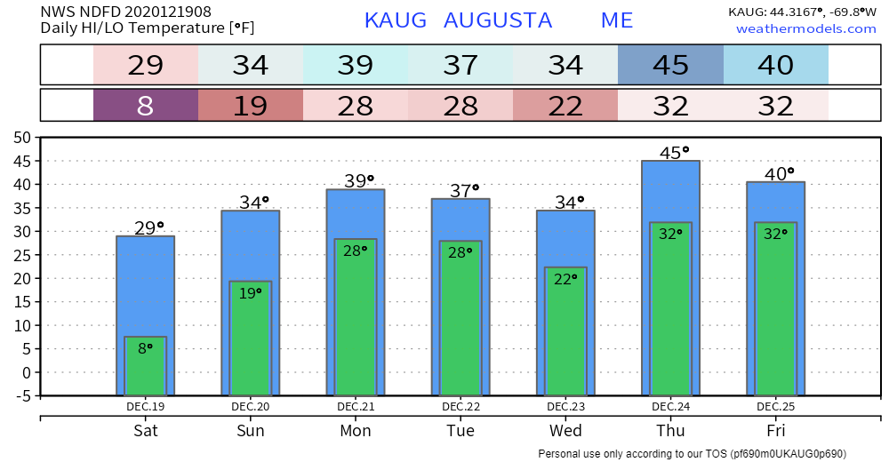 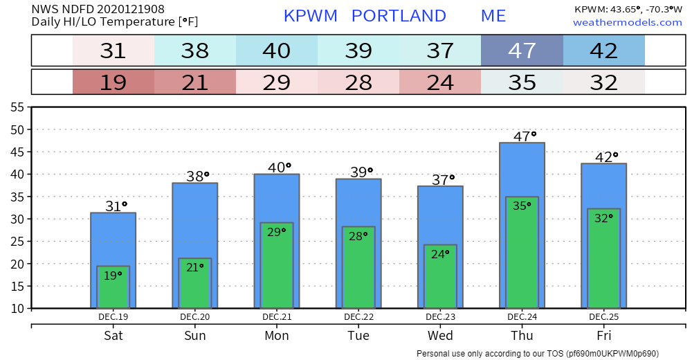 Help fill the gaps! |
| | BE PREPARED WITH A NOAA Weather Radio. For $20-$40, it could provide important information to you when you need it. The weather bands are standard on most public safety scanners, and newer scanner models. Weather radios can be programmed for auto alert. Click here for more information. |
| ► ► For the latest official forecasts, bulletins and advisories, please check in with the National Weather Service in Gray for western and southern areas, or Caribou for northern and eastern parts of Maine |  |
** FUNDING NEEDED FOR 2021 **
Thank you for supporting this community based weather information source that is funded by your financial contributions.
Stay updated, stay on alert, and stay safe!
- Mike

Mike Haggett
Kennebunk, ME
Weather-Ready Nation
Ambassador
Certified Weather
Forecaster
Penn State '21
American Meteorological Society
National Weather Association
SKYWARN-CWOP
Matthew 19:26
Please
Support
Pine Tree Weather
In 2024


Archives
July 2024
June 2024
May 2024
April 2024
March 2024
February 2024
January 2024
December 2023
November 2023
October 2023
September 2023
August 2023
July 2023
June 2023
May 2023
April 2023
March 2023
February 2023
January 2023
December 2022
November 2022
October 2022
September 2022
August 2022
July 2022
June 2022
May 2022
April 2022
March 2022
February 2022
January 2022
December 2021
November 2021
October 2021
September 2021
August 2021
July 2021
June 2021
May 2021
April 2021
March 2021
February 2021
January 2021
December 2020
November 2020
October 2020
September 2020
August 2020
July 2020
June 2020
May 2020
April 2020
March 2020
February 2020
January 2020
December 2019
November 2019
October 2019
September 2019
August 2019
July 2019
June 2019
May 2019
April 2019
March 2019
February 2019
January 2019
December 2018
November 2018
October 2018
September 2018
August 2018
July 2018
June 2018
May 2018
April 2018
March 2018
February 2018
January 2018
December 2017
November 2017
October 2017