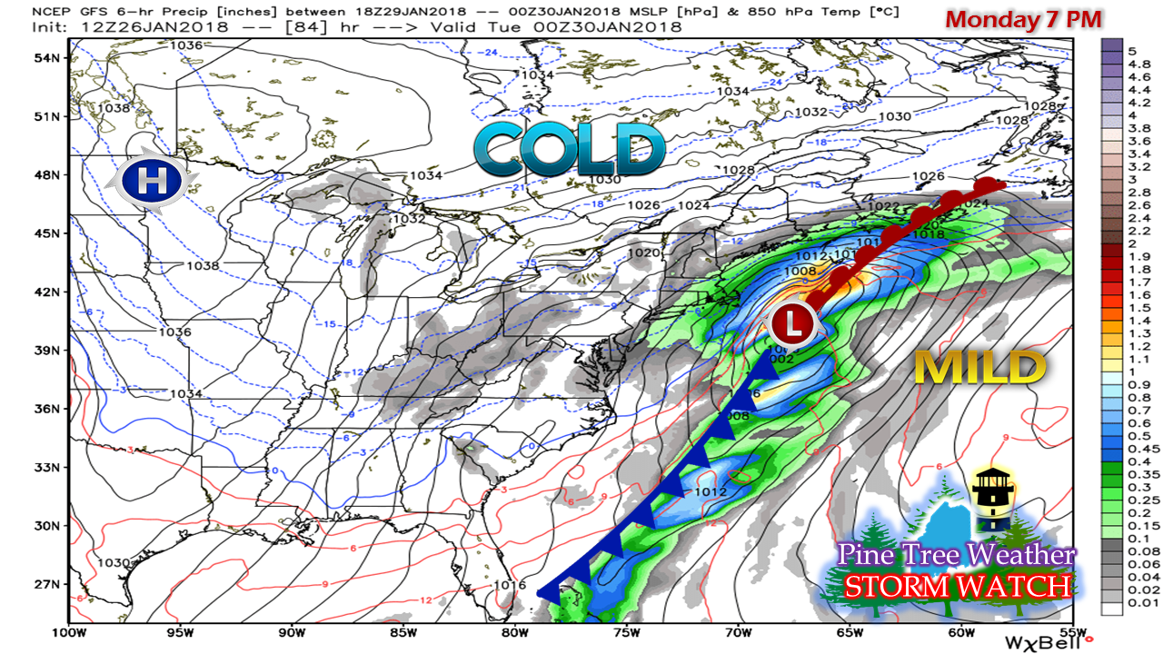
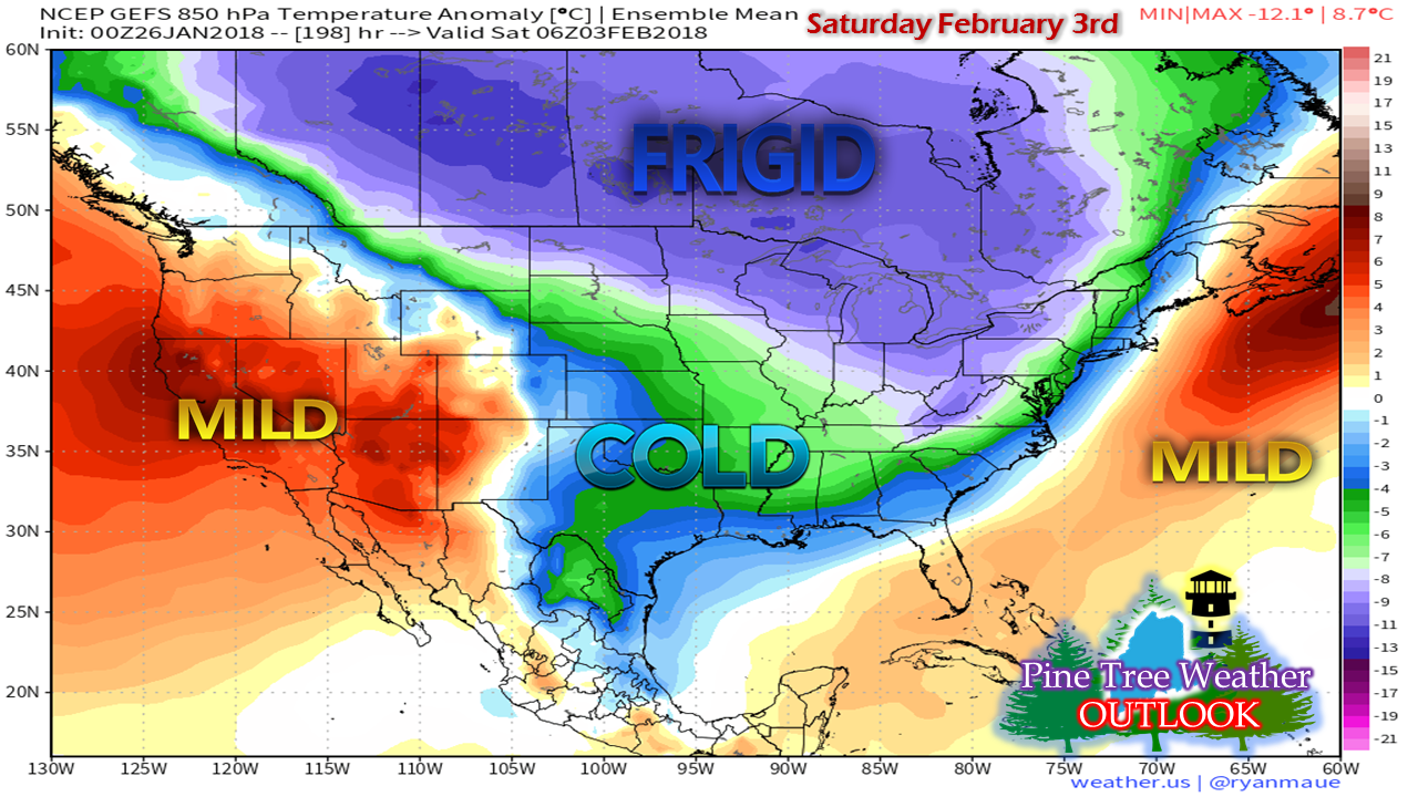
Winds of changeAs I mentioned on the Pine Tree Weather Facebook page, I am going to be involved with a project over the next few weeks. That project will be moving my family from Poland Spring to Kennebunk. We have been blessed to enjoy everything that western Maine has to offer for over 16 years. This decision was not easy. Given the circumstances, it is the right one to make. My family has been through a lot in the past 14 months with the tragic losses of my wife's siblings along with health of other family members. As a result, I will have to cut back on weather operations until we get settled, which could take a while. I will do what I can as time permits. You can always check Facebook and Twitter for information if I do not post here. In the meantime, I will still be watching and tracking the weather rather closely for obvious reasons, since I will be moving. I will pass along general ideas of information and things to watch out for. I may not be as in-depth, but you'll hear from me on potential impacts. Once we do get settled in, I will return to more frequent updates. In the long run, this move will help free up time for me to do a much better job with Pine Tree Weather. I politely ask that you bear with me. Thank you. A Monday/Tuesday surprise?It would be wise to keep an eye on the weather forecast over the weekend for this event that could affect the region Monday into Tuesday. A frontal boundary will pass through the region Saturday night and then stall offshore. Low pressure forms along the front and travels northeastward for the first of the workweek. While this chart shows a close shave with the storm, the trend has been west with model guidance. This has been rather typical this winter. Guidance has had a habit of showing offshore storms that gradually move closer and closer to the coast as time approaches. The chances of this being an all snow event are pretty good at the moment. Another arctic blast will be dumping into the Midwest as the western ridge re-establishes itself. That will supply the cold air. The moisture pump from the south appears firmly attached along the front. We've seen this movie before. Early February could be interestingSpeaking of movies we've seen before this winter, the signals for early February are looking similar to what was experienced around Christmas. The western ridge of mild air funnels cold air all the way to the Gulf of Mexico. A strong ridge over the Atlantic sets up Gulf moisture to travel along the deep trough, and the eastern seaboard is caught in the middle.
While this is strictly a signal for now, long term guidance has been hinting at this over the past couple of weeks. The idea has support. Actual timing of potential storms and impacts are too far out to know for now, but confidence is good that early February could be a stormy one. It would be wise to keep an eye on the energy supplies, and keep storm supplies well stocked. We have a lot of winter left to go. Stay tuned. - Mike |
Mike Haggett
|


