|
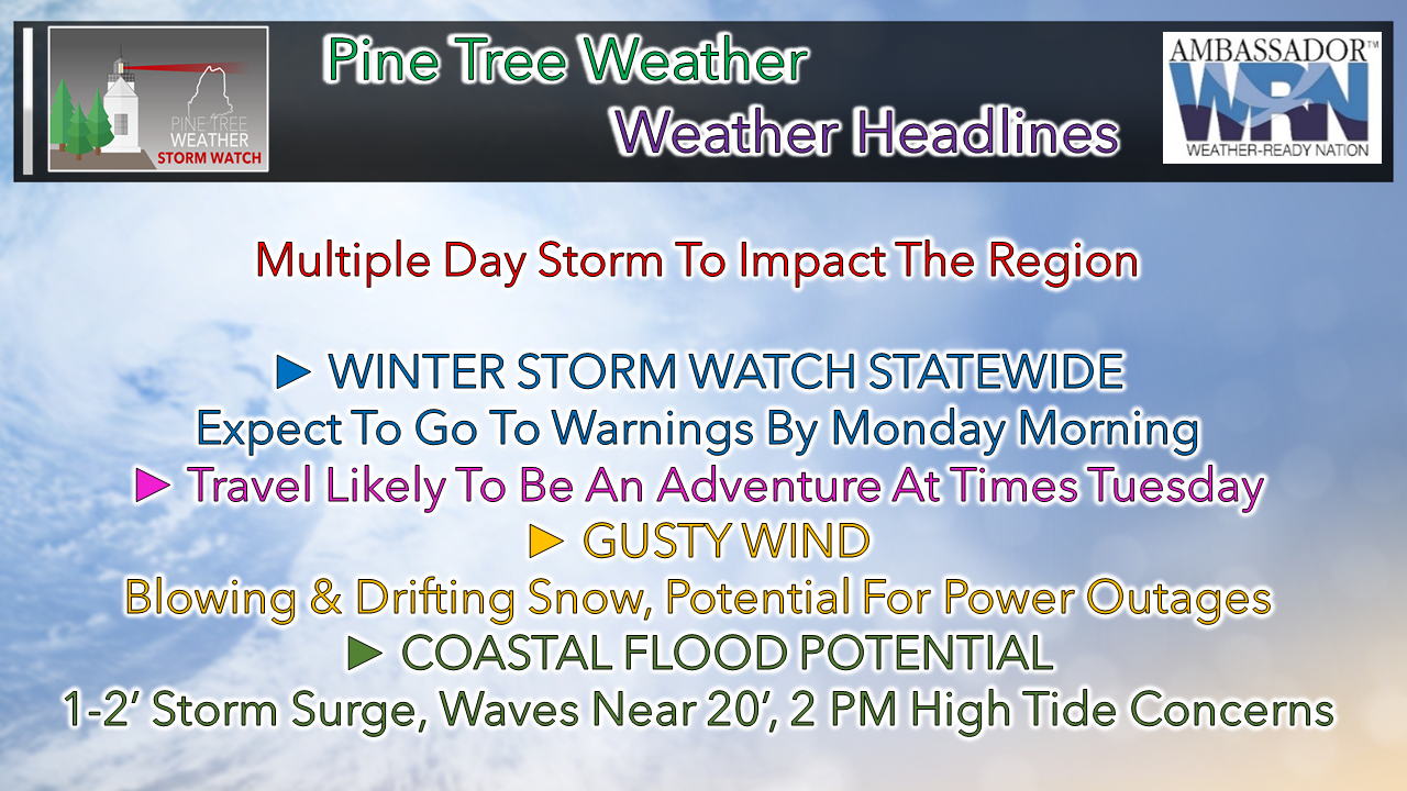
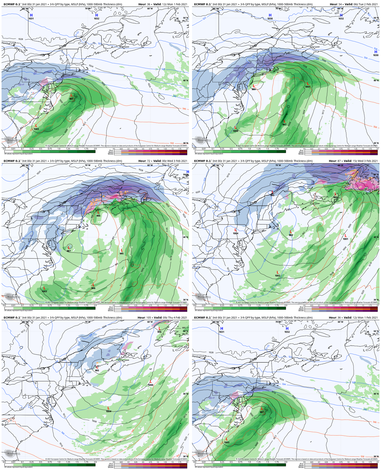
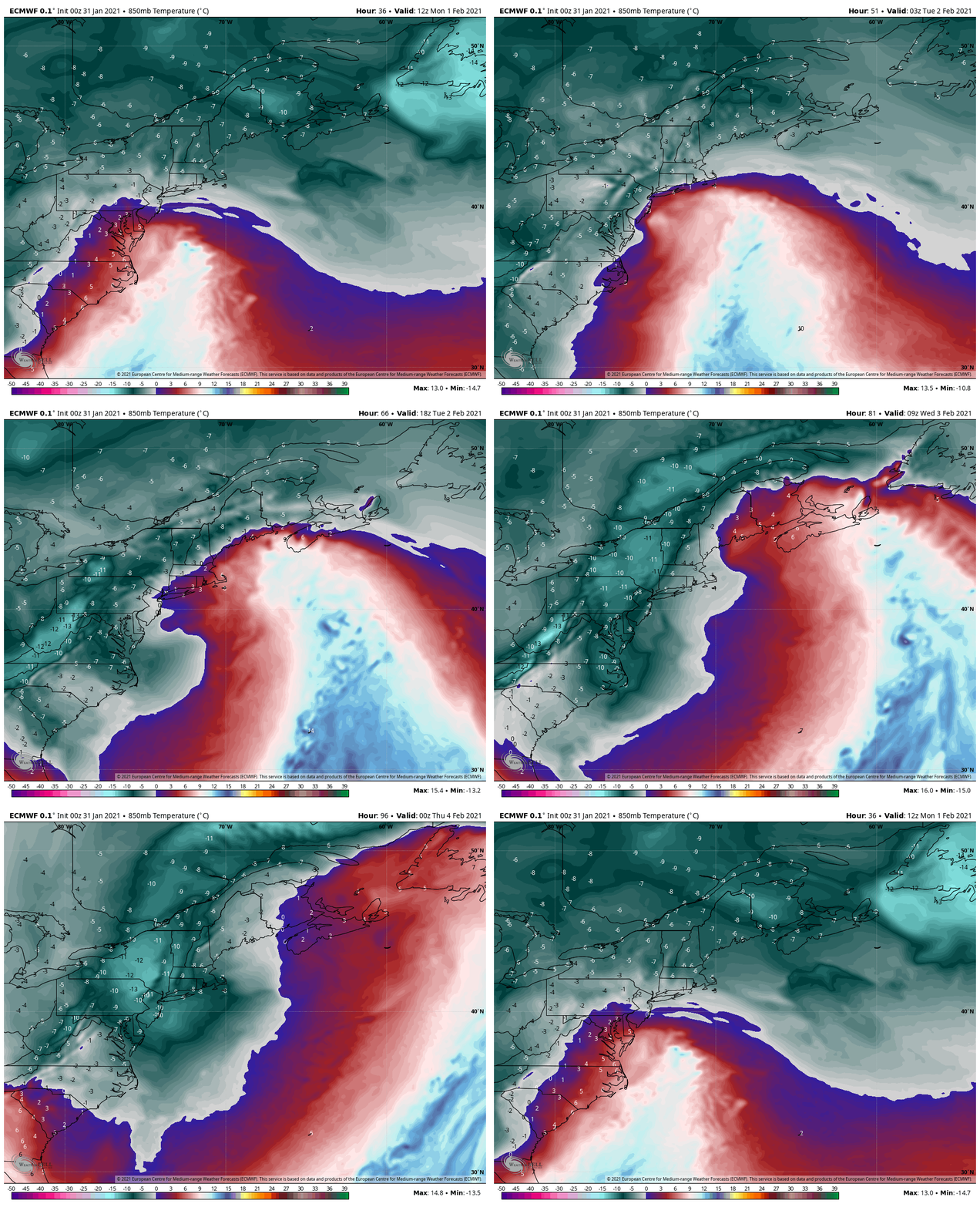
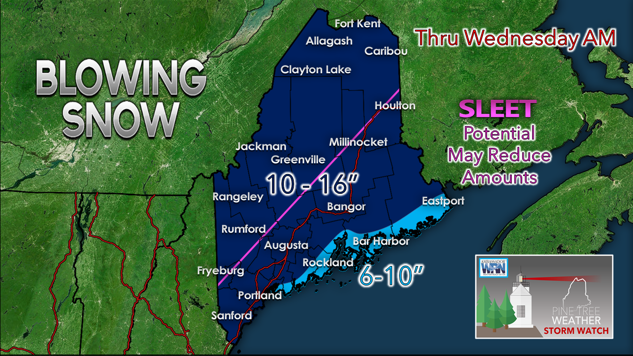
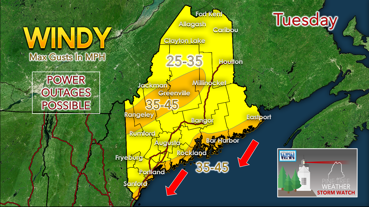
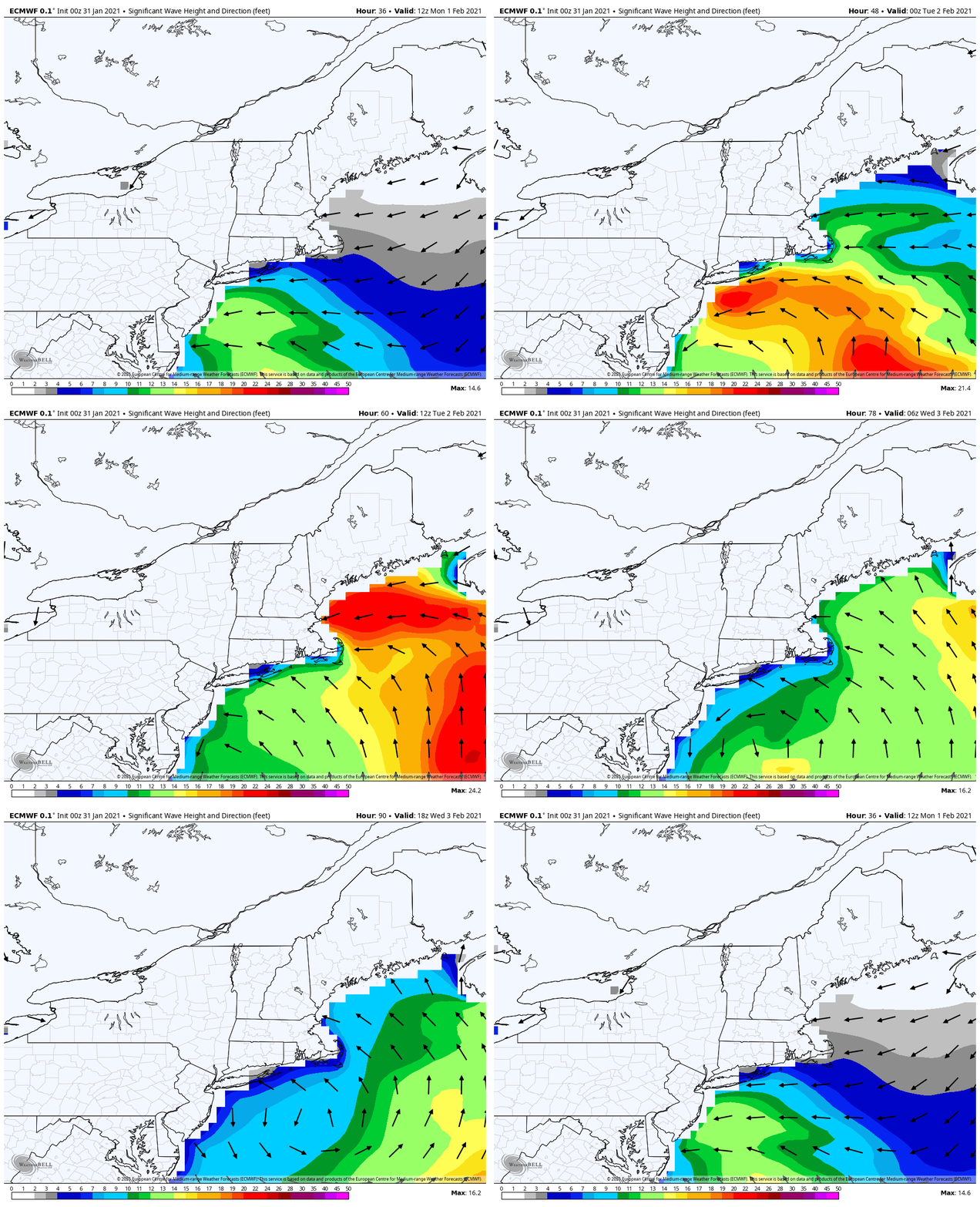
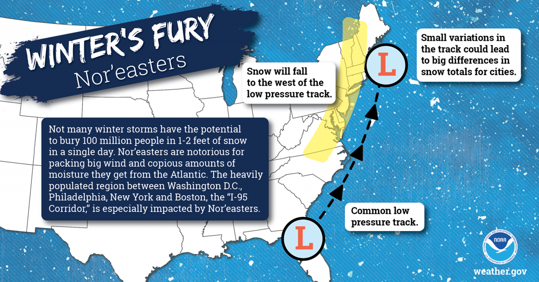
Today is the day to check your storm supplies, fill up the gas tank in your vehicle, and look the yard over to tie down any loose objects ahead of the storm. This is shaping up to be a multi-day event. It's shaping up to be the strongest widespread snow event we've seen so far this winter. Timing and precipitationMonday starts off clear for the morning commute for southern areas, but conditions go downhill as we head towards the evening commute. Northern areas do not appear to see the first flakes from this until early Tuesday. Monday night into Tuesday is the main event for the southern half of the state, Tuesday into Tuesday night for the northern tier. Steady snowfall appears to end over southern areas Tuesday night, and early Wednesday for northern areas. The snow machine will continue with light to moderate snow showers for interior areas Wednesday into Thursday, before finally shutting down Thursday evening. This is a complex and complicated set up. This is a wide area of upper level energy that will spin off surface lows that appear to spin around each other. The parent low sets up over the DelMarVa Sunday night. The concern I have is for a secondary low forming in the Gulf of Maine which could throw a wrench in the outcome on Tuesday. As mentioned in Saturday's post, this is an all snow event to start off, and snow appears likely to be the dominate feature. There remains the chance for a warm nose to work into the mid-levels of the atmosphere and could bring in sleet. There is also a chance for freezing drizzle or rain later in the event. This storm appears to bring roughly a foot overall for most areas. There is roughly 1-1¼" of liquid involved here. Deformation bands are going to dump at 1-3" per hour rates at times. Coastal areas should watch for the low level warm front, which may knock down totals there. NOTE: If the secondary low forms over eastern areas of the Gulf of Maine, that would shut down the advancement of the warm front and the threat for sleet and freezing rain and bring totals up to the 10-16" level with the rest of the region. Pending on how this organizes, there is always the chance dry slotting may come into play, which would knock down snowfall totals also. Ski country will be happy to know that another 3-6" is possible Wednesday and Thursday. With the wind, the snow total may not be measured by snow on the ground, but by the feet of the drifts. The wind shall blowI refrain from using the word "blizzard" because of criteria, which is sustained wind of 35+ mph with ¼ mile visibility for 3 hours, which there is low chance of that occurring. I do think whiteout "blizzard like" conditions are totally on the table here. Driving will be a very slow process, and I do believe our plow crews will have difficulty keeping up between the heavy snowfall rates and wind at times during the day Tuesday, and into Tuesday night for northern areas. My main concern for power outages are for the higher elevations and the coastline where wind will be the strongest. The closer to the coast, the more wetter the snow, but may stay dry enough not to stick too much. The ocean is going to churnFor the shorelines, the Tuesday 2 PM high tide will be a concern. Strong northeasterly wind and 1-2' storm surge appear to pile the water up along the shoreline, which could bring flooding in areas. Seas 12-20' are likely for exposed areas. Expect splash-over and beach erosion in the typical areas. Expect statements on this to be issued from the National Weather Service. Winter’s Fury: Nor’eastersNot many winter storms have the potential to bury 100 million people in 1-2 feet of snow in a single day. Nor’easters are notorious for packing strong winds and copious amounts of moisture they get from the Atlantic. The heavily populated region between Washington D.C., Philadelphia, New York City, and Boston -- the “I-95 Corridor” -- is especially impacted by Nor’easters. weather.gov/safety/winter-noreaster Be prepared to receive alerts and stay updated!
For more information in between posts, please follow Pine Tree Weather on Facebook and Twitter.
Thank you for supporting this community based weather information source operates by financial contributions. Stay updated, stay on alert, and stay safe! Thank you as always for your support! - Mike |
Mike Haggett
|

