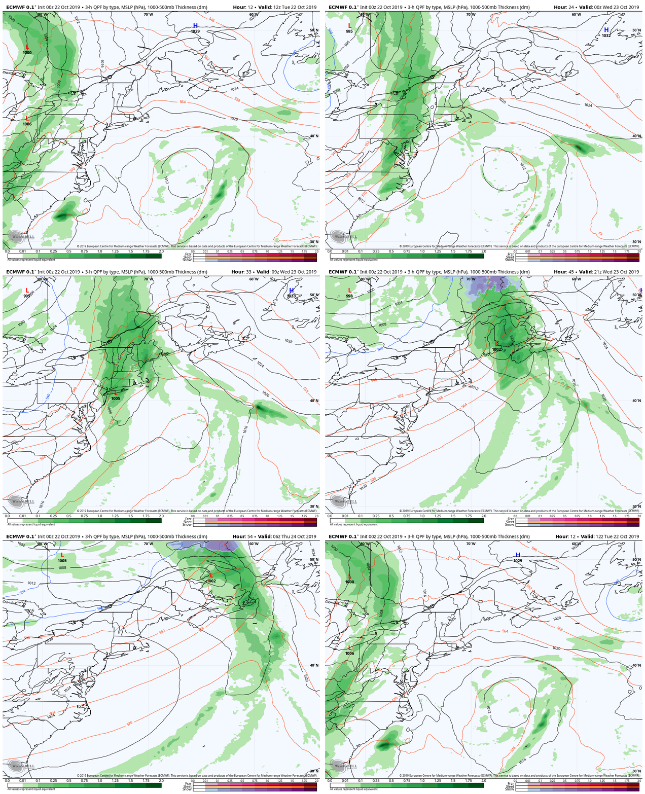
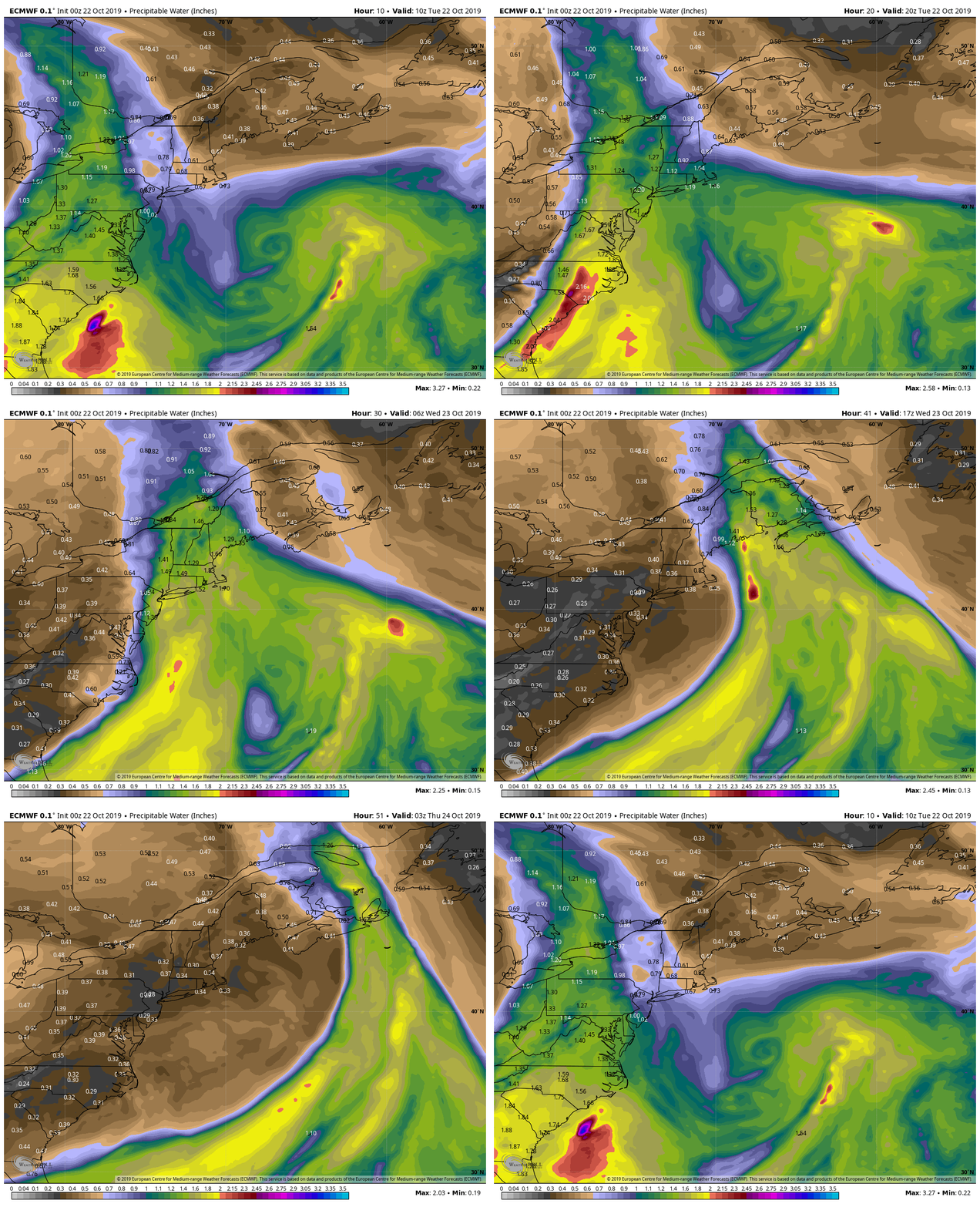
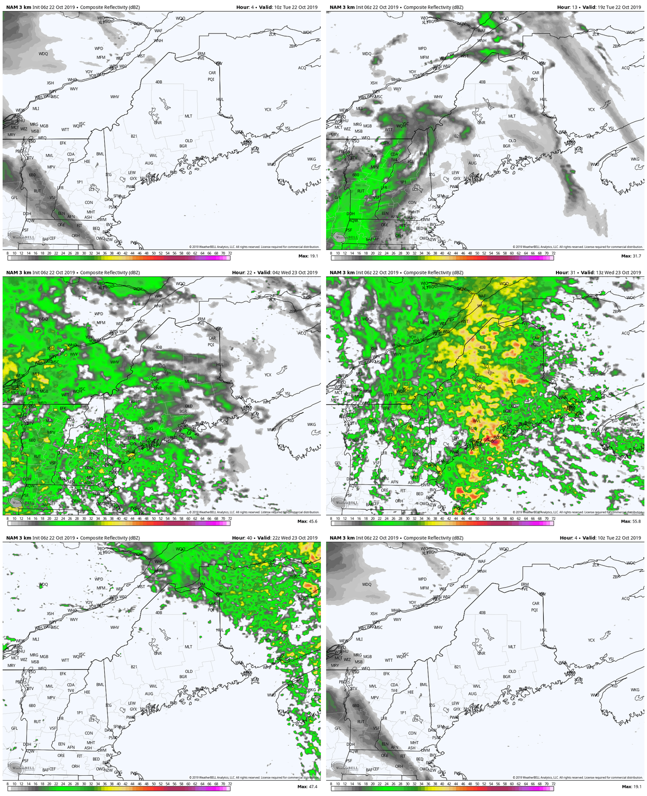
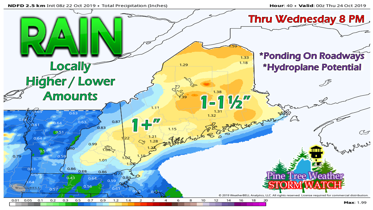
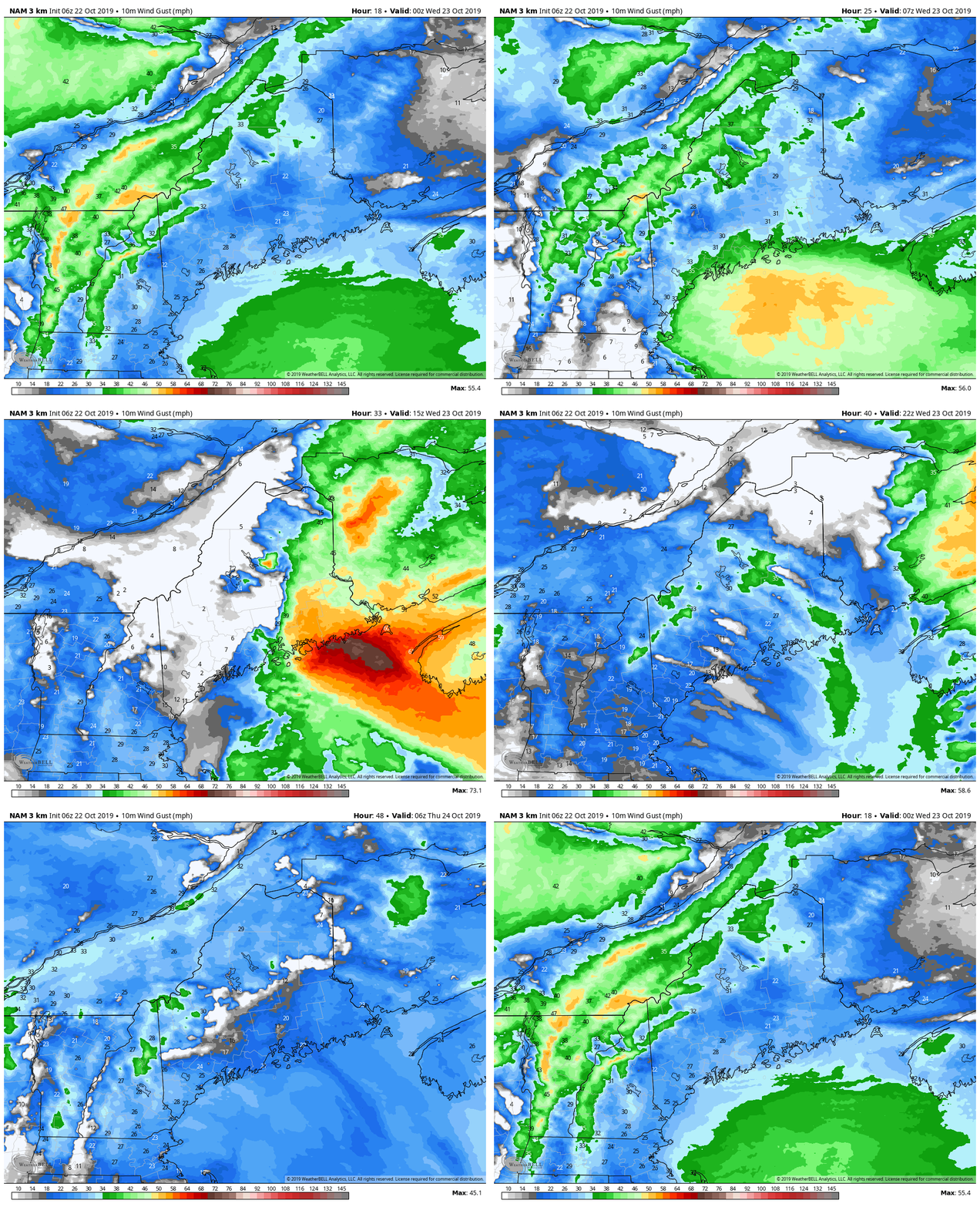
Storm has potential to overperformIt may look fairly innocent in the loop above, but there is some cause for concern with this one. This is another case of a negatively tilted trough aloft that will spin off a surface low along a cold front near Long Island, NY. The storm will develop along the front, and then intensify as it passes through eastern Maine on its way to the Canadian Maritimes Wednesday. The storm will tap into moisture from the south and bring a quick hit of heavy rain and raise humidity levels briefly before departing. A quick mover brings a shot of heavy rain for mostA few sprinkles or a light shower may occur on Tuesday, but the steadier rain does not appear to arrive until Tuesday evening. Rain overspreads the region Tuesday night, and could be heavy at times with rumbles of thunder possible heading into Wednesday. Rain tapers from the southwest by around noon, to northeast by early evening. Higher elevations of the western mountains may get a touch of snow overnight Wednesday into Thursday. Eastern and northern areas are likely to get the most rainfall. Southern areas will get a decent amount. The Rangeley Lakes region may be on the low end with this storm. Expect reduced visibility and standing water on the roads Wednesday morning. With the wind picking up along the coast, watch for slick spots caused by leaf drop. Wind Advisory posted for the MidCoast & DownEastConcern for power outages for a region that has barely recovered (or still dark) from the storm last Thursday is likely the last thing anyone wants to hear about, but it is a possibility for the Penobscot Bay and DownEast areas. As the storm intensifies, wind will pick up from the east-southeast and could gust up to 45 mph or higher Wednesday morning. The wind will be stiff enough to bring down tree limbs in areas and knock power out in areas.
As the storm departs, it appears to remain breezy with wind shifting to the west-northwest gusting upwards of 25 mph Wednesday night into Thursday. Make sure you have your storm supplies replenished, and stay on alert for potential surprises. NOTE: Updates the remainder of the week may be sporadic due to family commitments. ► ► For the latest official forecasts, bulletins and advisories, please check in with the National Weather Service in Gray for western and southern areas, or Caribou for northern and eastern parts of Maine. ► ► DONATION DRIVE UPDATE - $880 shortfall for the year ahead! You can help keep Pine Tree Weather going with a donation of any amount now through VENMO @PineTreeWeather, a monthly donation on Patreon or messaging me on Facebook or Twitter to send a check in the mail. Thank you for your support! For more information from me, please check the Pine Tree Weather Facebook page as well as my Twitter feed. Always stay weather aware! - Mike |
Mike Haggett
|

