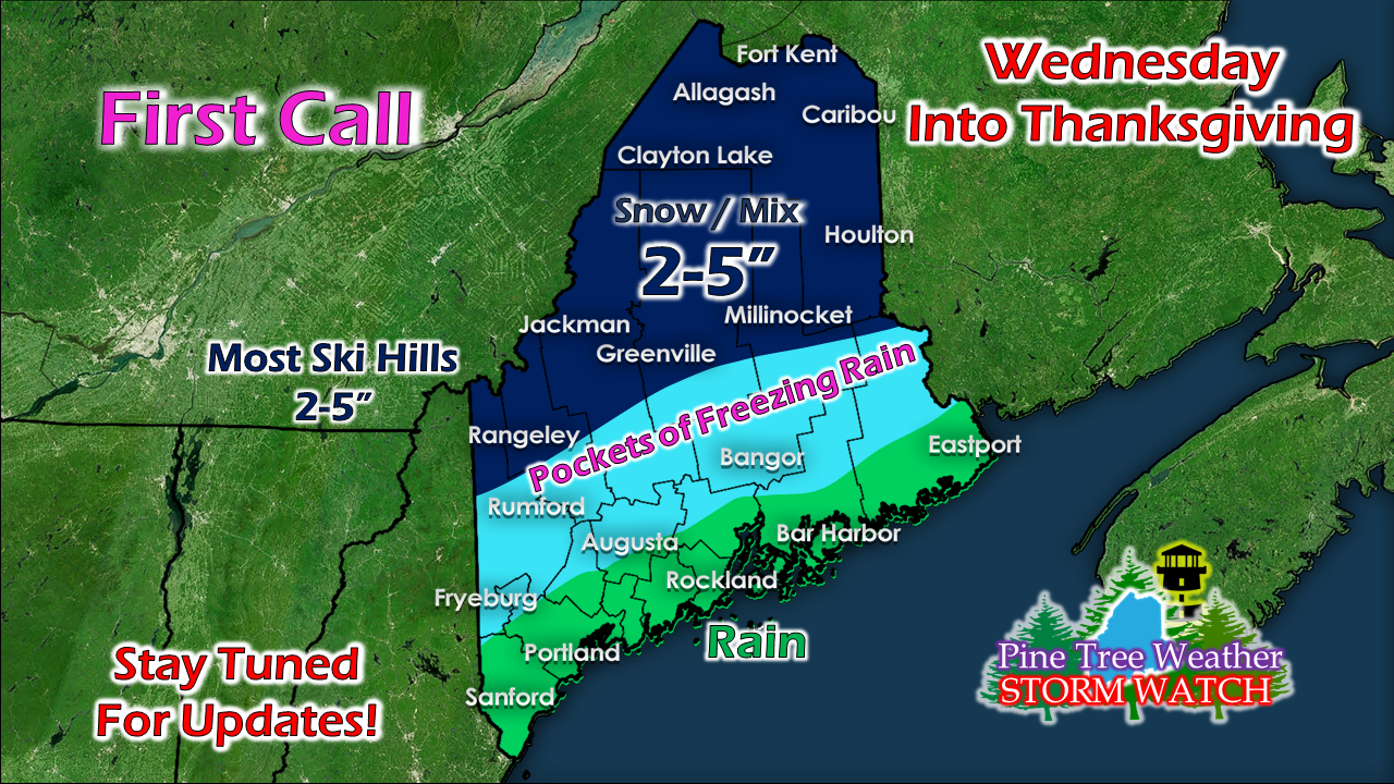
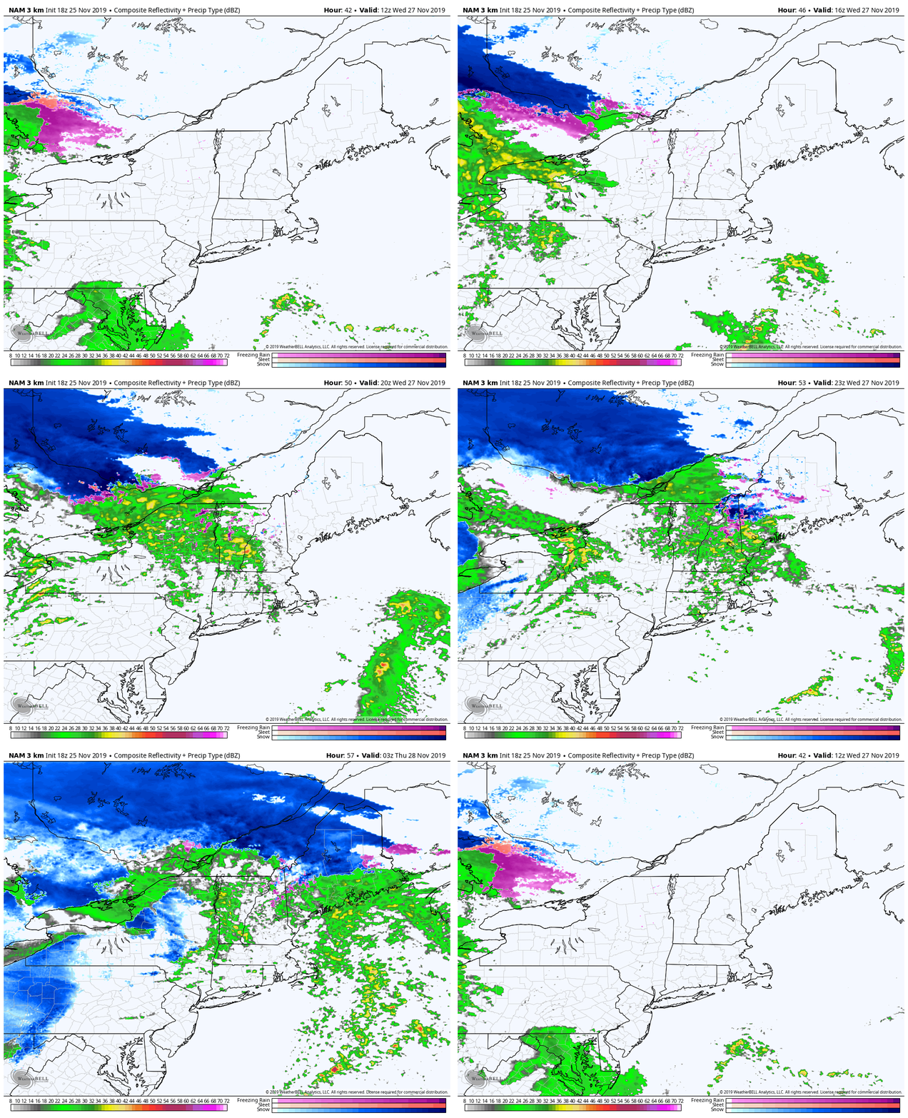
Travel Tuesday if you canAt this point, this storm does not appear to be like the one experienced on Sunday. That said, it will create impacts for interior areas. With Wednesday the main travel day for many for Thanksgiving, timing could not be worse. Granted, we've had worse storms, but any time there is a chance for ice and sleet, it's not a good thing. The best area for snowfall will be along the Quebec border region in western areas on up into northern Maine. Western ski country may see some sleet & freezing rain mixed with snow. Once the storm pulls away, a couple inches of fresh powder are possible with upslope snows going into Thanksgiving. For the foothills south to the coastal plain, it appears to be freezing rain to rain event. The air is a bit warmer with this storm, and with southerly flow, above freezing air has a fair chance making it inland. I can never rule out cold air damming showing up, so I suspect it will hold on in areas longer than guidance bills it. For much of the coastal plain, this appears to be more of a rain event. Again, I can't rule out cold air damming completely, but with areas that happens will be further inland approaching the foothills. A warm front works into the region Wednesday afternoon and evening, which will bring rain south, and the snow and mix to the north. Low pressure over the Great Lakes spins off a coastal low over the Gulf of Maine, then rolls into the Canadian Maritimes Wednesday night into Thursday morning. Precipitation appears to end over southern and eastern areas Thanksgiving morning, with snow showers tapering off over the mountains and north in the afternoon / early evening. Important to note: this storm is going to blow up to the east of us, and then stall. Expect breezy conditions Thursday and Friday, before settling down over the weekend. Next storm after this one appears to start next week, and could be a snowy affair for many, if not all. I will update on that as the week unfolds. I will update on this storm Tuesday morning. ► ► For the latest official forecasts, bulletins and advisories, please check in with the National Weather Service in Gray for western and southern areas, or Caribou for northern and eastern parts of Maine. ► ► $625 shortfall for the year ahead! You can help keep Pine Tree Weather going with a donation of any amount now through VENMO @PineTreeWeather, a monthly donation on Patreon or messaging me on Facebook or Twitter to send a check in the mail. Thank you for your support!
For more information from me, please check the Pine Tree Weather Facebook page as well as my Twitter feed. Always stay weather aware! - Mike |
Mike Haggett
|


