|
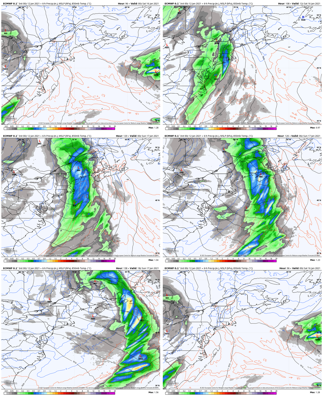
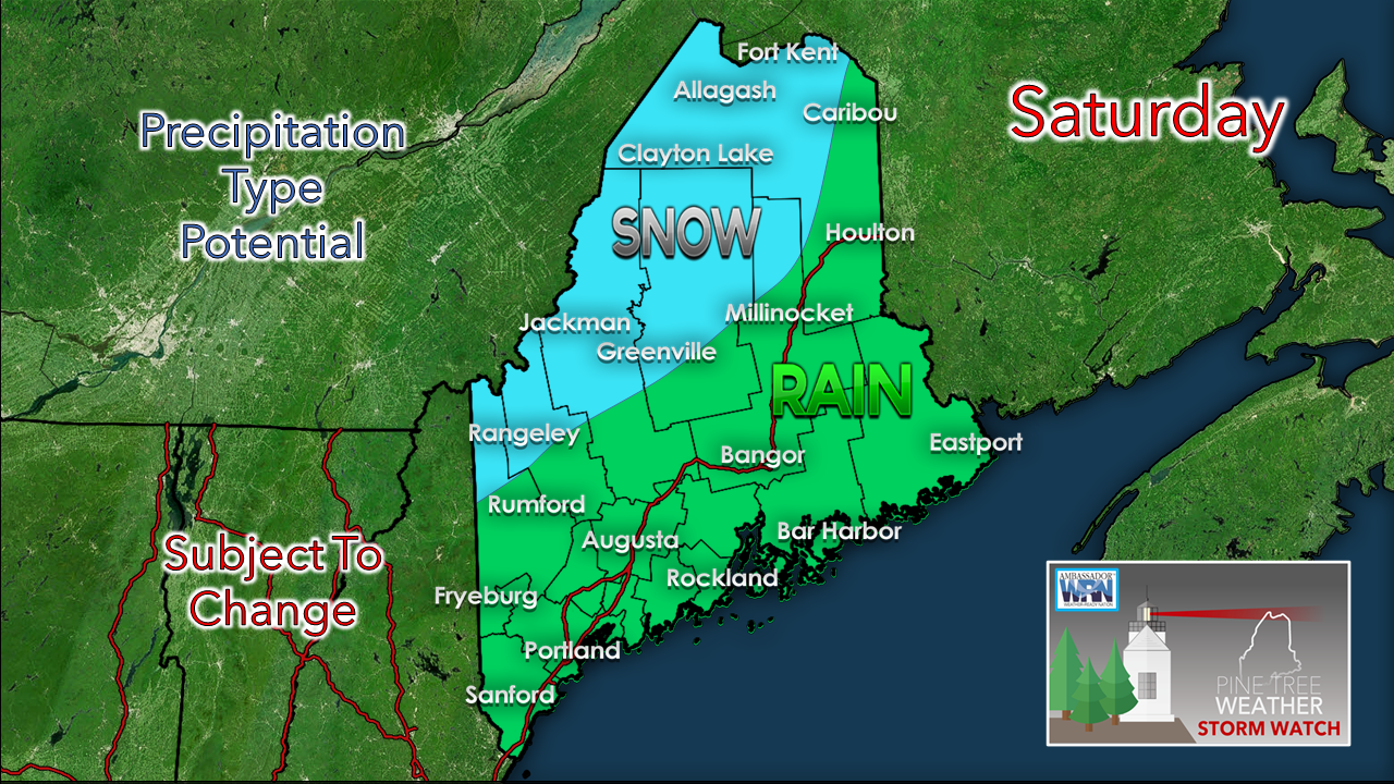
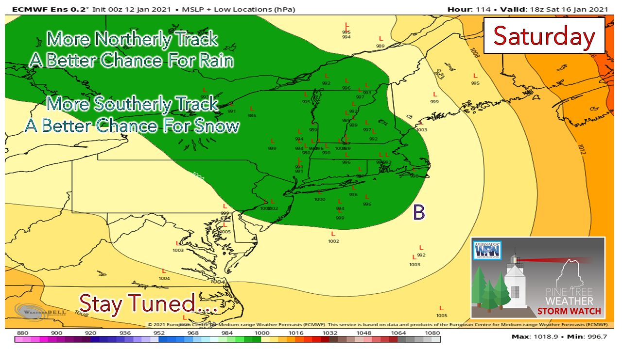
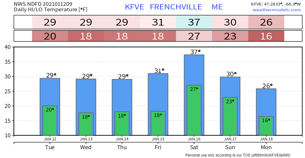
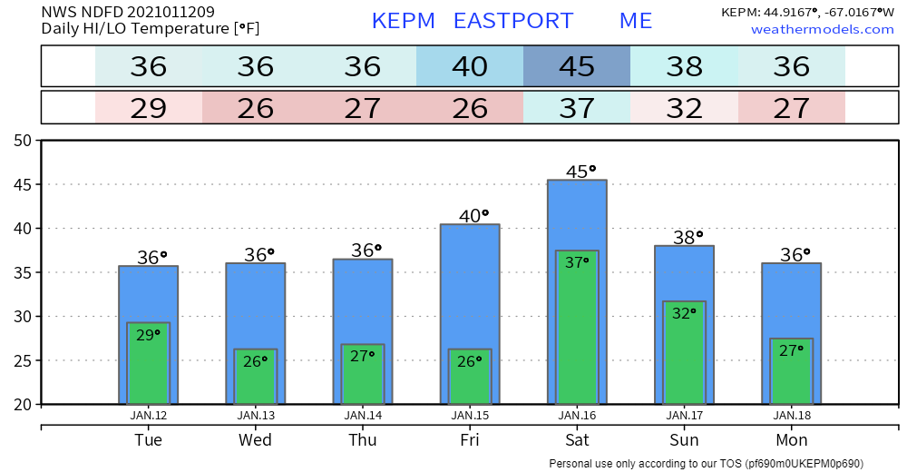
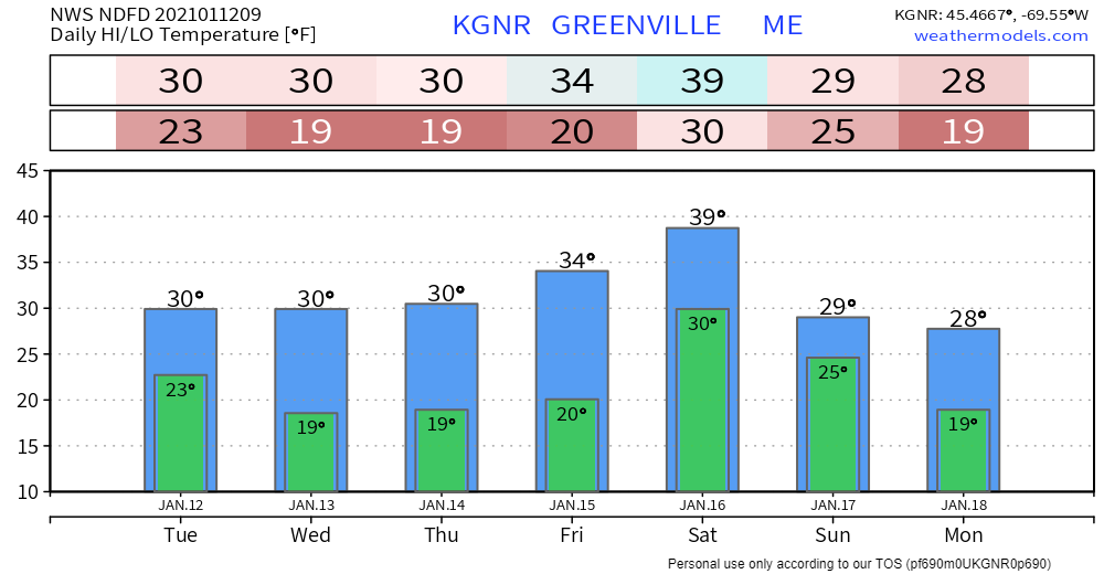
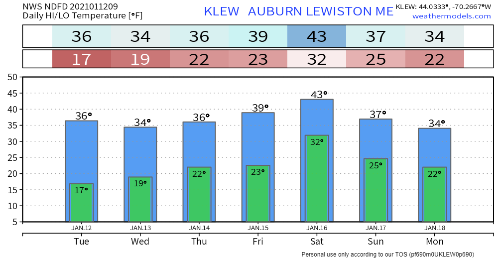
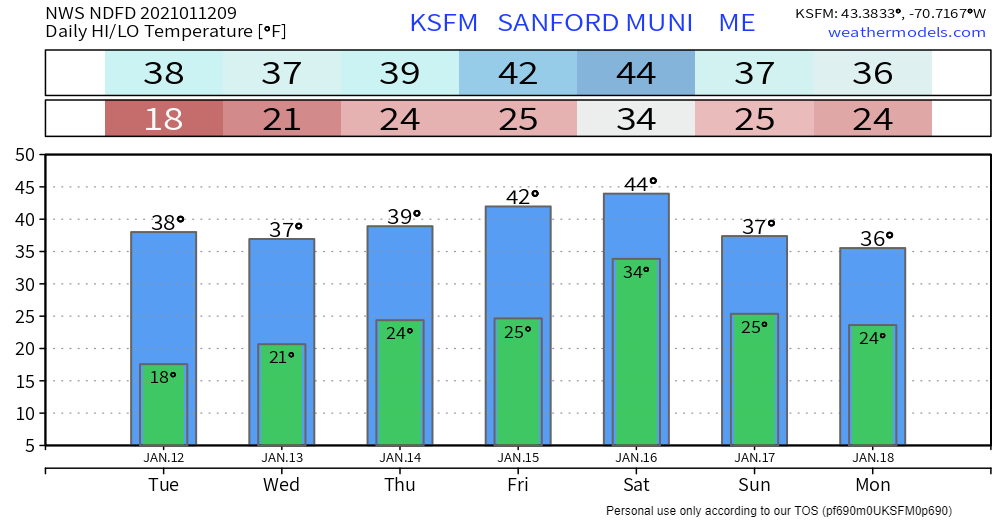
Before I get into the outlook, I just want to let you know that I am going to shift gears a bit and operate more on a storm by storm basis rather than a day by day basis. School is my top priority for now and will be over the next several weeks. I will do what I can when I can, and thank you in advance for your patience and understanding. Looking ahead to SaturdayIt does appear at this point to be more of a southerly event with this storm. The key to the outcome of this appears to be with the track of the area of low pressure along the frontal boundary, and how much moisture gets brought in along the front to it. As we have seen in previous storms of this type, there appears to be the presence of a low level jet, which could bring gusty winds to the shorelines and higher elevations and funnel in moisture with it. For now, the surface wind does not appear to be too crazy, but as the lifeguard says at the pool, the situation is fluid. For now this appears to be a mainly snow event for the mountains and northwestern Aroostook, with rain the dominant feature elsewhere. There is the possibility of sleet and perhaps freezing rain for the western foothills on over to interior eastern areas, but for now, that threat appears very low, but it is something to watch out for. Track will be key here. Unlike the tombstone of the deterministic model ideas, the ensembles show the idea of uncertainty. Nothing is carved into stone at this point. Consensus at this point indicates low pressure will be well north of the benchmark 40° N / 70° W "B" on the chart, so for now that makes it a mainly rain event for the coast, and we'll see what happens beyond that as time gets closer. Beyond the low level jet, there is a decent upper level jet associated with this. Guidance is increasing its idea on the amount of moisture associated with this. Where the low forms, intensifies will be critical in determining the cut off of warm air from the south and the introduction of cold from the northeast. The track of that dictates who gets what for precipitation type, and for how long. Stay tuned. Temperature outlook through MondayBe prepared to receive alerts and stay updated!
For more information in between posts,
please follow Pine Tree Weather on Facebook and Twitter. Thank you for supporting this community based weather information source operates by financial contributions. Stay updated, stay on alert, and stay safe! - Mike |
Mike Haggett
|

