|
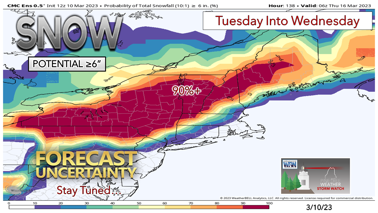
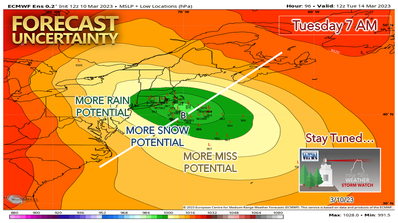
I don't want to get too far ahead with this storm, but it is important to pass this information along to thoughtfully plan for what could be coming. This is shaping up to be a 24-to-36-hour event. There is potential for heavy, wet snow. There is potential for strong wind. The combination of the two means there is potential for power outages. It would be wise to start preparing for that possibility now. If the forecast trend continues, there are likely to be school, municipal, and business closings. This could be a rough one for the plow crews to keep the roads clear. For those who must travel, it is fair to anticipate that the commutes (note the plural there) could be a very slow affair. Many questions still need answersI am going to be right upfront here and say that predicting snowfall amounts for this storm are going to be challenge. It's March. The sun angle is above 40% as we approach astronomical spring in about 10 days. This means the effect of solar insolation (radiational warming the atmosphere) is going to be a factor. I take 10:1 snow ratio charts and ideas with a grain of salt given where we are at in the season as a result of that. In these situations, snow is likely to compact quickly. There are several other factors that will dictate whether or not there will be double-digit snowfall amounts with this. Track, timing of heavier snow bands, and storm intensity all will factor into this. No place is exempt from snow at this point. Comparing the ideas of the European ensemble ideas posted here on Thursday to that of Friday's offering still does not show a great deal of confidence with track. Other samplings of other model ensemble ideas continue to show a charcuterie board of outcomes. The main question in all of this remains is when the northern stream meets the southern stream and where the trough lines up in accordance with that. Spring snow season is here. Prepare accordingly. Stay tuned. Thank you as always for your support! Pine Tree Weather is funded from followers like you. I would appreciate your financial support. Click here for how you can contribute. You may not like the weather, but I hope you like what I do! Please hit the like button on Twitter and Facebook, and share! Stay updated, stay on alert, and stay safe! - Mike NOTE: The forecast information depicted on this platform is for general information purposes only for the public and is not designed or intended for commercial use. For those seeking pinpoint weather information for business operations, you should use a private sector source. For information about where to find commercial forecasters to assist your business, please message me and I will be happy to help you. |
Mike Haggett
|


