
Watch your thermometers! High pressure has slid offshore, and and onshore flow has developed. This could bring pockets of freezing drizzle to the region Friday night into Saturday. Watch your thermometers. Remember, if you using your car thermometer as a gauge, deduct 5° to better gauge surface temperatures. Watch out for icy spots! 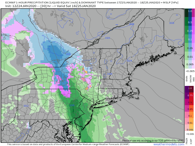 No real changes in timing of the event. Steadier precipitation arrives Saturday night and briskly moves north. Be aware of some gusty winds that accompany it. For southern and western areas, this appears to be over, or ending soon after daylight Sunday. For northern and eastern areas, it will be Sunday afternoon. Snow showers kick up for the mountains, Moosehead and Allagash by Sunday evening, and are likely to continue until the upper low exits the area Monday evening. 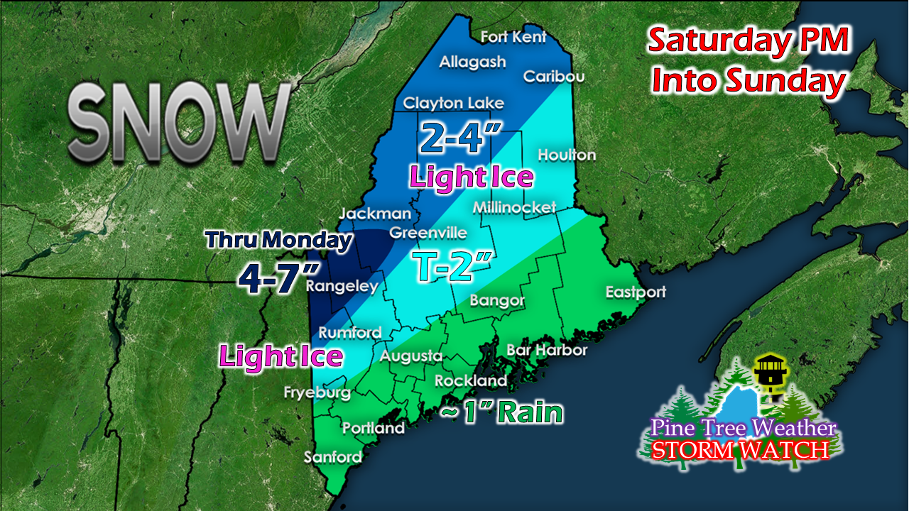 Given the tropical moisture associated with this storm, this will likely be a heavy, wet slop for interior areas. Backside snow showers will be fluffier as drier air works in behind the surface low. Pockets of freezing drizzle and rain are possible away from the coast and in protected valleys. At this point, I do not expect any accretion for concern. NOTE: Given the nature of the cut-off upper low, models are still all over the place on precipitation types and amounts. There is bust potential here for snow, so be aware of that. As I said this morning, 2-4" is a fair bet for the ski hills on the back side of this, and that idea remains on track. A week to watch for the next one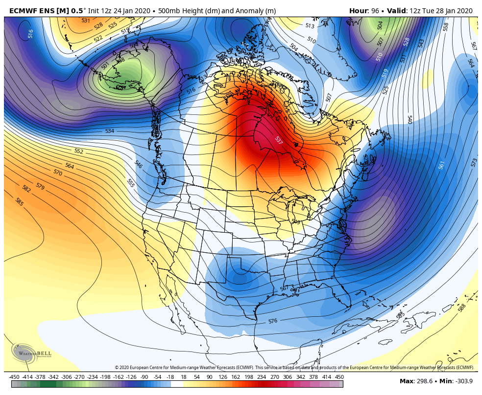 I get asked, "Where is the cold?" It's been in Alaska for much of January. After a record temperature setting summer there, the region has been the coldest location this winter in the northern hemisphere. I've been waiting for the bitter cold balloon that has meandered around there all month to pop, and it appears that is going to happen. A strong ridge over Siberia in conjunction with another over the eastern Pacific appears to jar it loose. With a trough working across the southwest this week, it may tap into that some of the Alaskan cold, and set up the east coast for a potential snow event next weekend. Stay tuned. Stay on alert! ► ► For the latest official forecasts, bulletins and advisories, please check in with the National Weather Service in Gray for western and southern areas, or Caribou for northern and eastern parts of Maine.  ► ► $125 shortfall for the year ahead! You can help keep Pine Tree Weather going with a donation of ANY amount now through VENMO @PineTreeWeather, a monthly donation on Patreon or messaging me on Facebook or Twitter to send a check in the mail. Thank you for your support!
For more information from me, please check the Pine Tree Weather Facebook page as well as my Twitter feed. Always stay weather aware! - Mike |

Mike Haggett
|


