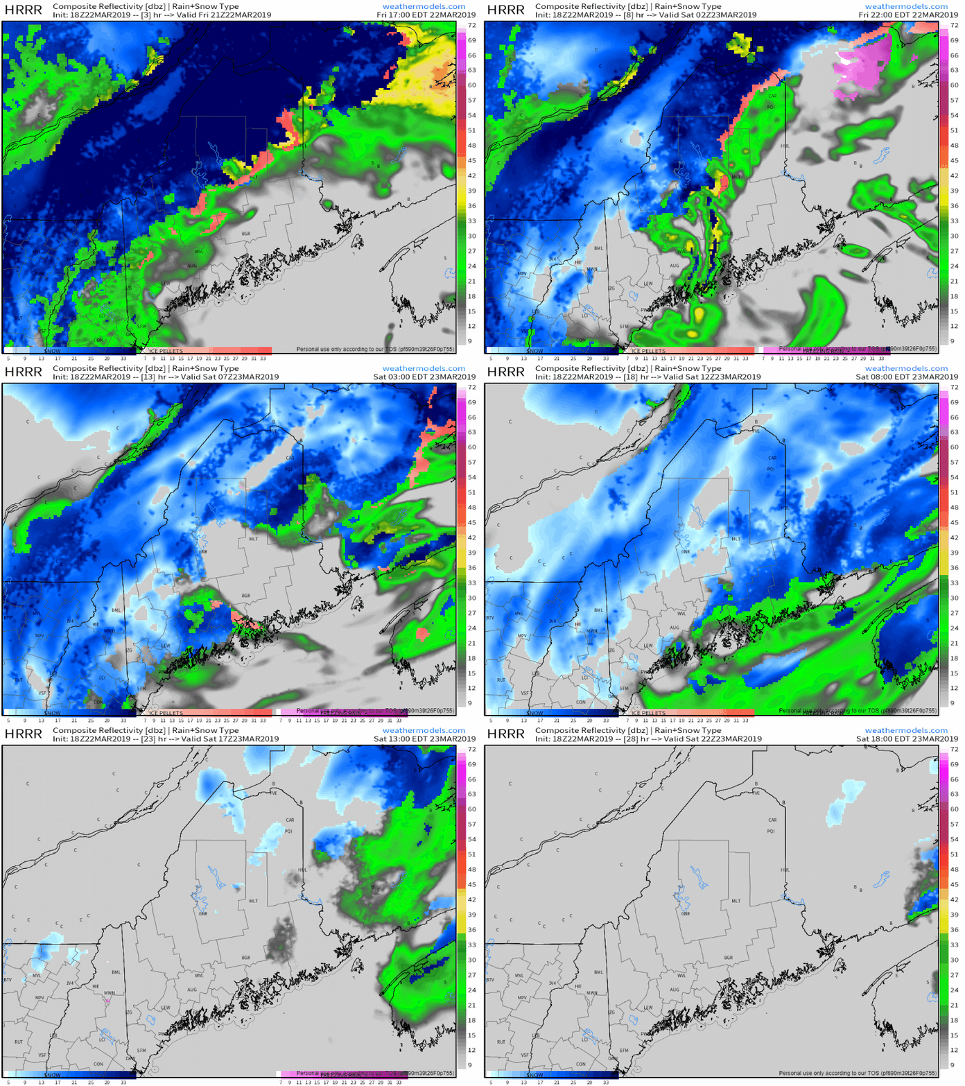
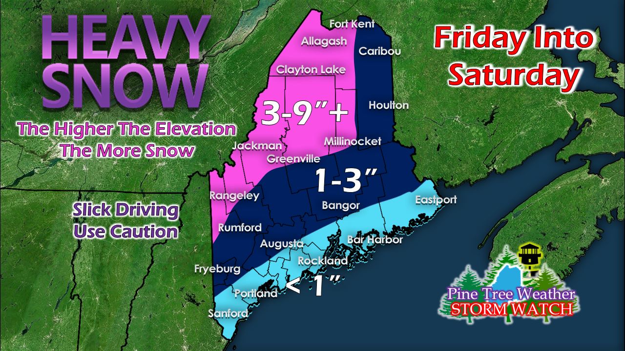
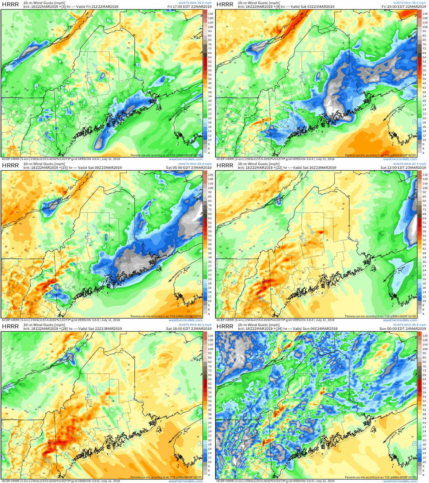
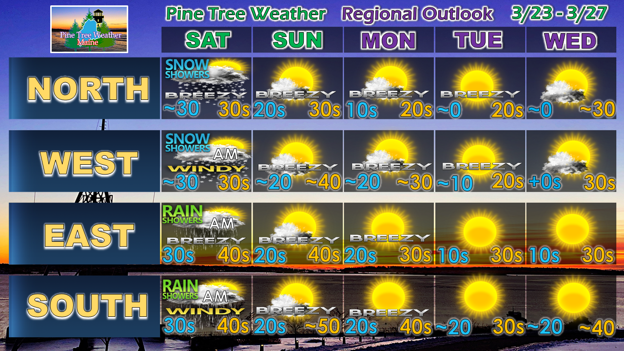
Storm slowly departsThe current storm will stall over the region until upper level energy to the west moves in and boots it out of the region by Saturday afternoon. Snow continues for the mountains and north steady at times through the night. As the storm slowly moves eastward, cold air will filter in behind it and bring snow showers to the coastal plain overnight and into Saturday morning. This map I posted on Facebook Friday morning still appears good for general total snow amounts by the time the storm ends Saturday. I am still thinking a foot or more total for the ski hills and also for the Katahdin region. As the storm moves eastward, the wind will pick up. For areas where heavy wet snow has accumulated on trees and power lines, this will be concerning for you. Wind out the northwest could gust in the 30-40 mph range, with higher gusts for the mountain tops. The breeze settles down somewhat Saturday night, but will continue on Sunday. Outlook through WednesdayA weak frontal boundary passes through the region Sunday night, which may bring some snow showers or flurries to the mountains. Any accumulation appears to be dusting to an inch in areas. Temperatures fall well below normal Monday and Tuesday as an arctic high takes over. A trough deepens over the central part of the country midweek and a ridge builds in to bring temperatures back up as we head into the second half of the week.
NOTE: Due to the quiet pattern, I will take a break this weekend and spend time with my family and recharge. My next update will come on Monday. ► ► For the latest official forecasts, bulletins and advisories, please check in with the National Weather Service in Gray for western and southern areas, or Caribou for northern and eastern parts of Maine. ► ► Your financial donations are much appreciated to keep this site funded and for further development. I sincerely appreciate your support not only financially, but also in sharing my efforts with others. Always stay weather aware! - Mike |
Mike Haggett
|


