Nor'easter season is beginning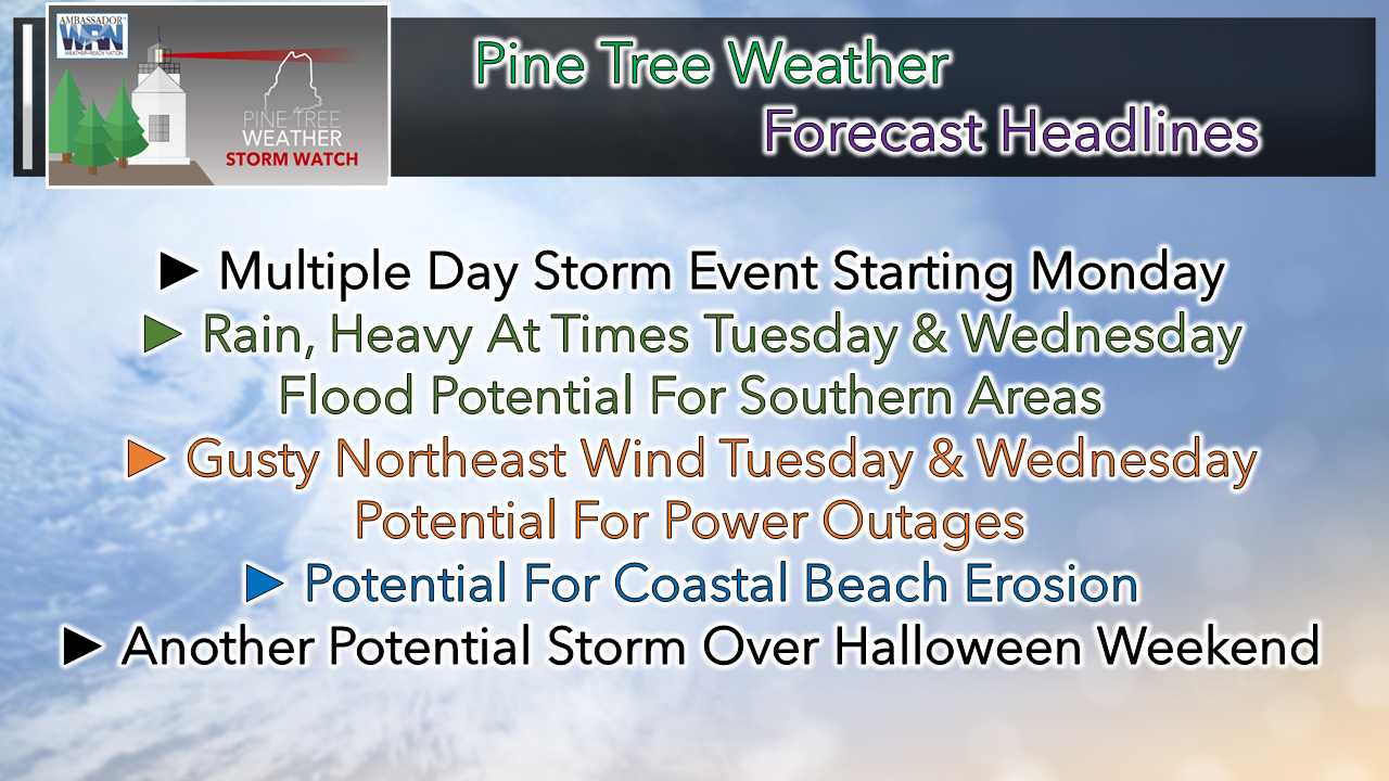 October has been unseasonably warm and relatively dry to this point, and that appears to change. Cold air is making its presence known in the atmosphere as winter approaches. For life along the 45th parallel, the battle between cold and warm air sets the stage for storm activity, and that is the pattern that is being established as we wrap up the month and head into November. Sunday may be the last dry weekend day for a couple of weeks. If you have outdoor projects to get done, it would be a good day to do it. Soggy and windy times are ahead. It would be good to check your storm supplies, test your generator, secure any outdoor decorations or any other loose objects. Flying trash cans are distinct possibility for some urban areas as the week unfolds. Some uncertainty with the forecast for early week storm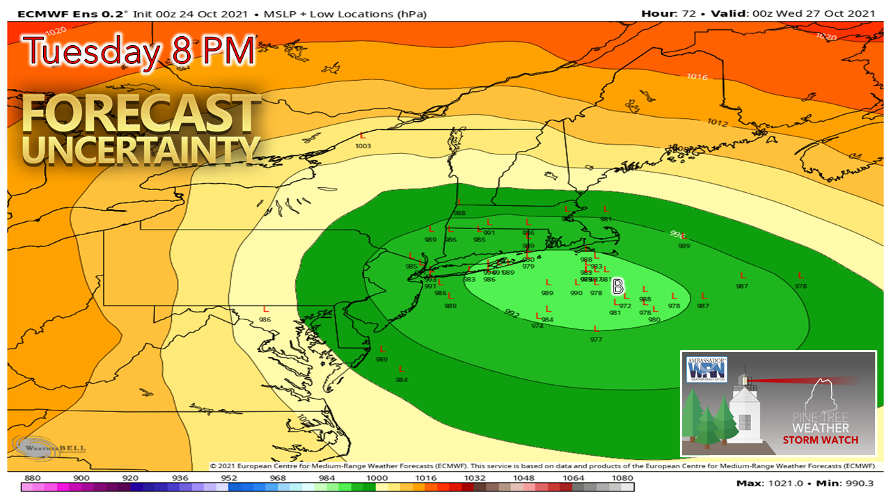 As a forecaster, it's rather concerning to me to see the model spread as varied as it is so close to impactful storms, and that is a disturbing trend I have noticed recently that appears to be coming more common. The only sure bet at this point is for wind and rain for southern areas. Uncertainty for impacts over northern areas remains in question, which is somewhat typical with storms that flirt with the benchmark "B" point, 40° N / 70° W. This is close to a benchmark storm, but as of the Saturday night model runs, there is still quite a spread in ensemble ideas, which indicates there is room for error which could affect the forecast. 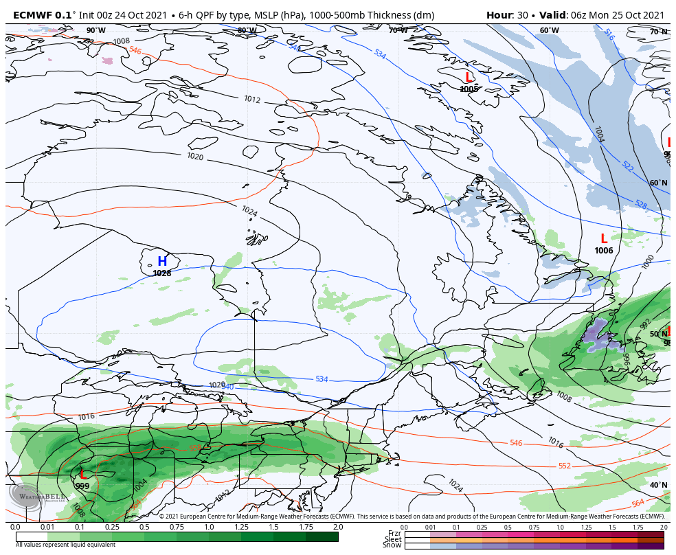 Monday 2 AM - Thursday 2 PM: An upper-level ridge and associated surface warm front noses northeast on Monday, which brings the first round of showers to the area. Three key factors will play in how this plays out. For one, that large area of high pressure which will act as a block over eastern Canada. This will affect what happens for northern areas. Second, the area of low pressure forming near the Great Lakes being supported by an intensifying cut-off upper-level low. Third, duration of time the cut-off upper low and associated developing and decaying surface lows which hangs around before moving eastward. Both of those factors will determine the track and impacts of the storm. As of Sunday morning, the general idea is for this to be a three-day event, with Tuesday being the most impactful. 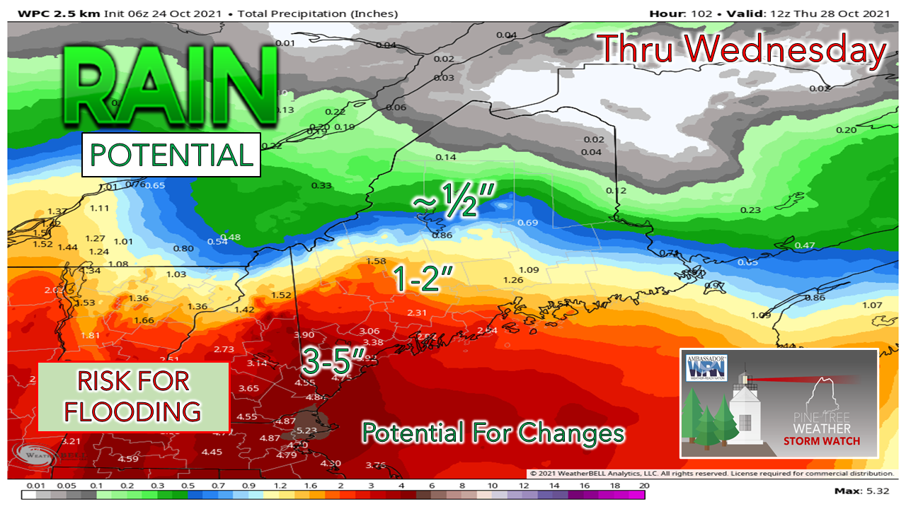 One thing that forecast confidence is good is that southern areas are likely to receive the most rainfall. The idea here from the Weather Prediction Center shows potential for 3-5" of rainfall for southwestern areas at this point. How much rain falls over the north depends on the strong Canadian High and its influence on the cut-off upper-level low. There is a chance where most of Aroostook County gets nothing more than spot showers or clouds out of this. The coastal plain is likely to see the impacts of wind, which is typical of Nor'easter storms. The duration and speeds are still to be ironed out, but gusts in the 25-35 mph range Tuesday afternoon through Wednesday is potentially there, which would mean threats for power outages would be possible until the storm moves east and the stiff breeze settles going into Thursday. That respite from the wind may be brief, however. Power of Water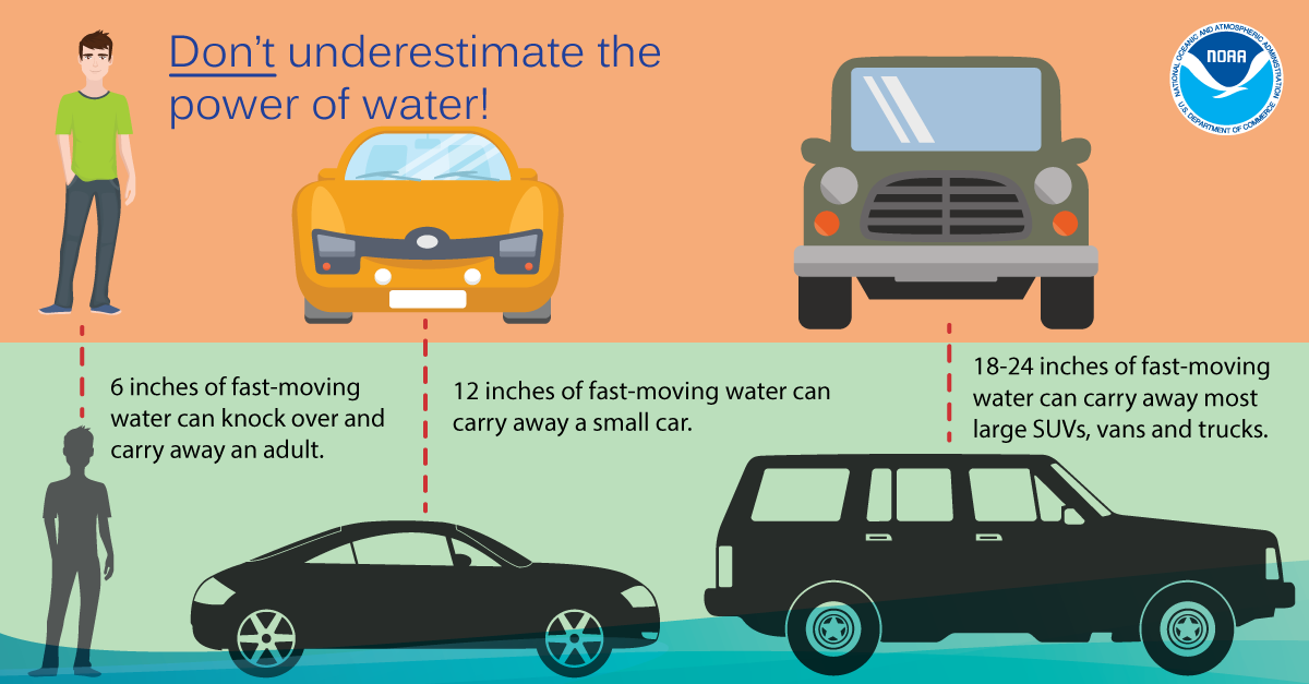 Don’t underestimate the power of water. It only takes 6 inches of fast-moving water to knock over and carry away an adult, and 12 inches to carry away a small car. Turn Around Don’t Drown! weather.gov/safety/flood-turn-around-dont-drown Storm potential for Halloween weekend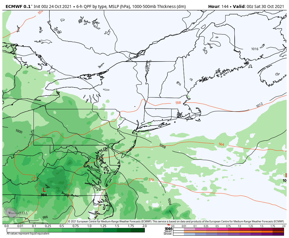 Friday 8 PM - Sunday 8 PM: On the heels of the storm that impacts the region midweek comes the potential for another decent storm to affect the region with wind and rain Saturday into Sunday. Updates on this will come.  Temperature outlook through FridayTemperatures start off near normal at the beginning of the week before running above normal through Friday. 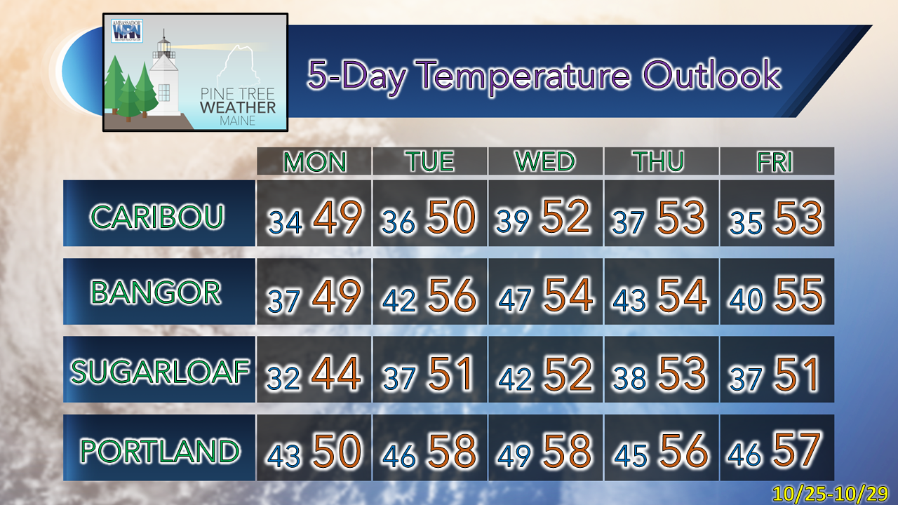 Be prepared to receive alerts and stay updated!
 For more information in between posts, please follow Pine Tree Weather on Facebook and Twitter.
Thank you for supporting this community-based weather information source which operates by reader supported financial contributions. Stay updated, stay on alert, and stay safe! - Mike |

Mike Haggett
|