
Tough travel at times in areas through the region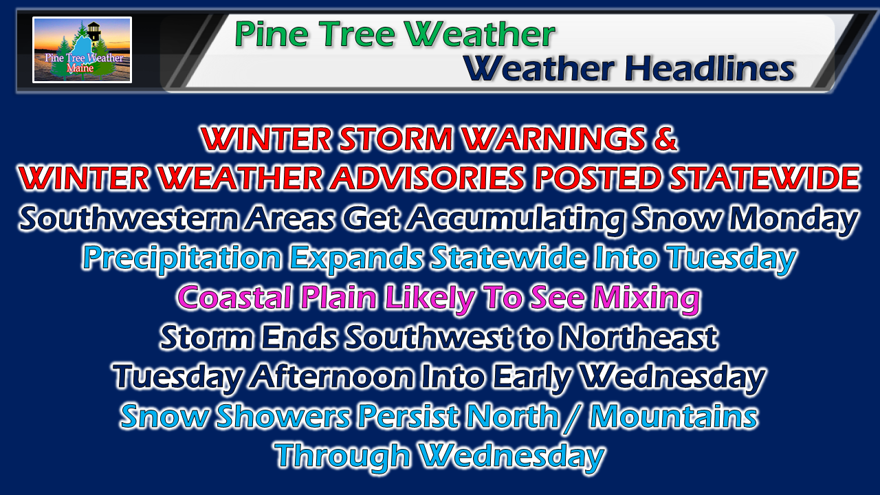 No real changes in forecast thinking, just some subtle tweaks to reflect observations. If you have New Year's Eve plans, my suggestion is to get to your destination Tuesday evening and stay there. Amateur night + slick spots from departing storm = risk of unfortunate circumstances. Think through your plans. 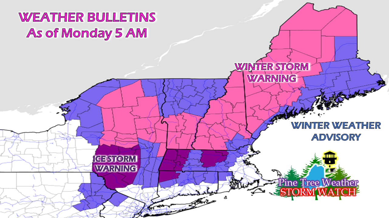 All of northern New England is now under some sort of winter advisory or warning. Ice storm warnings for central & western Massachusetts and New York. Travel south and west is strongly discouraged until Wednesday. Southwestern areas get the precipitation Monday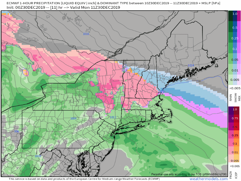 High pressure to the north will keep northern and eastern areas dry for the daytime hours. Southwestern areas see snow and possibly some sleet mixing in through early evening. 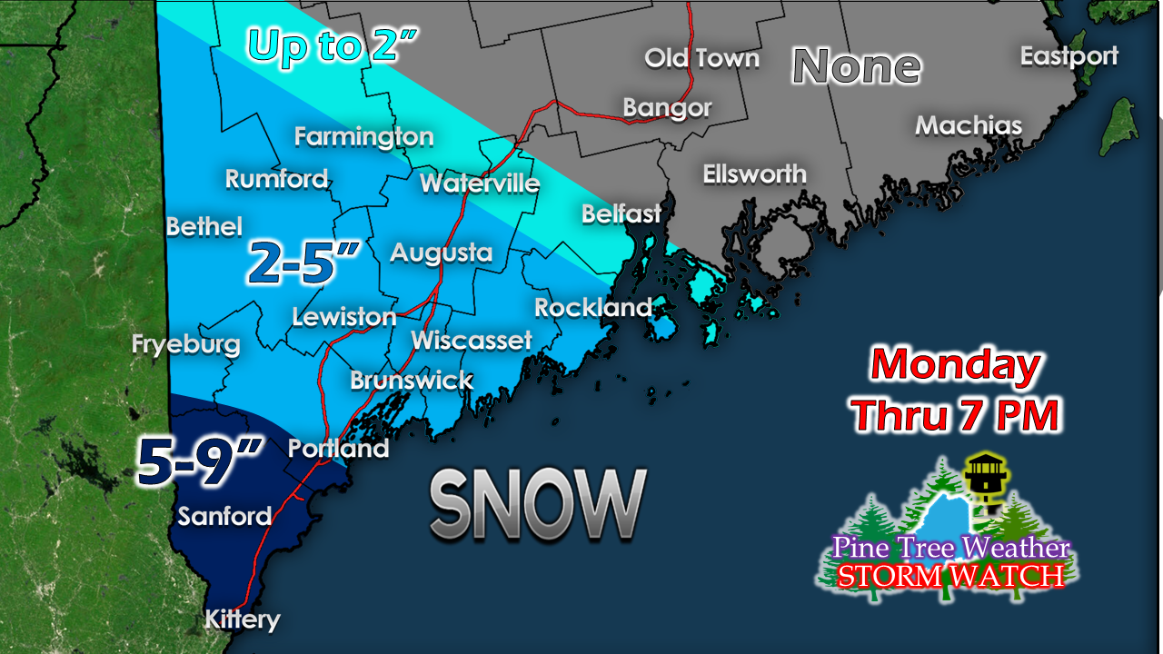 York County remains the jackpot area for the first leg of the storm. Sleet may knock down snow amounts. New Year's Eve a mess everywhere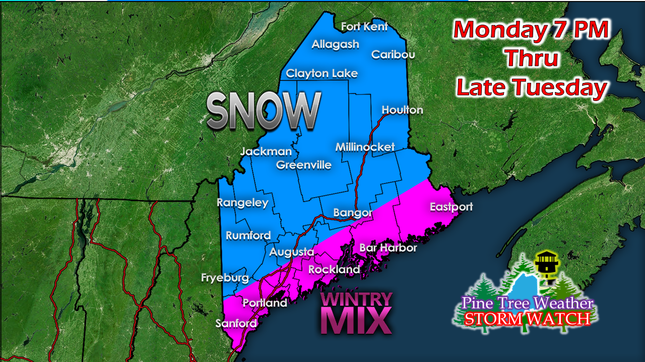 Interior areas continue to appear to be mainly snow. The coastal plain can expect snow changing to sleet and/or freezing rain. Shoreline areas can expect a period of rain as the coastal storm moves northeast. How far inland rain goes depends on cold air damming. Cold air will do what it wants to. 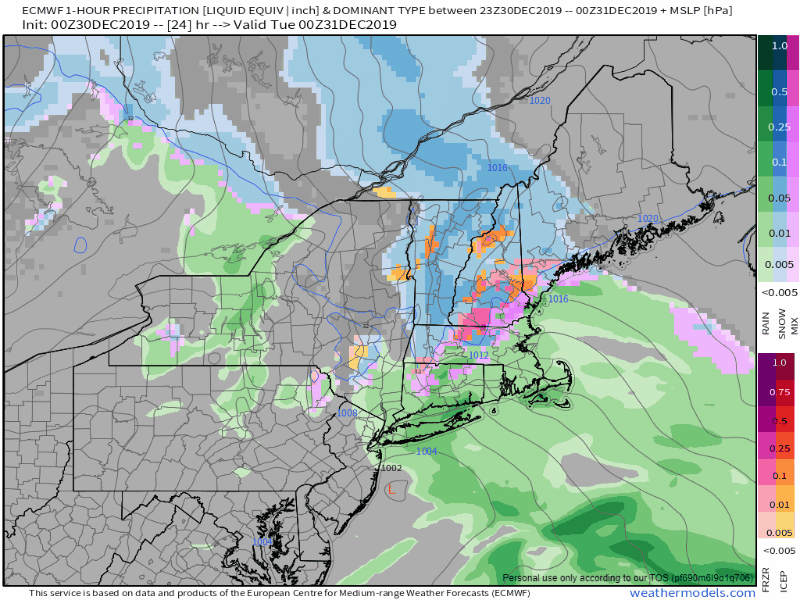 Snow ventures to the north and east overnight and mixing begins to creep in along the coast by Tuesday morning. 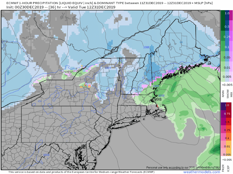 Storm moves northeast during Tuesday. Precipitation ends over southwestern areas by around early afternoon. 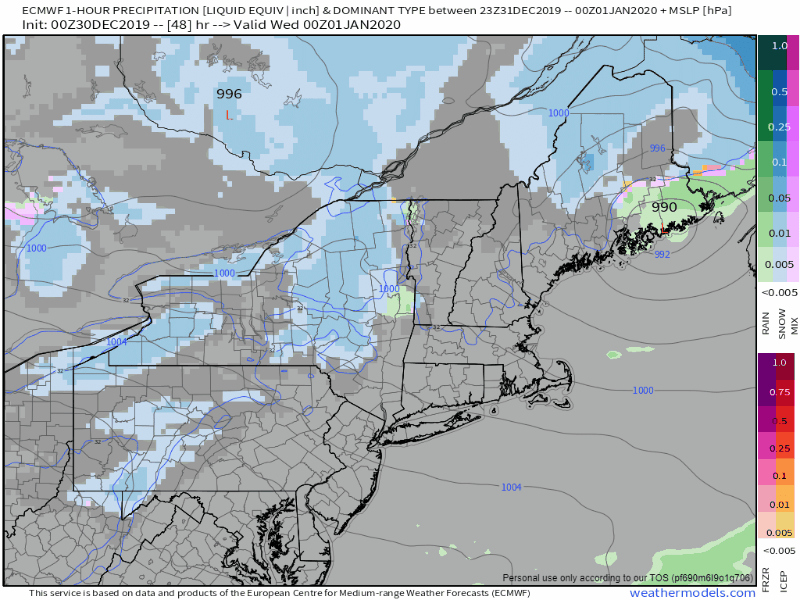 Precipitation ends around Bangor and eastern areas early Tuesday evening. Snow showers will persist in the mountains and north into New Year's Day. 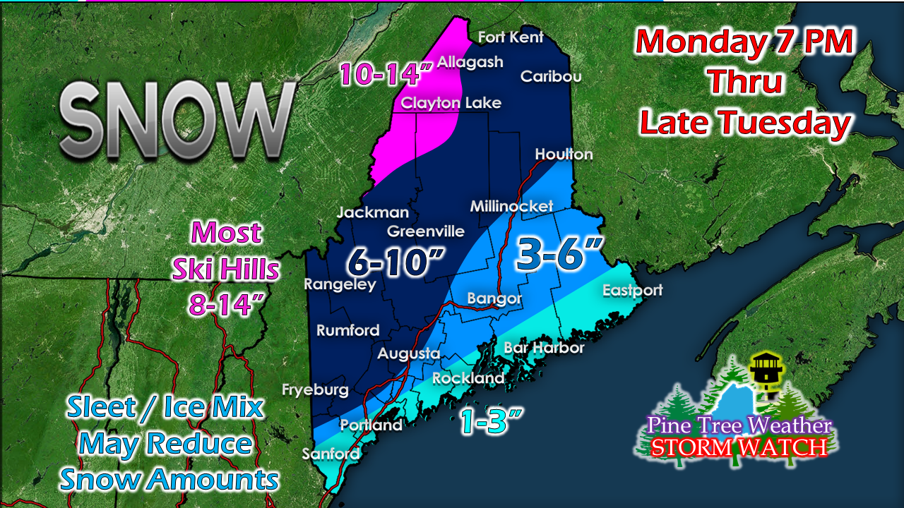 Enjoy the snow if your headed to the slopes! Please help me get fully funded in order to continue! ► ► $200 shortfall for the year ahead! You can help keep Pine Tree Weather going with a donation of ANY amount now through VENMO @PineTreeWeather, a monthly donation on Patreon or messaging me on Facebook or Twitter to send a check in the mail. Thank you for your support!
For more information from me, please check the Pine Tree Weather Facebook page as well as my Twitter feed. Always stay weather aware! - Mike |

Mike Haggett
|


