
Buckle up and button upFor folks along the coastal plain on up into western areas, it's time secure any objects that could go airborne. Pick up the yard, tighten up the grill cover, test the generator, and check supplies is the to-do list for the day. We're not in panic mode, but we do have a corker of a storm in the works that will bring impacts to the region overnight Wednesday into Thursday. For those with trash pick up on Thursday, the longer you can hold off putting it out the better. If you can't, find some way to secure receptacles so they do not blow over and make a mess. Guidance is hinting at a sub 980 mb storm (28.93") and ensembles are rather adamant in backing the idea up. While I opt to avoid media hype terms like "bomb cyclone", that is essentially what we are dealing with here. With a storm dropping in central pressure around 30 mb in 12 hours, it will bring a punch. With this one, wind is the big concern. Wind is likely to cause power outages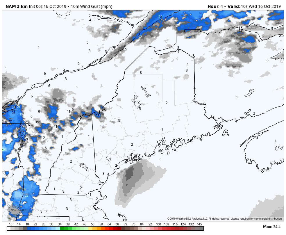 Given the track of the storm as a coastal hugger, the stronger gusts will be on the east side, and will be stiff. A High Wind Watch is in effect for the entire Maine coast. Gusts along the shorelines could reach 50-60 mph, with offshore buoys flirting with hurricane force. This will be strong enough to bring down trees and or tree limbs which will cause power outages. While the coast is the immediate concern, strong wind gusts are also expected over much of western Maine, where gusts in 30-45 mph range is possible. High profile vehicles should find a safe place to park and avoid the Turnpike through Thursday morning. While the region deals with surface wind, there is concern about downdraft wind gusts from aloft. A low level jet a 70-75 kts could transfer down in heavy downpours, and could bring localized damage that way. The worst of the wind will be over for most locations by mid-morning on Thursday. Once the storm tracks to the east, a northwest flow will develop and remain breezy behind the storm through Friday. Timing and rain amounts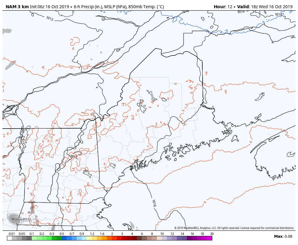 Rain will come heavy and quick over southern and western areas Wednesday night into Thursday morning. Showers arrive over eastern areas around 2-4 AM, and reach northern areas by 7-9 AM. Rain tapers to showers over southern areas by early afternoon, and then tapers off by Thursday evening. With the storm being blocked, showers will persist over the western mountains, north and east into Friday, and end Friday night. Rainfall amounts are always tricky with rapid developing storms. The potential for dry slotting is real. Southwestern areas of Maine along with the western mountains have a good chance of roughly 2" of rainfall, with 3-4" possible in New Hampshire. Northern areas appear on the lean side of this event, with roughly a half inch or slightly more possible by the time the last drop falls Friday afternoon. Urban street flooding due to clogged storm drains from leaf drop is very possible. Hydroplaning on the highways from heavy downpours for the morning commute in southern areas is a concern. With the leaf and pine needle drop, roads and intersections could become surprisingly slick. Expect reduced visibility with heavy rain, flying debris with the wind, and use caution traveling. Waves to batter the shorelines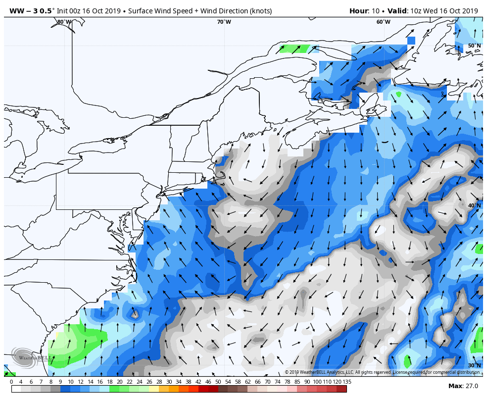 Seas of 13-18' are expected to batter the shorelines at their height on Thursday before slowly subsiding over the weekend. Splash-over is possible in areas with the Thursday afternoon high tide, along with some moderate beach erosion in areas. For more details on that, check out the new marine page on the website with links to forecasts the offshore waters.
► ► For the latest official forecasts, bulletins and advisories, please check in with the National Weather Service in Gray for western and southern areas, or Caribou for northern and eastern parts of Maine. ► ► DONATION DRIVE UPDATE - $920 shortfall for the year ahead! You can help keep Pine Tree Weather going with a donation of any amount now through VENMO @PineTreeWeather, a monthly donation on Patreon or messaging me on Facebook or Twitter to send a check in the mail. Thank you for your support! For more information from me, please check the Pine Tree Weather Facebook page as well as my Twitter feed. Always stay weather aware! - Mike |

Mike Haggett
|


