|
Before I get going here, a special thank you to those who are sending me checks, contributing through VENMO, and for my monthly Patreon donors. I am about 60% funded for the year ahead. It takes about $3000 a year to fund this entity. This is a labor of love here. I don't mind getting out of bed at 2 AM to formulate these discussions, but without financial support, it's hard for me to justify doing it. If you have not donated recently, or are interested in helping me out, I would really appreciate the support. My wife and I are taking a much needed night away that was planned a month ago. I may provide a brief update on this storm Sunday on Facebook if time allows. I appreciate everyone's patience as I continue juggle my education, full time job, and family. A Colorado Low blossoms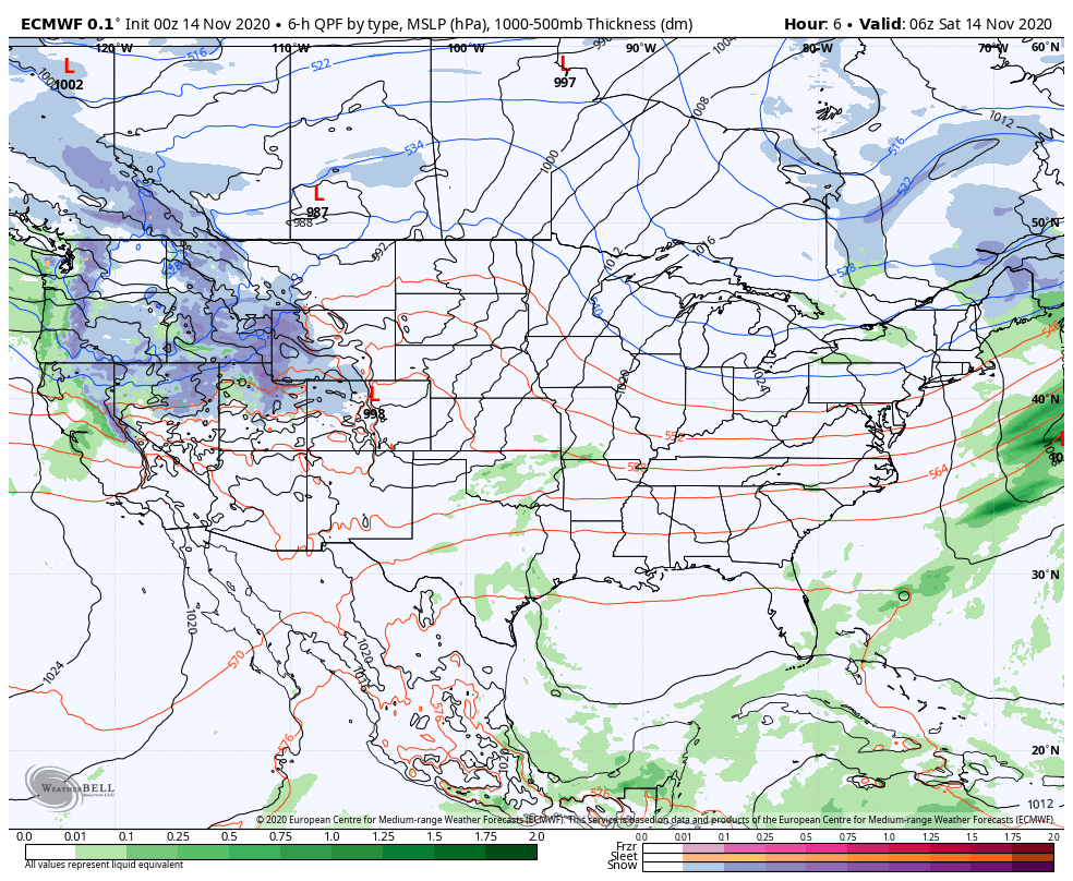 Pardon the weather nerd in me, but I find fast developing Colorado lows in winter to be fascinating. The seeds get planted in the eastern plains of the Centennial State and taps into moisture from the south. Deep cold plunges in from the northwest. The storm tracks into the upper Midwest and then bombs out as it gets to the Great Lakes and into central Ontario. All of this happens within 48 hours. That is what appears to happen here. For Maine, we are on the southeast quadrant of these types of storms. With cold air around, this scenario presents a mixed bag of precipitation types. Timing The storm is setting up to be a quick hitter. Sunday sees clouds on the increase as the cold front attached to the area of low pressure to the northwest moves eastward. Precipitation gets going late in the afternoon for western and eastern areas, working north and east and impacting those regions by around midnight-1 AM Monday morning. As quick as it comes, it ends. This appears to be over and done for western and southern areas by 2-3 AM, and the last of steady precipitation exits northern and eastern areas around sunrise. Precipitation types and amounts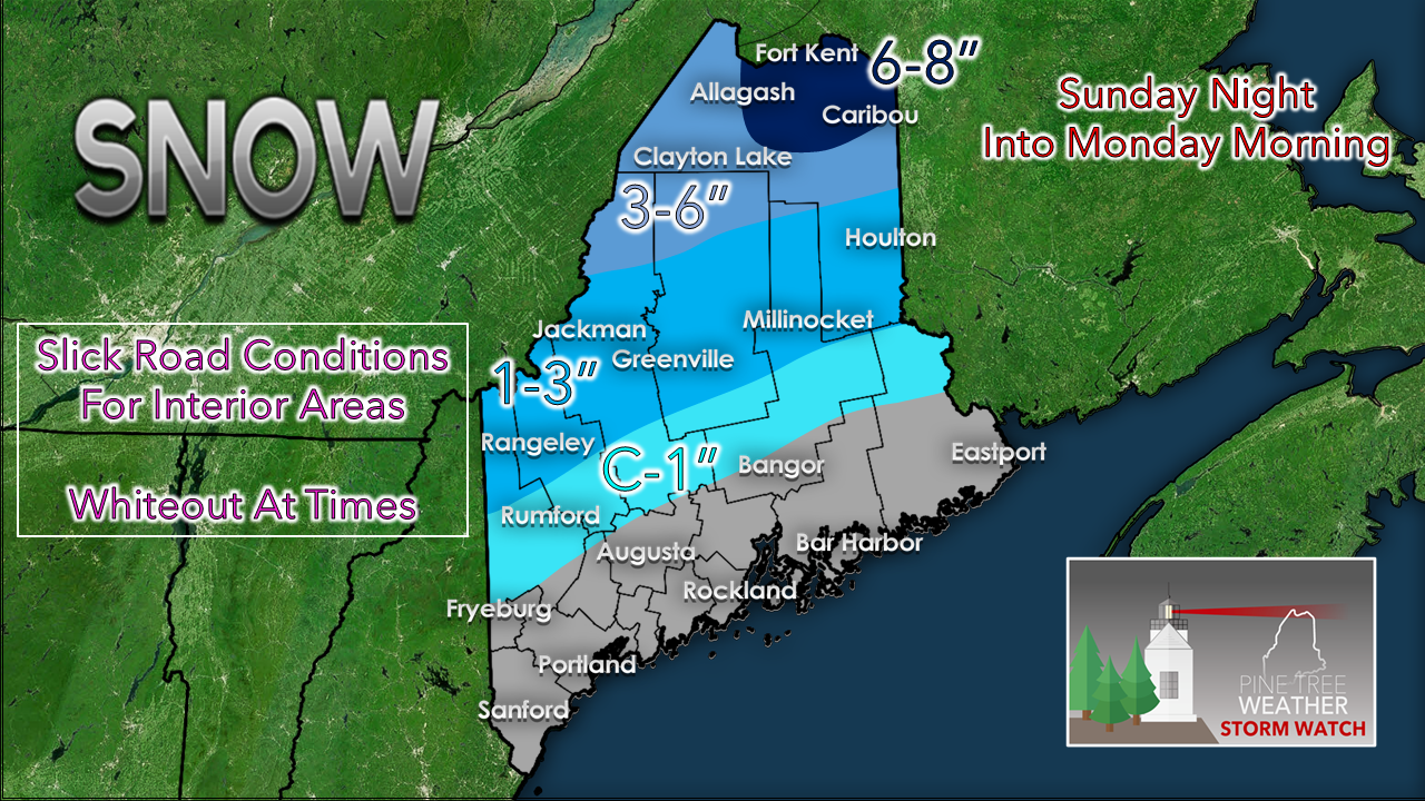 Given the timing of the storm, this appears to be solid snow event for northern areas. Western areas may see a sleet / freezing rain mix at the onset before flipping to snow late evening. If this slows down, I could see an increase in snowfall amounts for the western mountains. An hour or two delay in arrival could bring enough cold air in to bring 3-6" down to Carrabassett Valley and Rangeley, and perhaps 1-3" for the western foothills, and a coating to 1" into the interior coastal plain. The snow is likely to be heavy in weight from Jackman / Houlton south. This sets up potential power outages in conjunction with the wind, which I will discuss. 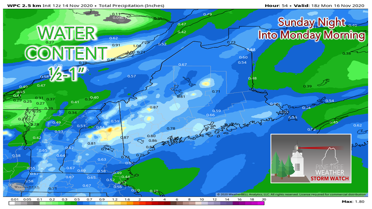 Once the snow in melted down where it falls and where rain is the main precipitation type, it's a decent amount of water. Most places will get out of this with a ½-1" of liquid equivalent out of this, which is desperately needed.  The southeast wind factor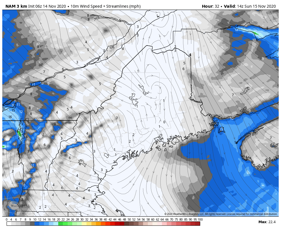 Ahead of the precipitation comes the wind. I mentioned that the region is in the southeast flank of the storm, which means the wind will come out of the southeast. Thinking back to the October Gale of 2017, it does bring up some cause for concern. Granted, this storm isn't going to anything like that, but the region has a history of higher than average power outages on strong southeast wind events versus strong northeast or northwest wind events, due to the root structure of trees. Southeast wind storms are not common, but we appear to be having more of them in the past three years. After the frontal boundary passes through, the wind shifts to the west/southwest Monday morning. The breeze will be stiff with gusts into the 30 mph range through the day, and will be a part of the forecast through midweek. 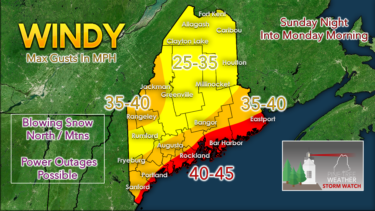 Southeast wind direction means the coast will take the brunt of the wind. The higher peaks of the western mountains will get strong gusts also. Blowing snow will not only be an issue Sunday night into Monday, but will continue to be a potential travel hazard for the mountains and north through the middle part of the week. Also for the coast, specifically the shorelines: we will be dealing with king astronomical tides with the new moon. The Sunday night high tide at roughly 11 PM may bring minor flooding and splash-over in the typical low lying areas. Fortunately, this high tide is predicted to be 1' lower than the tide in the 10 AM hour earlier in the day. There will be some impacts, but not what it could be. For those with shoreline interests, you can consult the Marine page for more information and links to NOAA forecasts. Outlook and temperature forecast through FridayOnce the storm clears out early Monday, cold air works in on gusty west/southwest breeze Monday and will shift to the west/northwest Tuesday. Wind chill indices could be in the single digits above/below 0° by Wednesday morning for the north and mountains, with teens potentially for the coastal plain. I also expect snow showers for the mountains to continue through the middle part of the week also, which could bring bonus inches for the ski hills and surrounding areas. For the rest of the region, it appears to be dry and cold for much of the week. A slightly warmer trend is on the way as we head into next weekend. 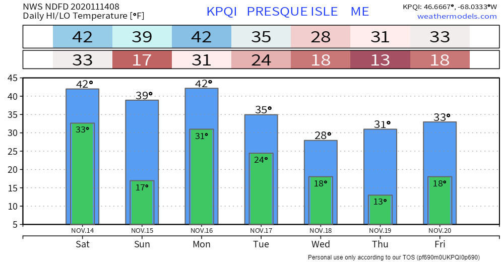 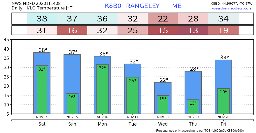 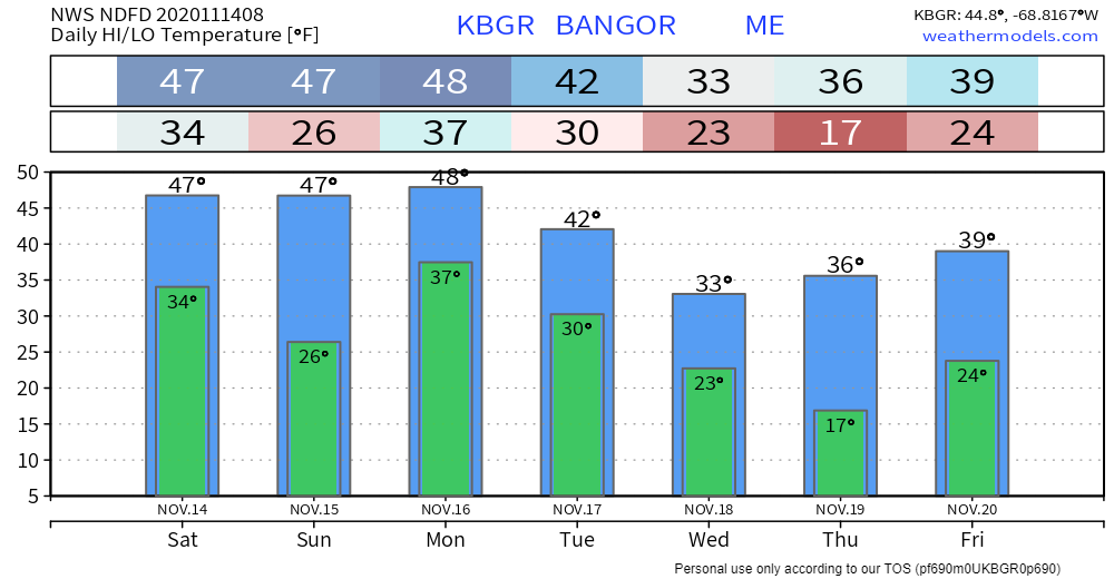 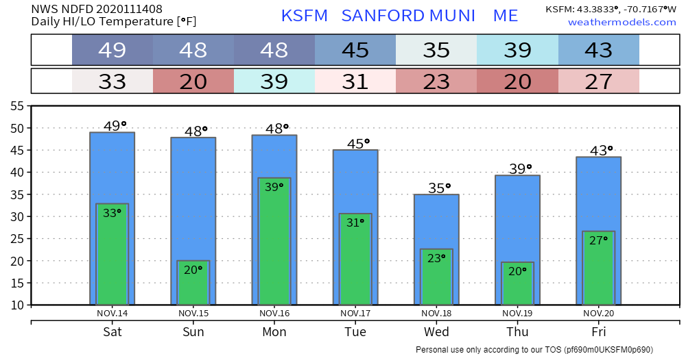 Staying warm when the power goes out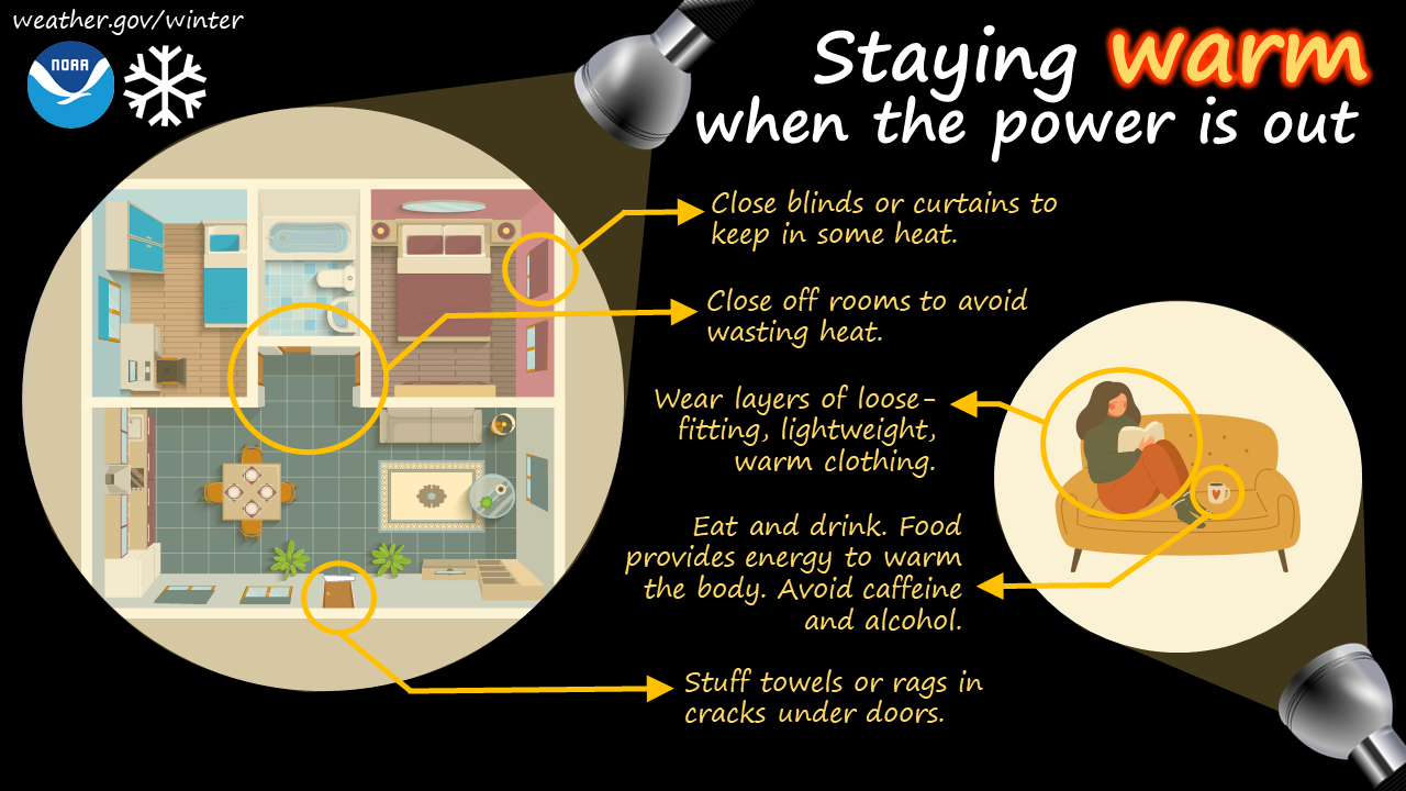 When the power goes out in winter, the cold can be deadly. But even without power, there are still ways to warm things up. Closing blinds and curtains and closing room doors can help contain heat, and stuffing towels in the cracks under doors can help keep the warmth in. And don’t forget about eating and staying hydrated - food provides energy to warm the body. Learn more about winter safety: weather.gov/safety/winter Be prepared to receive alerts and stay updated!
For more information, please follow Pine Tree Weather on Facebook and Twitter.
** FUNDING NEEDED FOR 2021 ** Thank you for supporting this community based weather information source that is funded by your financial contributions. Stay updated, stay on alert, and stay safe! - Mike |

Mike Haggett
|