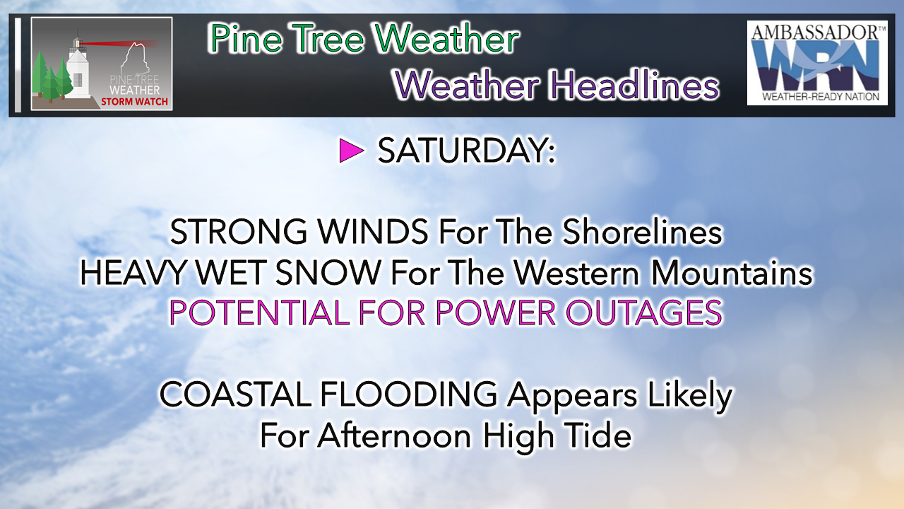
 Timing and precipitation amounts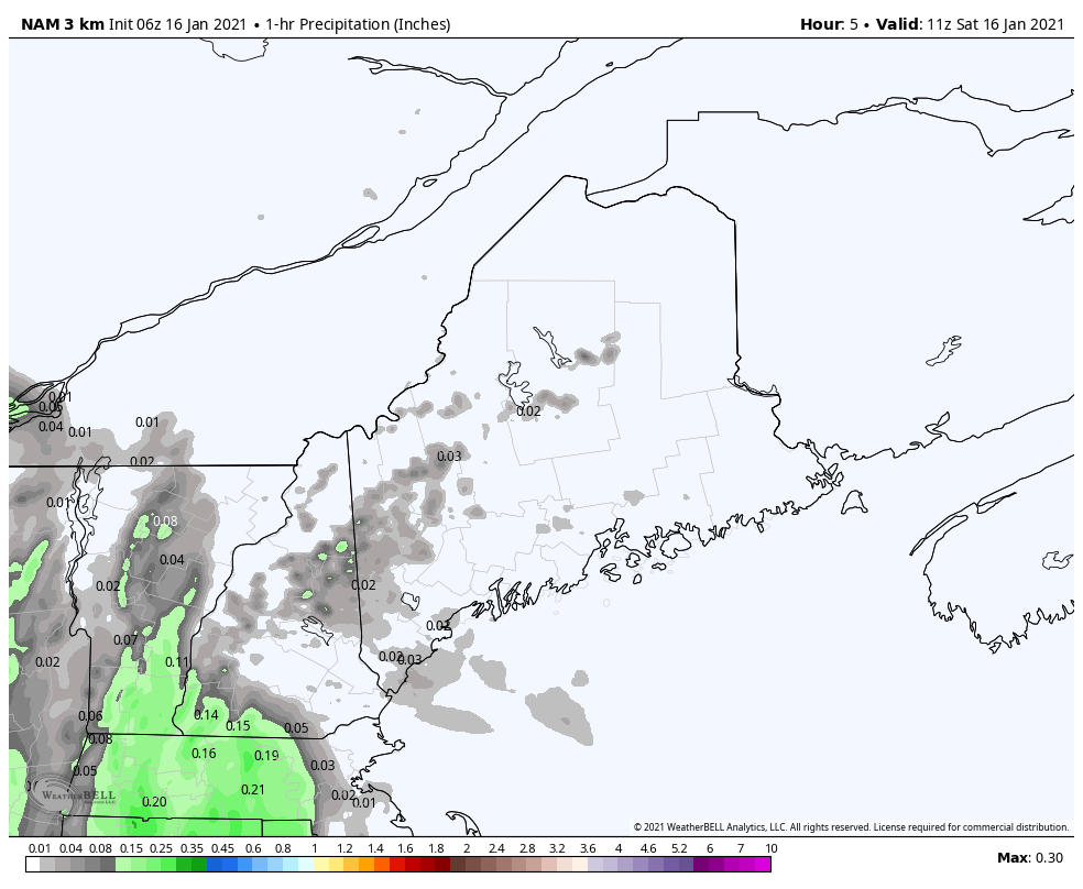 Rain for the coast, potential for mixed precipitation for the foothills and snow for the mountains overspreads the state during the day. Northern areas may be a bit late to the party, but they will get in on it by this evening. Precipitation in various types could be heavy at times during the afternoon. This could cause localized flash flooding in areas of rain, and bring heavy snow at 1-2+" per hour rates for the mountains. By late afternoon, rain appears to end for southern areas. 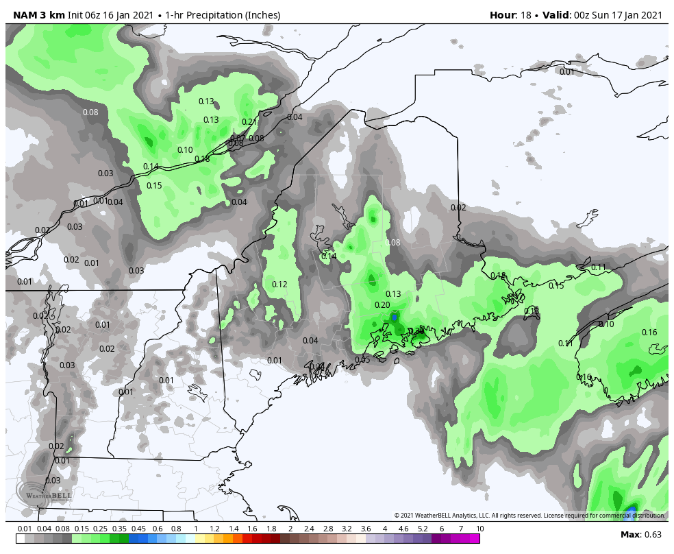 From 7 PM onward, precipitation ends over eastern areas. Northern and western areas see steady snow or mixed precipitation continue at varying intensities through the overnight and into Sunday morning. 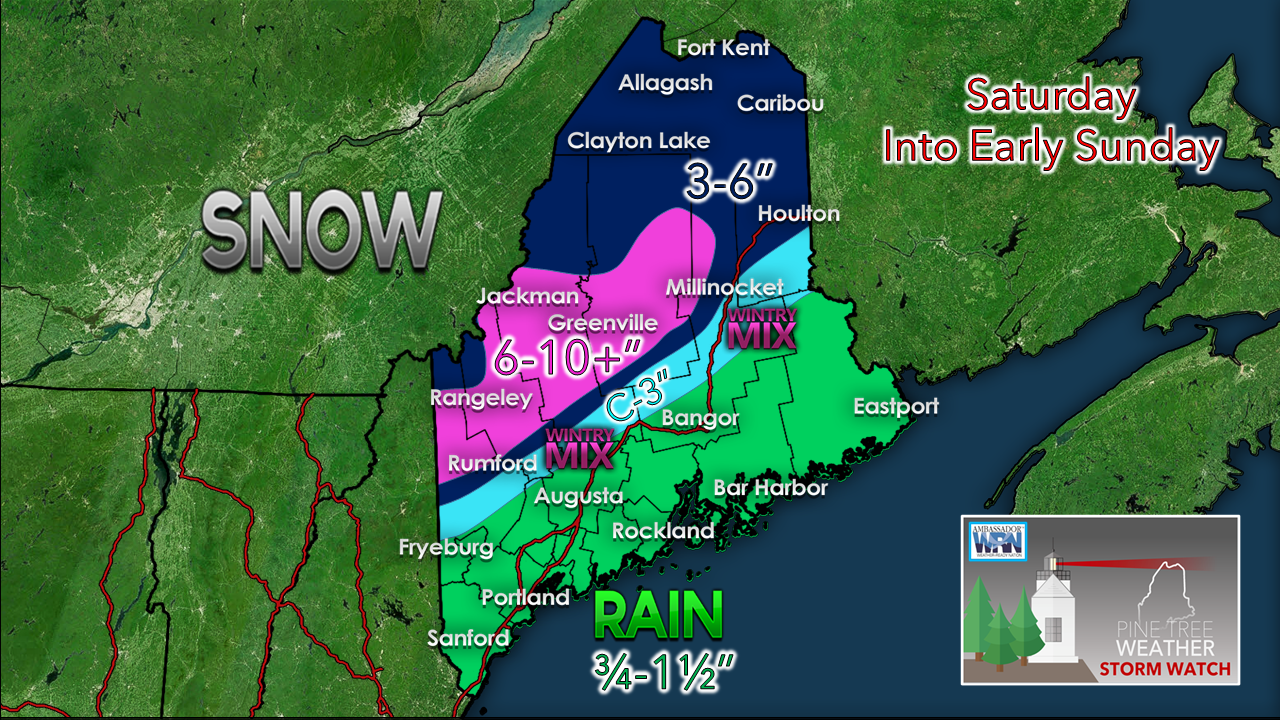 As stated here on Friday, most of the ski hills get a foot or more of snow from this event. There will be a sharp gradient with this event between where the rain, perhaps a mix of sleet and freezing rain and rain all come together over the western foothills on up into southern Aroostook. I am still concerned for Southwestern Oxford County (Fryeburg, Bridgton, Porter, Parsonfield) for a surprise here. The 1-2° difference in thermal profiles is the difference between light snow and a foot of snow. That is my main area of concern for bust potential, along with where the boundary of heavy snow and heavy rain come together. It's a matter of a handful of miles. Given the moisture profile, this is a wet snow event for the mountains. Snow to water ratios are roughly 6-7:1. Expect it to be sticky, slushy, and difficult to move. This is heart attack snow here. Take your time shoveling. For the coast, a general ¾-1½" of rain is expected, with locally higher amounts which could exceed 2". There is potential for basement flooding for those that are prone to it. Urban street flooding due to run off from snow melt is also a concern for interior areas of the coastal plain that have a snowpack. Expect reduced visibility from heavy downpours, along with areas of fog. Ponding on roadways could cause potential for hydroplane conditions on the speedier roads. There is the potential for a couple claps of thunder, maybe thundersnow for the mountains given the tropical characteristics involved here. Gusty winds may cause outages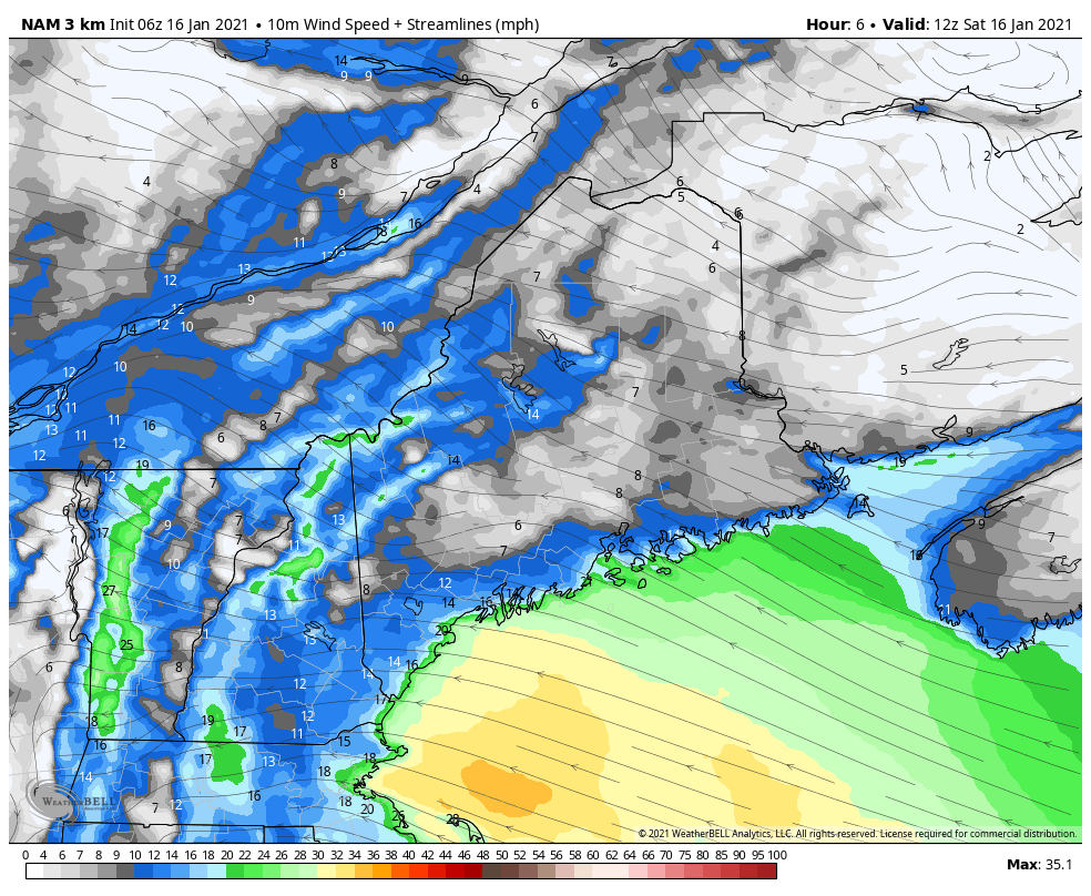 The National Weather Service has upgraded to high wind warnings for the MidCoast and DownEast shorelines. A strong low level jet along with heavy rain bring both a horizontal and vertical threat. Gusts peak by early afternoon over southwestern areas, MidCoast by late afternoon, and early evening DownEast. Wind gusts drop fairly quickly as the storm tracks northeast. Expect breezy conditions to continue Sunday and Monday. 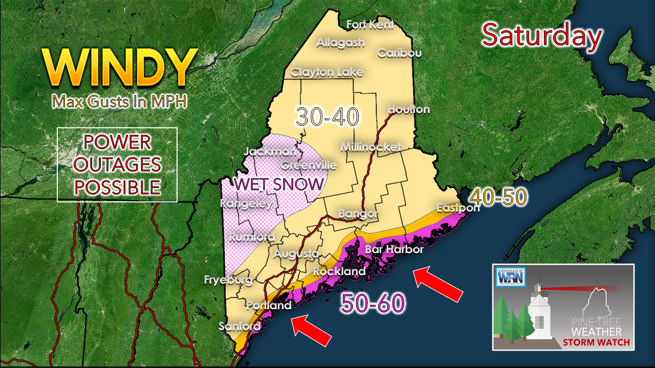 While the wind may not be as strong over the interior as it potentially appears for the coast, with areas of wet snow, it won't take a whole lot of wind to cause power outages. Folks seeing snow that sticks need to be prepared to lose power. With the wind direction generally from the ESE, this sets up storm surge from the high astronomical tide from the passing new moon. Timing of the afternoon high tide is around 1 PM. Expect the likelihood of splash-over, minor flooding in the prone areas, along with minor beach erosion from 11 AM through 3 PM. Tree Danger During high winds, trees can become dangerous objects. Stay safe by avoiding exterior rooms and windows, and by staying off the road. Prevent damage to your property by trimming loose branches and parking away from trees. weather.gov/safety/wind
For more information in between posts,
please follow Pine Tree Weather on Facebook and Twitter. Thank you for supporting this community based weather information source operates by financial contributions. Stay updated, stay on alert, and stay safe! - Mike |

Mike Haggett
|