Heads up for southwestern areas of Maine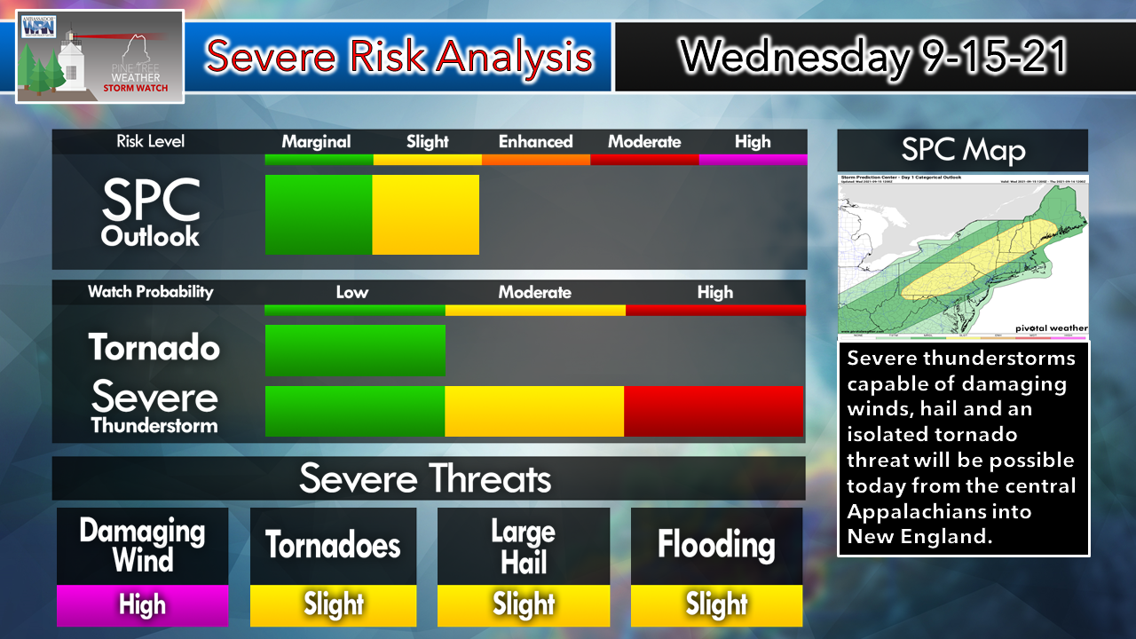 As I have stated here in the past couple of days, this is one of the more impressive set ups for severe storms the region has seen this year. The element of a strong cold front, typical of late summer, and warm air at the surface has set the stage for nasty storms to break out over the region Wednesday afternoon into the early evening. All severe weather threats are on the table, with damaging wind most likely to occur in strong storms. Isolated tornadoes, small to large hail and localized flash flooding are all possible. This is a day where you want to stay on alert, have multiple ways to receive alerts, and take action when a severe thunderstorm or tornado warning is called. 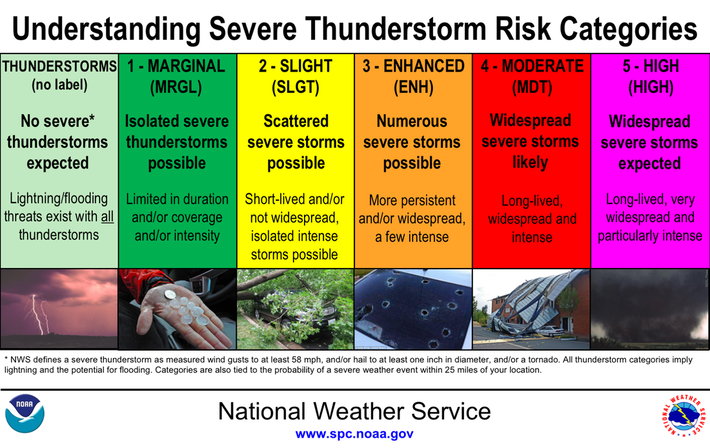 The Storm Prediction Center maintains the "Slight" risk level for severe potential over southwestern areas of the state. Severe storms are possible everywhere in the region today, but the best chance is for the western foothills, Capital District, and interior York and Cumberland Counties through Wednesday evening. 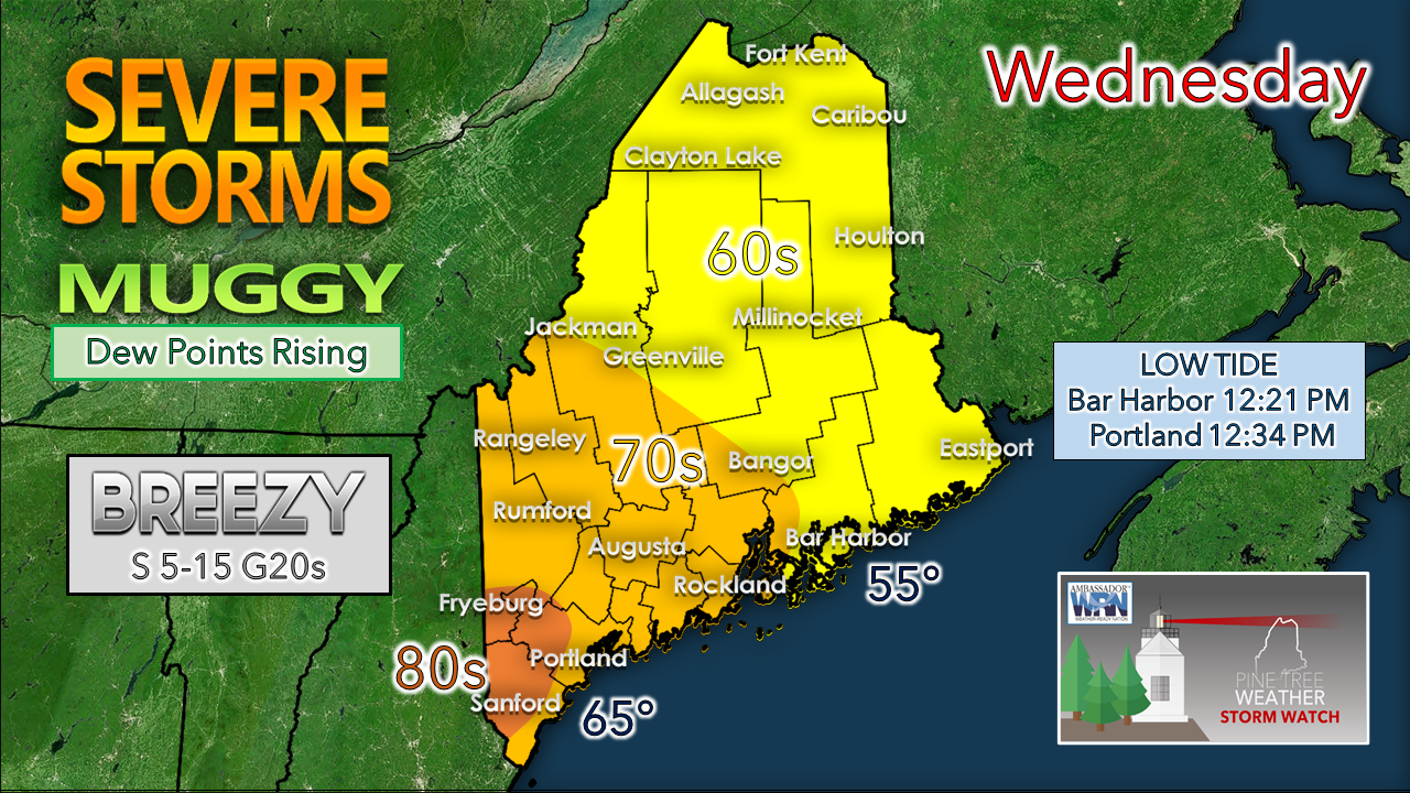 A look at the temperature forecast indicates the further south, the warmer it gets. Humidity levels rise to the point where dew points could reach the low 70s for southwestern areas by mid-afternoon as a southwest flow pumps the moisture and fuel for storms into the area. A southerly breeze helps keep the shorelines cooler, and could be rather stiff along the coast with gusts reaching 25-30 mph ahead of the approaching frontal boundary. Tornado / damaging wind threat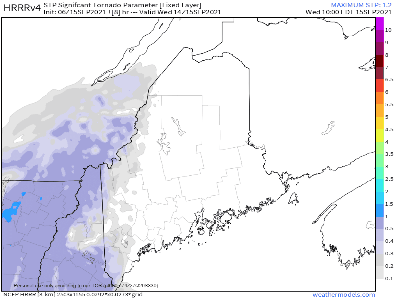 This loop from the HRRR model run at 2 AM Wednesday shows the areas of risk for tornadic activity and damaging wind Wednesday afternoon into the evening. The parameter is based on the amount of spin in the atmosphere. There appears to be plenty of it. These types of levels are more common in severe outbreaks in southern areas of the country. While the risk is certainly there for tornadic activity, the chance for a spin up is isolated. Please understand that if a tornado warning is called for your town that it is imperative to find shelter in a safe, secure building, preferably a basement or interior location away from windows. Cover yourself with a mattress or some other form of protection and stay in that location until the warning has cancelled. If a severe thunderstorm warning is issued, expect damaging wind, and consider the same procedure to stay safe. Timing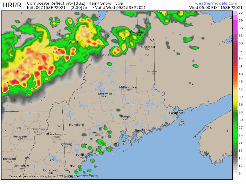 5 AM - Noon: Northern areas see the threat for showers and storms through midday 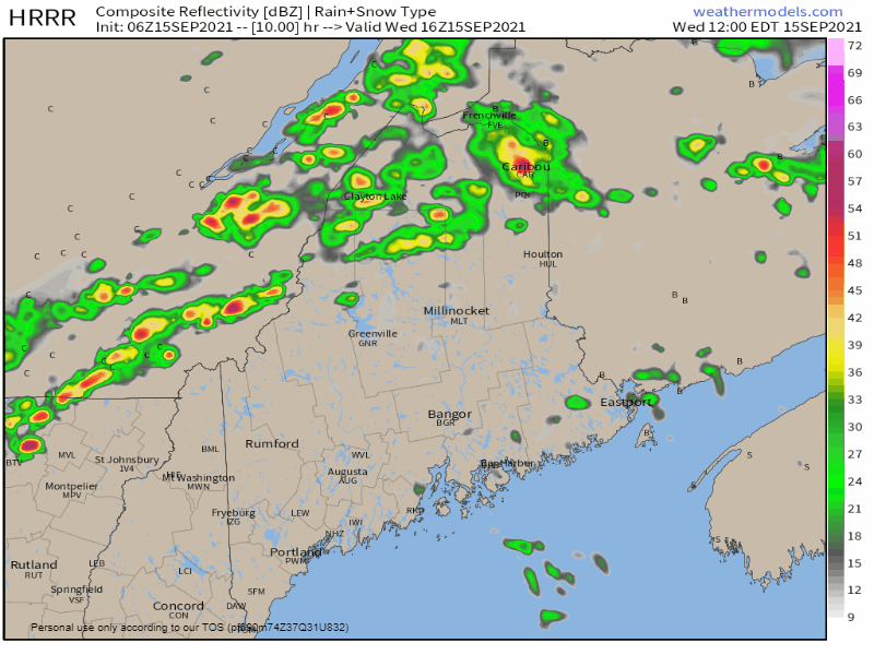 Noon - 6 PM: The height of heating of the day brings the optimal chance for severe storms. Please note the discrete (stand-alone) cells over southwestern areas. This is where the main threat for tornadic activity exists. 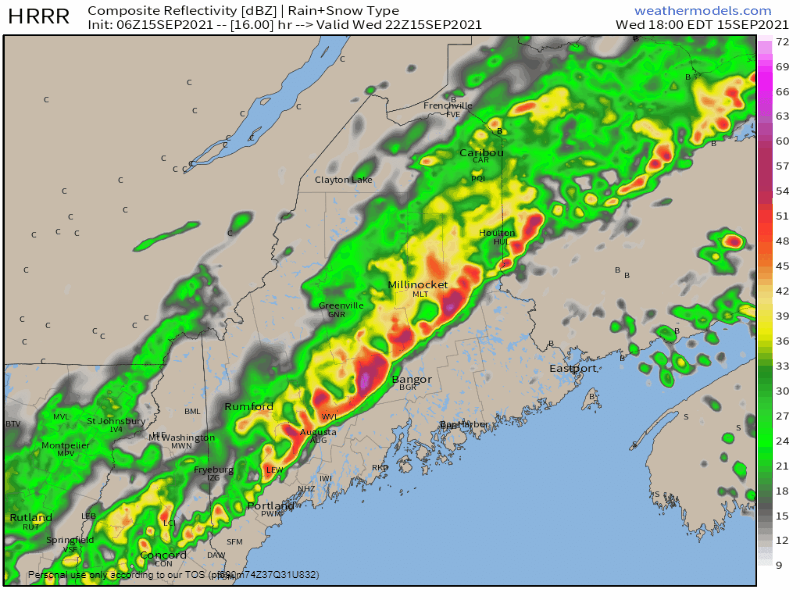 6 PM - Midnight Thursday: Storms keep their punch until mid-evening when the atmosphere stabilizes. Scattered light to moderate showers continue over the coastal plain. 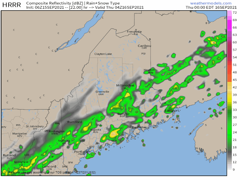 Thursday Midnight to 9 AM - The remaining shower activity continues to move east in the wee hours and exits Washington County by 8-9 AM.  My Twitter feed is where I will pass along observations and warnings through the day. You do not need an account to follow but will need one if you want to interact. Please report any damage or storm observations with photos if possible when you can do so safely. Severe Thunderstorm Watch vs. Warning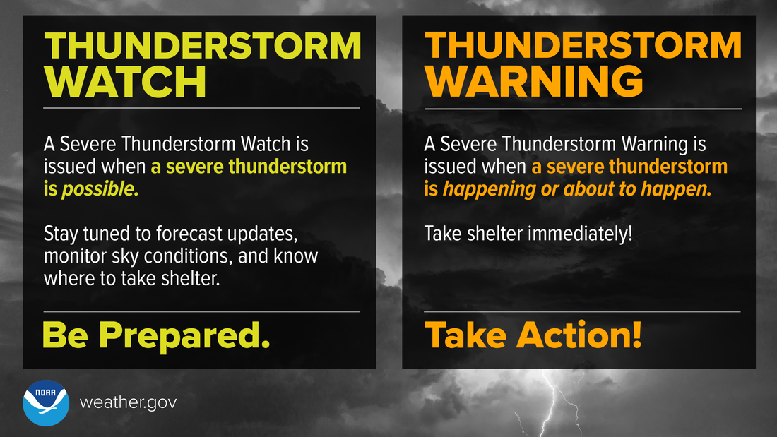 A Severe Thunderstorm WATCH means Be Prepared. Stay informed and be ready to act, because severe thunderstorms are possible. A Severe Thunderstorm WARNING means Take Action! Take shelter in a strong building, because severe weather is occurring or will occur shortly. weather.gov/safety/thunderstorm-ww Weekend update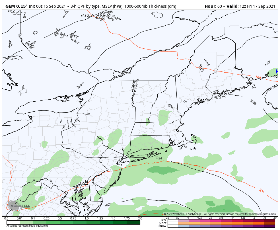 www.nhc.noaa.gov/After early morning showers clear out Thursday, the region dries out for the day. A tropical disturbance the National Hurricane Center is projecting to develop into a tropical storm (Odette or Peter) passes to the southeast, but outflow ahead of it may generate showers, drizzle, and fog for the coast on Friday. A cold front brings a round of showers and thunderstorms for Saturday. Sunday is the pick of the weekend at this point.   Be prepared to receive alerts and stay updated!
For more information in between posts, please follow Pine Tree Weather on Facebook and Twitter.
Thank you for supporting this community-based weather information source which operates by reader supported financial contributions. Stay updated, stay on alert, and stay safe! - Mike |

Mike Haggett
|