
A look from above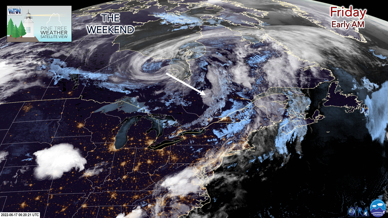 The forecast for Maine in a single image: the upper-low over northern Ontario heading to the southeast. This large atmospheric feature is likely to bring chilly temperatures, snowflakes to higher elevations (4,000 ft+) and intermittent showers through Sunday. For the folks that have the benefit of having Monday off for Juneteenth, which appears to be the pick of the weekend. First, strong to severe storms are possible for Friday. Heads on a swivel for Friday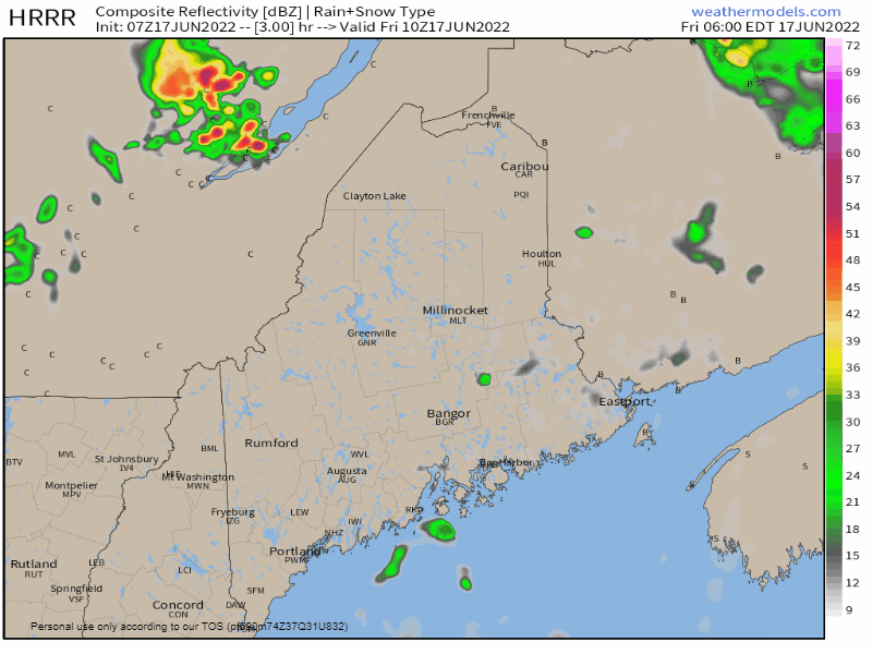 Friday 6 AM to 9 PM - The mountains and north could get in on the action mid to late morning, and the storms that do bubble up could mean business as they cross the state. Damaging wind, frequent lightning, hail and an isolated tornado are all possible. The good news is the threat ends with the passage of the cold front over much of the north, west and south by mid-afternoon, and by early evening over eastern areas. 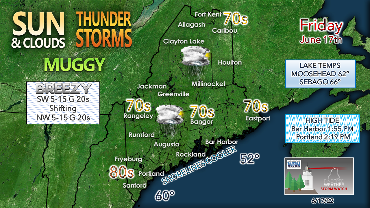 Dew points rise up ahead of the front and it could get rather sticky, but once the front passes through, a northwesterly breeze kicks up and dries the air out. It's definitely an eye-to-the-sky day. Please make sure you have multiple ways to receive alerts, and if a severe storm is called for your area, that you take the threat seriously and take shelter in safe structure as soon as possible. Unsettled pattern through the weekend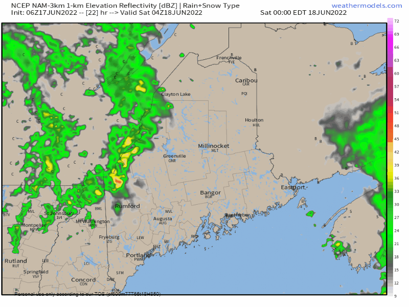 Saturday Midnight to Sunday 2 PM - The upper low parks itself over the region due to upstream blocking south of Greenland. As it spins around, it picks up moisture off the ocean and throws it back into the region. I get the idea a surface low may form over the Gulf of Maine and enhance rainfall chances through Sunday. As the strong ridge over the North Atlantic eases late Sunday, the upper low slowly moves to the northeast. Showers are possible for the north on Monday. Tuesday appears dry statewide. Wednesday may bring some scattered showers and Thursday may bring the next chance for a widespread rain event. 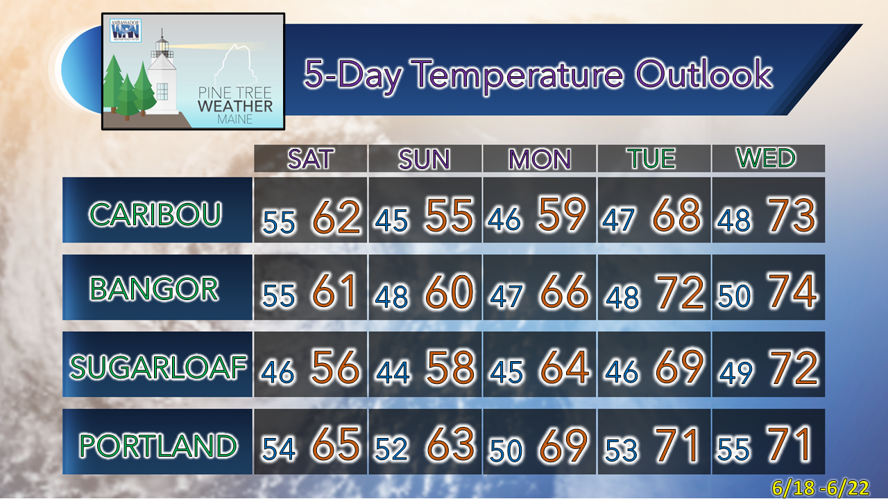 Thank you for supporting this community-based weather information source which operates by financial contributions from people like you. Stay updated, stay on alert, and stay safe! - Mike NOTE: The forecast information depicted on this platform is for general information purposes only for the public and is not designed or intended for commercial use. For those seeking pinpoint weather information for business operations, you should use a private sector source. For information about where to find commercial forecasters to assist your business, please message me and I will be happy to help you. |

Mike Haggett
|


