 We've dealt with far worse storms, but this appears to be a decent one for the coast. The further south, the more impacts. Southern New England is likely to get hammered with 4-6" of rain and wind gusts upwards of 70 mph, perhaps higher. This storm is likely to cause travel disruptions. If you are traveling via train or air out of Boston, it would be wise to check on the status of it. Storm track and intensity to dictate outcome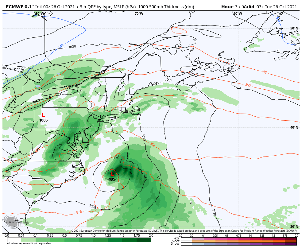 Tuesday 2 AM - Thursday 8 AM: While tracking this storm for a number of days, track and intensity have been the main questions. Given the dynamics of a rapidly developing storm enhanced by a negatively tilted cut-off upper-level low with blocking to the north, west, and east makes a forecast a challenge. It is the timing of the upper-low capturing the surface low that will cause it to retrograde and add to intensification. Overnight guidance has come into a better agreement on track and intensification, but there continues to be wiggle room, and the concern that comes with that, is wind. 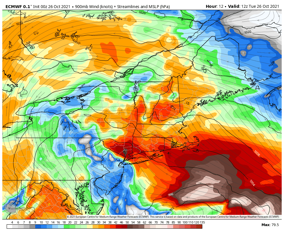 Tuesday 8 AM - Thursday 8 AM: This is a model idea of the low-level jet stream at roughly 3200 feet above sea level. With the rapid intensification of the storm, wind speeds could range 70-90 knots Tuesday evening into early Wednesday morning. While wind speeds at the surface are not expected to reach that high due to low-level inversions that act as a cap. In areas of heavy rain, strong wind could mix down and create downdrafts. If the storm behaves itself in track, the stronger gusts would stay to the south. If the storm tracks a bit further to the north, that would bring a greater wind threat. 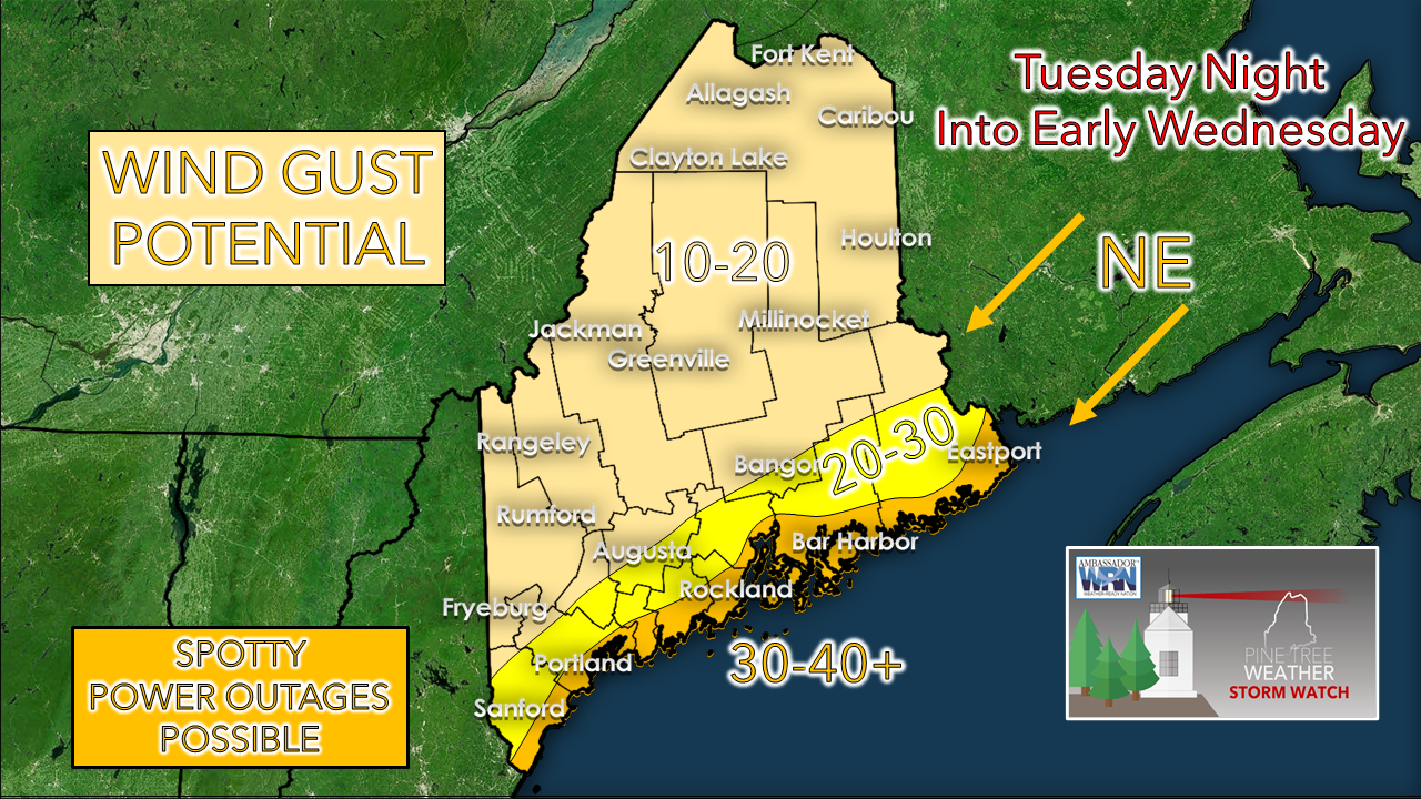 The National Weather Service Gray office has issued a wind advisory for the coast from Penobscot Bay west into York County from 6 PM Tuesday to Noon Wednesday. At the time of this post Tuesday morning, the National Weather Service Caribou office is contemplating the same for the DownEast shorelines but will wait and see how the storm track and intensity forms. Expect difficulty with travel on the speedier roadways and potential for flying leaves and debris. 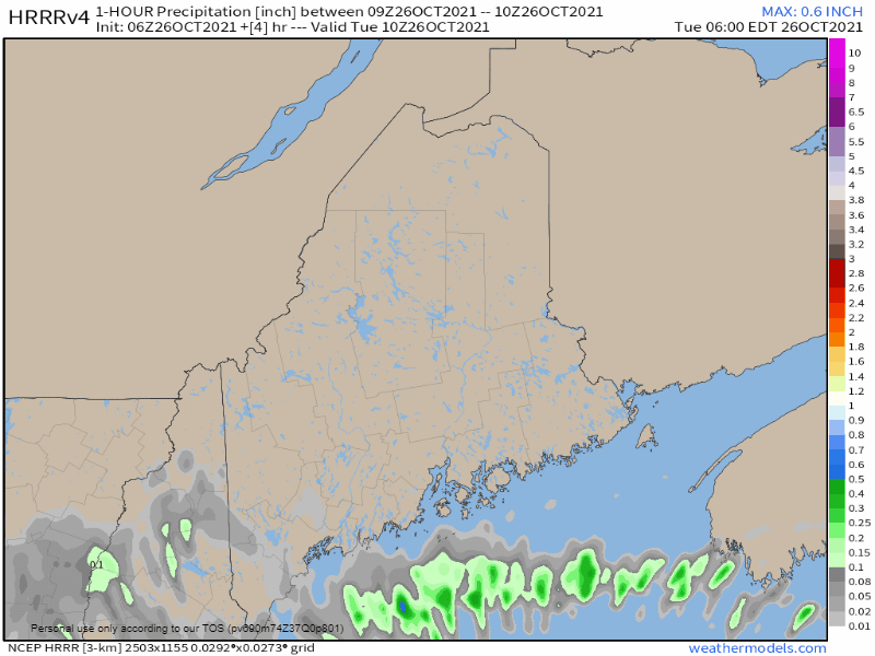 Tuesday 6 AM - 6 PM: A look at one hour forecast rain accumulations from the 2 AM HRRR model run shows the outer bands of the storm working in off the ocean during the day. Showers could be moderate to briefly heavy in spots at times through midday. High pressure blocking does its job and seals off the forward progress of rain to the north. 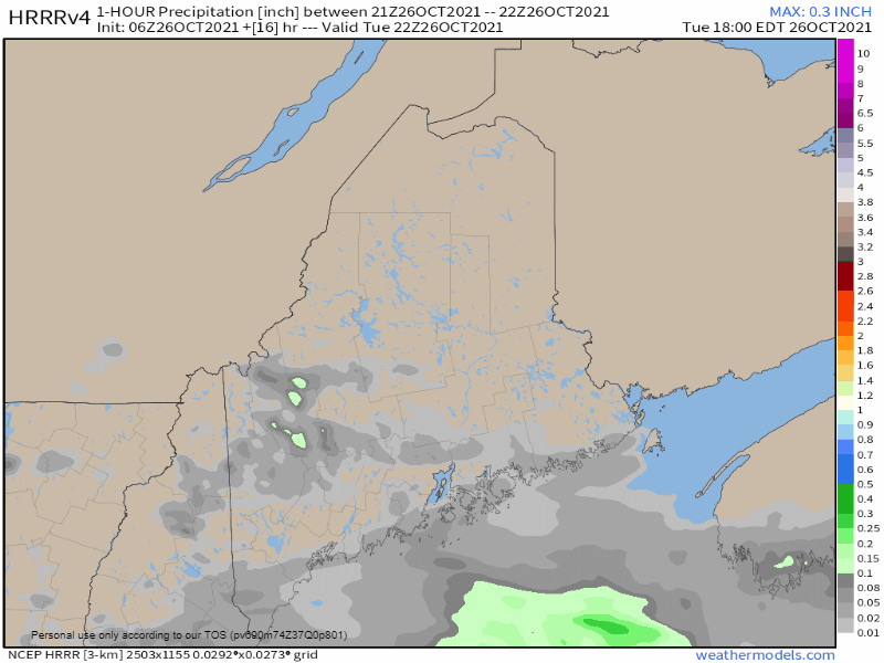 Tuesday 6 PM - Wednesday 6 AM: As the storm moves north and intensifies Tuesday night, more rain bands move in. This period is the greatest concern for strong wind gusts which could make it to the surface in the areas of heavy rain. Rain is expected to continue during the day on Wednesday, tapering off by late Wednesday afternoon. 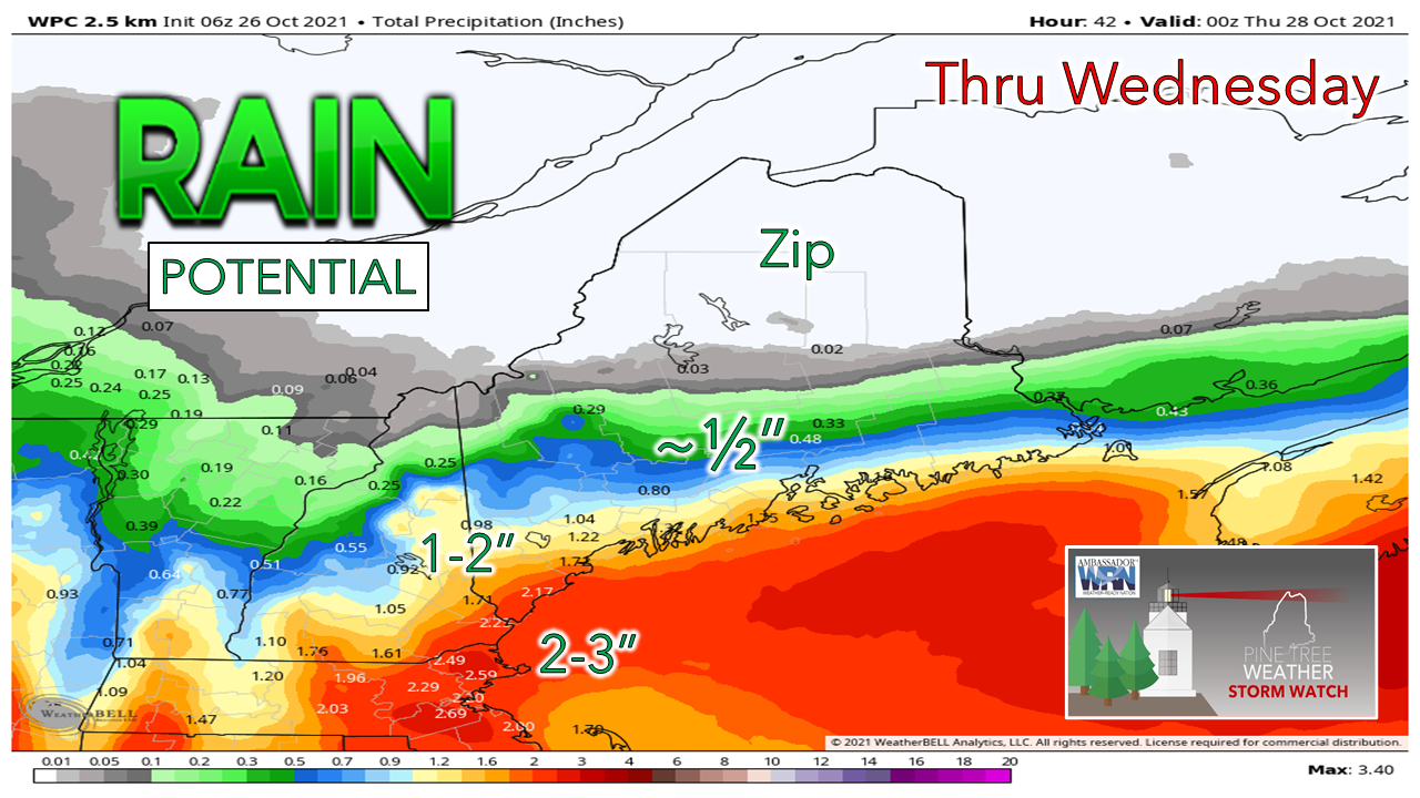 Forecast for rain amounts continues to stay consistent. A solid soaker for southwestern areas. Northern areas sit this one out. Expect areas of urban street flooding from clogged storm drains and potential for slick spots from wet leaves on the roadways.  Power Outages Powerful storms can pack a windy punch. Don’t wait until you’re in the dark! Check your emergency kit now to ensure you have plenty of batteries and other essential supplies on hand. ready.gov/kit Weekend a 50/50 split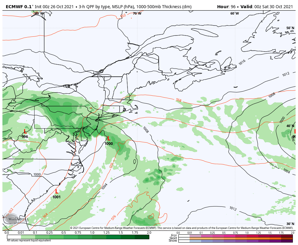  Be prepared to receive alerts and stay updated!
 For more information in between posts, please follow Pine Tree Weather on Facebook and Twitter.
Thank you for supporting this community-based weather information source which operates by reader supported financial contributions. Stay updated, stay on alert, and stay safe! - Mike |

Mike Haggett
|