
Worst of the wind to remain offshore of Maine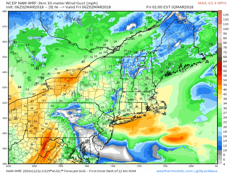 With the forecast trend of the storm more to the south, the higher gusts from the storm appear to stay just offshore of the Gulf of Maine. It appears to be stiff enough (40-60 mph) along the shorelines that it could cause power outages. My main area of concern is for the islands of Penobscot Bay southward along the coast which will see the highest gusts during the day on Friday. As the storm gradually slides southeast, it takes the harshest of the wind along with it. Given the slow nature of departure, the north / northeast breeze appears in the forecast through Monday, with speeds ever so slowly diminishing. Morning high tide to run at moderate flood level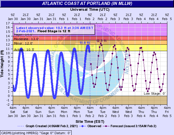 The good news as far as the high tide goes Friday morning is concerned is the big wind does not appear to reach the area until the afternoon. The tide will be high enough where moderate flood levels could be achieved in the morning cycle however. Coastal flood warning is in place for the shorelines of Cumberland and York Counties from 9 AM to 2 PM. Two more tide cycles will be a concern for Friday night and again Saturday during midday for minor flooding before the effect of the astronomical phase tails off. Given the timing of the storm, impacts and track, the potential for major problems for the shorelines in Maine appear avoided. That won't be the case for areas in Massachusetts and Cape Cod. What is predicted to happen there could be historic, eclipsing the Blizzard of '78 and the Perfect Storm of '91. Snow impacts confined to the north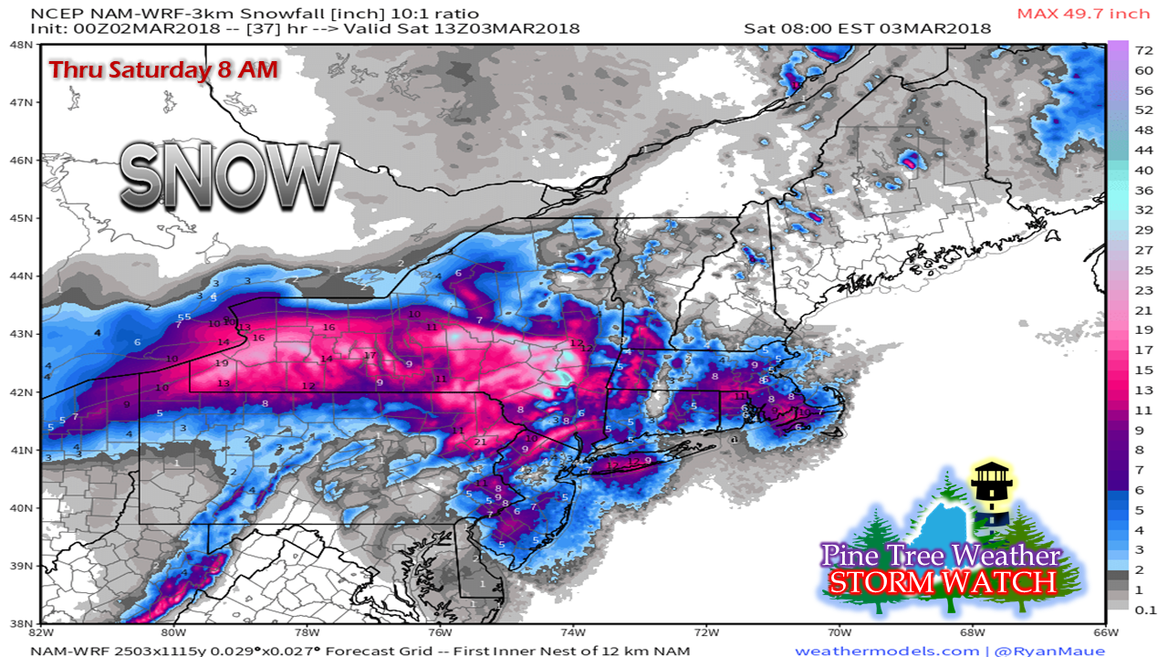 Given the unique dynamics of the storm, snow appears to be an afterthought for Maine. This is on track to be a higher elevation event, which will help the ski hills recover from some of the recent losses of the mild temperatures. My idea of 2-6" for the higher peaks remains consistent, with lesser amounts in the valleys. The main core of precipitation from the storm is tracking to the south and west. Personal UpdateI broke the news on my Twitter feed yesterday that my home in Poland is now under contract to a potential buyer. The next ten days of the negotiation and inspection process will dictate what happens from there. The move is to Kennebunk is tentatively set for third week in April, pending on how the next ten days play out.
Twitter is where you can keep track of me for statewide information and other items of interest, along with some foolishness. You don't need an account to read my timeline, but will need one if you have any questions. I will update here when I can as time permits. As always, keep in touch with the fine folks at NWS Gray and NWS Caribou for the latest bulletins and forecast updates. - Mike |

Mike Haggett
|


