Warm and muggy conditions return for our Friday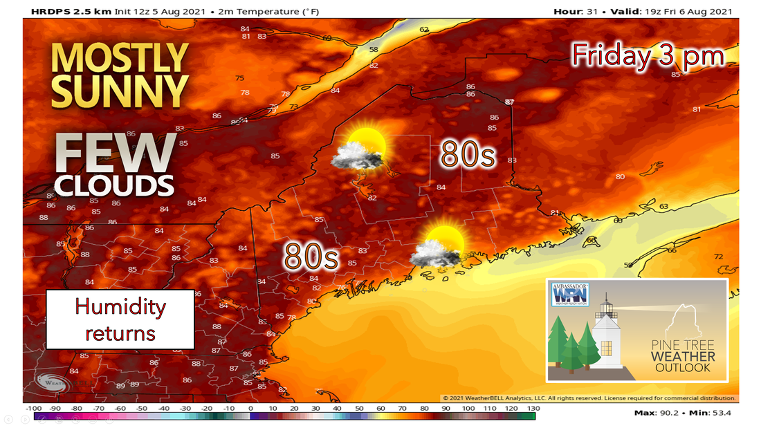 As the rain begins to taper off and move to the northeast into Nova Scotia by midnight, mostly cloudy skies will remain in place with low temperatures dipping into the upper 50s to lower 60s statewide. Some areas of fog are possible overnight tonight as well. Dry and warmer weather is expected for the day on Friday. High pressure settling to our south and an upper-level high-pressure building over the area will bring mostly sunny skies and warmer temperatures. Highs will generally be in the 80s across the interior of the state as a southwesterly flow establishes itself and in the 70s for the coastal locations and the higher terrain across western Maine. This will be followed by a mostly clear and warm night as we remain in southwest flow north of the high pressure off the Mid-Atlantic coast. Lows for Friday night will only drop into the 60s for most areas. Humidity returns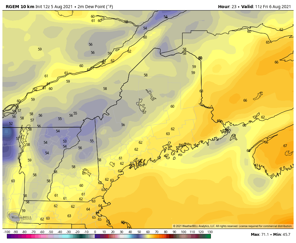 On Friday, most people will notice the change in air mass as we head into the weekend. Southwesterly winds will bring more humid air to our region and will remain in place for a couple of days. Friday afternoon dew points will be in the lower to mid-60s, which is starting to creep into the uncomfortable territory. For the weekend, dew points will continue to increase steadily making it feel sticky outside. By Saturday southern and central parts of the state will likely see dew points in the mid and upper 60s. Sunday will be the muggiest of the two weekend days with dew points climbing into the upper 60s for most. We will remain in a strong upper ridge and very warm and humid weather will persist over the area into the middle of next week. Showers are expected Saturday evening into Sunday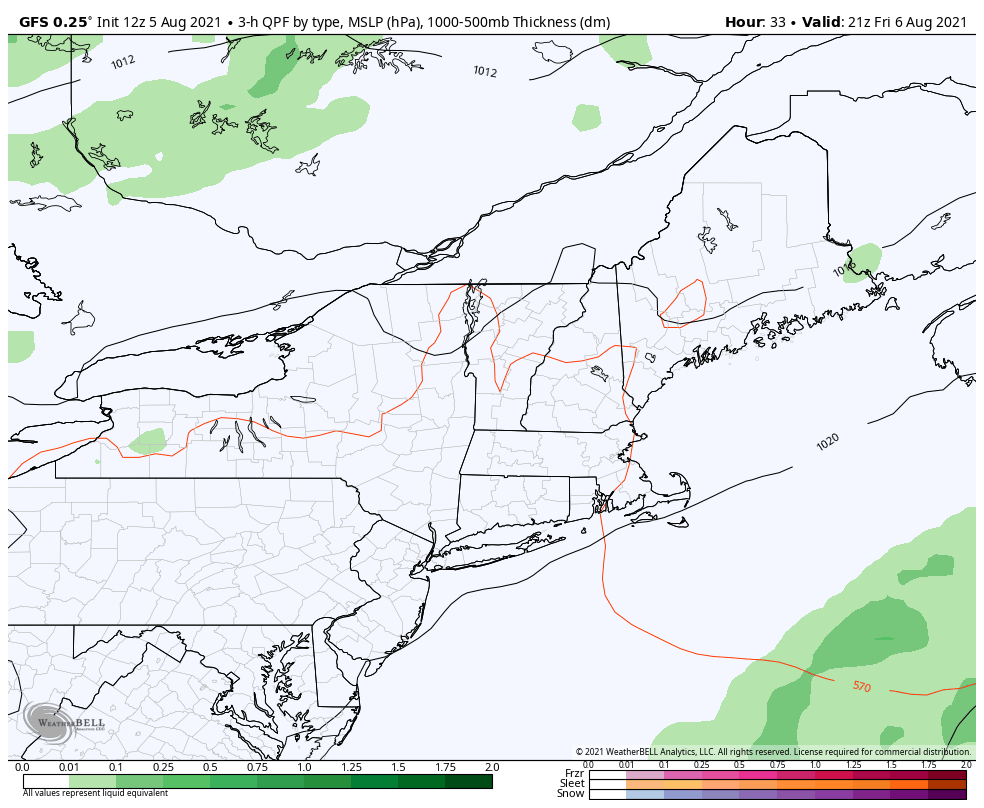 A weak area of high pressure will cross New England on Saturday, but a cold front will be moving southward across Quebec during this time. Expect a few scattered showers and storms, mainly across the higher terrain ahead of the front, Saturday afternoon and evening. The front will then continue to push through the area on Sunday, bringing scattered showers and thunderstorms to many inland locations during the afternoon hours. Some models are indicating the front stalling out along the coastline on Sunday with lower instability due to onshore flow. Otherwise, Saturday will begin mostly sunny with clouds increasing ahead of the front. Expect highs in the upper 70s to mid-80s. For Sunday, showers and thunderstorms will diminish and weaken during the morning as high pressure moves back in. Sunday will turn out partly to mostly cloudy with some showers, mostly in central and southern areas, as the front stalls near the coast. High temperatures will remain right around the 80°F mark. Beginning of the next workweek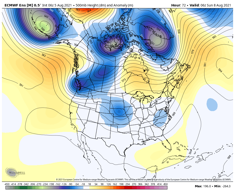 There is good agreement that large-scale ridging will build across the Northeast from this weekend through next week. Small frontal boundaries will also ride along the southerly flow bringing increased chances for showers and thunderstorms in the evening every few days. An overall moderating trend in temperatures appears likely as the ridge builds. This upper-level ridge will likely help to keep temperatures on the warmer side, indicating a return to the summer heat and humidity. Drought Monitor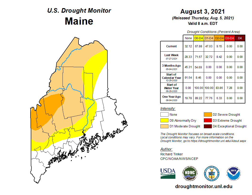 The latest U.S. Drought Monitor update displays varying levels of drought throughout the state of Maine. Many coastal regions are still no longer experiencing dry conditions due to the wet ending to July and the start of August. Many western areas are still experiencing dry conditions. This is noticeable in portions of Oxford, Franklin, and Somerset counties which are under Severe Drought conditions, indicated by the darker orange color. The lighter orange color extending outwards from this area indicates Moderate Drought, this area was extended farther north into Aroostook County. Locations shaded yellow are not yet experiencing drought but are at level D0 - Abnormally Dry. 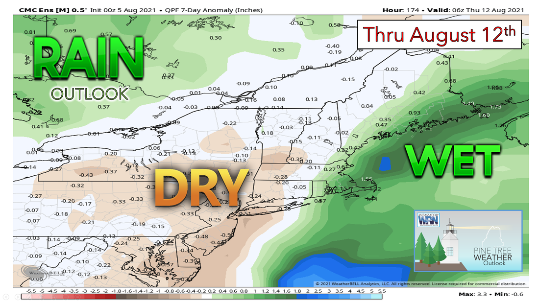 Looking forward to next week, models are trending average to slightly above-average in terms of rainfall for most of the state. With rain showers expected over the weekend and small disturbances through next week, there will be a few chances to help limit drought conditions in the short term. Precipitation is always welcomed but it looks like the coastal areas will see the most while the interior continues to lag behind in rainfall deficits. Be sure to check back next Thursday for a new updated drought monitor and outlook! Flash Flooding Flooding is a major threat coast to coast every year. Flash Flooding, River Flooding, Storm Surge and Coastal Inundation from Tropical and Non-Tropical Systems, Burn Scars/Debris Flows, Ice/Debris Jam, Snowmelt, Dry Wash, and Dam Breaks/Levee Failure are all important information many people face during flooding events. Make sure to enable Wireless Emergency Alerts on your phone. If flooding occurs while you’re outdoors, immediately get to higher ground. weather.gov/safety/flood Temperature outlook through mid-AugustThe plots below show the trend of the high and low temperatures for Carrabassett, Bangor, Caribou, and Portland over the next week and a half. Temperatures will likely increase slowly going into next week. Above-average temperatures and humidity will return bringing summer weather back to Maine. 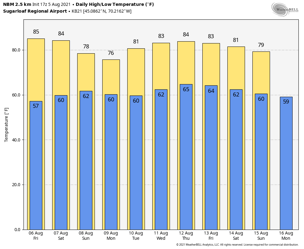 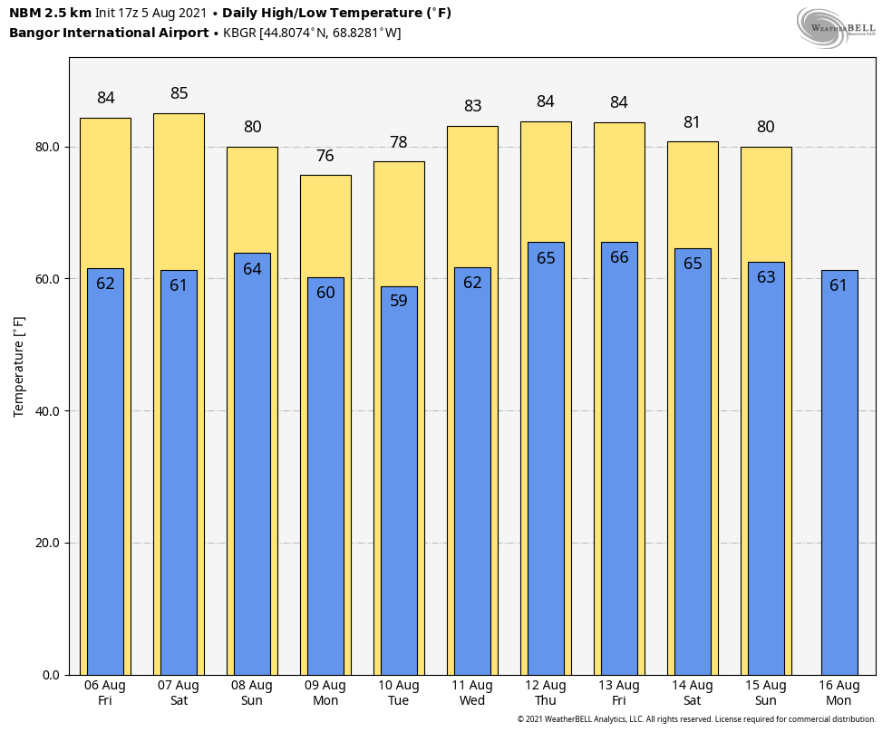 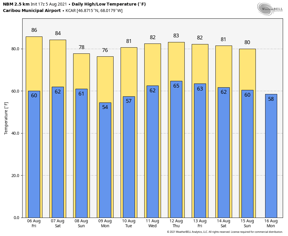 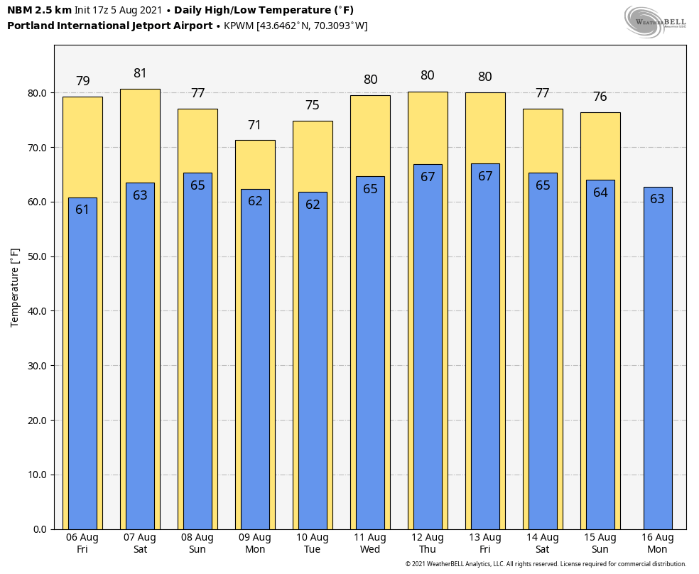 Be prepared to receive alerts and stay updated!
For more information in between posts, please follow Pine Tree Weather on Facebook and Twitter.
Thank you for supporting this community-based weather information source which operates by reader supported financial contributions. Stay updated, stay on alert, and stay safe! |

Mike Haggett
|