Snow day on the way for interior areas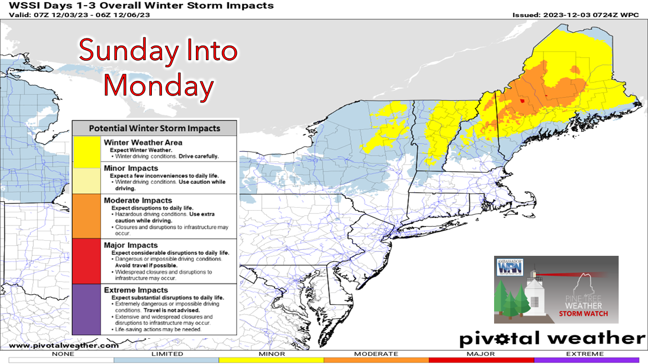 Most areas of the region are under either a Winter Storm Warning or Winter Weather Advisory with the storm on the way starting Sunday afternoon. While snow is expected to end from west to east Monday morning, I do expect many schools, daycares, and municipal offices will either have delays or close for the day. It would be wise to gas up your vehicle, check your windshield washer fluid, and clean or replace your windshield wipers for those that must travel on Monday morning. While the forecast over the interior is rather straightforward, the closer to the coast, the more complicated it gets. The timing of heavier snowfall is not ideal, either. What to be aware ofThe challenge with forecasting this event is the charge of cold air that comes rushing in overnight as the ocean low begins to siphon off energy from the surface low to the northwest. The position of those two along with high pressure to the north will be critical to determine snowfall amounts south of the western foothills on up into the interior coastline of eastern areas. 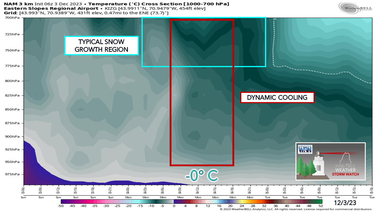 There are some discrepancies in guidance regarding how impactful that could be. The main concern is dynamic cooling. This rush of cold air comes with precipitation at its peak. This allows the snow to stay intact as gravity gets ahold of it and brings it to the surface. The graphic of low-level temperatures from the short term NAM3km model looking specifically at Fryeburg shows this potential. This is also a key factor in what happens along the southwest coast. As I mentioned in Saturday's update, the idea of a 35° surface temperature and snow falling is real, and this is why. While I am still in the camp that it may not stick on road surfaces, some grassy areas could see some accumulation. Anytime there are two systems going through a phase, there is always the potential for a bit of dry slotting to occur. In this case with the ocean low tracking east of the benchmark 40° N / 70° W point south of Cape Cod and the surface low located in Quebec, that is a fairly large gap. Timing and position on that point will be critical as well. 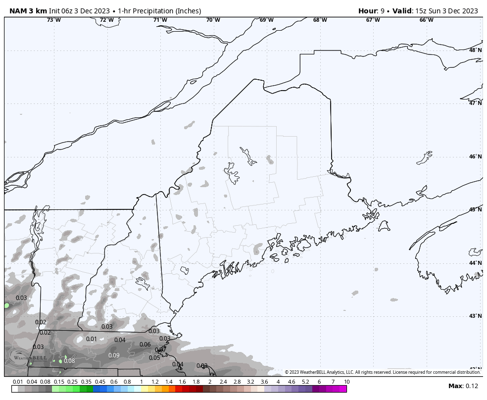 Sunday 10 AM to Monday 7 PM - Precipitation starts off light to moderate and stays that way through Sunday afternoon into the evening. As the ocean low taps into the surface low and draws energy off of that, this is where dynamic cooling comes in and heavier precipitation comes in the wee hours of Monday morning. This creates the "thump" that could increase snowfall rates upward to 1"+ an hour, as a parting gift. Precipitation ends over southern areas by the time of the morning commute, central areas by mid-morning, and northern areas by early afternoon. The western mountains get snow showers on the backside that continue into Monday night. 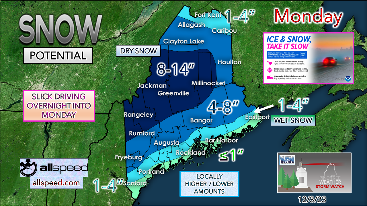 A bit of a tweak in the snowfall map from Saturday's update with slightly lower amounts in the north and other minor adjustments. This is another potential sharp gradient set up for the coastal plain, where the north end of Sebago Lake could see 6" and Windham 2" or less. Upwards of 1" of liquid equivalent precipitation is expected out of this for southern and western areas, with lesser amounts to the north and east.  Outlook through the weekA few weak disturbances pass through the region Tuesday into Wednesday that may bring snow showers or flurries in spots. A strong ridge works next weekend, and there could be some light precipitation that comes in with it. The next potential storm is roughly one week out as cold air works back into the region early next week. 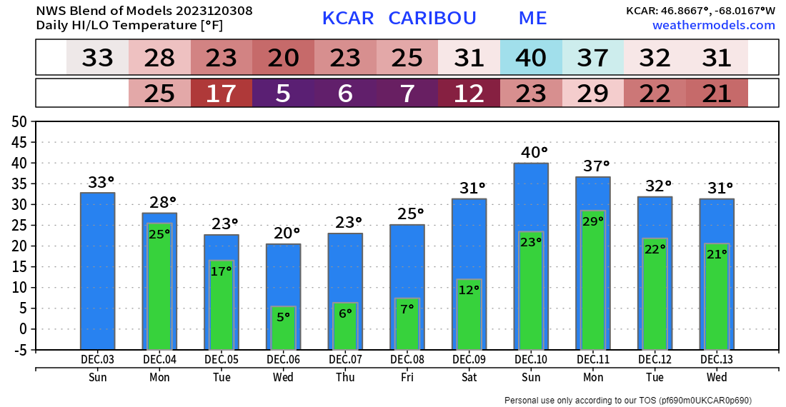 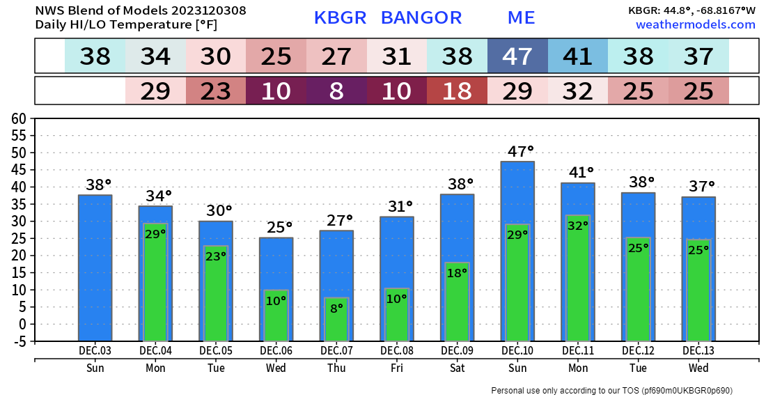 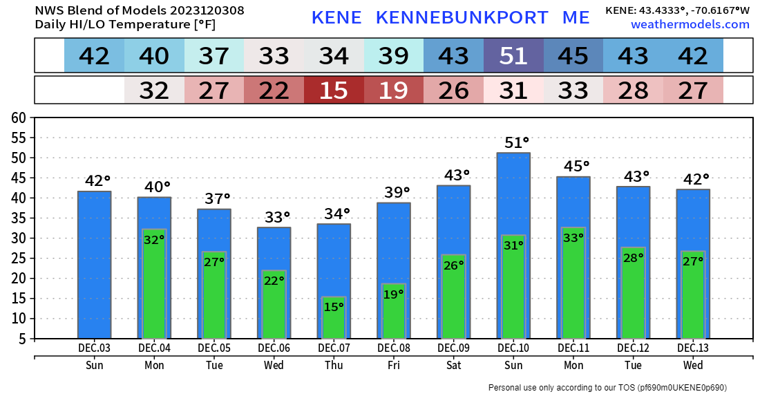 Please make my 2 AM wake up calls worth it |

Mike Haggett
|