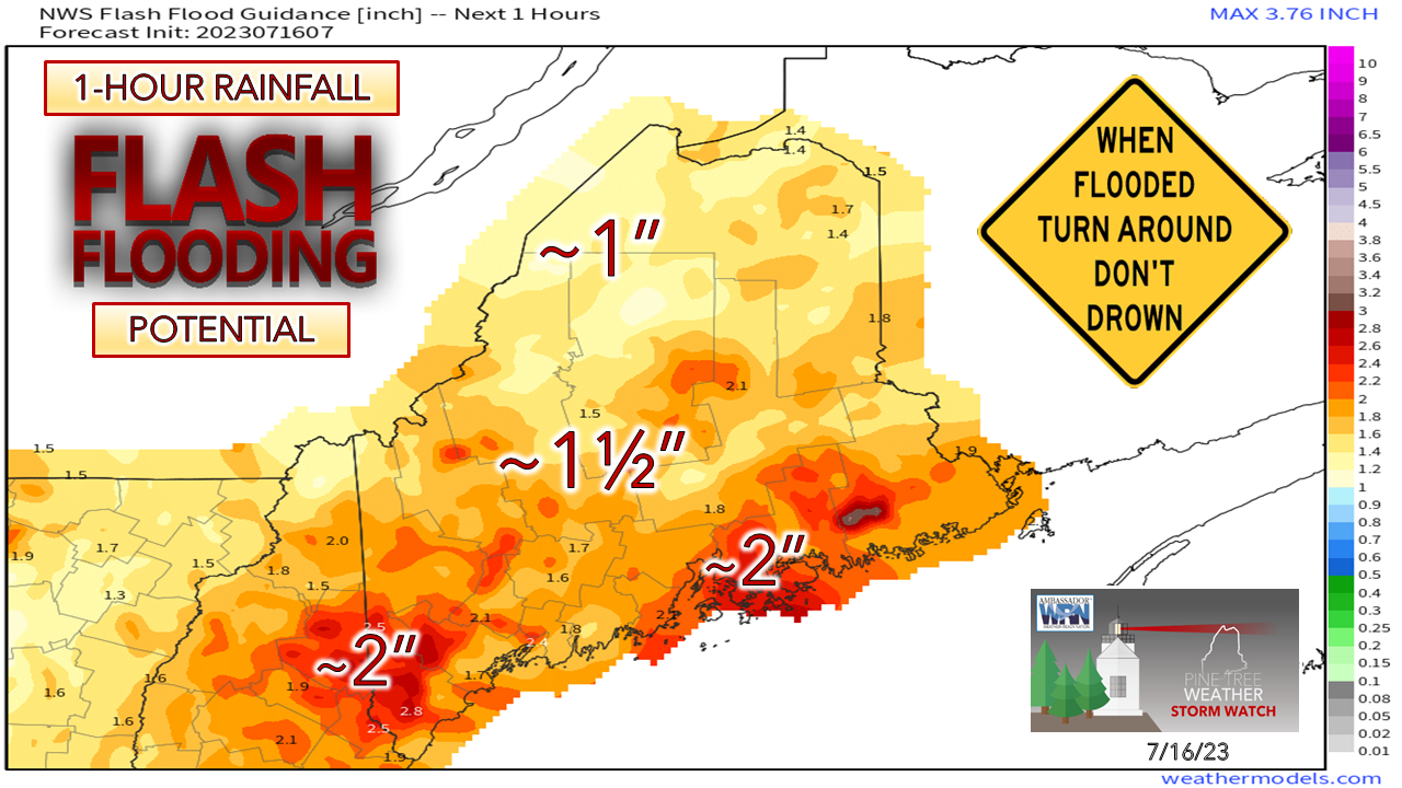
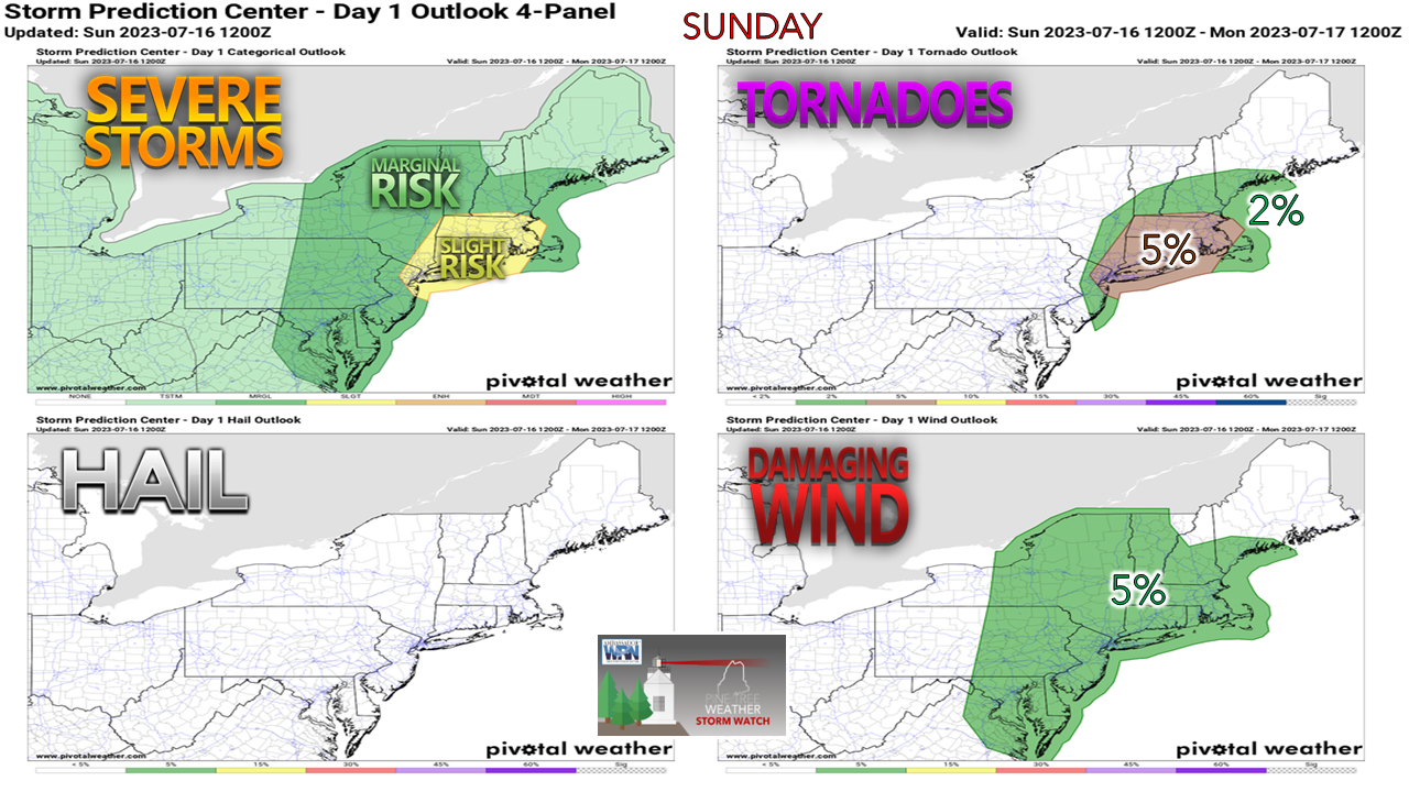
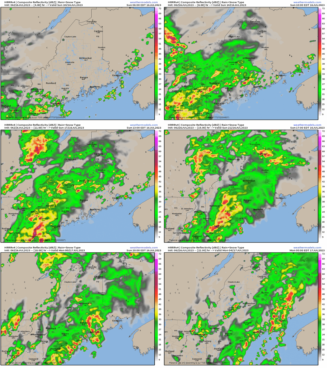
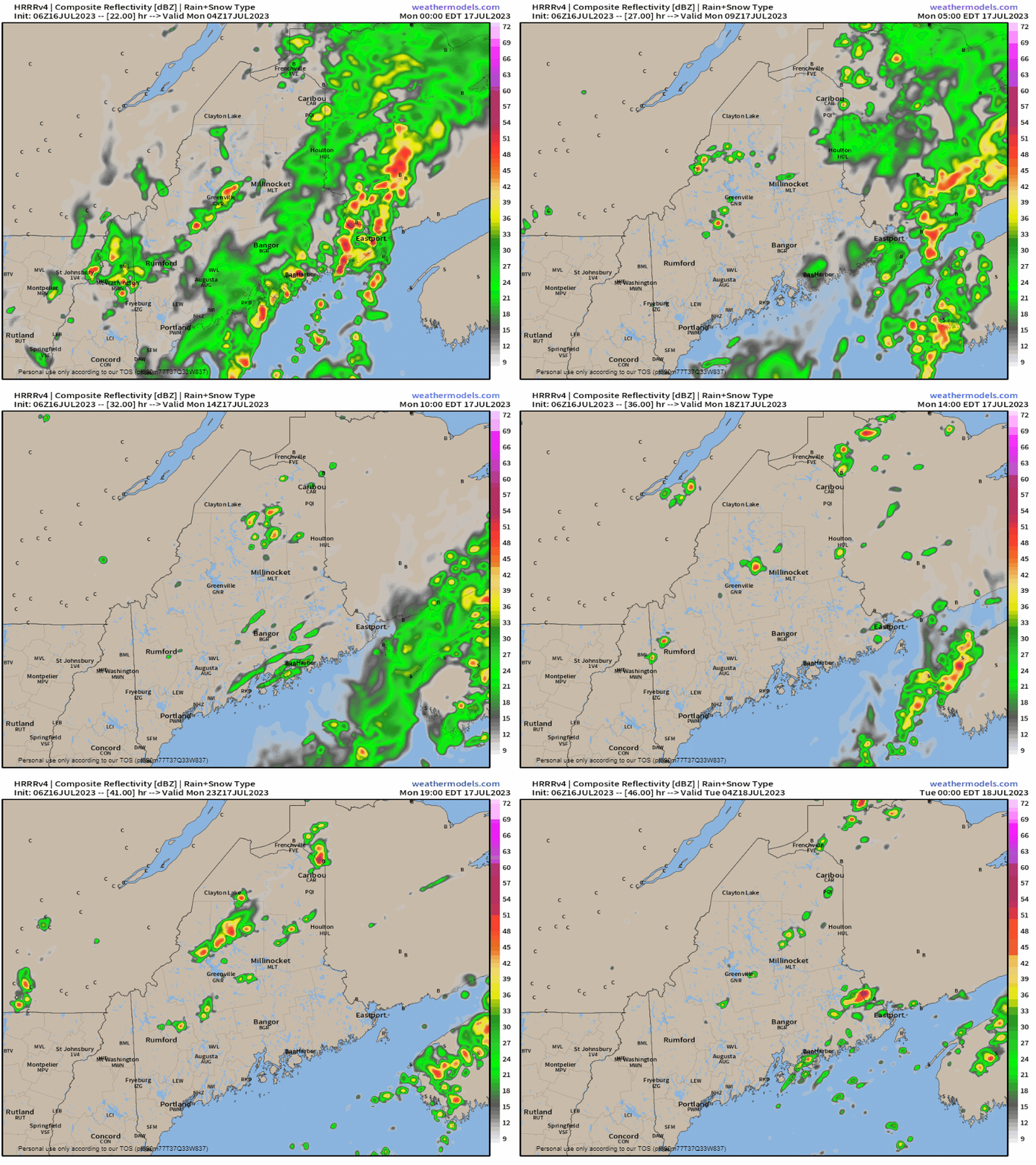
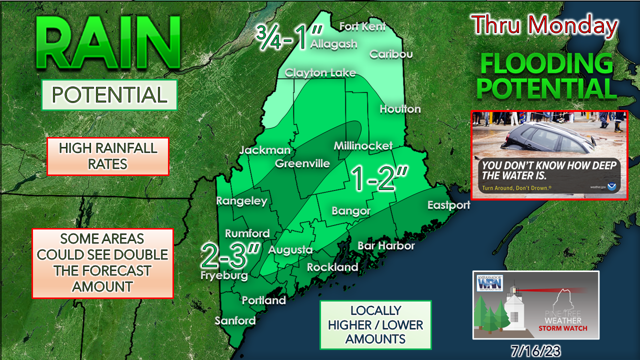
Most of New England under flood watchOutside of the South Shore / Cape Cod and far northeast of the Kingdom of Vermont, the six-state region is under a flood watch. Rivers are high, the ground is saturated, and with one of the richest air masses recorded in the area per National Weather Service data for precipitable water values, the atmosphere is expected to be juicier than a watermelon. I've used this graphic several times this week to continue to make the point that the ground cannot handle torrential rainfall. Given the fact the pattern has been on repeat since early June, washout potential of roads and driveways, potential for rock and mudslides in the mountains, urban streets turning into rivers, and brooks and streams tipping their banks in little to no time is where the region is at right now. Conditional severe storm threat for southern areasI mentioned this chance in Saturday's post and now Storm Prediction Center has come into agreement on the conditional potential. While the standard "sun's out, thunder guns come out" rule applies, in this case it could occur without sun. Convective available potential energy caught in a warm tropical airmass rising above the surface along with a potent low-level jet could spin up a tornado or two, or at the very least cause damaging downdraft wind. While this isn't a tropical storm, the characteristics are incredibly similar. Another rule of practice is that experienced forecasters know that you can never trust a warm front, and the potential for surprise is always there, no matter what time of the year. Warm front on Sunday, cold front on MondaySunday 7 AM to Monday 8 PM - The forecast for precipitable water values to show the oversaturated atmosphere. Classify it as "gross", "disgusting", "oppressive", "weather-you-can-wear" or whatever you so choose to call it. This is all of that. Dew points starting on Sunday in the upper 60s to low 70s will rise into the 70s for most if not all of the state given the nature of this beast. Sunday 6 AM to Monday Midnight - DownEast areas luck out and salvage a good portion of the day on the dry side while the rest of the state deals with showers, areas of torrential downpours and storm potential. With the warm front will come some gusty wind to add some insult to an already bad weather day, as gusts could reach 20-30 mph, higher with storms. Monday Midnight to Tuesday Midnight - As the cold front passes through overnight, it kicks the heavy rains and aggressive humidity to the east. The air behind the front may feel somewhat refreshing, but dew points appear to remain in the 60s. There is a chance for a scattered shower and/or thunderstorm through the day and into the evening. The general idea for forecast rainfall amounts has altered slightly to include the coastal plain on the higher end. The jackpot area continues to focus on the higher terrain of the mountains thanks to orographic lift. Forecast ideas are generating localized rainfall potential for 5-7". I will repeat again... never trust a warm front. Expect surprises. Stay on alert. Make sure you have multiple ways to receive alerts. If a tornado or severe thunderstorm is called, seek shelter in the lowest area of your home in a basement or crawl space. If that is not available, grab a mattress and head for the bathtub and cover up, and wait for notification that the threat for the storm has expired. Wireless Emergency Alerts (WEA)WEA are emergency messages sent by authorized government alerting authorities through your mobile carrier. America’s wireless industry is helping to build a Weather-Ready Nation through this nationwide text emergency alert system. weather.gov/wrn/wea Pine Tree Weather is funded from followers like you. I would appreciate your financial support. Click here for how you can contribute. You may not like the weather, but I hope you like what I do, and support my efforts. Thank you! Stay updated, stay on alert, and stay safe! - Mike NOTE: The forecast information depicted on this platform is for general information purposes only for the public and is not designed or intended for commercial use. For those seeking pinpoint weather information for business operations, you should use a private sector source. For information about where to find commercial forecasters to assist your business, please message me and I will be happy to help you. |
Mike Haggett
|


