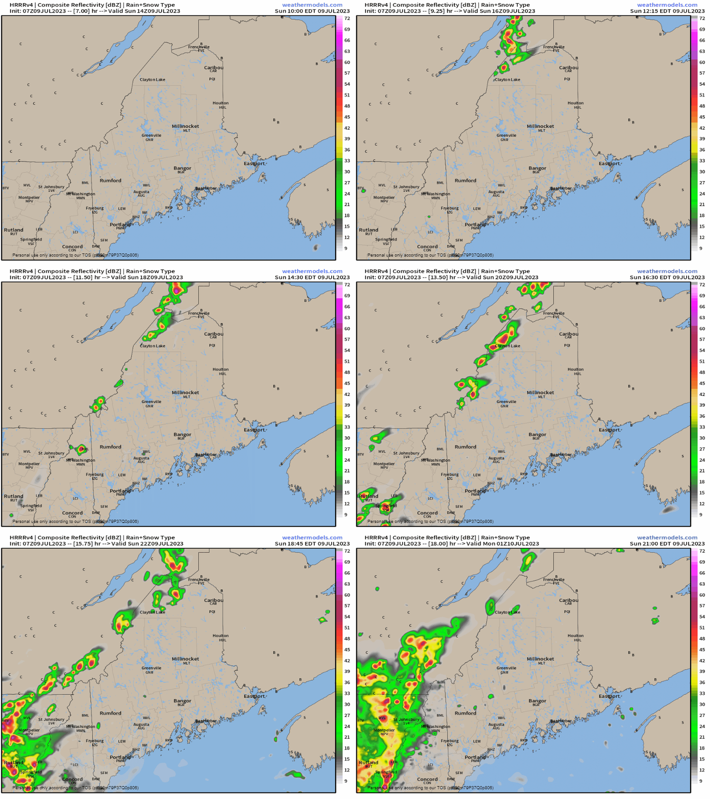
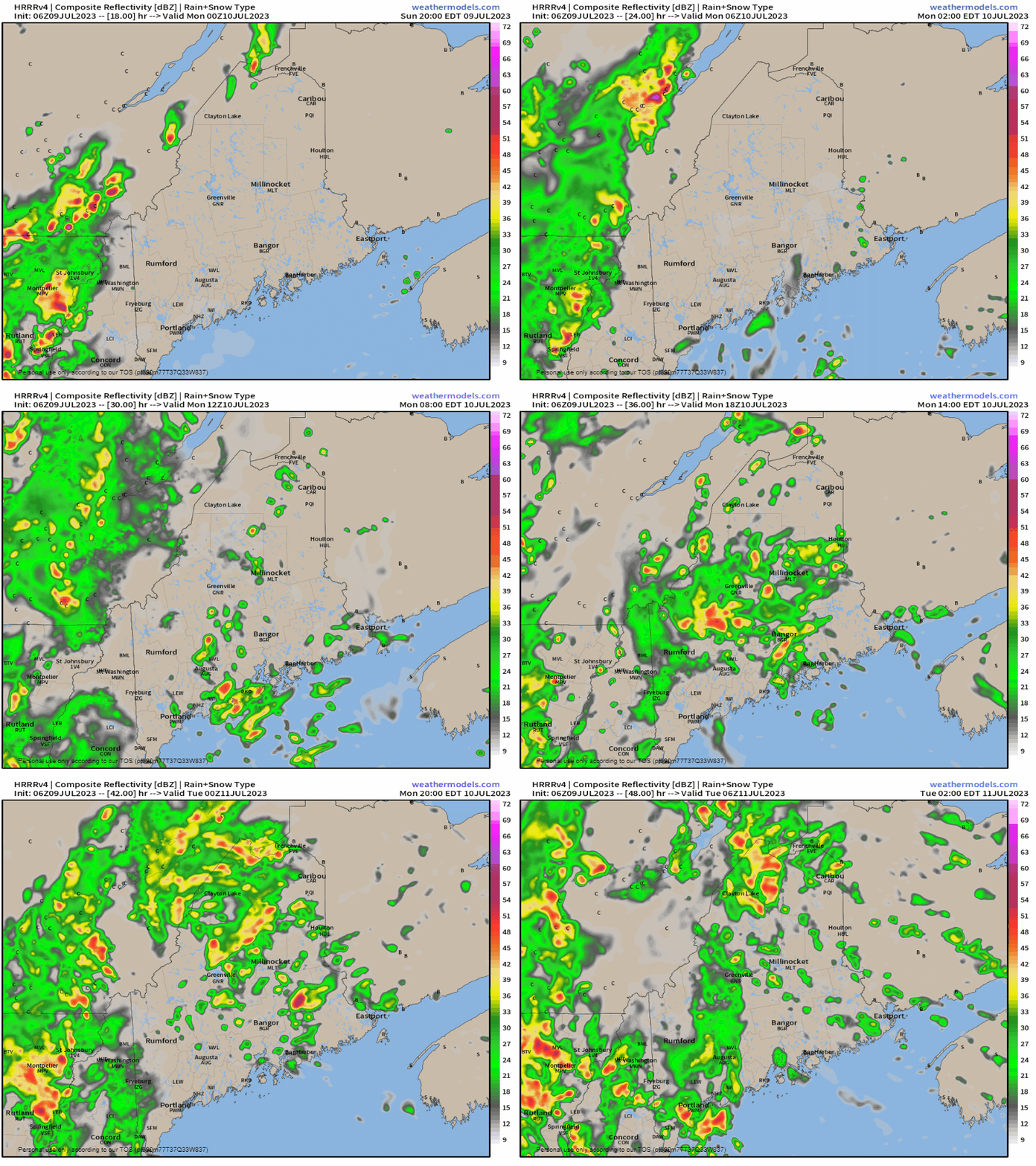
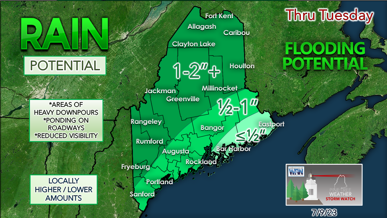
Steering level becoming more definedThe upper low over north central Canada is showing the ridge to the southwest that it means business in its decent toward Hudson Bay. The ridge is telling the upper low to "bring it on" and it will last over the next few days. The pipeline of severe weather is going to continue for the next several days until the upper low gets shoved northeast later in the week. The moisture hose from the Gulf of Mexico continues to pump rich air into the northeast and will continue to through Monday. Let's talk TROWALI don't like to get too technical about what is going on with the atmosphere, but in this case, it is warranted as a bit of an education lesson. The scenario here is the parent upper low over north central Canada will create offspring in the form of another upper low along the slow-moving frontal boundary that will track through the region through Tuesday. Given the tropical moisture around and the development of that new upper low, it will create what is meteorologically known as a TROWAL. The term TROWAL is an acronym for TRough Of Warm air ALoft. This is a phenomenon that happens when mature cyclones with tropical characteristics which, in a nutshell, will produce a prolonged period of heavy rainfall. For those curious about the complete definition of a TROWAL, you can click here for it through the NOAA / NWS glossary. Showers and storms along the Quebec border for SundaySunday 10 AM to 9 PM - The areas that got hammered with flooding rains Saturday are on track to get hit again for Sunday. Fog areas of fog and drizzle, along with a spot shower is possible west of the Penobscot and along the coast. Temperatures where the sun gets out climb into the 80s, with 70s elsewhere. Wind will be more noticeable over the Quebec border areas during the day and pick up over southern areas later in the afternoon into the evening as the front approaches. Most of the heavy rain stays to the west of the stateSeeing the train that is coming is a cause of great concern for New Hampshire and Vermont. With all the recent rain and seeing where the TROWAL is setting up along the axis of the front means areas of double-digit rainfall totals in areas that could potentially wash out roads and cause mud and rockslides in the mountains. For Maine, there may be some of that, but not as widespread as what is set up to happen to the west. Where the TROWAL spins up training and backfilling convective showers and storms is the concern. The risk of the creation of elevated thunderstorms synonymous with tropical storms is certainly there, but it's an isolated situation as I don't expect any major concern there. Sunday 9 PM to Tuesday 2 AM - Showers and potential thunder become more widespread over the state heading into Monday and continuing through the day and into early Tuesday. The threat for localized flash flooding increases through the day and into Monday night. Areas of fog are likely, along with torrential rainfall. A general idea on rain totalsInterior areas and the higher elevations are likely to get the most rain out of this. Where there is training and backfilling, these numbers may double or triple. Some areas may only get a ½" while 5 miles across town, that area may get 2" or more. There is no question the atmospheric dynamics will be ripe for torrential rainfall. Please use caution as you travel as rain could fall in sheets and could happen rapidly. Click here for the old school Weather Channel Local ForecastScroll to the bottom and click on Hazardous Weather, scroll back up, enter your town, then click go! Pine Tree Weather is funded from followers like you. I would appreciate your financial support. Click here for how you can contribute. You may not like the weather, but I hope you like what I do, and support my efforts. Thank you! Stay updated, stay on alert, and stay safe! - Mike NOTE: The forecast information depicted on this platform is for general information purposes only for the public and is not designed or intended for commercial use. For those seeking pinpoint weather information for business operations, you should use a private sector source. For information about where to find commercial forecasters to assist your business, please message me and I will be happy to help you. |
Mike Haggett
|


