
|
The good news is we'll be precipitation free over the weekend to have the chance to rest and reload. We'll have this storm to contend with for the first of the week, then another Thursday, and then maybe next Saturday, but that's too far ahead with very low confidence on that. We'll deal with what is in the headlights for now, and that is this one coming up the first of the week. The next one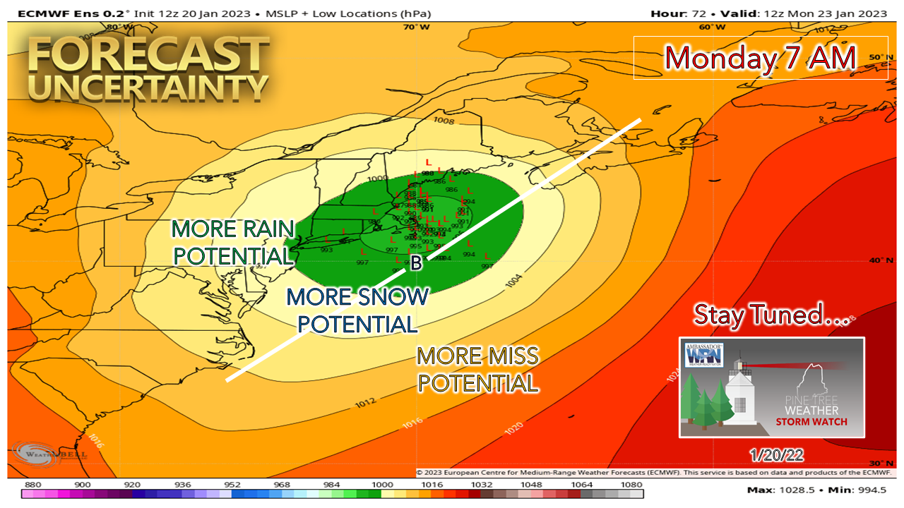 I mentioned Thursday on Twitter and Friday on Facebook that model ideas were a bit nutty with this one, but I think at this point with the kicker energy in weather balloon sample area that we can start off with an idea and then narrow it down from there. The individual European ensembles still have a fair amount of play as you can see above, but those will consolidate by the Saturday morning 12z (7 AM) data run that comes public between 2-3 PM. 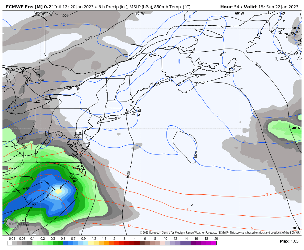 Sunday 1 PM to Tuesday 1 AM - Using the European ensemble mean run without precipitation type for track purposes. The idea right now is for the storm to cross the Cape Cod canal, enter the Gulf of Maine and punch Nova Scotia in the left eye and skirt the Bay of Fundy. Worthy to note right off here that this is setting up to be a faster moving storm than models first thought, and it appears to develop rapidly as the storm is heading for the Canadian Maritimes. This is critical for the shorelines with the astronomically high tides. This delay of organization and quicker exit also has a ripple effect on the precipitation types and amounts. For the shorelines, the blessing here is with the track the wind will stay in more northerly direction. If this were an inside runner like the Grinch Storm with wind out of the southeast, we'd be dealing with major issue. We'll have splash-over and some minor flooding more than likely, but with the wind blowing offshore, that is a huge help. High tide is around noon, and this storm will be giving the southeast tip of Nova Scotia a shiner at that point. That is what you want if you have trouble in the neighborhood with astronomically high water marks. 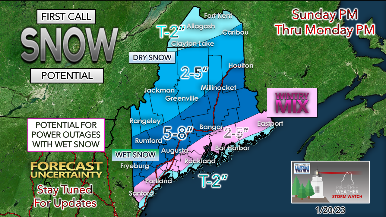 I am going to get right out in front of this and say there is reasonable confidence of a strong coastal front that will work inland. Snow could dump on the cold side, with an area of mixing along the boundary, and rain to the south of it. The pickle here is how far inland it will go. The storm starts off at night, but with the 45° ocean water that is outrageously warm for January is going to feed warm air and moisture into that front. I'll make no bones about it, bust potential is high for places around Sanford, Lewiston, Augusta, Bangor and Calais, and I am not sure if the uncertainty around the coastal front will be resolved in future forecasts with this storm. Warm air is likely to intrude aloft from the south and then shift northeast as the storm approaches and as it passes southeast of the area Monday morning. Wet snow is likely to be problematic here for power outage concerns. While the wind won't be strong on the front end, it's going to crank from the northwest as the departing storm intensifies on the way to Newfoundland. I am also going mention I have seen ideas of bigger snowfall amounts in my Twitter feed. That may have been a valid case a day or two ago, but some have 12-18" for the mountains. I pose this question... if the forecast liquid equivalent amount of ½" is what is expected there, the 12-18" solution would be a 25:1 snow to liquid ratio, which with a -9°C (15°F) at the ideal snow growth level is about as a ridiculous an idea as I have seen. Remember the blizzards we had back in 2016? The cold in that one was 10°C colder than that in the snow growth level. Could places get a foot out this? It's possible, but for now, that idea to me is isolated and not widespread. We'll see if that changes, but idea is trending down and not up due to the acceleration of the storm. I will update on this next Saturday afternoon. Stay tuned!  Temperature outlook through Wednesday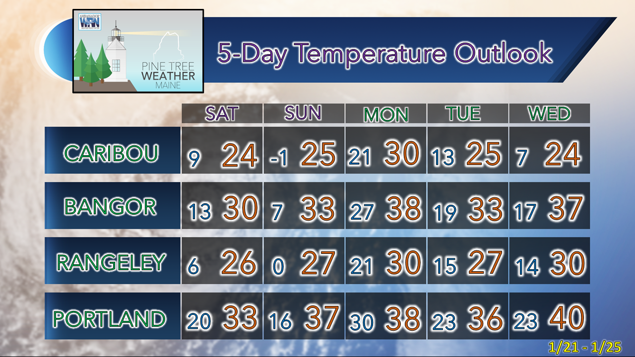 |

Mike Haggett
|


