
A look at the steering level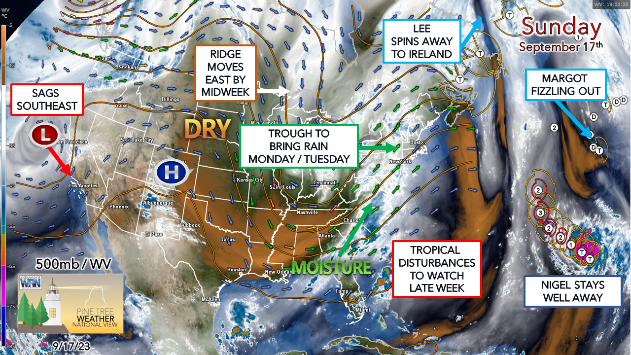 The 500mb steering level (~20,000 ft) with water vapor from 3 PM Sunday shows a bit quieter set up over the country than we've seen in a while. There is a frontal boundary on the way that is moving Sunday night into Monday which is expected to bring another unwanted healthy dose of light to heavy rain over the region for the day and into Tuesday. An upper -level ridge moves in behind it to dry us out for later in the week. Whether or not next weekend remains dry depends on what happens off the southeast coast. I am seeing hints of a potential tropical flare up, but nothing to hang my hat on yet. As the saying goes, where there is smoke, there is potential for fire, and time will tell if anything comes out of it or not. After the hammering parts of Maine received with Lee, and with tropical storm season at its peak, everything gets watched now in the south. Post-mortem on Lee The concern all along was not about if eastern Maine was going to get hit, but how bad. I am grateful that my idea of the loss of power of 250,000 came in well under as at the peak, 95,000 lost service, which was more than enough. There were 39 reports of trees down, one fatality as a result of tree falling while driving in the storm, 16 reports of flooding, along with rainfall in the 2-5"+ range from Penobscot Bay to Houlton. Thankfully the storm came into the Gulf of Maine far enough to the east that Nova Scotia took the steam out of it and spared western and southern areas of the stronger wind gusts. The storm was bad enough. My thoughts are with those who are dealing with the cleanup and rebuilding. Unfortunately, another slug of rain is on the way that will slow down the recovery process on Monday. A wet start to the week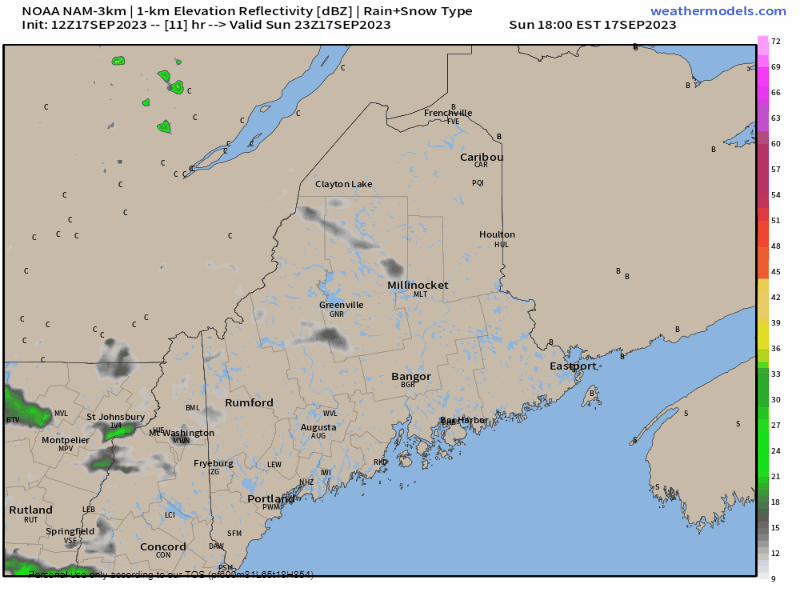 Sunday 6 PM to Tuesday Midnight - Folks around the state enjoying a dry day with a bit of breeze will want to close their windows before bed Sunday night. Rain showers are expected to move into the region late Sunday evening and into Monday morning. Rain could be heavy at times during the day, along with areas of fog. I am not concerned with severe storms or thunder with this system as it appears to be a garden variety rain event. A bit of a breeze, but nothing to do any damage. Shower activity continues for the region into Monday night. 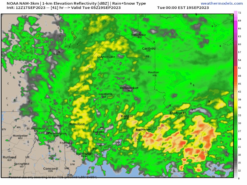 Tuesday Midnight to 7 PM - Rain tapers off over southern, eastern, and areas south of the mountains in the west Tuesday morning. The north and the mountains could see some showers around through the day. Expect areas of fog Tuesday morning to start off where the rain has ended. What is left of the shower activity is expected to depart Tuesday night, with the entire region seeing dry conditions on Wednesday.  A general 1-2" of rain is expected statewide with this rain event. The mountains and MidCoast may go higher than that. I am seeing ideas of upwards of 3"+ in isolated areas. Many areas have already exceeded the typical September allotment, and this will be added to it. It's all a surplus at this point since most areas have already met or exceeded what we get in the average year. Your financial help is needed for PTW to continue You may not like the weather, but I hope you like what I do, and support my efforts. Thank you! Stay updated, stay on alert, and stay safe! - Mike NOTE: The forecast information depicted on this platform is for general information purposes only for the public and is not designed or intended for commercial use. For those seeking pinpoint weather information for business operations, you should use a private sector source. For information about where to find commercial forecasters to assist your business, please message me and I will be happy to help you. |

Mike Haggett
|


