
Spotty light precipitation until Saturday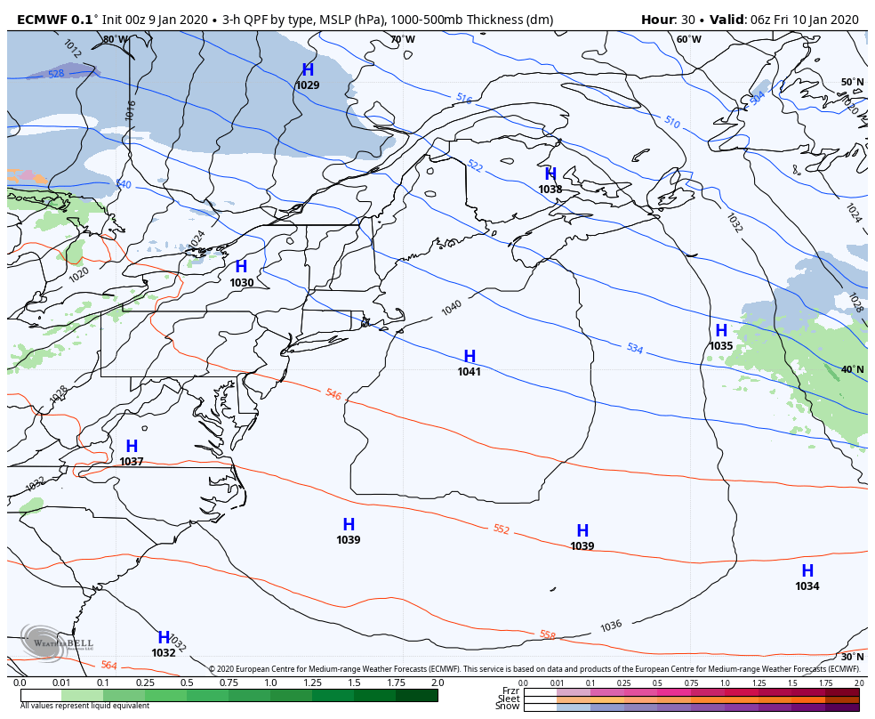 I see this loop and all I can think of is summer. Bermuda high in place, a big surge of Gulf of Mexico moisture, and a cold front moving in from the west. It's a perfect recipe for severe weather. Coming back to reality, I see that it is January. This isn't good. This storm will bring all four precipitation food groups to the region, and copious amounts of it for most areas. Precipitation amounts appear light between now and Saturday. Heads up to my followers in the western mountains and foothills... you may get some light mixing for a period on Friday, but it does not appear to have any big concerns. Saturday night into Sunday is the main event. It starts north, and then drops south, and it could get real bad. Breaking down precipitation type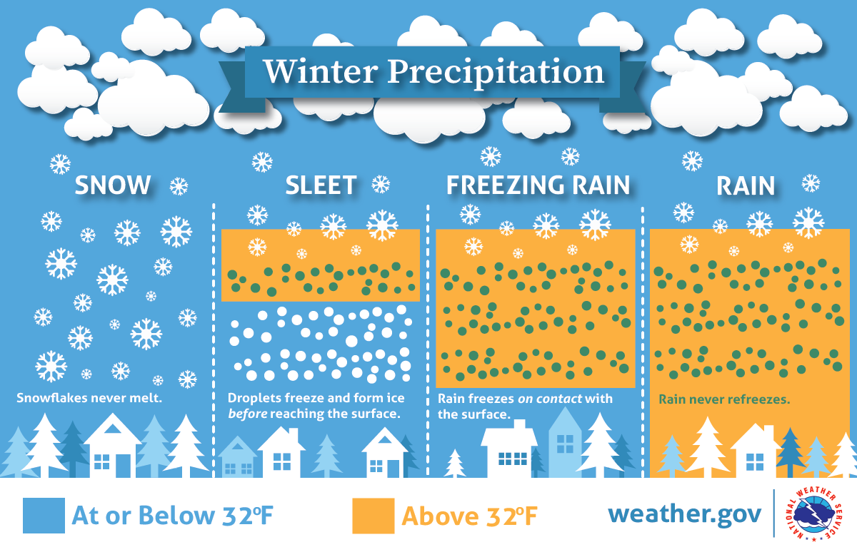 Everything we are dealing with here is temperature dependent. not only at the surface, but in the upper levels of the atmosphere. Where the warm nose sticks in aloft and the timing of the cold air bleeding down from the north will dictate who gets what and for how long as the system moves through. Here are two competing ideas in that regard: 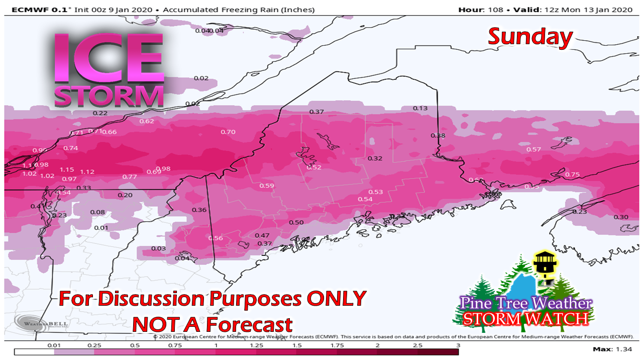 The European idea is for a freezing rain event, and enough of it to be concerned for potential power outages. The wind appears to pick up Sunday afternoon as the frontal boundary passes through, which could bring down tree limbs and power lines. Then their is this scenario... 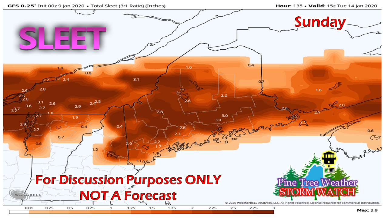 This is colder idea. The GFS is thinking enough cold will bleed down and will be entrenched enough at the lower level to make this a sleet / ice pellet storm. The idea of power outages is greatly diminished, but roads will be a big mess. 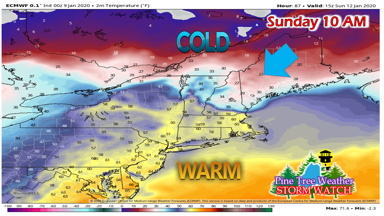 Anytime I see temperatures in the single digits / low teens in the north with a northeast wind flow, I get worried. It's that type of cold that does not mix out, and it is like moving a brick wall given its dense nature. Could models be overdoing the idea of cold as a result? Absolutely. We've witnessed that time and time again. It's much easier for cold to move in aloft than at the surface. It's all a timing game on the cold, and guidance hasn't quite figured it out yet. And since we have Gulf moisture around, along with a sharp temperature gradient, there's this: 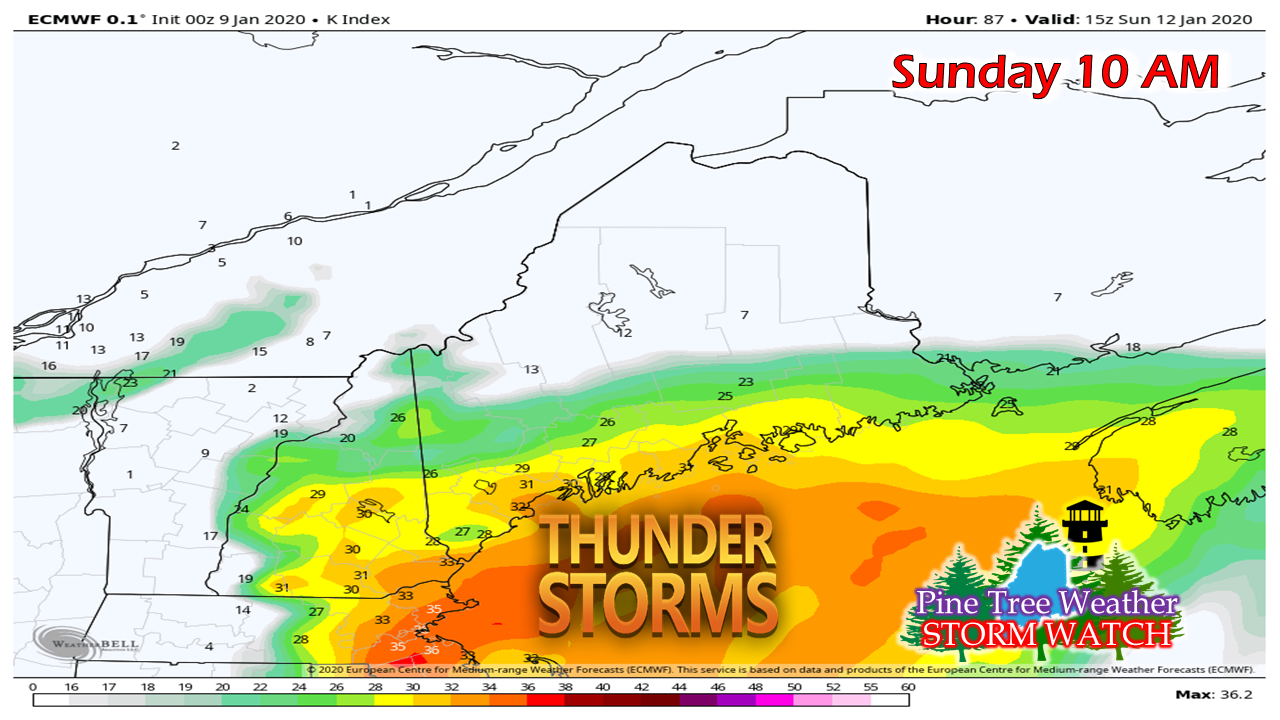 We've had some thundersnow already this winter. We could have thundersleet, and possibly thunder freezing rain. Any time there is thunder, there is usually a downpour that comes along with it. 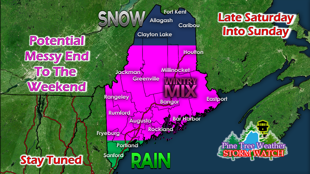 I posted this idea on Facebook yesterday, and I am sticking to it. Northern areas may need a yardstick to measure snow with this one. The big concern is for sleet and freezing rain for western and eastern areas, with rain the dominant precipitation type over the far south. It's not about amounts of who gets what at this point, it's about impacts. Make sure you are ready for it. Check your storm supplies, fuel for your heat sources, and expect disruption in travel and potentially power supply. NOTE: I am heading out of town Saturday afternoon to Boston for the American Meteorological Society Conference and will be there through Wednesday. I will do my best to update either here or on Facebook. I have a full plate of items to deal with between now and the time I get to Boston, but I will do my best to keep you posted. Stay tuned. ► ► For the latest official forecasts, bulletins and advisories, please check in with the National Weather Service in Gray for western and southern areas, or Caribou for northern and eastern parts of Maine. So close to the finish line! ► ► $65 shortfall for the year ahead! You can help keep Pine Tree Weather going with a donation of ANY amount now through VENMO @PineTreeWeather, a monthly donation on Patreon or messaging me on Facebook or Twitter to send a check in the mail. Thank you for your support!
For more information from me, please check the Pine Tree Weather Facebook page as well as my Twitter feed. Always stay weather aware! - Mike |

Mike Haggett
|


