
A bad storm for much of the region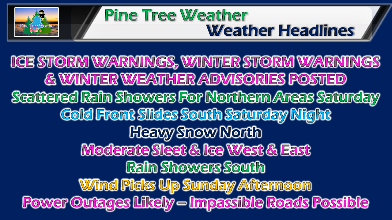 As I have said for the past couple days, prepare. If you are in a warning or advisory area, you should have your storm supplies stocked up and generators ready to go, For most, it won't be so much about amounts, as it will be about impacts. Expect surprises. This storm will have them. With tropical moisture and cold air, there will be thunder, there will periods of heavy precipitation, and there will be problems created from it. Respect of conditions is what this storm commands. Through Sunday evening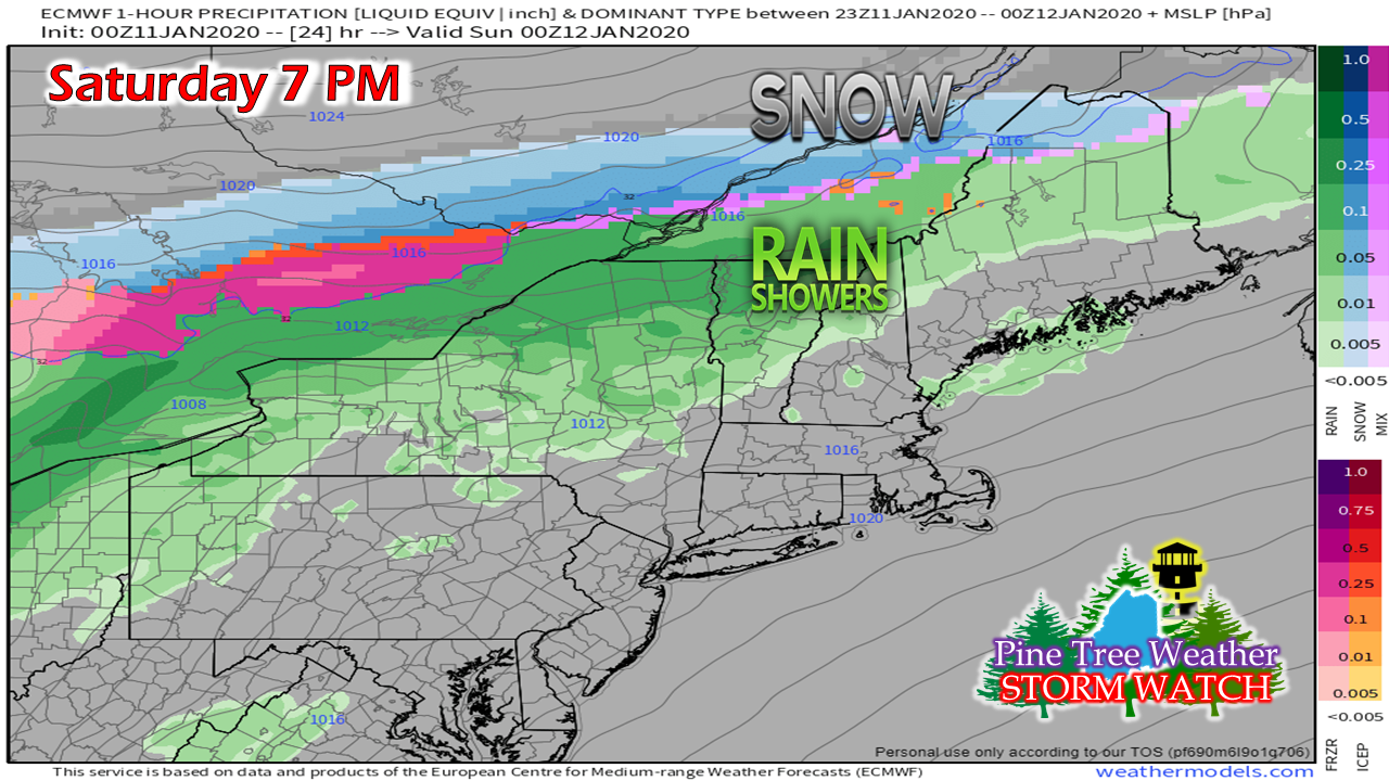 Northern areas deal with scattered showers through the day as the frontal boundary stalls out over the Gaspe peninsula. It starts to move south late afternoon, and will begin to interact with the charge of moisture coming in from the Gulf of Mexico. 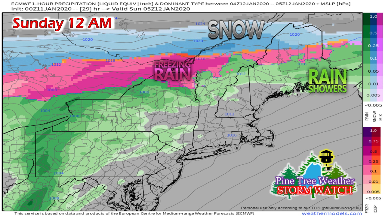 By midnight, freezing rain and sleet begins to creep in for the central highlands. 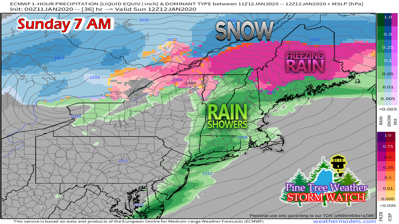 By 7 AM, heavy snow to the north, and the ice storm is well underway. NOTE: the model depiction here may be a tad on the warm end. Central & DownEast Maine should be expecting ice 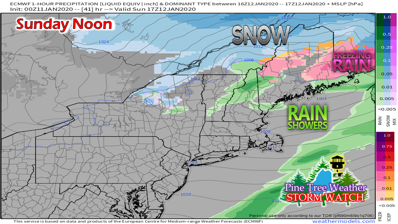 By Sunday noon, precipitation begins to taper off for southern areas. A surge of warm air ahead of an approaching cold front from the west may flip ice to rain over the western foothills. Most of the icing will have taken place by this point. 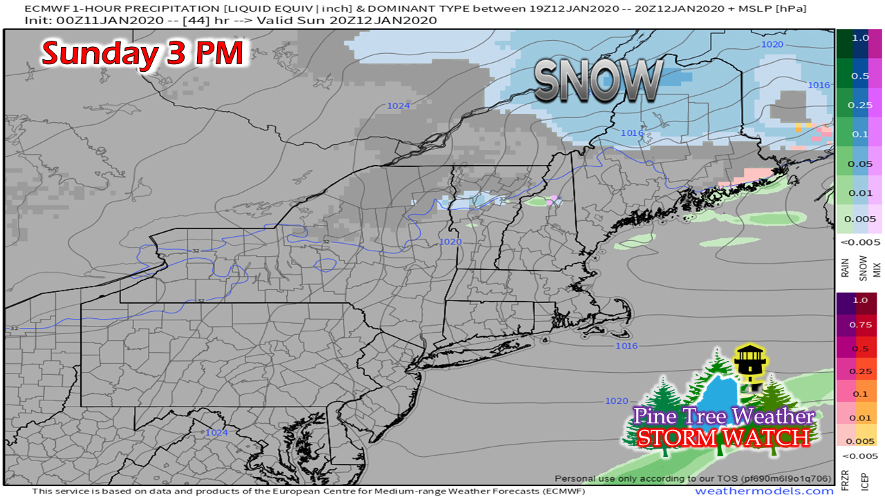 By 3 PM, the last of the precipitation exits DownEast areas. Snow begins to taper off for northern areas. 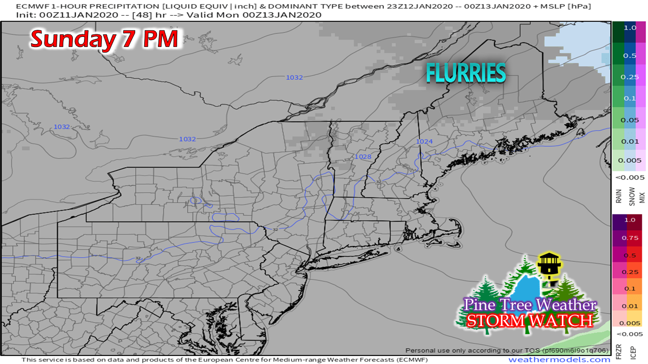 By early Sunday evening, snow showers and flurries will be all that remains, and those should end by around midnight. 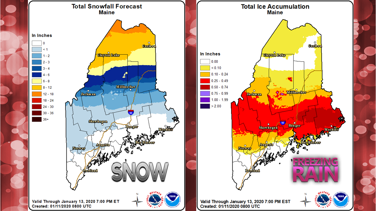 National Weather Service outlooks for snow and ice here. DownEast areas likely to see the most impact from ice. Northern areas get the most snow. Jackman-Greenville-Millinocket-Houlton-Danforth are in the crosshairs of the storm with not only freezing rain, but ice pellets (sleet) also. As I mentioned on Facebook Friday afternoon, frontogenesis is going to be a key player in this. Banding will set up. Where it does is going to dump. Some areas are going to get more than they bargained for out this. Conversely, some areas may underperform as well. Southern areas may see isolated thunderstorms with a shots of heavy rain. Western and eastern area may see isolated thundersleet or thunderice, and perhaps northern areas may see isolated thundersnow. Expect surprises. Wind picks up as storm departs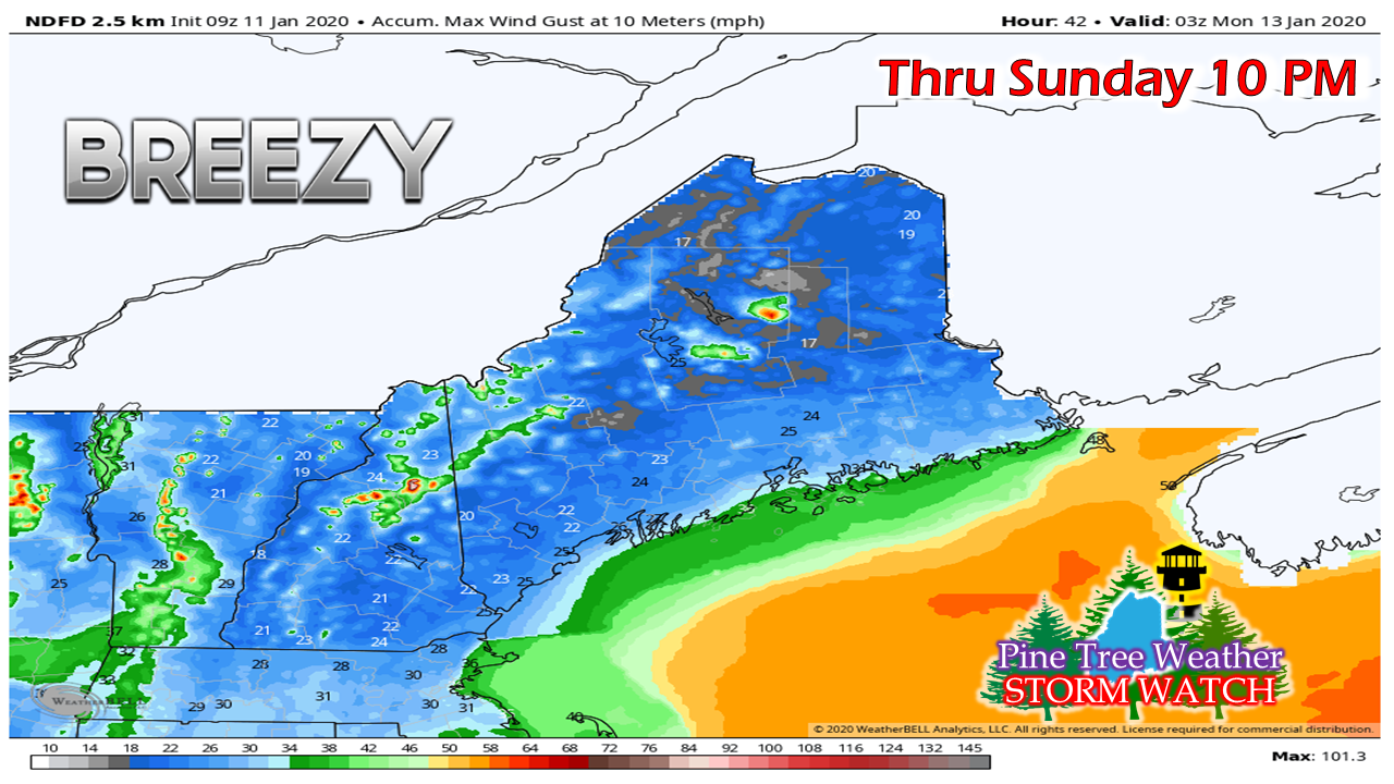 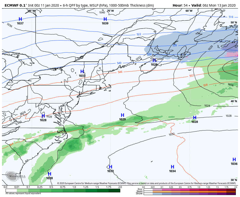 As the storm exits, high pressure takes over for Monday into Tuesday. A warm front approaches the region Tuesday, which may bring some light snow / mix Tuesday night. Precipitation from that ends early Wednesday. 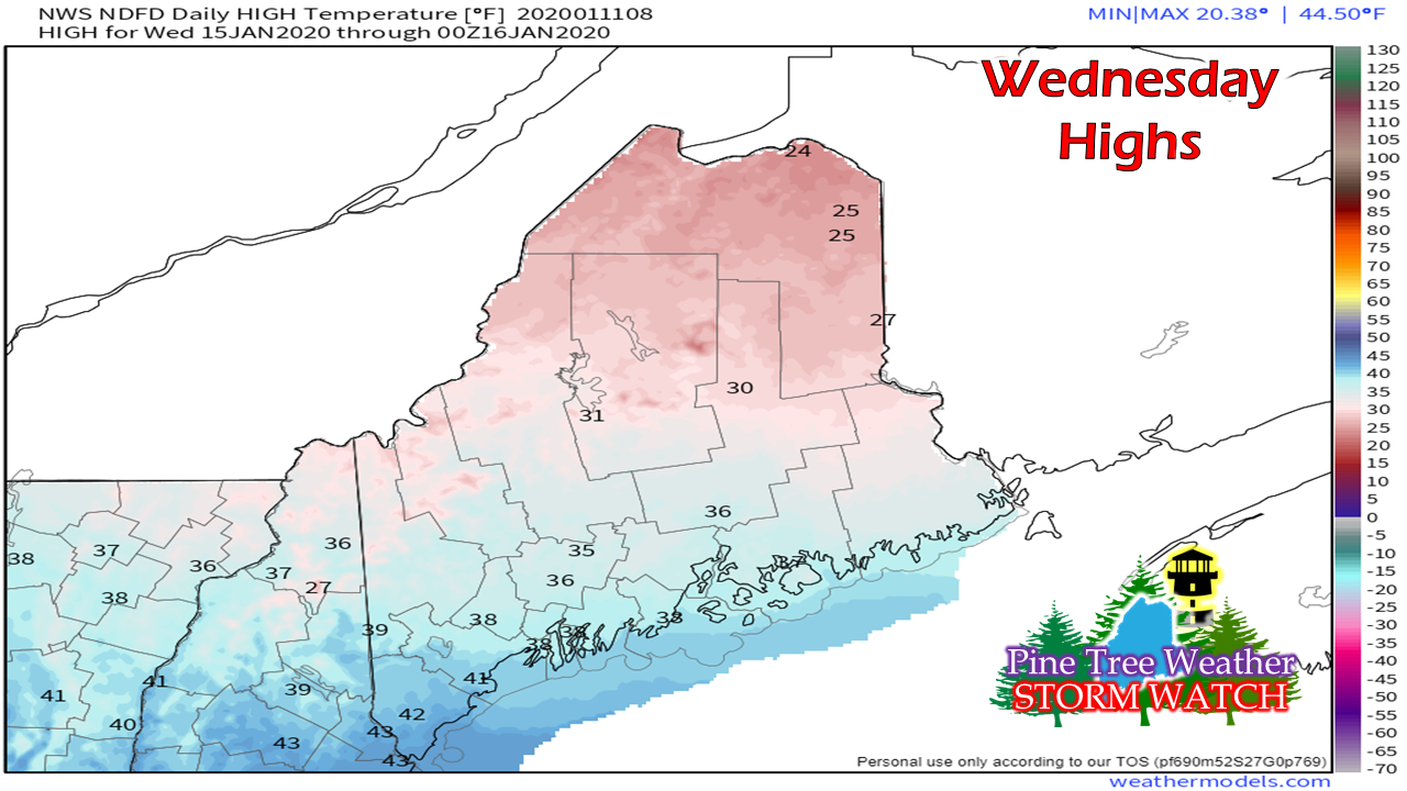 With the warm front comes warmer temperatures, which will help get the ice off everything in areas where the mercury climbs above freezing, and help clean this storm up. We may get a snowier system Thursday into Friday. Stay tuned for more on that, ► ► For the latest official forecasts, bulletins and advisories, please check in with the National Weather Service in Gray for western and southern areas, or Caribou for northern and eastern parts of Maine. NOTE: I will be leaving for Boston for the American Meteorological Society convention Saturday afternoon, and will be there through Wednesday. I will do my best to keep you folks updated while I am away. Facebook and Twitter are the places to find me. So close to the finish line! ► ► $65 shortfall for the year ahead! You can help keep Pine Tree Weather going with a donation of ANY amount now through VENMO @PineTreeWeather, a monthly donation on Patreon or messaging me on Facebook or Twitter to send a check in the mail. Thank you for your support!
For more information from me, please check the Pine Tree Weather Facebook page as well as my Twitter feed. Always stay weather aware! - Mike |

Mike Haggett
|


