|
Before I get into Teddy's effects, just a heads up for frost again Monday evening over the state. Many areas have already seen growing season declared over by the National Weather Service. If you are still growing, cover up what you can. Warmer nights are on the way after this one. Teddy track shifts slightly west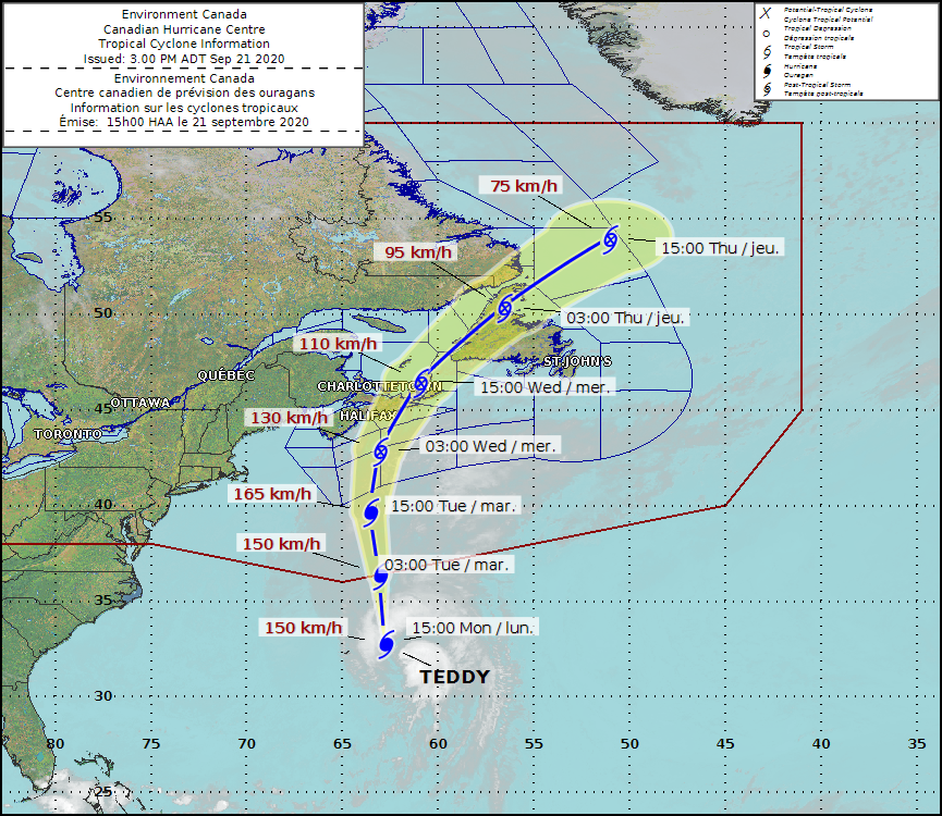 For my Maritime followers, I hope you are ready. Watching Twitter for most of the day, I've seen reports of folks gassing vehicles and gathering last minute items. This is going to be bad Nor'Easter with high end tropical storm / low end hurricane force wind gusts which will cause power outages, could bring 2-5" (50-125mm) of much needed rain, especially east of Halifax and a shoreline battering between big waves and storm surge. Stay tuned to local media there. There are some brilliant forecasters with the CBC, CTV, Global and Environment Canada that are all over this storm. You are in good hands where you are. Good luck, bonne chance and expect some lines at Tim Horton's drive thru for coffee after the storm passes. Power outages possible DownEast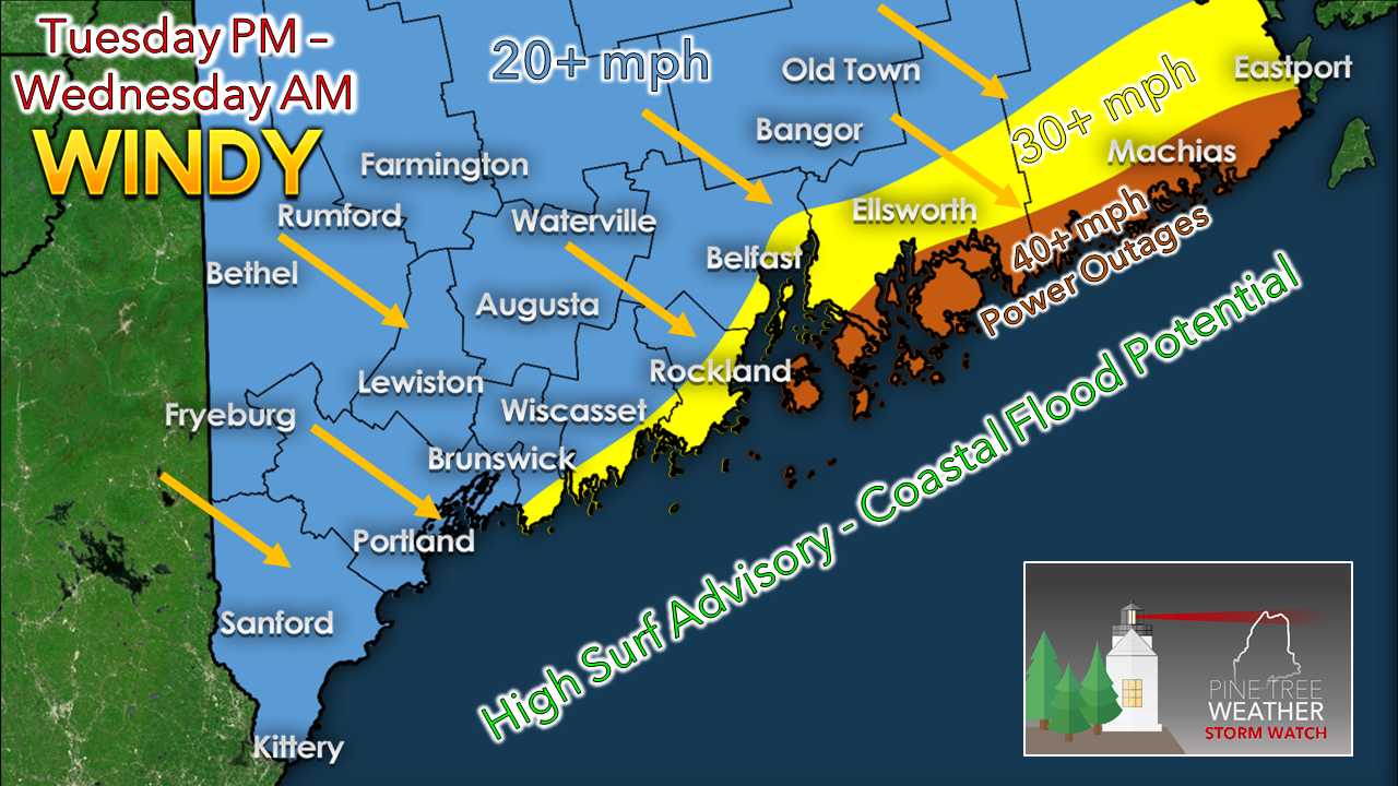 Over on this side of the Bay of Fundy, it will get breezy. Gusty wind from the northwest will increase on Tuesday. There is concern for power outages for Penobscot Bay east along the DownEast coast, especially for coastal Washington County. 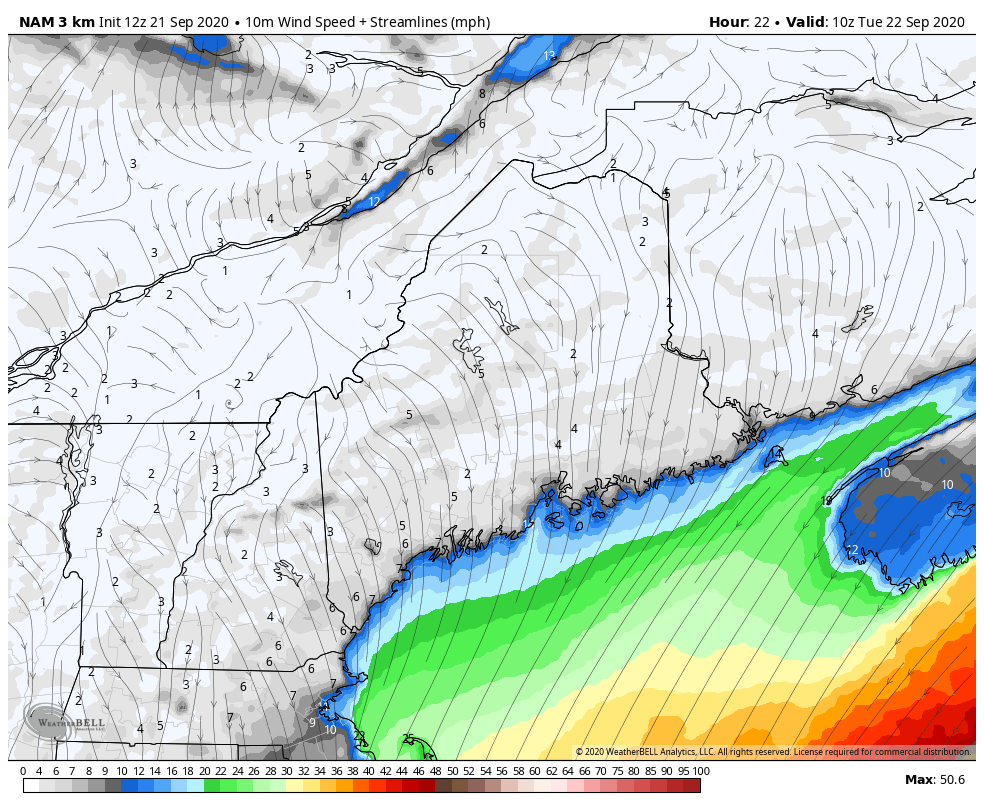 After Teddy passes over Nova Scotia and into the Gulf of St. Lawrence, the wind field will continue to expand as it heads for Newfoundland. That means will stay breezy in Maine through Wednesday. Important to note here that this storm is dragging down dry air from the northwest. The combination of that and gusty winds have elevated fire risk statewide. A fire weather watch has been called for Tuesday, which may turn into Red Flag Warning. We may end up in the same situation for Wednesday. Keep it real simple... NO BURNING, and use extreme caution with any flame. Coastal flooding / storm surge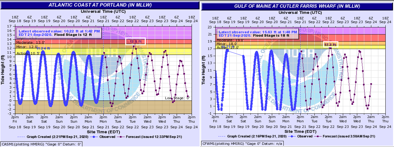 Astronomical tides and bad ocean storms means coastal flooding. Portland could see moderate levels of flooding with the Tuesday afternoon high tide. Up the coast in Cutler, it will come rather close to minor levels. Any low lying areas that are susceptible to coastal flooding are likely to get it. 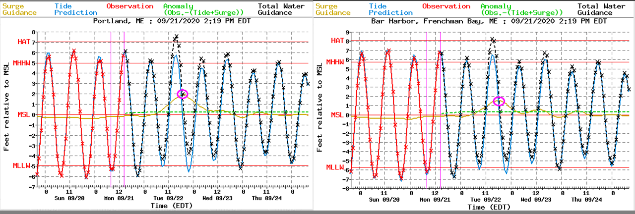 With the astronomical tides comes 1-2 feet of storm surge. Portland is forecast for a 2 foot surge, Bar Harbor near that level. Maximum waves will run in the 12-17+ foot range for exposed areas Tuesday night before subsiding slowly on Wednesday. Rain for far eastern areas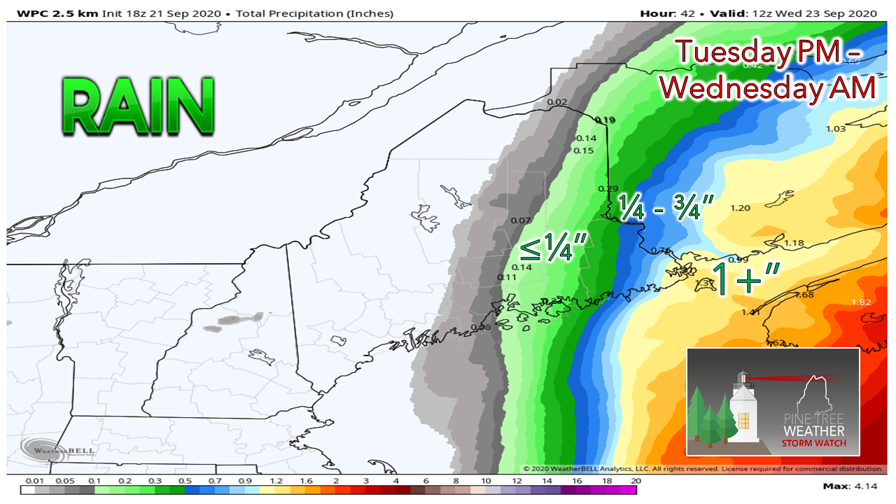 While western and southern areas get shut out of rain, eastern areas will get some. Washington County appears to get the most out of this, and the more east, the better. If the storm tracks further east, lesser amounts will come. If the track is a bit further west, a bit more will come. Being on the fringe makes it a tough call for precipitation amounts. Back to quiet times after the storm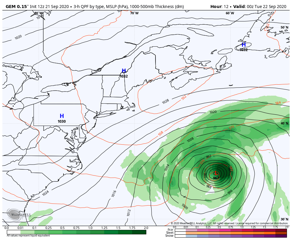 It will be all over but the wind and some residual surf Wednesday, and then that settles Thursday. High pressure controls the region through Saturday. The next chance for rain after this may come Sunday / Monday. Watch the surf from a safe distance!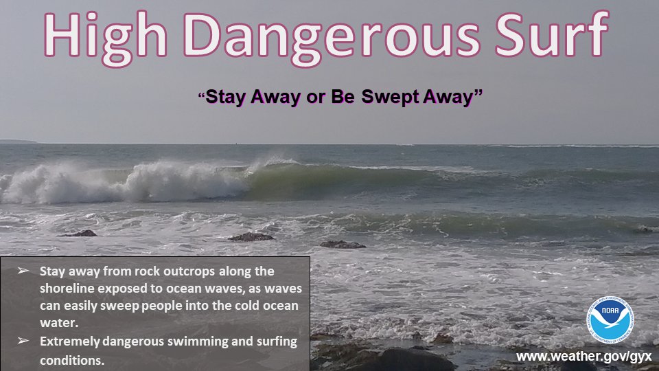 The surf is tempting for photographers and watcher... do so at a safe distance! Surfers should use extreme caution as the rip currents will be extreme. Be prepared to receive alerts and stay updated!
For more information, please follow Pine Tree Weather on Facebook and Twitter.
** FUNDING NEEDED FOR 2021 ** Thank you for supporting this community based weather information source that is funded by your financial contributions. Stay updated, stay on alert, and stay safe! - Mike |

Mike Haggett
|