
Forecast storm track stays east of Maine As of 5 AM Sunday, Teddy is a CAT3 major hurricane southeast of Bermuda. Maximum sustained winds of 115 mph / 185 kph moving northwest at 12 mph / 19 kph.  Fortunately for Bermuda, which dealt with Paulette a week ago, the worst of the storm stays just to the east of the tiny island country. The shorelines will get battered and wind will bring impacts there. The heavy rain stays out to the east.  The key forecast challenge for this storm is the transition from tropical to extra-tropical. As the storm accelerates into higher latitudes and enters cooler waters, the core of the storm transforms and changes characteristics.  The eye of the storm collapses, but the wind field expands. The gusts won't be as strong as in the eye, but the tropical storm force speeds cover a larger areas. Impacts for Maine and the Maritimes As I noted here on Friday, and upper level trough moving in from captures Teddy and causes the jog to the northwest. Nova Scotia appears to take the storm head on, with northeastern areas of the province and Cape Breton Island dealing with the worst of the conditions.  Penobscot Bay, DownEast areas on over to Grand Manan and the Bay of Fundy and points east will deal with the wind. Tropical storm force gusts appear to arrive Tuesday morning. As the storm moves east, wind speeds slowly drop over eastern Maine Tuesday night into early Wednesday. Nova Scotia / Prince Edward Island and southwestern New Brunswick see the wind reduction Wednesday afternoon in the the evening. This won't be Juan, but power outages and travel disruption is likely for areas of the Maritimes. 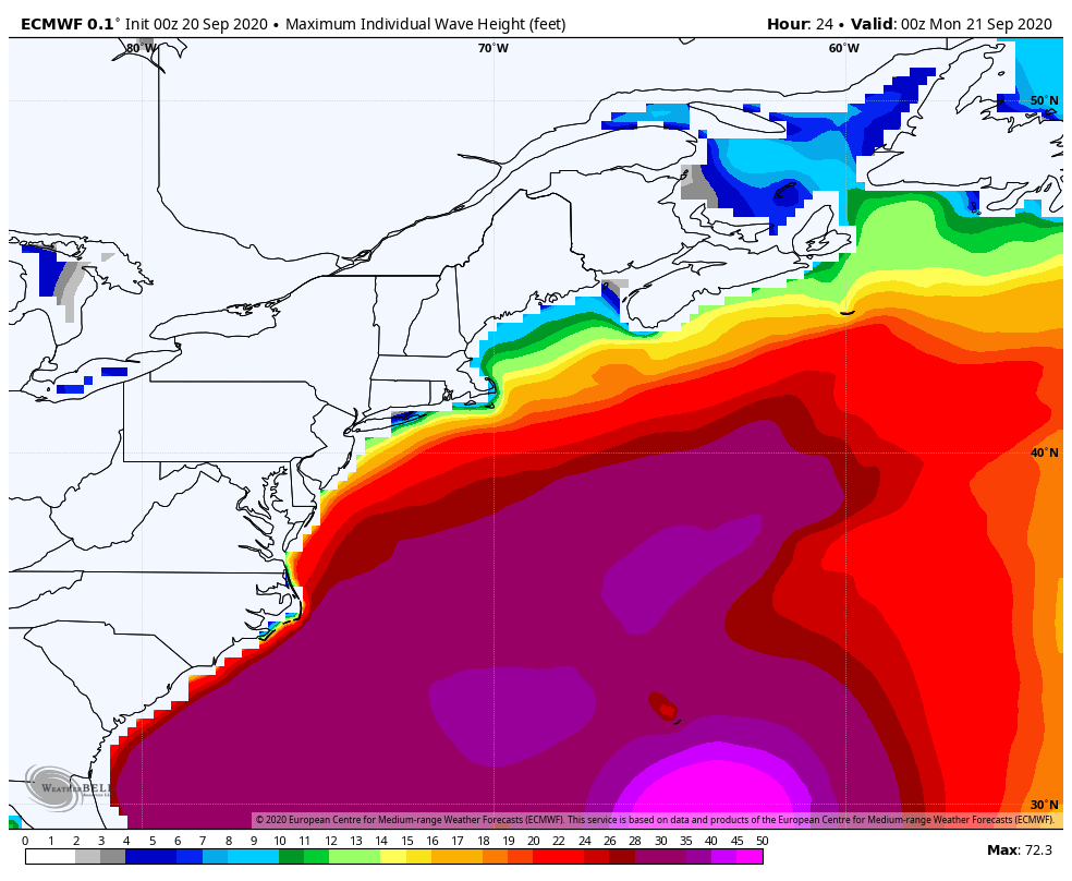 The waves begin to build on Sunday, peak early Wednesday and gradually settle out by Thursday. For the Maine shorelines, long period swells could bring 8-15 foot waves. With astronomical tides in effect, splash-over and minor flooding is possible with the high tide cycles through Wednesday morning. For Nova Scotia, waves build to 2-3 metres by Sunday evening, and could reach as high as 5-8 metres in areas Tuesday night into Wednesday, before settling out into Thursday. 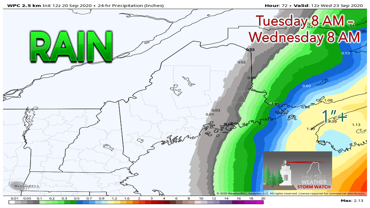 Eastern Maine is on the fringe for any rain from this event. The best chance for accumulation is for far southeastern Washington County. If the storm continues to track further east, less rain will fall. A slight jog west, rain amounts would increase slightly. With Teddy turning extra-tropical and spinning the moisture out of itself, it does not appear to be a big concern for flooding for Nova Scotia. The drought has been as bad there, if not worse than Maine this summer. This will bring some beneficial rains there. The next chance for rain appears to be late week for Maine for now. Check in with official forecast sourcesNational Hurricane Center official page for Teddy Canadian Hurricane Center Maine marine forecast links and current buoy observations on the Marine Page Marine weather for Atlantic Canada Temperatures warm up through the weekAfter this cool stretch, temperature begin to modify to near or just slightly above normal for areas of Maine starting Tuesday before cooling down a few degrees by the weekend.  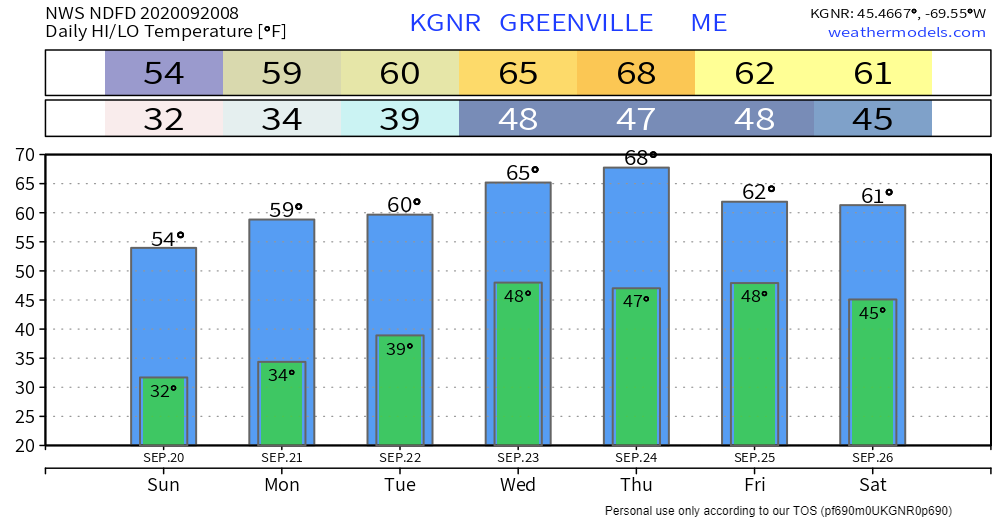 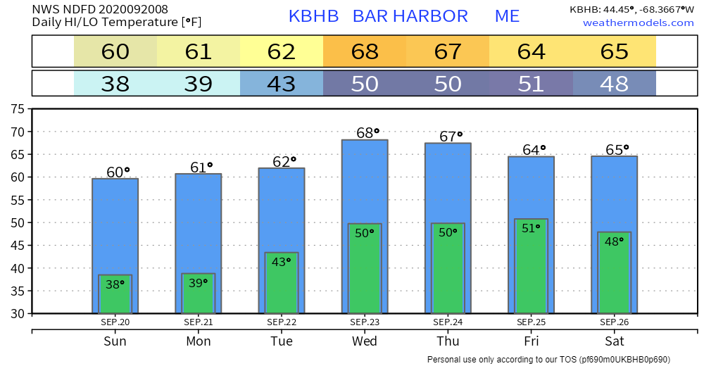  Is all of your personal property covered? Call your insurance company or agent and ask for an insurance check-up to make sure you have enough homeowners insurance to repair or even replace your home. Don’t forget coverage for your car or boat. Remember, standard homeowners insurance doesn’t cover flooding. Whether you’re a homeowner or renter, you’ll need a separate policy for it, and it’s available through your company, agent or the National Flood Insurance Program at floodsmart.gov. Act now as flood insurance requires a 30-day waiting period. Be prepared to receive alerts and stay updated!
For more information, please follow Pine Tree Weather on Facebook and Twitter.
** FUNDING NEEDED FOR 2021 ** Thank you for supporting this community based weather information source that is funded by your financial contributions. Stay updated, stay on alert, and stay safe! - Mike |

Mike Haggett
|


