|
I will preface my commentary here to say that what I am passing along here is not the final answer. It's important to stay updated through the National Hurricane Center, National Weather Service Caribou or National Weather Service Gray, and for my Canadian friends, the Canadian Hurricane Center, Environment Canada and your local media. Teddy is a powerful storm and appears that it could bring strong impacts to Nova Scotia Monday night into Tuesday. Eastern Maine appears to be on the fringe of the storm for now. Teddy is a major hurricane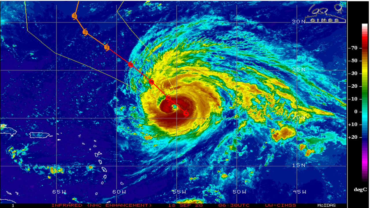 A first glance on satellite, two things come to mind. The storm looks a bit hairy due to shear that it is running into on the peripheral, but the core of the storm is solid and constructed to handle the journey ahead. 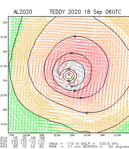 A close look at the wind field around the storm shows that well built core. The northeast quadrant is iron clad around the eye wall. This is a classic signal for deep, strong, sustainable convection that will protect itself well. This is a large hurricane as the wind field indicates. The storm will be dealing with shear, some dry air, and cooler sea surface temperatures. The combination of that should keep it in check. It may weaken a bit as it heads towards Bermuda over the weekend. Teddy to vault northwest Monday On Sunday, an upper level trough drops down from central Canada. As Teddy moves north, just to the east of Bermuda, it gets captured by the trough. The negative tilt in the trough pulls the storm to the north-northwest.  Looking at this from a surface map point of view, the storm makes landfall near Halifax, Nova Scotia Tuesday morning. The trough then takes the remnants of the storm through the Gulf of St. Lawrence and through Newfoundland Wednesday into Thursday. 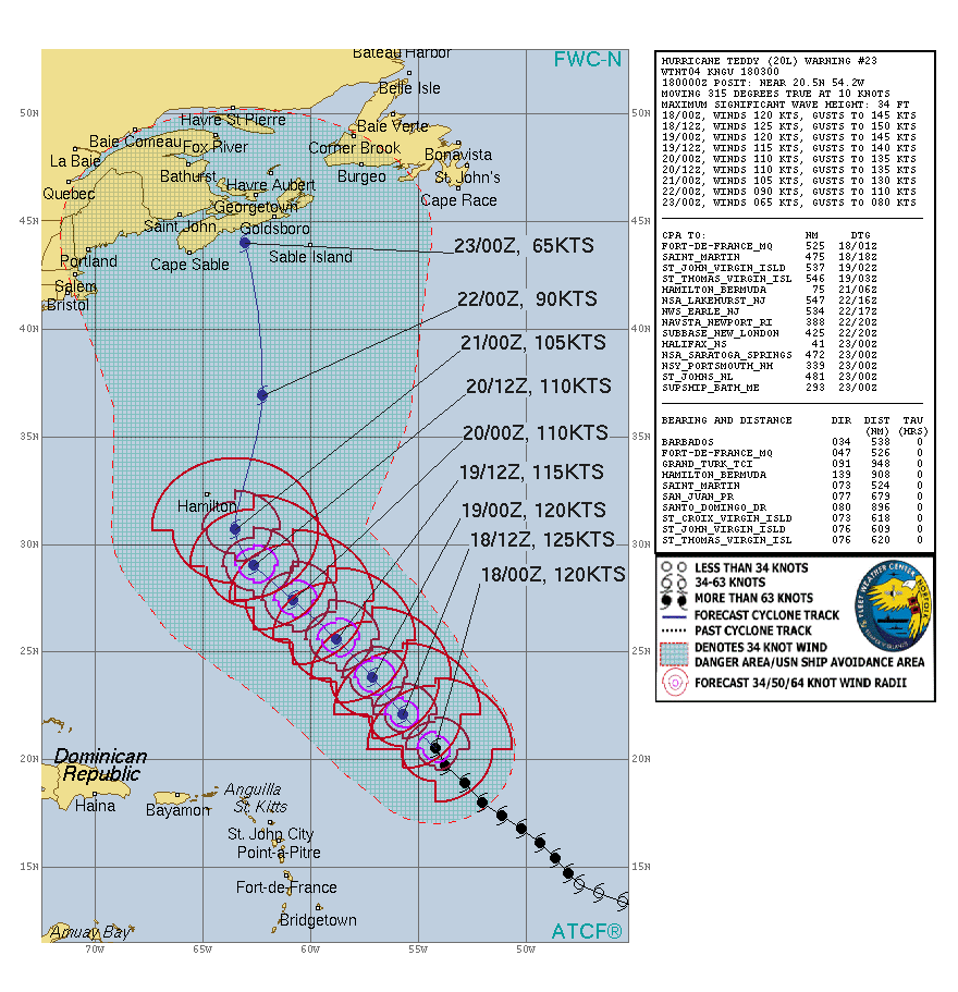 As the storm gains in latitude, the core will begin to weaken as it begins the transition from a tropical to extra-tropical storm. As that happens, the wind field of the storm will begin to expand to the west and east and cover a wider area. As with any storm with tropical characteristics, the key thing to remember with ANY of these is that the effects and impacts of the storm go far and beyond where the eye is. Tropical systems are not in a neat little box, especially when they expand and morph into mid-latitude storms. Wind and surf impacts The wind swath of the European model here indicates the potential of a crippling storm for Nova Scotia and take Prince Edward Island, and parts of New Brunswick for a ride as it moves north-northeast. Widespread power outages are a virtual lock. 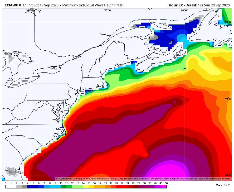 The ocean is going to get ugly. To add insult to injury, astronomical high tides are going to play a big factor in this as well. Folks with boats in the water in exposed coves or harbors may want to relocate them, or pull them out. Seas could range over 50 feet / 17 meters for the Nova Scotia shorelines. For Maine interests, folks with watercraft in the Penobscot Bay area eastward should give strong consideration to protect their investment also. More details on impacts to come... stay tuned. Prepare ahead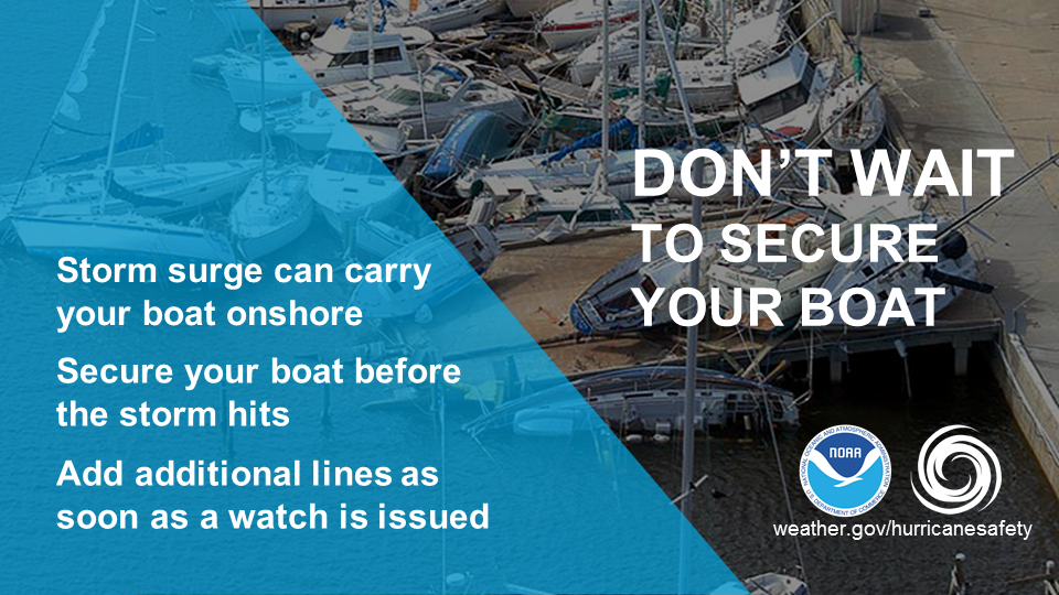 Don't wait for a Tropical Storm or Hurricane Warning to secure your boat. By then it's too late to safely work on a dock. Listen to weather forecasts and plan ahead. Haul out your boat or add additional lines as soon as a tropical storm or hurricane watch is issued. This will typically give you 48 hours before the anticipated onset of storm winds and will allow you to safely secure your boat. weather.gov/safety/safeboating-before Be prepared to receive alerts and stay updated!
For more information, please follow Pine Tree Weather on Facebook and Twitter.
** FUNDING NEEDED FOR 2021 ** Thank you for supporting this community based weather information source that is funded by your financial contributions. Stay updated, stay on alert, and stay safe! - Mike |

Mike Haggett
|