Friday Daytime Temperatures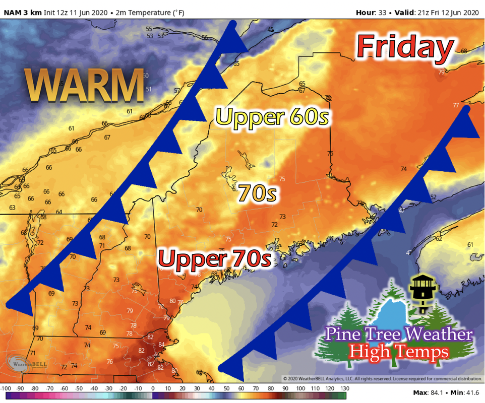 After the extratropical cyclone passes north of Maine, a series of weaker cold fronts pushes southeastward into Maine during the day on Friday. These cold fronts will begin to bring cooler Canadian air from the north into the state to begin the temperature cool-down for this weekend. Northern Maine could see high temperatures in the upper 60s, central and Down East Maine in the 70s, and southern and Portland area of Maine could see high temperatures in the upper 70s. 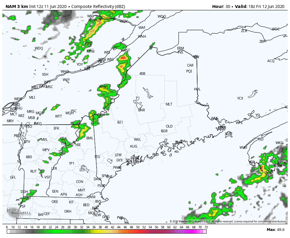 The GIF above runs from 1 PM Friday to 11 PM Friday. As those cold fronts move into the state, their forcing mechanisms of pushing the warmer air upward can create some pockets of thunderstorms in the mid to late afternoon. Friday Night Temperatures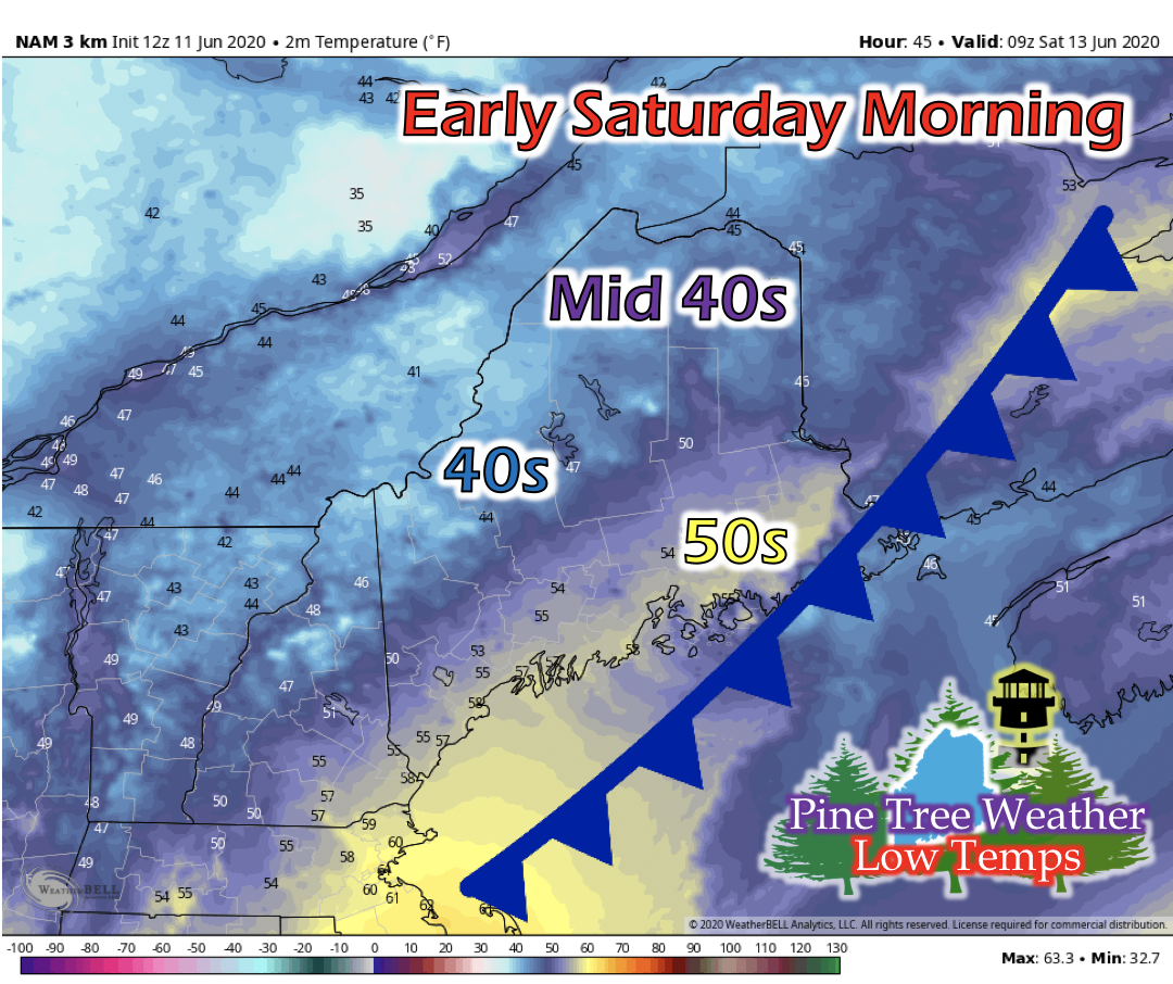 After the passage of the last cold front in the series, Friday night is cooler with light winds and partly cloudy skies. The dew point is shown by short-range models that they'll stay in the upper-30s, so frost potential for this night is fairly low. Saturday Daytime Temperatures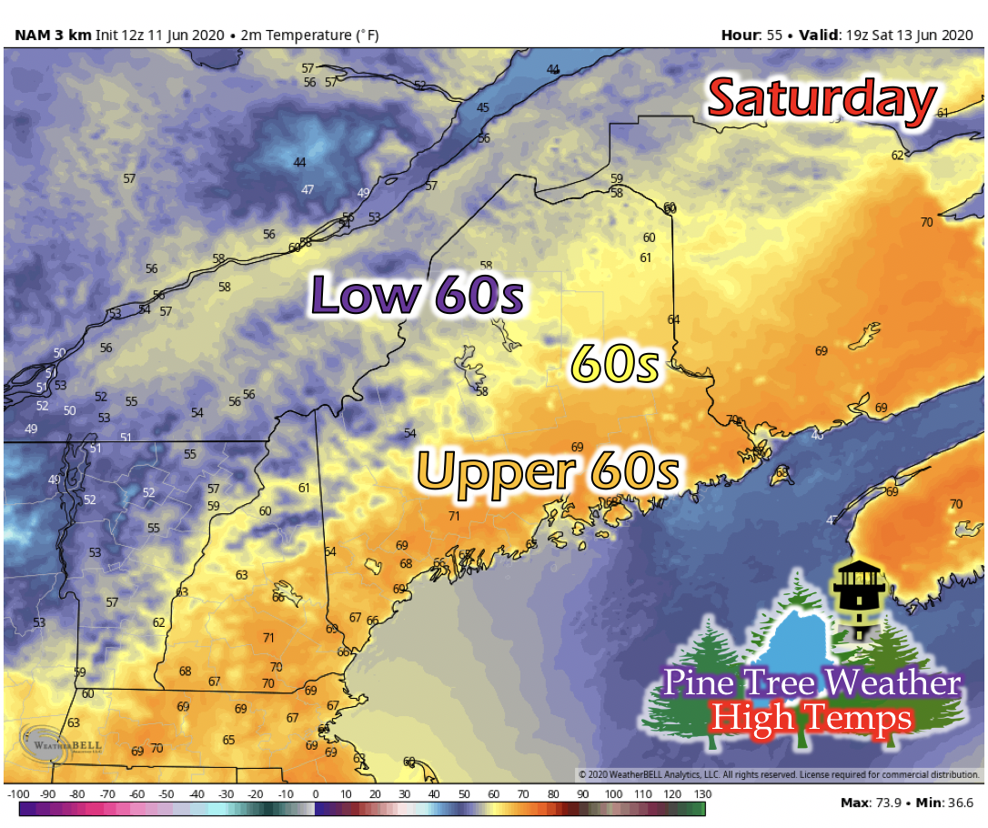 A Canadian high pressure system begins to build northwest of Maine on Saturday. The upper-level wind pattern shows signs of an inverted trough, where instead of a low pressure system residing in the trough, a high pressure system is there. This pattern is pretty common when a low pressure system cyclone of the strength from tropical depression Cristobal transforming into the extratropical cyclone passes north of Maine. For Maine, temperatures will be cooler under this pattern with northerly winds instead of southerly winds if this wind pattern was a ridge and not an inverted trough. Temperatures for western and northern Maine are expected to be in the low 60s, central Maine in the 60s, and Down East, Mid Coast, and Portland areas in the upper 60s. The Week Ahead: Temperatures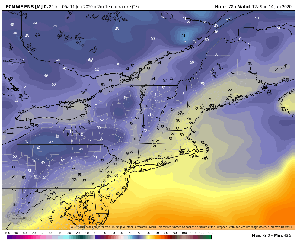 The GIF above runs from 7 AM Sunday, June 14th to 1 AM Wednesday, June 17th. The upper-level wind pattern output from a long-range model has the inverted trough remaining for Sunday and into Monday morning. In the meteorological world, a weak "omega-block" pattern sets up far south of Maine (around Virginia/North Carolina), meaning a forced stationary area of low pressure will reside there for a few days. For Maine, this means fair weather, with the high pressure area moving directly over the state. Maine will still have northerly winds keeping daytime temperatures somewhat cooler until this high pressure moves over the state. When it does, daytime temperatures will increase into the low to mid 70s, with clear skies and light winds. Help forecast verification, and stay informed!
For more information, please follow Pine Tree Weather on Facebook and Twitter.
Thank you for supporting this community based weather information source that is funded by your financial contributions. Stay updated, stay on alert, and stay safe! Enjoy the rest of your Thursday, the weekend is almost here! - Kaitlyn |

Mike Haggett
|