
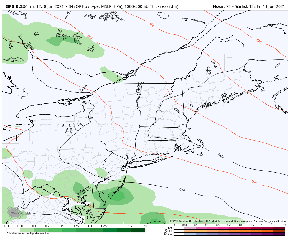
Temperatures begin to trend downward through late week, chances for showers in the days ahead6/8/2021 Heat wave ends today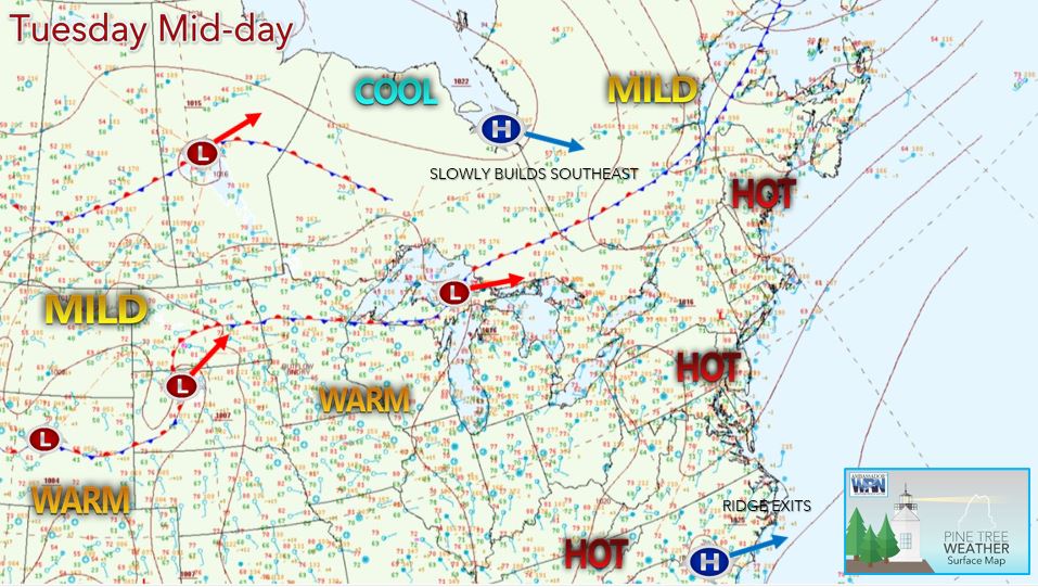 The Tuesday afternoon temperatures are in the 90's across SW Maine with mid to upper 80's common elsewhere across the state. Temperatures are slightly cooler in the 70's and 80's along the shoreline due to the persistent sea breeze. Some daily record high temperatures have been broken across the state for the second or third day in a row because of strong upper-level ridging over the Eastern United States including our region over the last few days. This will be the last very hot day across the state as a cold front brings in a more seasonable airmass for later in the week. Scattered showers and thunderstorms possible Tuesday night ahead of an approaching cold front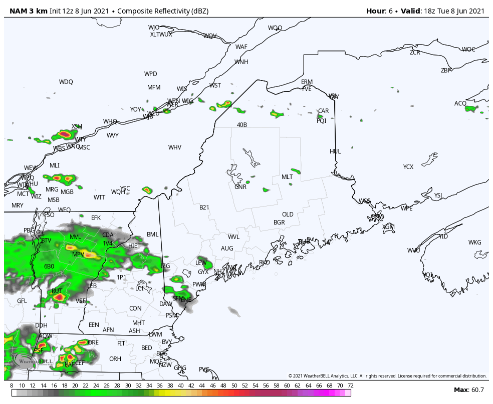 For Tuesday evening and into the overnight hours, we will see a chance for scattered showers and thunderstorms primarily for the southern half of the state (south of a line running from Millinocket to Houlton). These scattered showers and thunderstorms are associated with a cold front that is slowly pushing its way into our state from the north. This cold front will usher in a more comfortable air mass by providing relief from the excessive heat and high humidity we have seen the past several days from tomorrow onwards. Across the northern half of the state, we will see areas of patchy fog and isolated showers for the overnight. Low temperatures will range from the upper 50's across Aroostook County in the north to the upper 60's in SW Maine. Lower humidity and temperatures Wednesday onward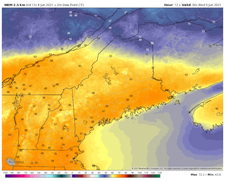 Wednesday morning the cold front will move through the northern half of the state pressing its way to the south and moving through the southern parts of the state by the late afternoon. Any scattered showers and thunderstorms that remain across the southern portion of the state should "fizzle out" with the passage of the cold front tomorrow afternoon. High temperatures Wednesday will be in the 70's across the north and the low to mid-80's across SW Maine and the interior. Temperatures should be in the 70's for the shoreline locations. Behind the cold front, we should see more seasonable temperatures and much lower dewpoints statewide as we head into Thursday. High temperatures on Thursday are likely to be in the low to mid 70's across SW Maine and the interior and in the 60's for the northern and coastal areas with sunny skies expected statewide. Dewpoints will be very comfortable in the 40's and 50's as opposed to the mid to upper 60's we saw earlier in the week. Showers possible for southern areas |

 | BE PREPARED WITH A NOAA Weather Radio. For $20-$40, it could provide vital information to you when you need it. The weather bands are standard on most public safety scanners, and newer scanner models. Weather radios can be programmed for auto alert. Click here for more information. |
| ► ► For the latest official forecasts, bulletins, and advisories, please check in with the National Weather Service in Gray for western and southern areas, or Caribou for northern and eastern parts of Maine. |  |

Thank you for supporting this community-based weather information source which operates by reader supported financial contributions.
Stay updated, stay on alert, and stay safe!

Mike Haggett
Kennebunk, ME
Weather-Ready Nation
Ambassador
Certified Weather
Forecaster
Penn State '21
American Meteorological Society
National Weather Association
SKYWARN-CWOP
Matthew 19:26
Please
Support
Pine Tree Weather
In 2024


Archives
July 2024
June 2024
May 2024
April 2024
March 2024
February 2024
January 2024
December 2023
November 2023
October 2023
September 2023
August 2023
July 2023
June 2023
May 2023
April 2023
March 2023
February 2023
January 2023
December 2022
November 2022
October 2022
September 2022
August 2022
July 2022
June 2022
May 2022
April 2022
March 2022
February 2022
January 2022
December 2021
November 2021
October 2021
September 2021
August 2021
July 2021
June 2021
May 2021
April 2021
March 2021
February 2021
January 2021
December 2020
November 2020
October 2020
September 2020
August 2020
July 2020
June 2020
May 2020
April 2020
March 2020
February 2020
January 2020
December 2019
November 2019
October 2019
September 2019
August 2019
July 2019
June 2019
May 2019
April 2019
March 2019
February 2019
January 2019
December 2018
November 2018
October 2018
September 2018
August 2018
July 2018
June 2018
May 2018
April 2018
March 2018
February 2018
January 2018
December 2017
November 2017
October 2017