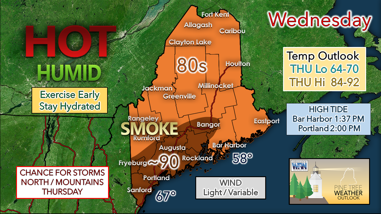
A toasty WednesdayGood day, everyone! While looking over guidance early this morning, the phrase "dog days of summer" came to mind while I was preparing this forecast. Even though we are fast approaching meteorological fall on September 1st, and the "dog days" are more of a mid-season reference, it will be a day with not much of a breeze for most areas. It may feel stealthy with the air not moving around much. Any patchy fog around to start the day fades out quickly, and temperatures will increase rapidly. While humid, a bit of drier air mixes down from above, just enough to take the edge off a bit. That mixing may also deliver the scent of smoke attributed to the wildfires out west that is caught in the upper-level air stream. High thin cirrus clouds, some haze and a smoky hue appear to be the dominant sky features of the day. A few popcorn cumulous clouds may pop up in the higher elevations. Sun will be strong and will deliver the heat. For folks headed to the oceanside to find cooler conditions, there does not appear to be much of a sea breeze to kick up today. MidCoast & DownEast areas may have the best chance. Keep in mind the timing of high tide as you pick your spot to perch. Outside of the return of patchy fog in spots Wednesday night, it's on track to be a mainly clear sky with little wind and continued warm overnight lows. Thursday continues to shape up to be the warmest day of the stretch. A weak cold front drops down from the northwest which may touch off some isolated showers or thunderstorms in the north and mountains in the afternoon. The break from humidity appears to come gradually behind the front, with the north and mountains feeling the refreshment before sunrise Friday. By around noon, all but southwestern areas see the humidity fall to comfortable levels, and by Friday evening, the dew points fall into the upper 40s north and 50s south in all areas by sunset. The weekend at this point appears unsettled. With the upper-level trough over the state and ridge to the southwest nearby, varying amounts of clouds with chances for showers Saturday afternoon into Sunday. That forecast will be fine-tuned we get closer. Be prepared to receive alerts and stay updated!
For more information in between posts, please follow Pine Tree Weather on Facebook and Twitter.
Thank you for supporting this community-based weather information source which operates by reader supported financial contributions. Stay updated, stay on alert, and stay safe! - Mike |
Mike Haggett
|


