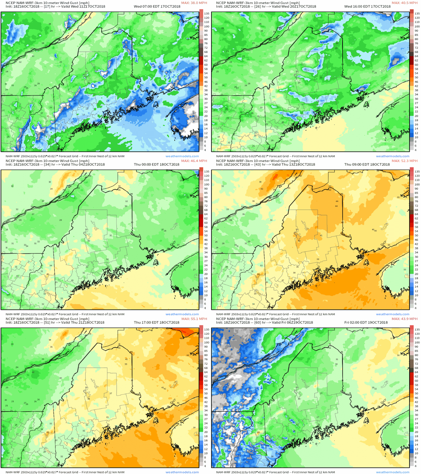
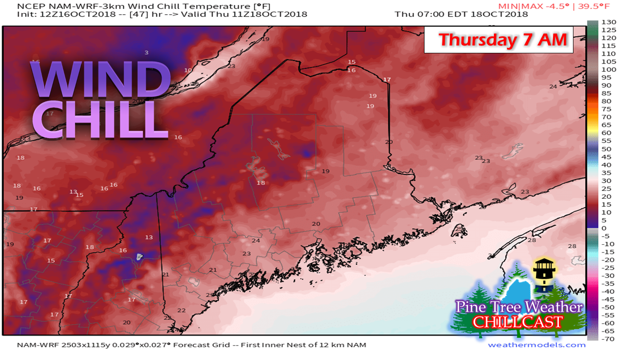
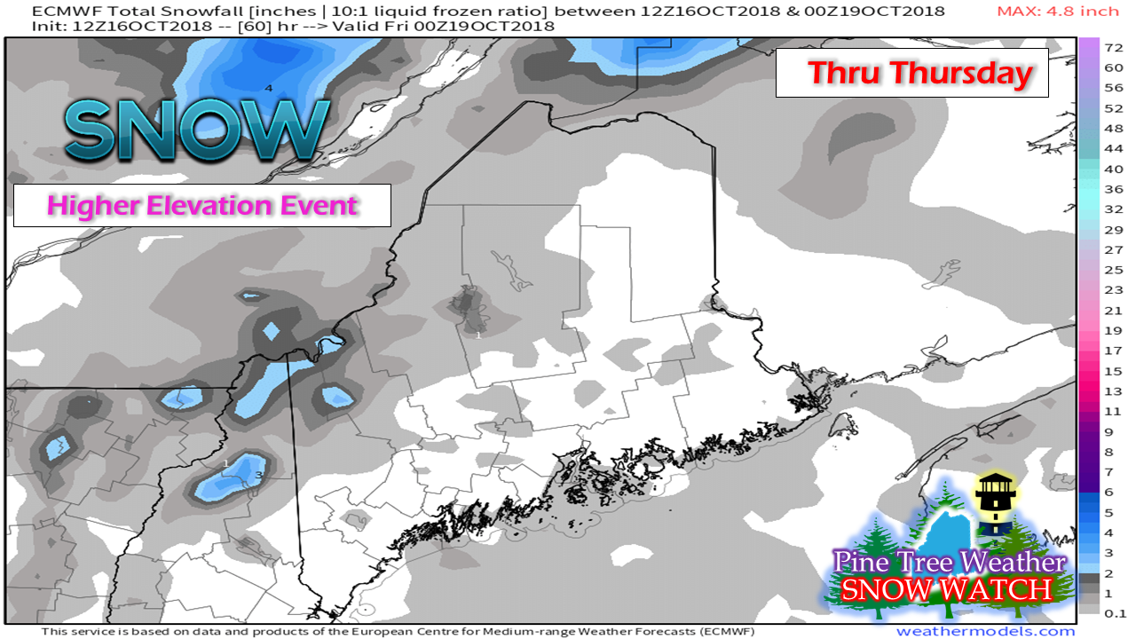
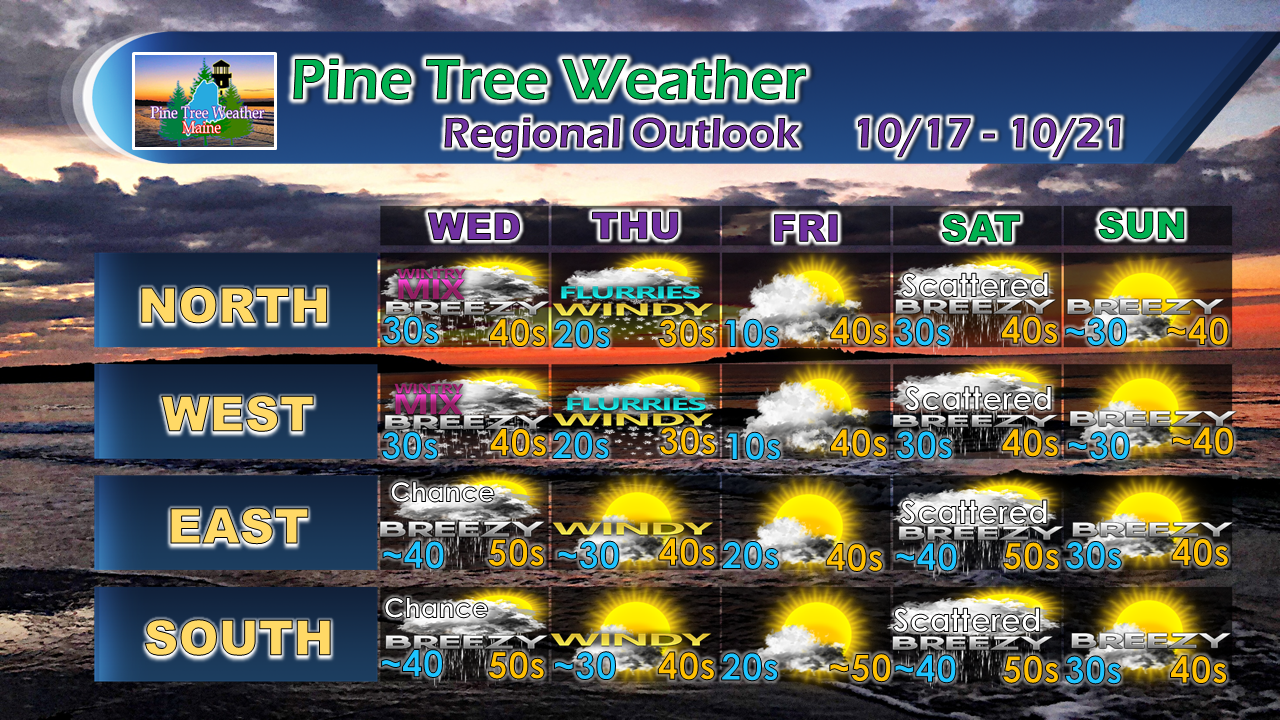
Breezy times to continueIt's October and the wind is starting to crank. This isn't anything new. This month tends to be one of the breezier ones due to changes in temperature and pattern. If you experienced a power outage with the wind Monday night into Tuesday, expect that to happen again. Until the leaves come completely off the trees, the threat will be there for power lines to come down. Make sure you are prepared in case power is lost. Stock up on essentials, test the generator, and be ready in case you lose service that takes time to restore. Gusty at times through early FridayGale warnings are ongoing for the offshore waters, a gale watch is in effect (at the time of this post Tuesday evening) for the shorelines Wednesday night through Thursday evening. While no watches or advisories have been posted for wind as of yet (there may not be any) one can expect it to be breezy and that there is potential for another round of power outages on Thursday. Wednesday will see the wind increase as another strong cold front passes through and it won't begin to settle until late Thursday, early Friday. We'll get a bit of a break Friday, but the breeze will continue over the weekend. Time to talk wind chillWith the breeze on the way comes the chill. Folks who lose power on Thursday will be dealing with cold temperatures. Model idea here indicates single-digit wind chill indices for the mountains and teens in the valleys, with 20s for the rest of the state. It makes you want to take a double-take on what month this is as you go grab your winter gear buried out of the closet to get your self and any offspring or furry companions out the door Thursday morning. Snow squalls on the way for the north countryIf the temperature doesn't get your attention, the snow squalls that drop some spotty accumulation may emphasize the point. With the wind, the snow will blow around, along with the leaves, garbage cans, recycle bins, and anything else that can go airborne. The ski hills will be tweeting and sharing pictures on Facebook and Instagram the joy of the early season snowfall. This fall isn't like the past few. We're getting an early jump on winter. As I have been saying, this cold pattern isn't going away anytime soon. Old Boy Scout motto: Be Prepared. Outlook through SundayRain showers change to perhaps some sleet to snow showers for the north country late Wednesday. Squalls are likely for some areas of the interior Thursday. Friday is a very chilly start everywhere, but thankfully with less wind. Another front passes through the region Saturday which may bring periods of scattered showers statewide. Sunday appears dry for now.
For the latest official forecasts, bulletins and advisories, please check in with the National Weather Service in Gray for western and southern areas, or Caribou for northern and eastern parts of Maine. For more information from me, please follow the Pine Tree Weather Facebook page and my Twitter feed. Thanks as always for your support! Please consider making a donation to keep Pine Tree Weather going through the year ahead. Check out the donate page on how to contribute. Always stay weather aware! - Mike |
Mike Haggett
|


