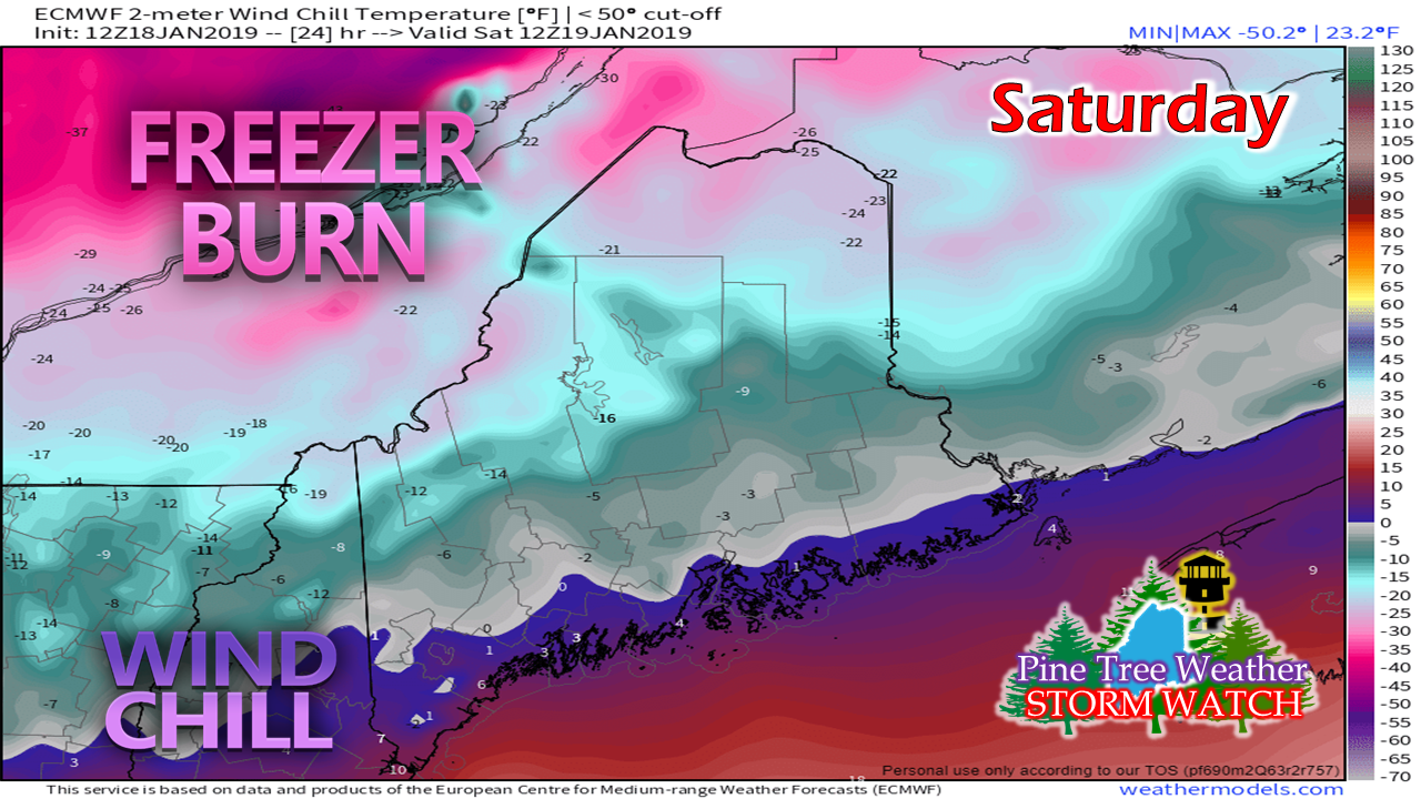
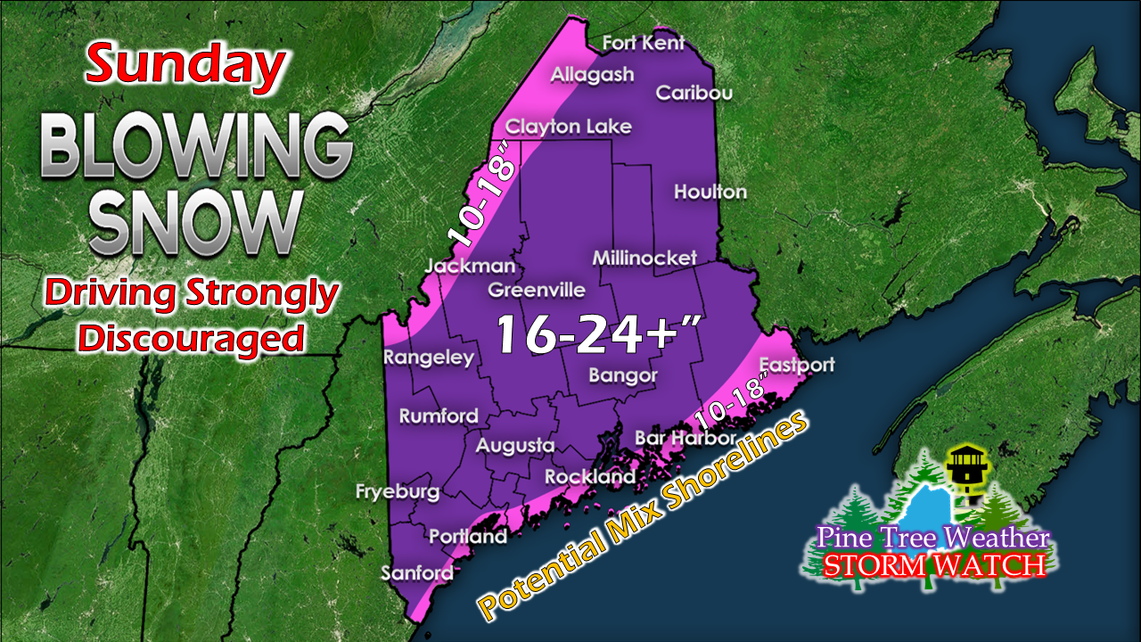
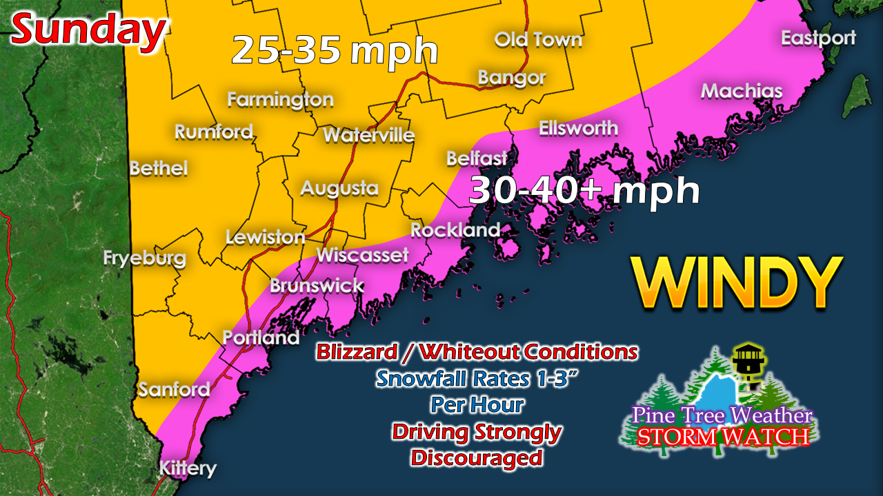
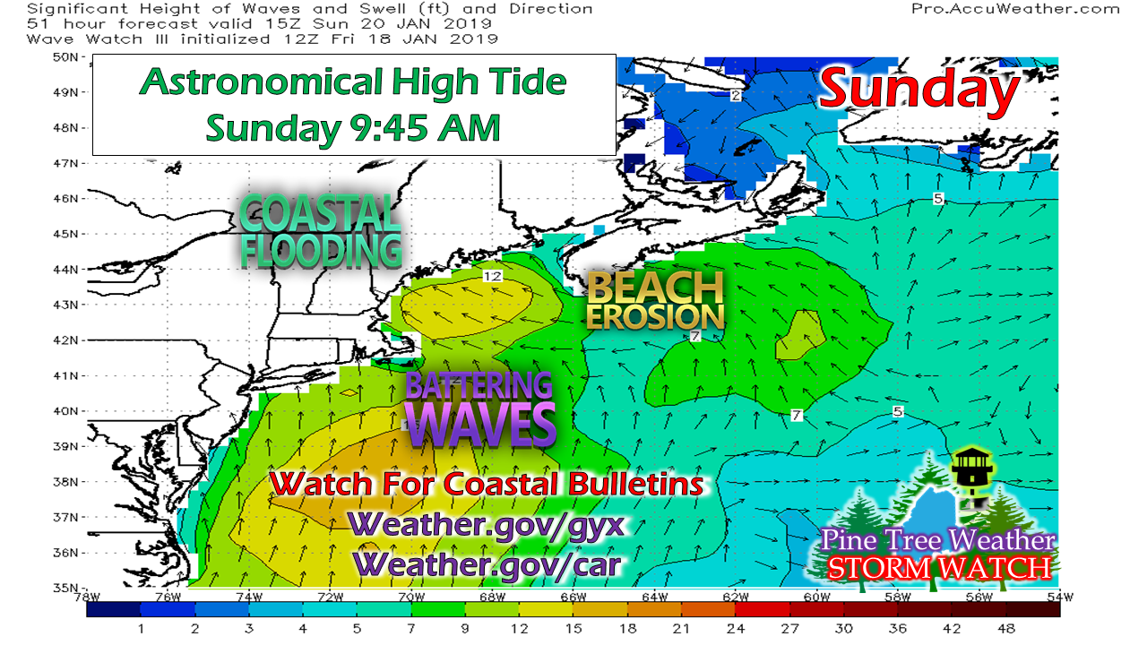
Saturday is bitter coldWind chill advisory is posted for northern Maine that starts around 1 AM Saturday and continues until 2 PM. Don't be surprised if that gets extended. All most all areas of the state will be double-digits below zero wind chill factor Sunday morning. Actual temperatures appear to fall to -15° to -10° by Sunday morning. This is important for two reasons: locking in the cold to the far south (York County) and snowfall ratios which are expected to be high (fluff factor) for much of the state. Subtle tweaks to the snowfall ideaI've adjusted this a touch, and may alter it a bit more pending on what happens with the overnight model suites and trends. Some guidance is insisting on pushing sleet in. I am not buying it just yet. I do not like model flip-flop trends that could be based on mid-level atmospheric action over the Midwest that models may not be reading correctly. Consistency in models run-to-run have been an issue with this system all week. The storm is coming together tonight. I will advise and update on this tomorrow. Regardless, the forecast is good for Fryeburg to Augusta to Bangor over to Vanceboro. Danforth may be the jackpot region, where totals may end up 24-30". Wind all day longThis snow is going to blow and drift on top of the snow totals. There will be fields empty and houses with drifts to their chimneys in areas. This wind continues into Monday. Expect gusts 20-30 mph for Martin Luther King Day, and close to 40 mph for the higher terrain. Need to watch the coastlinesThe folks at NWS Gray have issues a Coastal Flood Watch (time sensitive link) for the southwest coast for the Sunday morning high tide. There are concerns for minor to moderate coastal flooding as this tide will run around 11 feet for Portland and 22 feet for Eastport. The worst of the storm surge and wave activity appears in the afternoon around low tide. The Sunday night high tide runs about 2 feet lower. At the very least, there will be splash over in the usual areas. Stay in touch with the local National Weather Service office in your region for bulletins and action statements.
More updates coming. Stay Tuned! For the latest official forecasts, bulletins and advisories, please check in with the National Weather Service in Gray for western and southern areas, or Caribou for northern and eastern parts of Maine. For more information from me, please follow the Pine Tree Weather Facebook page and my Twitter feed. Your financial donations are much appreciated to keep this site funded and for further development. I sincerely appreciate your support not only financially, but also in sharing my efforts with others. Always stay weather aware! - Mike |
Mike Haggett
|


