
The last of the deep cold exits Friday; mixed bag for Sunday; spring showing signs of arrival3/7/2019 One more bitter cold start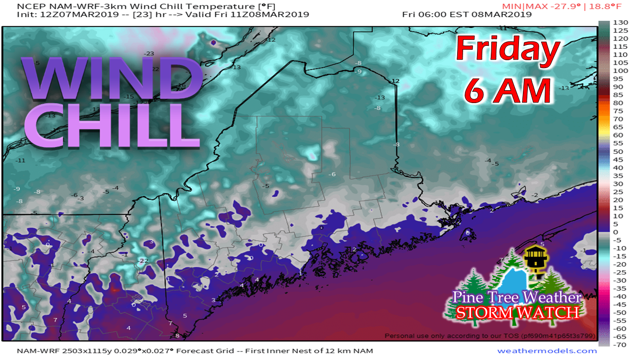 For those who enjoy the below zero wind chills, this may be your last weekend to enjoy them. The polar high that has given us this round of mid-winter temperatures will move east Friday night into Saturday. Northern areas may see some below zero wind chills to start off Saturday and Sunday, but this may be the end of the real bitter cold. Looking at longer range ideas, there will be chances for some single digit above zero wind chills Wednesday and perhaps late next weekend, but widespread below zero cold appears done for the season. A messy Sunday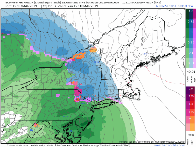 High pressure moves east Saturday. An inside runner approaches the Great Lakes, spins off a secondary low along an occluded front and moves into the region on Sunday. The system moves into Atlantic Canada early Monday. A cold front on the heels of the system slides through Monday. The storm slows progress as it nears Labrador, then heads for Greenland on Tuesday. 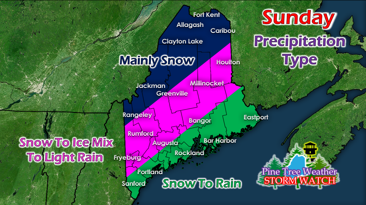 All areas are likely to start off as snow. How long it stays that way depends on geography and conditions. The coast may see some light snow before changing to rain. This appears to be another cold air damming situation for the western foothills into Southern Aroostook, which may bring a period of sleet and freezing rain, before switching to rain showers Sunday afternoon into the evening. The northern crown and the Quebec border region appears to be mainly snow, with a chance for some light mix Sunday night into early Monday. 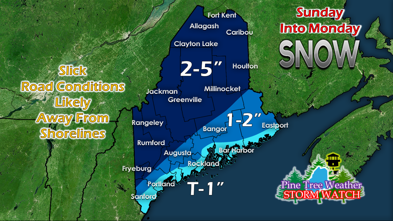 There is not whole lot of liquid equivalent precipitation with this event, roughly one quarter to a half inch possible. Any icing or sleet over interior areas is likely to be light in nature. With the rain, any snow that falls will likely turn to slush, which will likely be the case for the coastal plain on up into northern Washington County. Snow showers are expected to continue in the mountains and north Monday into Monday night, ending Tuesday morning. This may bring an inch or two on the backside of the system. Those totals are figured into this prediction. Spring is on the way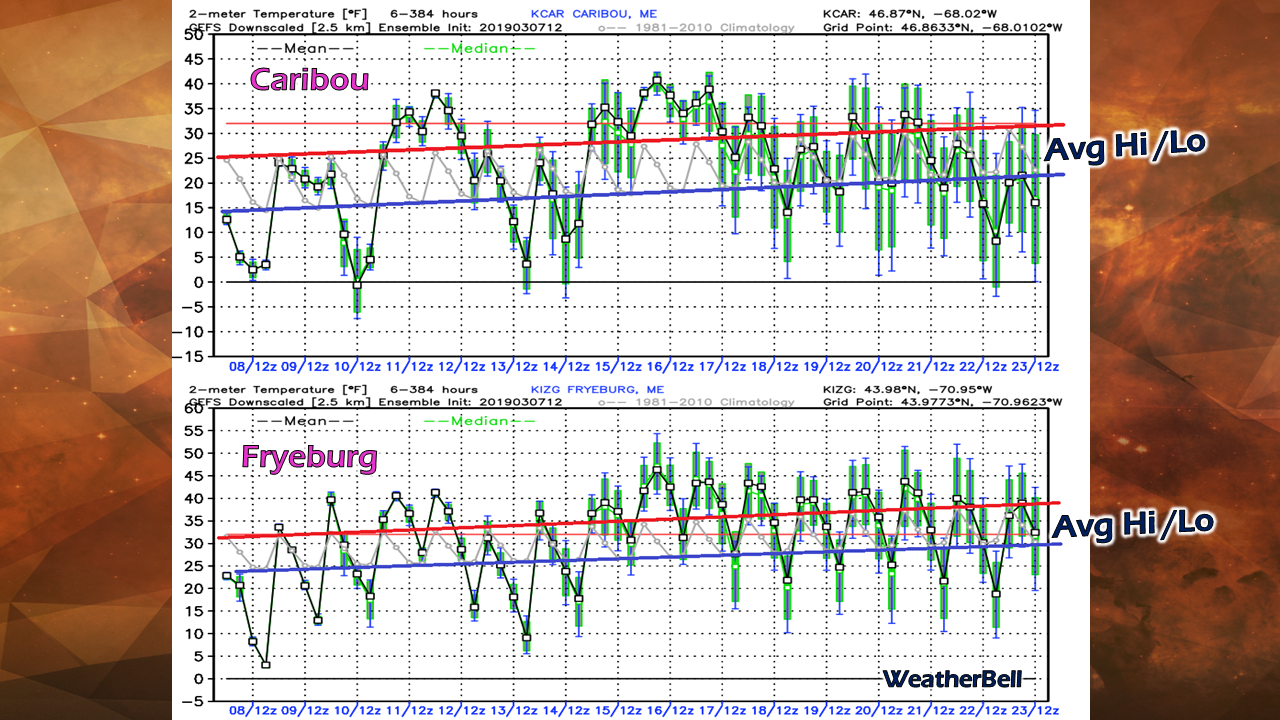 The roller coaster ride of spring temperatures will pick up as we head into the third week of the month. Long range forecasts indicate above normal temperatures overall during the period. As the graph indicates, there will be some chilly nights still to contend with, but the below zero starts are just about finished. It won't exactly be flip-flop weather for southern areas, but daily highs in the 40s flirting with 50s aren't that far away. For northern areas, it will take awhile to get to that point, but there are a few chances where the mercury may hit 40°. Some samples of snow to water content in northern and western areas indicated anywhere of 10-14" of water embedded in the deep snow pack. This is abnormally high, as has been the amount of snow the interior has received. For those in flood prone areas or have basements that flood from spring run off, you should keep this in mind. For those awaiting the maple sap run, you may start to see some flow as we head into next weekend. I am not quite prepared to say the coast can put away the snow shovels just yet, but the warmer trend does make it appear the end is coming soon. I've lived here long enough to know that anything is possible. Let's get through St. Patrick's Day and revisit that thought again. Outlook through Tuesday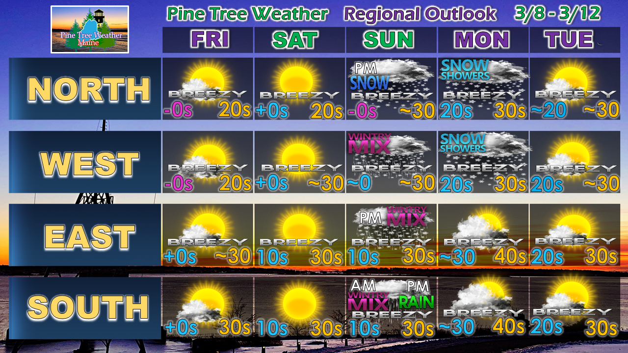 After the Sunday/Monday system passes through, the region appears storm free until next Thursday into Friday. Guidance thinks that may be a wet one statewide, but there is a plenty of time for that to change.
► ► For the latest official forecasts, bulletins and advisories, please check in with the National Weather Service in Gray for western and southern areas, or Caribou for northern and eastern parts of Maine. ► ► Your financial donations are much appreciated to keep this site funded and for further development. I sincerely appreciate your support not only financially, but also in sharing my efforts with others. Always stay weather aware! - Mike |

Mike Haggett
|


