
Southern Ridge Slowly ErodesThe region has been more or less stuck in an west to east zonal flow pattern for months. I've talked about it on Facebook and on my Bangor Daily News blog ad nauseam. This is why the area has dealt with drought and a cooler than normal summer. Over time, the strong anomalous ridge over the south is being chiseled away at. It will take more time for that to go away. When that goes away, the weather patterns will change and become more active. Since a lot of weather sources show you the usual fancy surface maps and satellite images, I like to go beyond that. That is all well and nice, but that doesn't show you the full story. Since I am on a journey of learning, I believe in teaching you as I go along. When you flip on the TV or check your other weather source besides me, you have a better perspective on how the atmosphere works. We'll look at the week from 20,000 feet above. Monday's coastal nuisance showers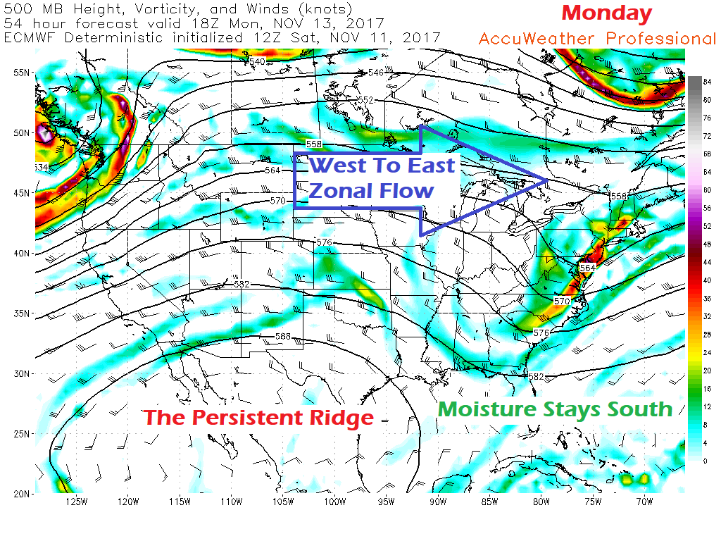 As I have mentioned, the zonal flow and the ridge have been consistent. This has kept the bulk of the moisture to the south. Here we go again. A shortwave trough dips down from Canada. It has a bit of upper level energy with it, but this overall is a dry frontal passage for Maine. When that energy hits ocean moisture, it taps into it. As we have seen for most of the summer, it's too little, too late. There is enough of an inversion here (not shown) where it will kick up a few light rain/snow showers for the coast. This will likely have very little accumulation and does not appear to cause any problems. After this passes, the area is dry with seasonable temperatures through mid-week. Thursday's system slightly juicier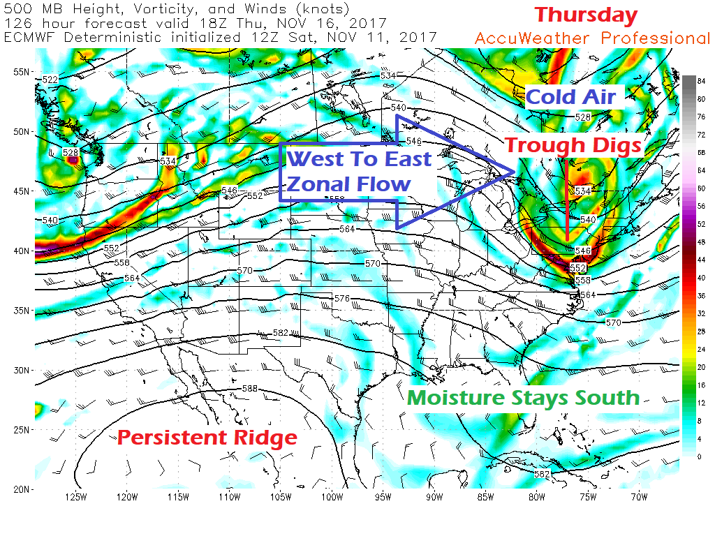 The ridge over the southwest weakens a bit and opens the door for a trough to drop down from Canada. Moisture from the south remains suppressed. Cold air funnels in with the trough. The trough is neutrally tilted, meaning north to south. What ever moisture is gets will come from the Great Lakes and the Mid-Atlantic. By the time it passes through the region, it may bring scattered rain or snow showers, but not much else. It will bring a brief period of cold with it, but the ridge to the west hurries back in to bring back seasonal normal temperatures to round out the week. Next Weekend Is A Bit More Interesting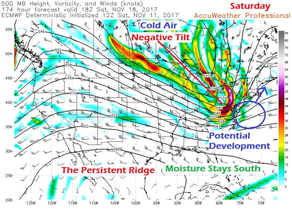 I mentioned in a previous post on this website that we will have to keep an eye out for next weekend. This still rings true. Important to note, as I said at the time, it's a signal. There is a bit more behind that signal now. While the ridge and moisture pieces of the pattern stay consistent, what is different is the negative tilt on the trough. Cold air is going to win this battle with the ridge long term. Here is yet another signal of that. It is with these negatively tilted troughs where the concern for NorEasters enter consideration. While Saturday appears to be a fair day for now, there is potential for storm development that may impact Sunday into Monday. But before the prediction of storm, it's important to look eastward. 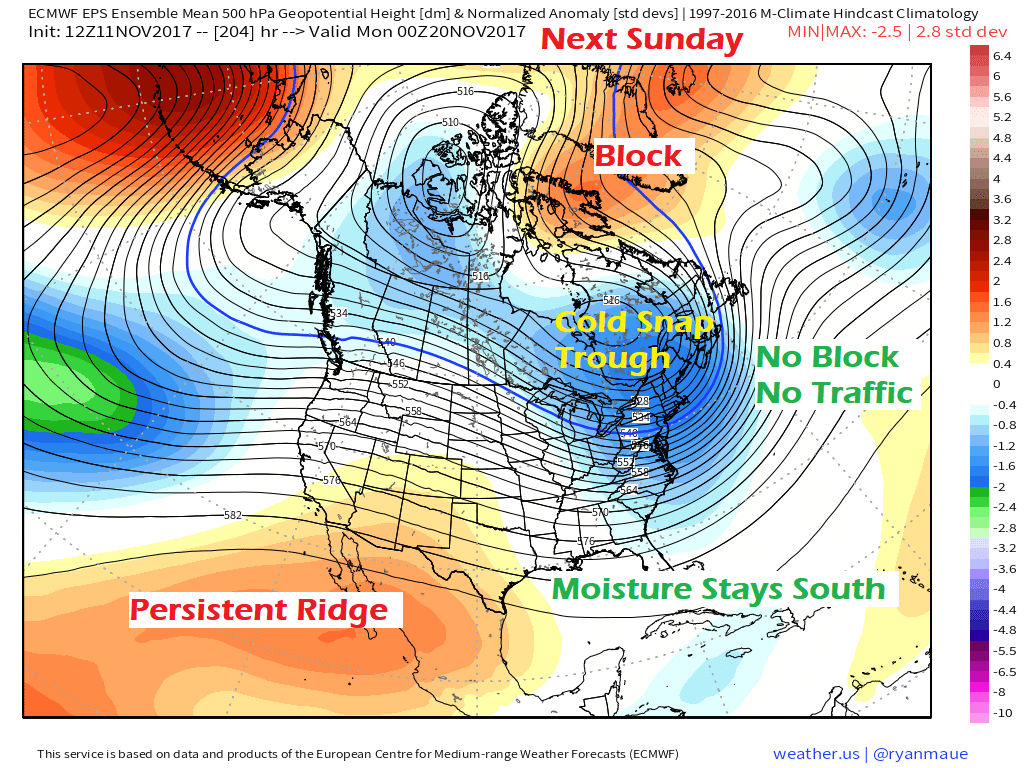 Looking at the European ensemble idea over a week out at the same level as the upper level energy charts I have shown in this post, there are two key elements missing over the Atlantic. No ridge near the area, and really no traffic around to interfere with anything. Sure, there is the strong ridge over Greenland, but that for now appears too far north to play a big role in this. Low pressure could form along the axis of the negative energy and swing a storm northeast into the region, which could bring some snow. Without any friction from a blocking ridge to the east, what storm forms in this idea isn't going to be a strong one. The storm that is possible to form won't get any help from the south. What will be dependent on accumulations is how cold the air gets (the fluff factor) and how organized the system gets before it reaches the area. Those are questions that are way too early to get answers for. I will be watching this all week and will update.
If you are looking for some sort of a clue when snow may become an issue, yours truly put snow tires on his vehicle on Saturday. If you haven't yet, it would be a good idea to move that up on the priority list of things to do this week. - Mike |

Mike Haggett
|


