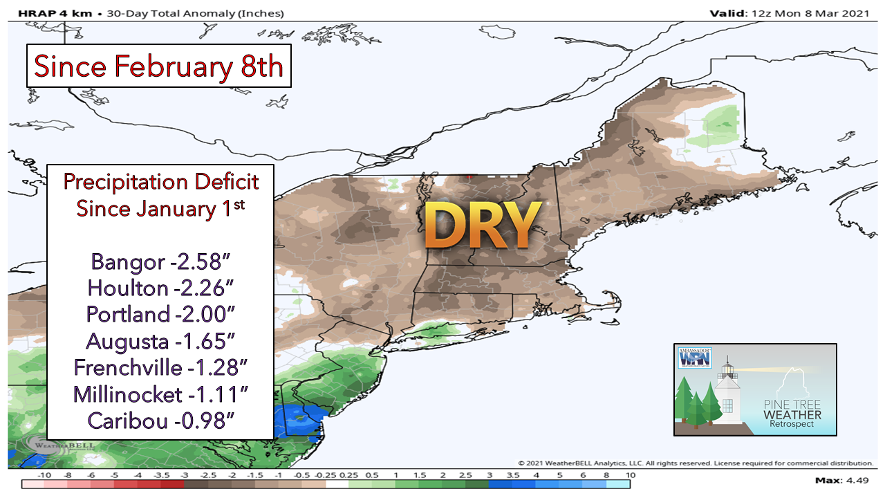
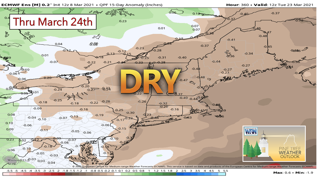
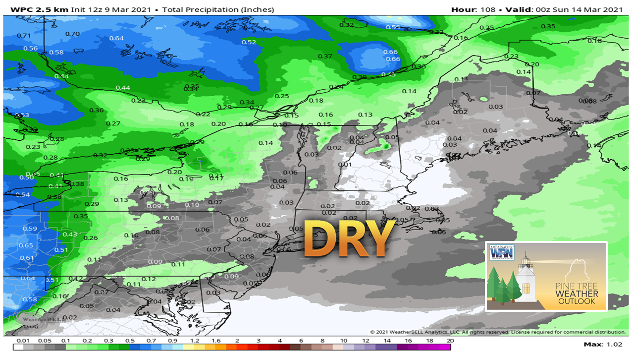
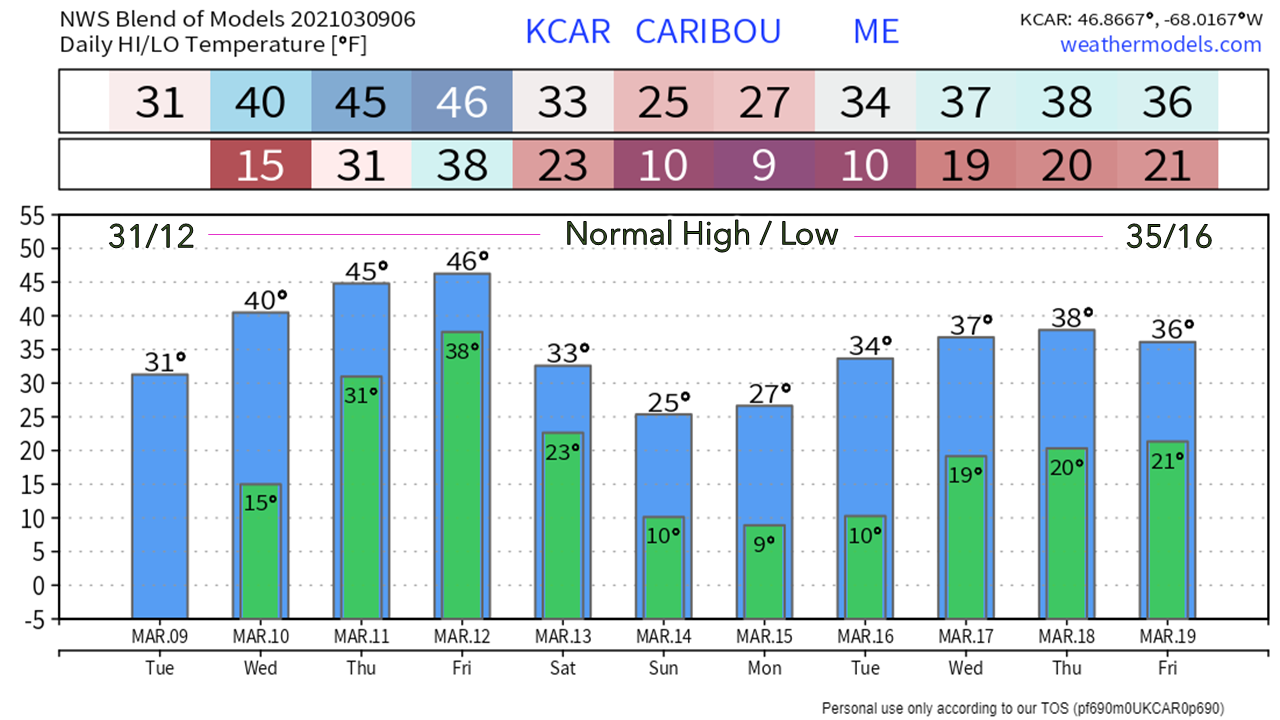
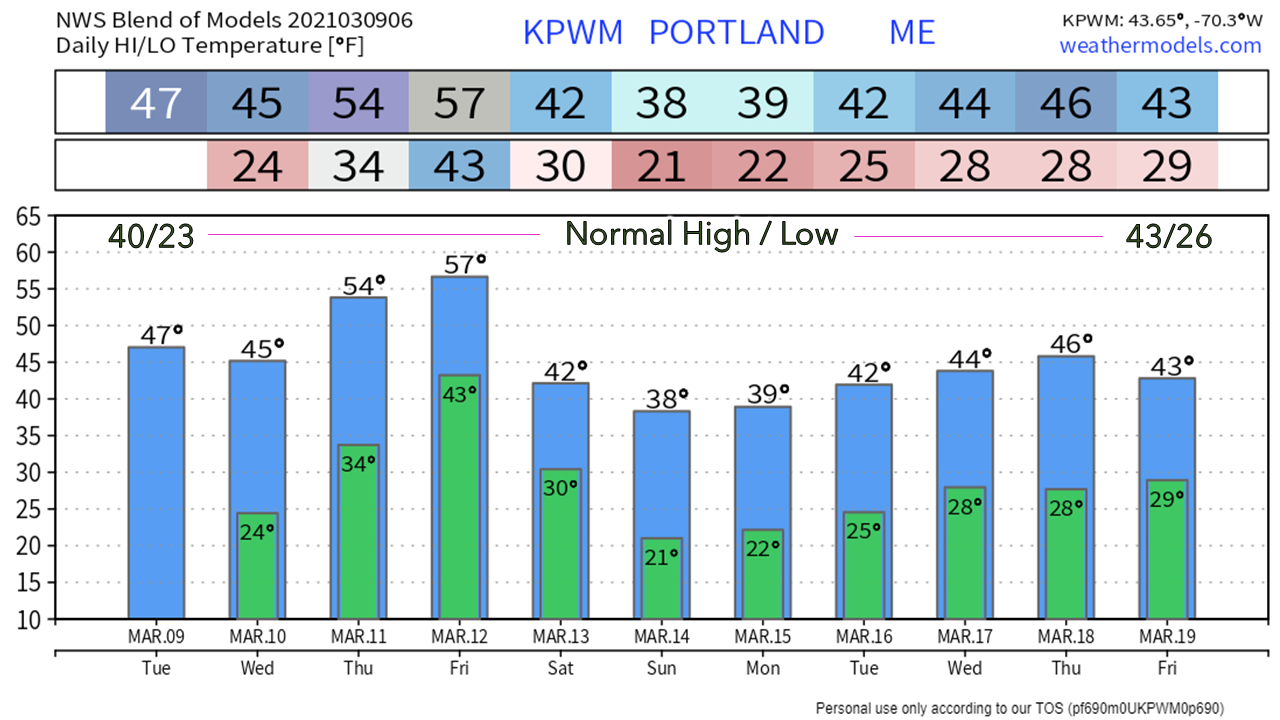
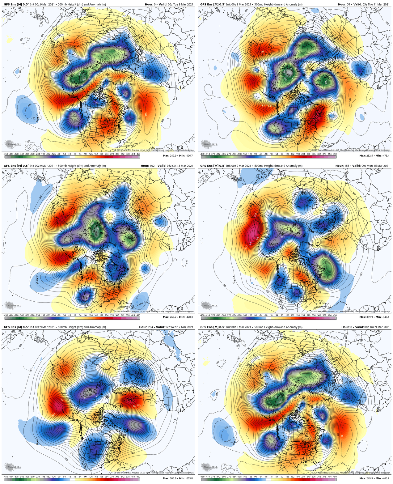
Status updateFirst off, I hope you are all healthy and well. I took a break from this over the weekend to get caught up on rest, be a husband and a father, and do a mental reset. College has been the most challenging this semester of any of the three previous. The end is coming. I am glad the pattern is quiet because I want to be able to enjoy what educational experience I have left, and I also want to excel at it. When the pattern shifts, you will see more updates. For now, I am going to skip the daily updates and focus on school, the day job, family and preparation for the future. This is Bud, the family dog. He's looking for spring. While he loves to run around on the beaches in the Kennebunk / Wells / Old Orchard area, he's ready for scent trails with squirrel and chipmunk pursuits in the woods. I have some insight on that. Where we are at, and the outlook for what is aheadA quiet pattern in winter means less snow and consequently less liquid. Most of the region is at least 1" or more below normal through March 8th. The good news is the Northeast River Forecast Center's outlook for spring flood concerns is below normal. There is ice on the rivers from the cold February, and flood potential exists pending temperatures and rainfall. The one piece of that missing, is the water. The European ensemble outlook is looking lean for the next two weeks. This has support from the American GEFS and Canadian ensemble ideas as well. The pattern appears west to east zonal, which keeps the region on the dry side. No surprise, the outlook through the weekend appears mainly dry. Many areas may not tip the spoon in the rain gauge of personal weather stations at all. Far northern and western areas have the best chance to record any amount of precipitation, and even that is very low. The temperature outlook features the typical roller coaster ride... Northern Maine could classify Wednesday to Friday stretch as a late winter heat wave. This will be the first period of 40°+ temperatures for 3 consecutive days there since early November, if my data review serves me correctly. For southern areas, the high on Friday may be the warmest since December 1st, and the warmest four day period since the first four days of that month. A cold front works into the region Friday night which will cool the region down to below normal over the weekend before a gradual climb upward next week. The hemispheric outlook over the next couple of weeks shows the deep cold over northeast Asia that will break off and move southeast into North America as ridging from the south chips away at it. We'll see periodic cool shots and chances for snow through the next couple of weeks, and then we'll have to watch out for the semi-annual April Fools storm as we head towards the end of the month. Be prepared to receive alerts and stay updated!
For more information in between posts, please follow Pine Tree Weather on Facebook and Twitter.
Thank you for supporting this community based weather information source which operates by reader supported financial contributions. Stay updated, stay on alert, and stay safe! Thank you as always for your support! - Mike |
Mike Haggett
|


