
The players are on the stage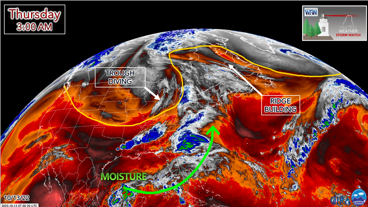 It's worth repeating that we've seen far worse storms in October than what the region appears to get from this one. This storm is likely to give some areas a slap on the face. Heavy rain with localized flash flooding and urban street flooding is the main concern here. A stiff south / southeast breeze is a concern for leaf drop and potential for some power outages. Mother Nature is about ready for her fall clean up, so the rest of us can get ours done before the flakes of winter pile up. 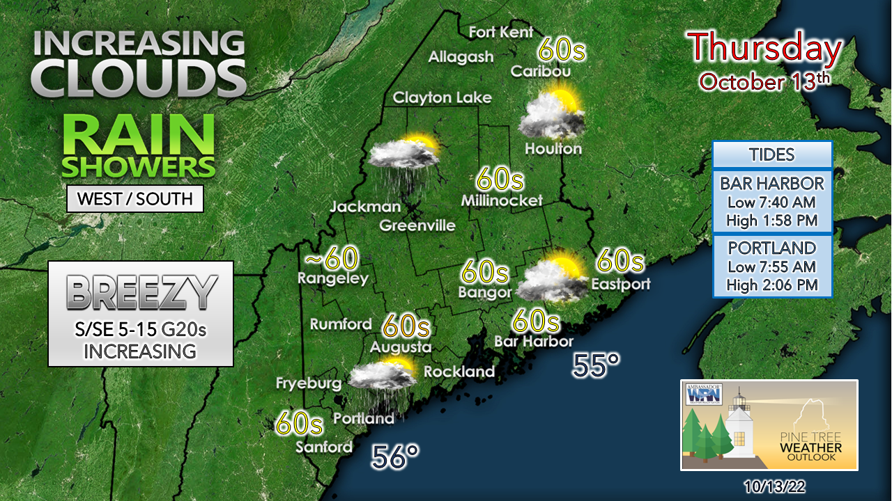 Humidity will be on the increase during the day as moisture builds in from the south. While this storm won't have a mid-summer tropical feel to it with sultry air, it may feel a bit muggy compared to recent days where dew points in the 30s and 40s balloon up into the 50s. Eastern and northern areas stay dry for the day and may not see much in the way of rain until Friday. Timing and rain amountsThere are still some questions on the timing of the end time for rainfall, but here's the best estimation I can provide as of early Thursday morning. 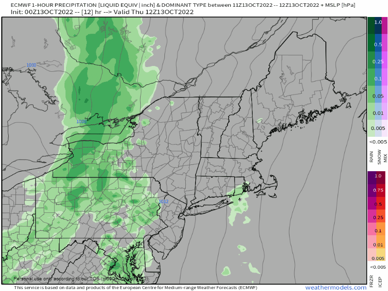 Thursday 8 AM to Friday Midnight - As the front moves east, shower activity breaks out over western and southern areas through the day. Showers turn to steady rain activity by late evening. 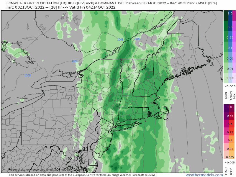 Friday Midnight to Saturday Midnight - This is where the forecast begins to come into question. The trough to the west runs up against the ridge to the north and east and begins to slow down. Under this scenario, far eastern areas may not see any rain at all until late in the day on Friday. The atmospheric river of moisture continues to pump in. Weak areas of low-pressure form along the boundary which could enhance the velocity of rainfall at times from low to moderate to heavy. IF the general idea depicted here stays true to form, western and southern areas see the faucet shut off Friday afternoon into early evening. Any slowdown of the forward progression of the front changes the end time. 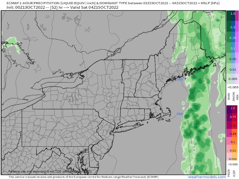 Saturday Midnight to 8 PM - Again, if the forecast idea remains on track, northern and eastern areas see rain end Saturday afternoon into the early evening. 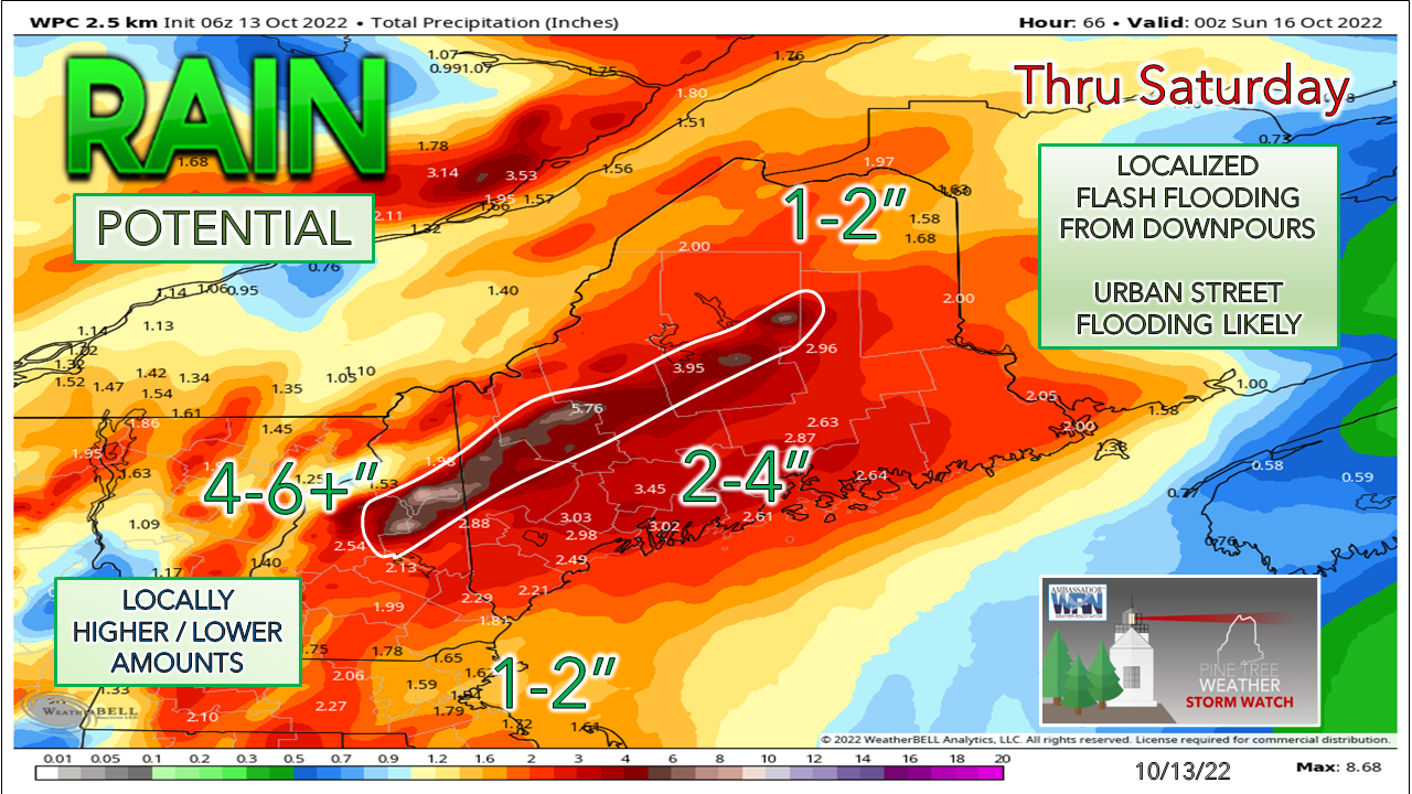 Southeast wind flow events throw copious amounts of rain at the mountains and that is where the most rain is likely to fall. If the front slows down forward progression by even an hour or two it will change the outcome to the higher. Conversely, if the front speeds up, it will knock totals down lower. This idea from the Weather Prediction Center is the best overall idea for what to expect at this point. A stiff breeze makes things messy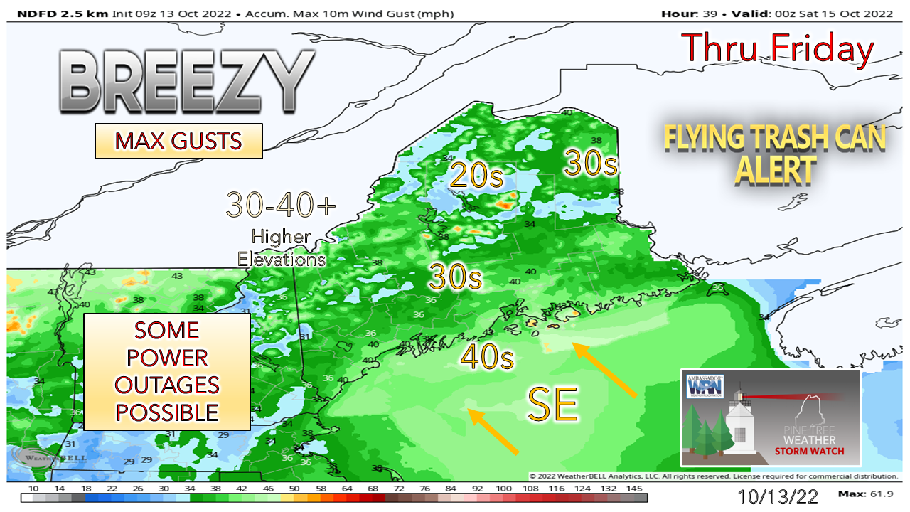 NWS Caribou has issued a wind advisory for the DownEast shorelines as they expect wind gusts to reach 40-50 mph. A general idea of maximum wind gusts in the 30+ mph range is a reasonable expectation, with higher gusts for the shorelines and the mountains. As the front passes, the wind direction shifts west and diminishes. ImpactsHeavy rain and wind with foliage at peak means massive leaf drop. Urban streets are likely to turn into rivers from clogged storm drains. Flash flooding could potentially cause washouts, especially in the mountain region. Thankfully, the rivers are low, but they will fill up from this event, and a couple may tip their banks. Standing water and leaves and or pine needles means roads are likely to be slick in spots like ice. Power outages are certainly a possibility where wind gusts are stronger. Stay updated on any changes to the forecast and be prepared. Outlook through TuesdayThe mountains and north may see a shower on Sunday from a weak shortwave. Monday and Tuesday bring the next chance for rain. Colder air begins to funnel in on Wednesday and may bring some snow to the mountains and north midweek. 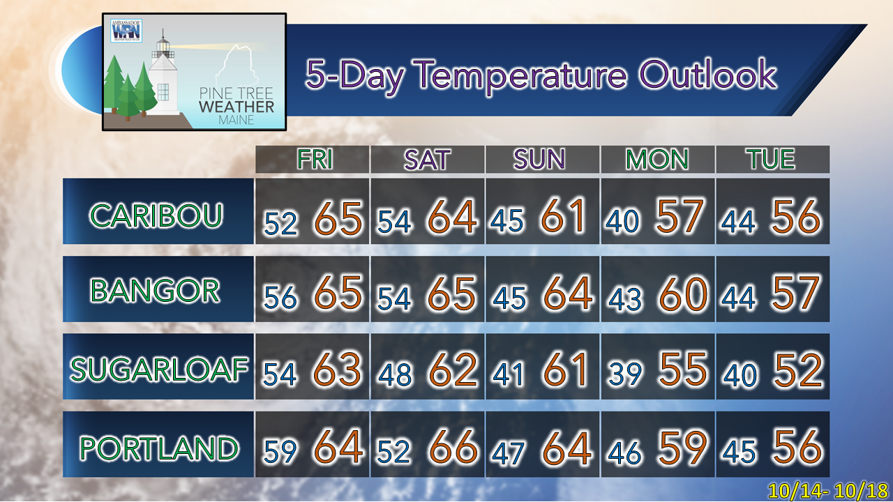 Thank you for supporting this community-based weather information source which operates by financial contributions from people like you. Stay updated, stay on alert, and stay safe! - Mike NOTE: The forecast information depicted on this platform is for general information purposes only for the public and is not designed or intended for commercial use. For those seeking pinpoint weather information for business operations, you should use a private sector source. For information about where to find commercial forecasters to assist your business, please message me and I will be happy to help you. |

Mike Haggett
|


