|
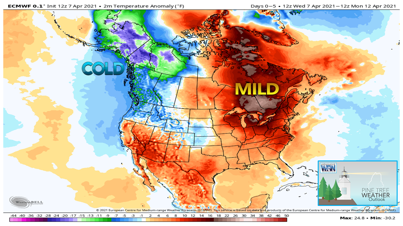
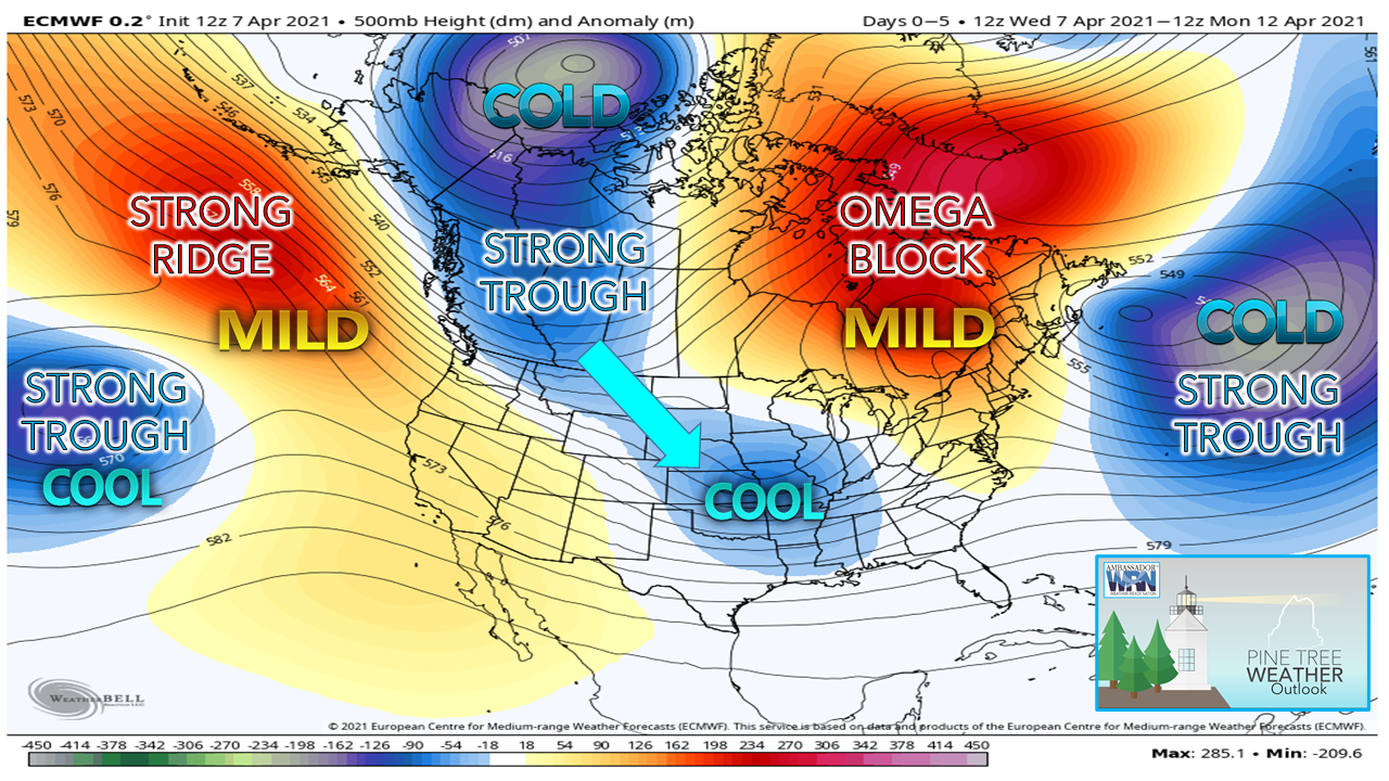
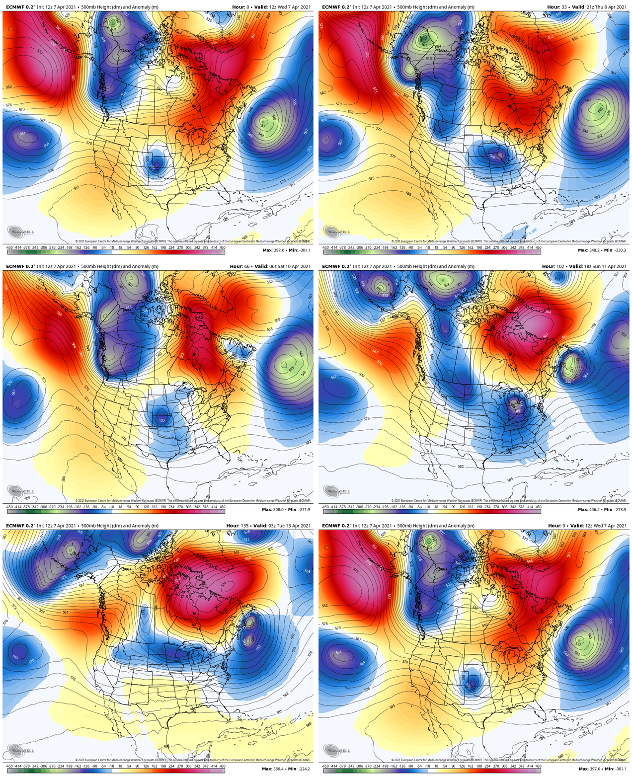
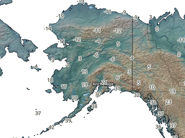
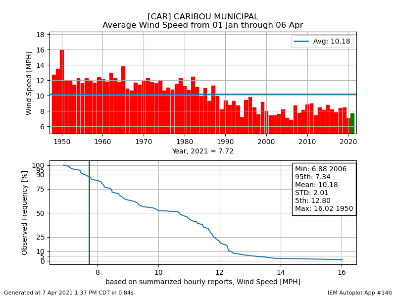
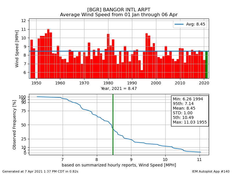
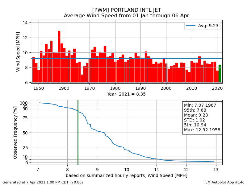
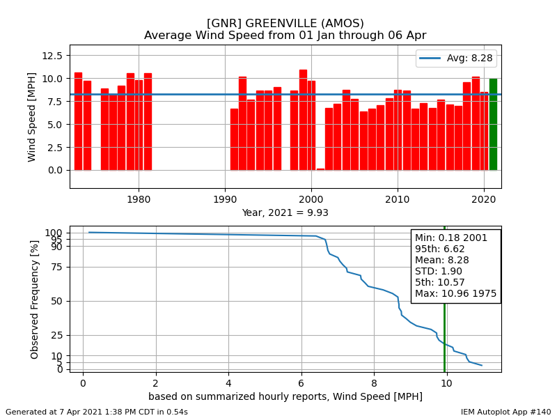
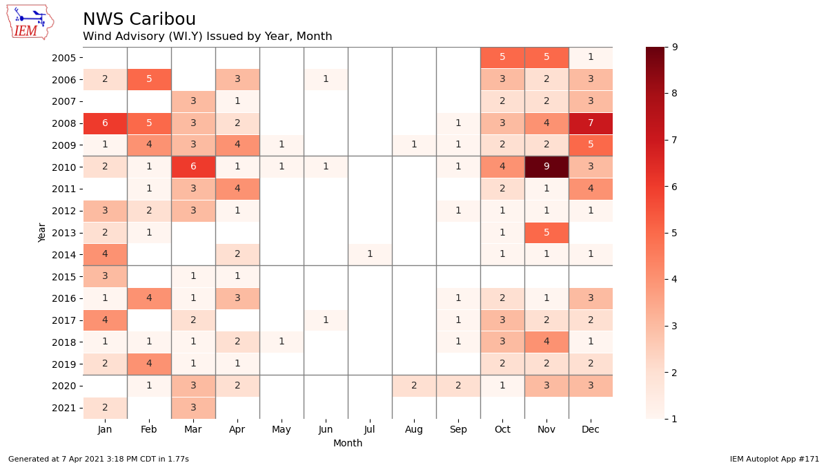
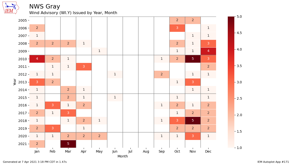
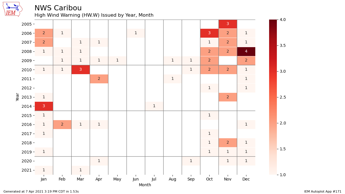
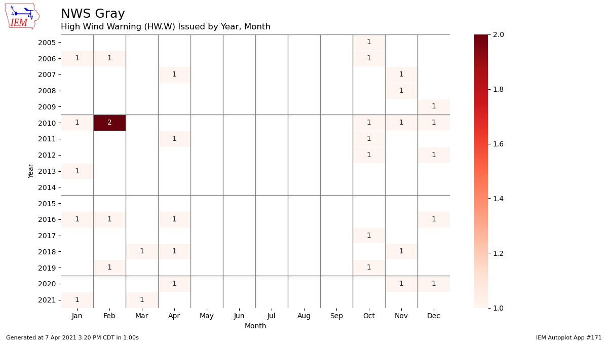
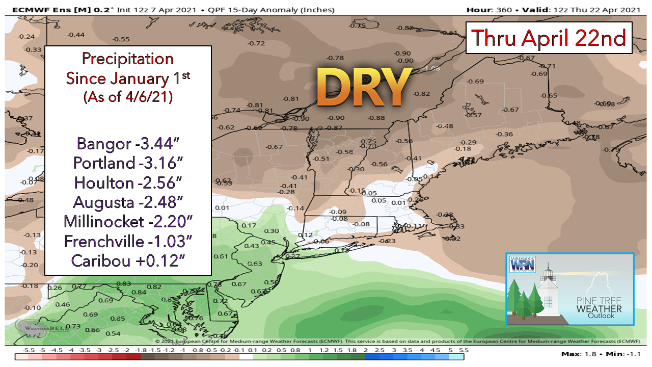
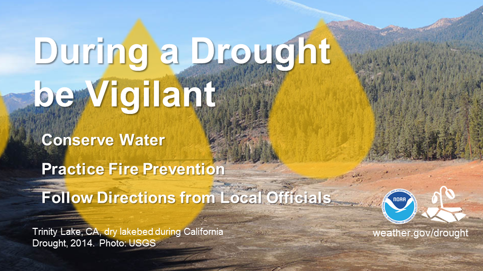
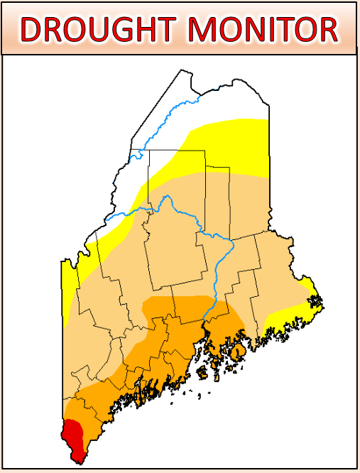
While not exactly a "mailbag" edition, I want to address three questions that I get asked quite frequently. I will address each one at a time. Is winter over?We are in mid-April. I am seeing where some broadcast meteorologists to our south have declared winter over for their coverage area. Some have symbolically dumped their winter TV show graphics ("show" is TV speak for their 2½ minute time on the news) as an indication they are confident that the flakes are over for the year. That may be the case to the south of us. The sun angle is higher, which cuts down on snowfall during the daytime, and the daylight is longer, which can decrease the amount of atmospheric cooling that can occur, depending on the set up. While the image above of the European model depicting cold and warm anomalies over a five-day period through Sunday could give the gardeners the itch to start planting flowers and vegetables with mild temperatures predicted, it is important to note and respect the area of bitter cold that is tucked up in Alaska. The cold we get in winter comes from the same general location where we get it from anytime of the year, and that is from the Pacific northwest. The cold over that region is going to move, and as it typically does, it will move southeast. While the omega block over eastern Canada protects our region into the weekend, the intense ridging is going to relax at some point, and that would change the pattern of temperature and precipitation for Maine. Putting the upper air forecast into motion, the cold over the Pacific northwest gets chipped away at and then moves: If you watch this loop a couple of times, you can see the omega block over eastern Canada retreat and pockets of cold with a series of upper-level disturbances move southeast and then eastward. If this idea is correct, we're not done with snow chances, nor are we done with below normal cold shots, either. It's important to point out here that the blocking over Greenland is a key ingredient in the development of Nor'easters. While the upper air pattern may indicate "mild" temperatures associated with the block, the cold certainly lurks. Temperatures are well below zero at the time of this temperature map on Wednesday at 11 AM Alaska Daylight Time (3 PM eastern time). While this cold will modify as it moves to the south and east, it does raise concern with this forecaster that we may not be done quite yet with seeing snowflakes, and certainly not with frost. For those with a green thumb with the itch to plant, unless it is a garden you can cover, I'd hold off on the temptation to plant for now. For those in the mountains and north, I'd keep the shovels handy just in case a plowable snow comes later in the month. Why is it so windy?I've answered this question several times over the past few months, and I will go a bit more in depth with it this time. Spring is our windiest season on average. As warm builds from the south and chips away at the cold in the north, the pressure gradient force (read: surface pressure) strengthens and Maine gets windier, lower pressure storms as a result. Fall is similar in that regard, but in reverse as cold works in to get the upper hand and drive the warmth south. Looking at wind speed averages from a few airports around the state since January 1st to April 6th shows the following results... To the north, Caribou: For the rooftop of Maine, wind speed is below normal in general by over 2 mph. For Bangor: The Queen City is right on average compared to seasonal averages at the airport since 1948. For Portland: To this point, Maine's largest city is about 1 mph below average through the first 102 days of 2021. Where there is an area that shows above normal speeds, the focus turns to Greenville: Unfortunately, the data sample has several missing years of data, but it is the only data I can get of any value for the mountain region. The average speed of 10 mph is 1.72 mph above normal in comparison with the data available. I offer a breakdown in the number of wind advisories and high wind warnings issued by the Caribou and Gray weather offices. A definition of a wind advisory from the National Weather Service Gray office is as follows: Issued for winds excluding those directly associated with severe local storms, tropical cyclones, and winter storms for a) sustained wind speeds of 31-39 mph lasting for 1 hour or longer; or b) wind gusts of 46-57 mph for any duration. A look at wind advisories issued by office: The case can be made that 2008 and 2010 have been breezier than recent years in Caribou. 2010 was also breezier in southern Maine and New Hampshire with the advisories issued by the Gray office. Important to note that since November, the Gray office has issued 11 wind advisories, but some in that count include New Hampshire only. The definition of a high wind warning from the National Weather Service Gray office is: High Wind Warning for high winds excluding those directly associated with severe local storms, hurricanes, and winter storms for a) sustained wind speeds of 40 mph or greater lasting for 1 hour or longer, or b) winds of 58 mph or greater for any duration. A look at high wind warnings issued by office: Who remembers the fall of 2008? A total of 8 high wind warnings issued in three months. The general average is for one per month during fall, winter, and early spring. For the western half of the state, the average of high wind warnings is less in comparison to the eastern half. Again, some of the data may include New Hampshire. I noticed an uptick with wind speed inquiries from followers since the Great October Gale in 2017 which left half the state without power. That storm put everyone on notice about the potential for outages and has made it a topic of sensitivity ever since. To answer the question, in general, the state is below normal for wind speed compared to other years. As I have stated previously here, where the wind is noticed the most is measured in the number of storms which cause power outages. It may appear windier than normal, but the impact of the breeze on the electric supply infrastructure is noticed more than the wind itself. What about rain?The ensemble ideas continue to be drier than normal as we head through the middle part of the month. Only one observing station in Caribou shows a slight surplus of the valuable liquid, thanks to the recent rain associated with the storm that has lurked offshore for days. Drought is starting to creep into the state and is well noted already in nearby New Hampshire. This will slow down the growth of foliage and keep the threat for wildfires into the near future. This is yet another reason to hold off on the green thumb itch for now. For those wanting to burn off brush and leaves, it would be wise to check the daily updates from the Maine Forest Service and give a courtesy call to your local fire department or forest ranger for burn permits and information. If you are using ground water for your main source of everyday needs, it would be wise to conserve if you have not already. I have received some reports of dry well issues in western areas through the winter, and I am sure there is more that I have not heard of. During a droughtDuring a drought, be vigilant. Conserve water by taking shorter showers and not washing your car. Practice fire prevention by properly disposing of cigarette butts and not setting off fireworks. Follow any additional directions from local officials. For more information about drought safety, visit weather.gov/drought Be prepared to receive alerts and stay updated!
For more information in between posts, please follow Pine Tree Weather on Facebook and Twitter.
Thank you for supporting this community-based weather information source which operates by reader supported financial contributions. Stay updated, stay on alert, and stay safe! Thank you as always for your support! - Mike |
Mike Haggett
|

