
|
I am getting back in the saddle again after some unexpected time away dealing with what may have been a virus, along with other family and personal matters. I am grateful to be healthy and in good condition. The changes in lifestyle implemented back in mid-February to combat my arthritis continue to pay dividends. I hope everyone enjoys what summer is left. The pattern is improving slowly, and it is a bit less rainy, thankfully. Overview of the steering level of the atmosphere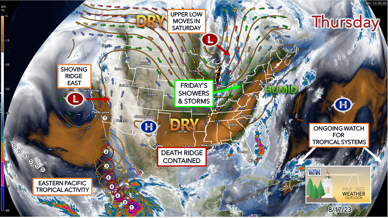 The pattern continues to look like early fall, and with the forecast temperatures, it appears that it will feel that way. After Sunday, the air conditioners and humidity reducing heat pumps can be shut off for a few days. The normal highs are in the mid- to upper 70s at this point, and the temperatures are expected to be cooler than that next week. The normal overnight lows in the mid-50s to 60° will be tough to reach as well. Outlook through midweek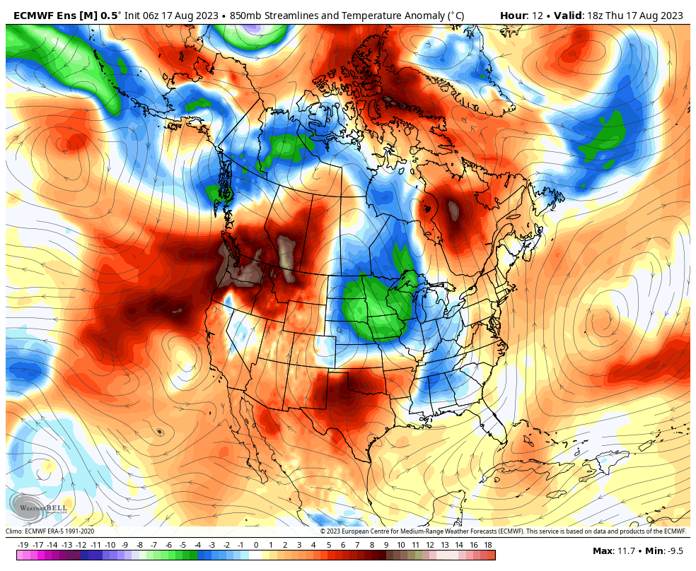 Thursday 2 PM to Wednesday 2 AM - A look at the 850mb (~5,000 ft.) temperature anomaly forecast shows the parade of cooler shots associated with the parade of upper-level waves and lows continuing through the areas. The death ridge of heat over the central part of the country is going to get agitated by an upper-low near California and combining with a hurricane heading north through Baja and into the southwest. Between the troffy conditions over the northeast and the heat of the ridge over the central part of the country, which may change the pattern to a more zonal west to east flow by the middle part of next week. 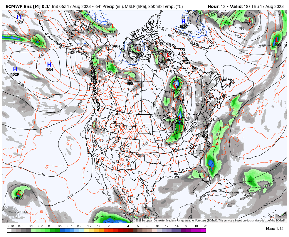 Thursday 2 PM to Wednesday 2 AM - The look at the ensemble mean surface map shows the death ridge over the central part of the country that has dictated the pattern all summer continues to hold serve. The tropical system over the west and a jog of the ridge to the north will allow for disturbances to pinwheel around it. With the jog of the ridge to the Midwest, this shuts down the southwest flow coming up the east coast, which will keep the humidity away and dew points more comfortable for the northeast. Severe storms and rain chance for Friday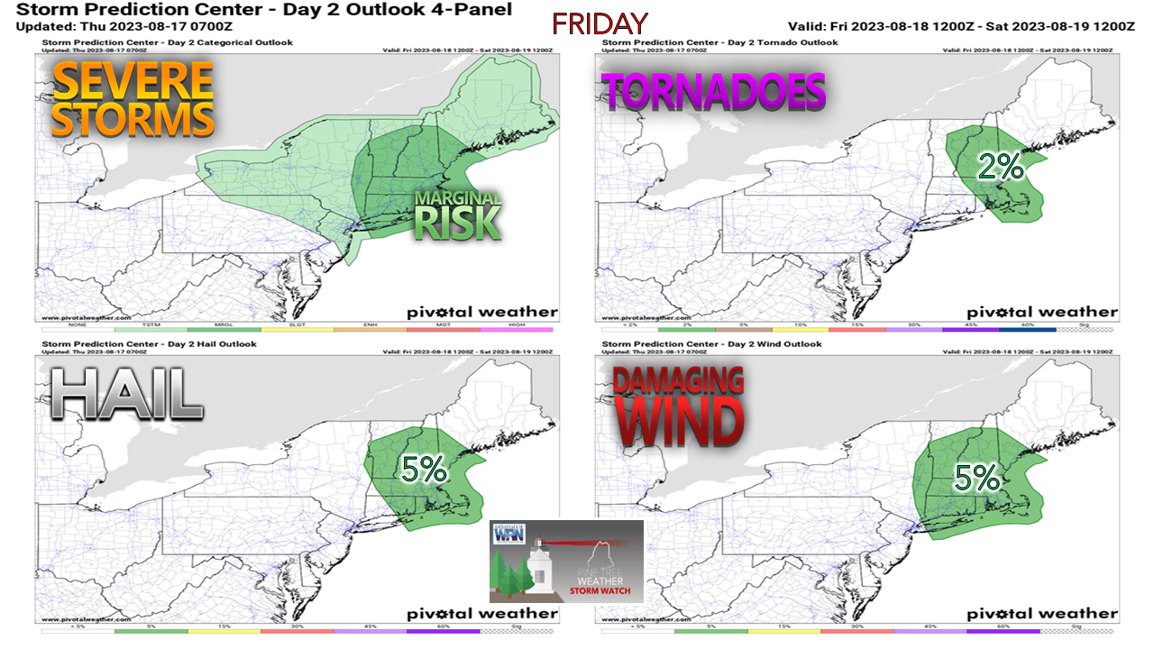 A warm front moves into the region Thursday night and the state wakes up in the warm sector by Friday morning. A cold front approaches the region Friday afternoon and sets up potential for strong to severe storms to develop Friday afternoon into Friday night. Given the strength of the cold front, there appears to be ample shear to cause spin in the atmosphere, and thus bring the risk of damaging wind and the small risk of an isolated tornado. With the cold air moving in aloft, hail is a concern as well. While I don't expect the chaos of what happened this past Sunday across the area at this point, I do expect some isolated storms. The severe factor will be determined based on the amount of sun. This is a "sun's out, thunder guns come out" situation for the afternoon into early evening. Given the sharp nature of the front, all areas have a decent chance of getting a couple of rumbles. 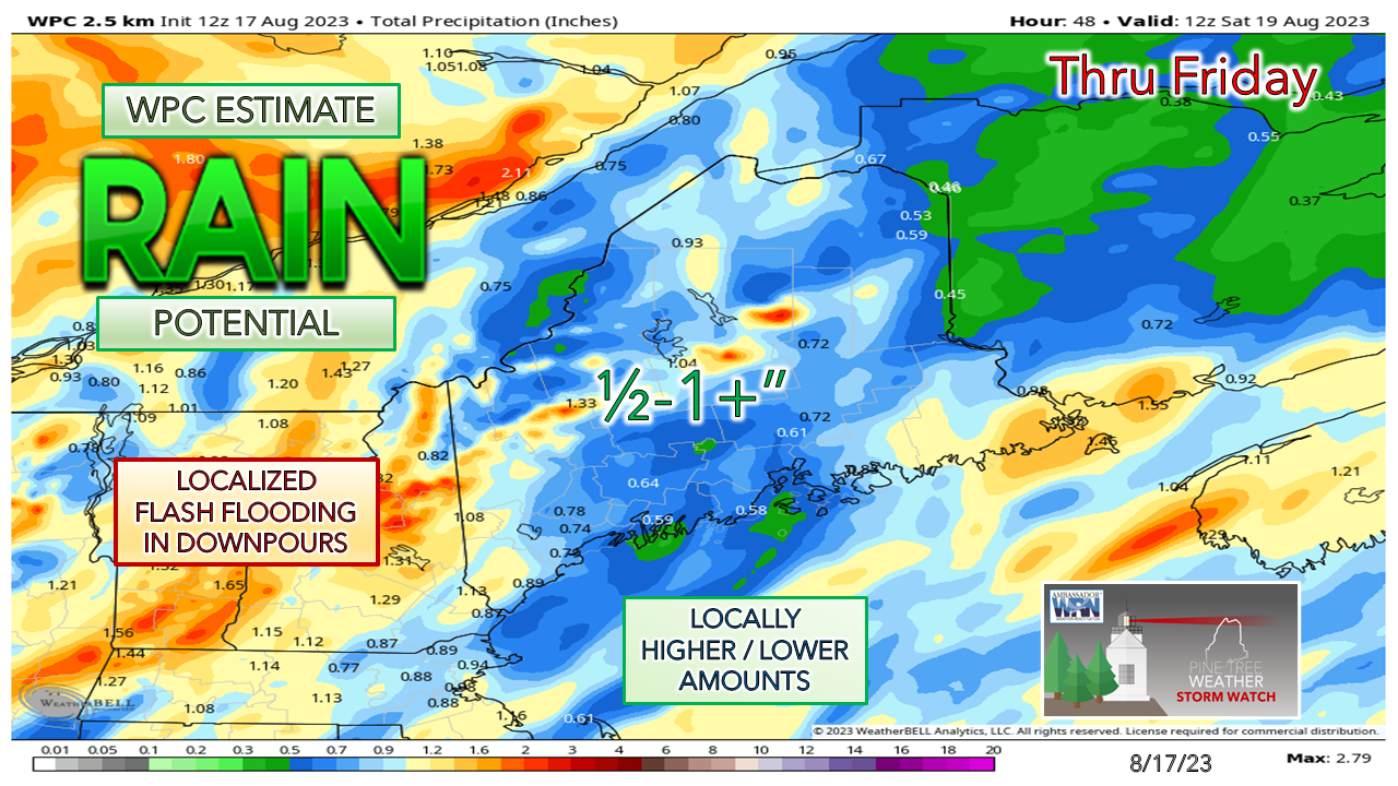 Using the Weather Prediction Center estimate here for potential rainfall shows much of the region in the ½-1" range. Southwestern areas and the mountains have the best chance of meeting and potentially exceeding that threshold pending on cloud cover and storm formation. A strong southerly wind ahead of the front brings an orographic lift situation for the south facing mountain slopes as moisture gets thrown into them. Flash flood guidance continues to remain in the 1½-2" per hour range which means the potential for flooding remains high given the saturation of the ground. The good news after this is the rain risk decreases in amount into next week. Saturday may bring a chance for a spot shower with the upper-low passing over. Sunday appears dry for most, outside of a spot shower in the mountains. A weak front passes through Sunday night and brings the cool down and drier air into the start of the week. The next chance for rain comes Tuesday into Wednesday, but it appears light in nature with no concerns for flash flooding as it appears for now. Pine Tree Weather is funded from followers like you. I would appreciate your financial support. Click here for how you can contribute. You may not like the weather, but I hope you like what I do, and support my efforts. Thank you! Stay updated, stay on alert, and stay safe! - Mike NOTE: The forecast information depicted on this platform is for general information purposes only for the public and is not designed or intended for commercial use. For those seeking pinpoint weather information for business operations, you should use a private sector source. For information about where to find commercial forecasters to assist your business, please message me and I will be happy to help you. |

Mike Haggett
|


